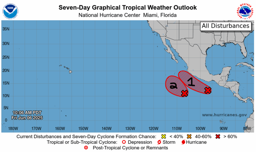
Despite suspicions of trouble in the Atlantic, there are no disturbances currently in the Atlantic, and there are no anticipations of any tropical activity in the next week. As for the Pacific, there are two disturbances sitting right next to each other, both with a pretty high chance of forming into tropical cyclones of some sort. I’ll get into the details below:
Disturbance 1:
The first disturbance is located just south of the southern coast of Mexico and is making its way up the coast in a west-northwestward direction. This disturbance has a 60% chance of forming into a tropical cyclone in the next 48 hours, and a 70% chance of formation in the next week. Due to the current environmental conditions, this disturbance is expected to become a tropical depression for only a couple of days and then dissipate early next week.
Disturbance 2:
The second disturbance is located right next to the first disturbance, as you can see in the image above. It is also moving in tandem with the first one in the west-northwestward direction. This second disturbance also has a 60% chance of formation in the next 48 hours, but an 80% chance of formation in the next seven days. In the region where both of these disturbances are forming, sea surface temperatures are well over the threshold for tropical cyclone formation, and wind shear is low following the forecasted tracks of both disturbances until the middle of the week next week.
Is landfall, or even merging, likely?
Both of these disturbances are projected to likely become tropical depressions, but are they also projected to make landfall? Since they are so close to each other, could they merge together and create one big cyclone? Looking at ensemble models, it is forecasted that these two disturbances will dissipate before they can make landfall. Check out the ensemble model below:
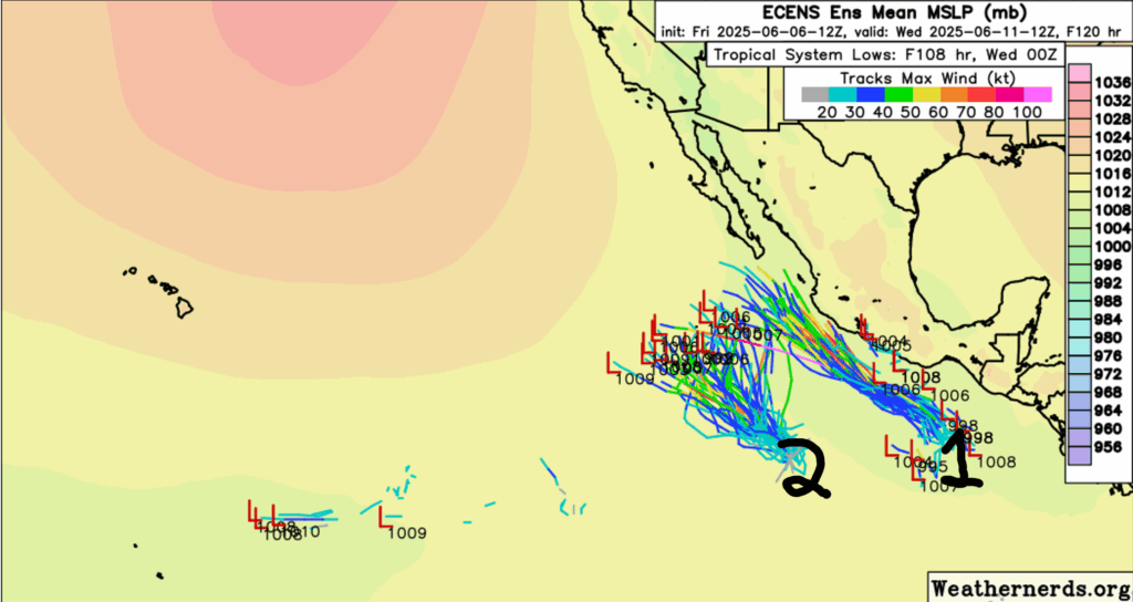
We can see that most of the ensemble members (all of the possible storm tracks) show no landfall, with the exception of a few rogue members from disturbance one. This same setup is pretty consistent across many different types of ensemble models, so we can be confident that these disturbances won’t last long enough to make landfall. Similarly, we can also see merging storm tracks for some of the ensemble members, so the merging of these two disturbances is possible, but low. The only likely effect on land from these disturbances would be some scattered rainfall across Mexico (See precipitation forecast below).

As for future tropical development this season, this specific region in the East Pacific seems to be the go-to area for tropical formations. This is not shocking, as very warm sea surface temperatures have been consistent for the duration of this hurricane season so far, as well as low wind shear and high instability in the atmosphere. This region is definitely one to keep an eye on!
Trouble in the Atlantic unlikely for now
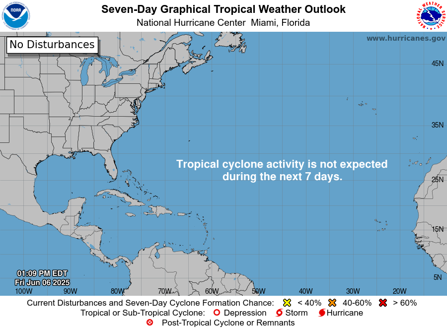
Despite some suspicions of a blowout hurricane in the Atlantic or Gulf regions, the NHC has no forecasted tropical activity in these areas for the next week. You may see models like the GFS being posted on social media or other online platforms forecasting huge hurricanes making landfall in the Atlantic or Gulf, but it’s important to keep in mind that it is only showing one run of a specific model.
It is crucial to compare different types of models in order to avoid bias, as the GFS can be biased at times with showing major tropical activity when it is most likely not the case. So, be careful with what you see online and use trusted sources, like the National Hurricane Center, which we use heavily here at NickelBlock!


