Today we will be seeing some on and off showers and possibly a thunderstorm throughout the day, but hopefully getting a bit of sunshine in the middle of the day. As for next week, more soggy weather will be coming through, with severe storms possible as well. So, let’s take a closer look at what’s in store:
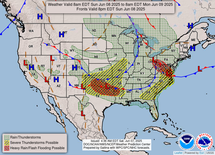
The current atmospheric setup we have for today shows a cold front sagging into Alabama, Georgia, and the Carolinas. This cold front will cause rain and thunderstorms ahead of it. There is also a stationary front over Louisiana and much of Mississippi. This stationary front will encourage the stormy weather to stay put. As you can see, rain and thunderstorms are forecasted for our entire area with severe thunderstorms possible for the northern part of Louisiana, and a small portion of Mississippi. There is even a risk for heavy rain and flash flooding in northwest Louisiana, so if you are in that area keep an eye out for any flood warnings that may be issued.
The risk area for severe thunderstorms is forecast to increase in our area tomorrow. Check out this map from the Storm Prediction Center:
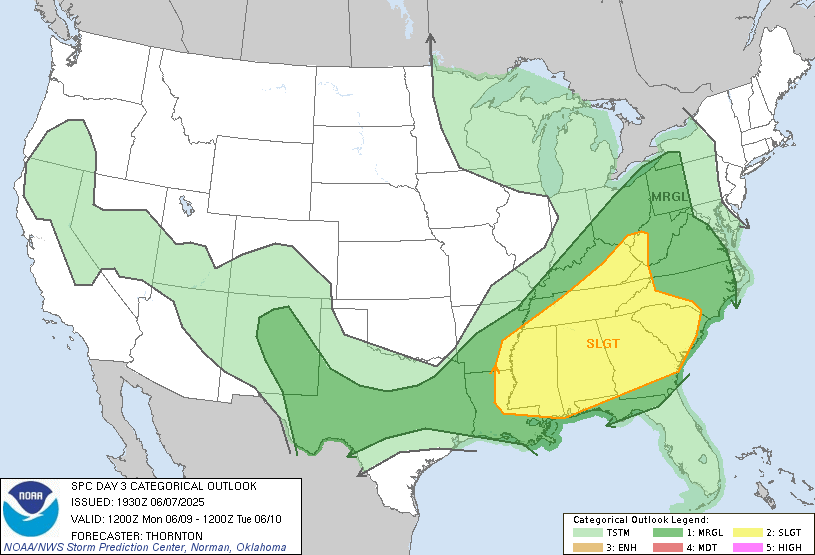
There is a level 2, or “slight”, risk for severe thunderstorms tomorrow for all of Mississippi and Alabama, and some of Louisiana as well. Although this is only a slight risk, damaging winds and even large hail are still a possibility. Once again, be ready for possible severe weather warnings, and head inside if any storms are approaching.
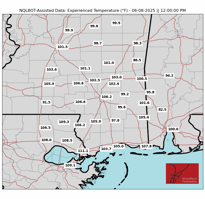
Temperatures will reach the low 90s today, but high humidity will make it feel substantially hotter than the actual temperature. Looking at the experienced temperature map above, we can see that the “feels like” temperatures exceed 100 degrees in many areas. So if you find some sunshine between storms, be sure to stay hydrated and take breaks when needed during outside activities!
Looking Further…

Looking at our 15 Day forecast, we can see a high chance of thunderstorms until Wednesday with a small break Thursday and Friday, and storms picking back up by the weekend. Although the incoming cold front is causing all this soggy weather this week, it will also help the temperatures cool off a bit, but with high humidity it may feel warmer than it actually is.
Note that many of these storms will be scattered, so it won’t be torrential downpours all day every day. Take a look at the precipitation forecast for this upcoming work week:
Regional Day-to-Day Forecast:
Today: Chance of showers and thunderstorms in the morning, mostly sunny during the early afternoon, and a chance of showers and thunderstorms later in the afternoon. Highs in the low 90s. Chance of precipitation 50%.
Tonight: Chance of showers and thunderstorms throughout the night. Lows in the low 70s. Chance of precipitation 60%.
Monday: Chance of showers and thunderstorms throughout the day. Highs in the high 80s during the day and lows in the mid 70s at night. Chance of precipitation 70%.
Tuesday: Chance of showers and thunderstorms throughout the day. Highs in the high 80s during the day and lows in the low 70s at night. Chance of precipitation 70%.
Wednesday: Chance of showers and thunderstorms throughout the day. Highs in the high 80s during the day and lows in the mid 70s at night. Chance of precipitation 30%.
Thursday: Mostly sunny in the morning, with a chance of showers and thunderstorms in the afternoon Highs in the high 80s during the day and lows in the mid 70s at night. Chance of precipitation 70%.
Friday: Chance of showers and thunderstorms throughout the day. Highs in the low 90s during the day and lows in the low 70s at night. Chance of precipitation 40%.
Saturday: Mostly sunny with a chance of showers and thunderstorms in the afternoon. Highs in the low 90s during the day and lows in the mid 70s at night. Chance of precipitation 40%.
Sunday: Mostly sunny with a chance of showers and thunderstorms in the afternoon. Highs in the high 80s during the day and lows in the mid 70s at night. Chance of precipitation 50%.


