To no surprise, more wet weather is forecasted for the rest of this week and going into next week, but with minimal risk for very severe weather. The typical summertime pattern of afternoon showers and thunderstorms is here to stay for a while, along with the usual 80 to 90 degree temperature range. Further into next week, though, there is a strong possibility for it to clear up for a couple days, so hopefully we just have to wait another week for some nice weather! Let’s get into the details:
Today’s setup and weather:
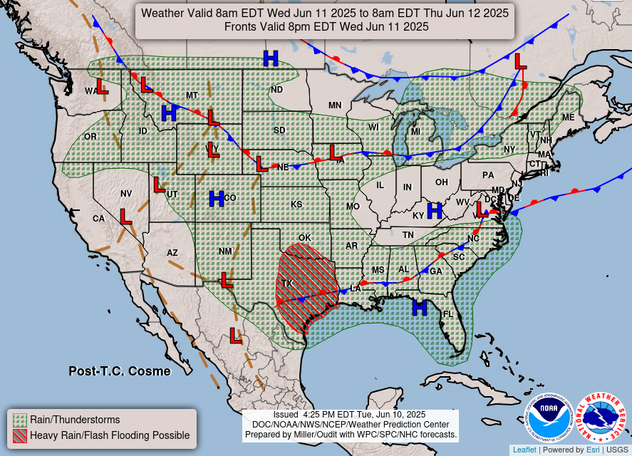
As you can see, we have more rain and thunderstorms forecasted in our region today, and some possible heavy rain and flash flooding over much of Texas and Oklahoma. There is a long stationary front draped over our entire area as well, unfortunately meaning that the wet weather is here to stay.
So, today we can expect some scattered showers and thunderstorms like usual, but any sort of severe weather is unlikely for today. Check out the precipitation for today:
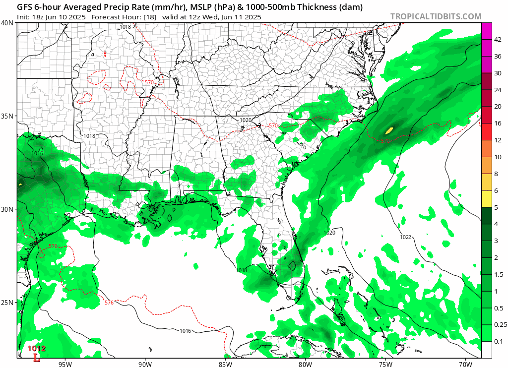
We can see scattered showers passing through the region. The Storm Prediction Center dropped the Marginal Risk for severe weather in our area. But still keep tabs on the National Weather Service alerts as advisories, watches, or warning may be necessary.
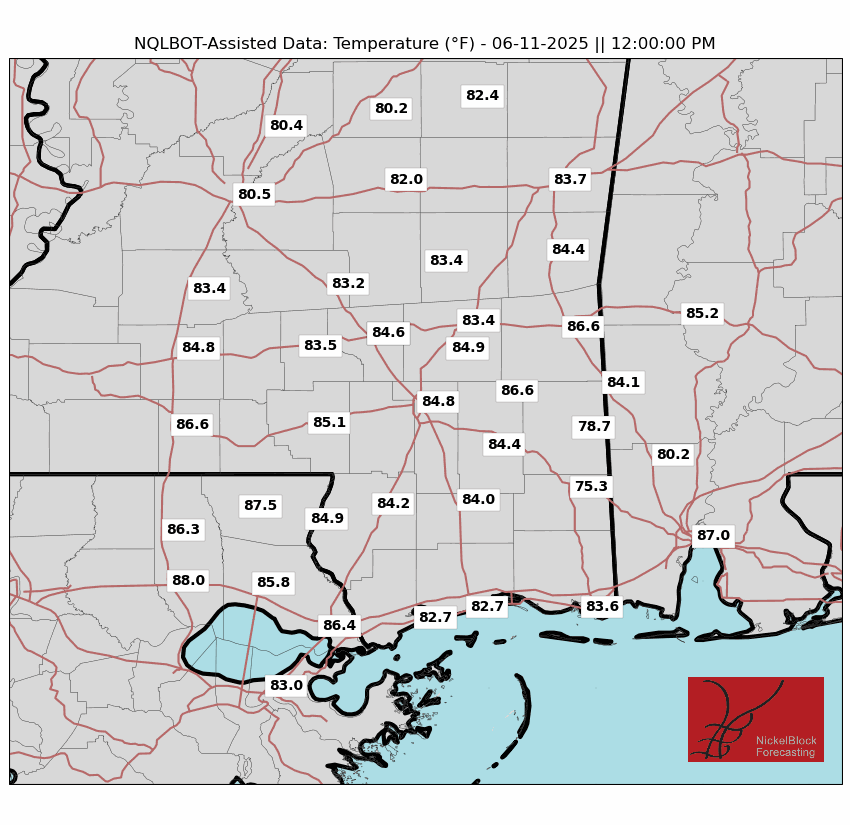
Temperatures are also looking a bit cooler than usual today:
This type of scattered, soggy weather will continue for the rest of the week and into the weekend, due to the stationary front that is sitting over us. We can expect some daily afternoon showers and thunderstorms, and high temperatures ranging from the mid 80s and reaching up to the low 90s.
Looking ahead – finally a break?

As for next week, we can see that the wet weather will continue through the beginning of the week. This will most likely be the typical situation of scattered afternoon showers and thunderstorms with high temperatures in the upper 80s and some high humidity making it feel pretty muggy outside. Mid-week and through the end of the work week we can also see a small break from all this wet weather with some sunny skies for next Wednesday to Friday.
Also notice the experienced temperatures (marked as “ET” in the image) for these nice days. It is going to feel much hotter than the actual temperature, often exceeding 105 degrees for the “feels like” temperatures. So if you plan on taking advantage of the sunny weather with outside activities, make sure to stay hydrated and take breaks when needed!
Regional Day-to-Day Forecast:
Today: Mostly sunny in the morning, with a chance of rain and thunderstorms, mostly in the afternoon. Highs in the mid 80s. Chance of precipitation is 70%.
Tonight: Chance of scattered showers and thunderstorms throughout the night. Lows in the low 70s. Chance of precipitation 40%
Thursday: Chance of showers and thunderstorms throughout the day. Highs in the high 80s during the day, and lows in the mid 70s at night. Chance of precipitation 70%.
Friday: Chance of showers and thunderstorms throughout the day. Highs in the high 80s during the day, and lows in the mid 70s at night. Chance of precipitation 80%.
Saturday: Partly sunny during the morning, with a chance of showers and thunderstorms in the afternoon. Highs in the high 80s during the day, and lows in the mid 70s at night. Chance of precipitation 70%.
Sunday: Mostly cloudy during the morning, with a chance of showers and thunderstorms in the afternoon. Highs in the high 80s during the day, and lows in the mid 70s at night. Chance of precipitation 80%.
Monday: Partly sunny during the morning, with a chance of showers and thunderstorms in the afternoon. Highs in the high 80s during the day, and lows in the mid 70s at night. Chance of precipitation 80%.
Tuesday: Partly sunny during the morning, with a chance of showers and thunderstorms in the afternoon. Highs in the high 80s during the day, and lows in the mid 70s at night. Chance of precipitation 60%.
Wednesday: Partly sunny during the morning, with a chance of showers and thunderstorms in the afternoon. Highs in the high 80s during the day, and lows in the mid 70s at night. Chance of precipitation 50%.


