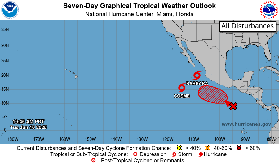
With two tropical storms and a disturbance wreaking havoc on the East Pacific, there is a lot to talk about today. Tropical Storm Barbara was briefly categorized as the first hurricane of the 2025 hurricane season on Monday morning, but by that same evening it weakened to a tropical storm.
Tropical Storm Cosme is moving alongside Barbara, and fortunately is not forecasted to strengthen to a hurricane. Additionally, following in Barbara and Cosme’s footsteps is yet another disturbance!
Tropical Storm Barbara
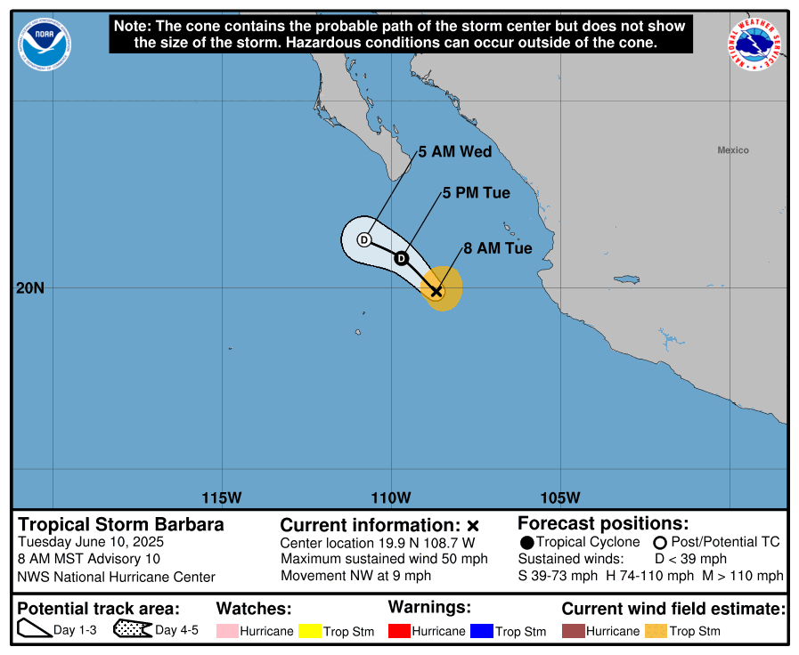
As mentioned before, Barbara became the very first hurricane of the 2025 season for less than a day until it weakened to a tropical storm due to it encountering cooler ocean temperatures to the North. Barbara is currently located west of Puerto Vallarta, Mexico and is moving in the Northwest direction at about 9 mph. Tropical Storm Barbara has a central low pressure of 1004 mb with maximum sustained winds at 50 mph.
Fortunately, Barbara is forecasted to weaken further and dissipate by Wednesday, without making any landfall. The main concern on land would be some rough surf on the coast of Central Mexico and the southern tip of Baja California Sur. Other than that, there are no other imminent threats on land to be concerned about.
Tropical Storm Cosme
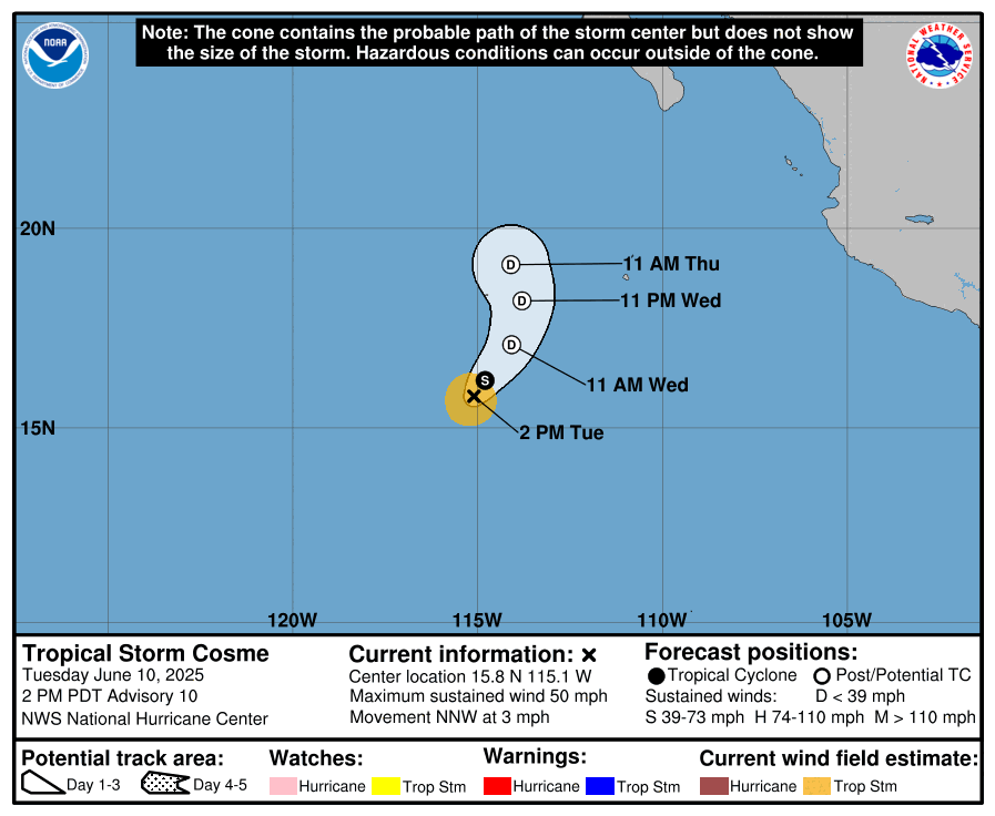
Tropical Storm Cosme is also moving northwest, but a slower pace than Barbara at 3 mph. Cosme is also forecasted to last a little bit longer and eventually weaken and dissipate moving into Thursday evening. Cosme’s central low pressure is estimated to be 1001 mb with maximum sustained winds at 50 mph. Similar to Barbara, Cosme is not projected to make landfall. Additionally, we are not expecting any hazards on land so far.
So, although there is a lot of tropical storm activity going on in the East Pacific, both systems are forecasted to weaken rather quickly and dissipate with in the next day or so without making landfall. There are also no major threats to land, with the exception of some possible rough surf in Mexico.
Disturbance in the Pacific
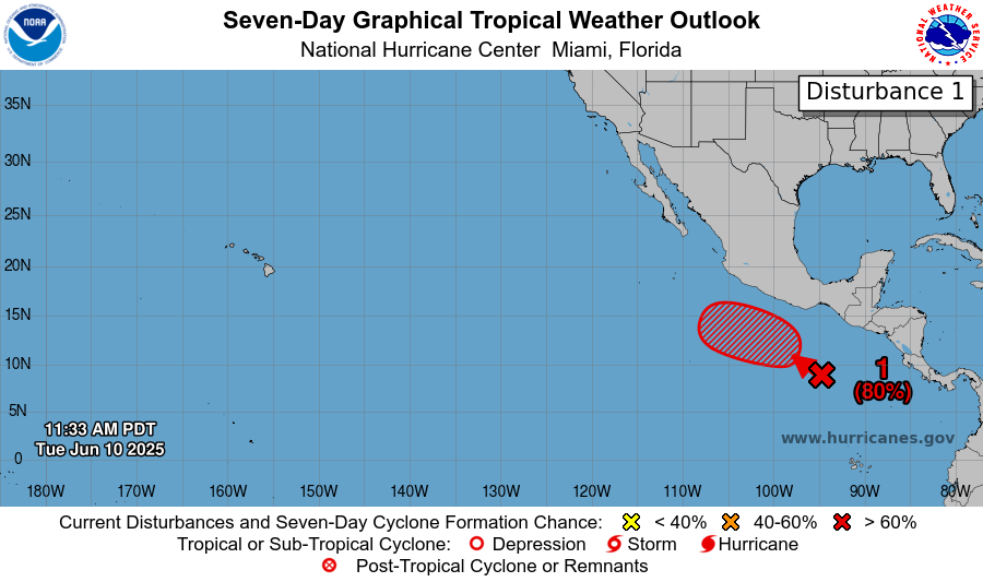
There is another disturbance forming off the southwestern coast of Mexico, and has an 80% chance of tropical formation in the next week, but only a 10% chance of forming in the next 48 hours. The disturbance is following behind our two tropical storms in the west-northwestward direction, and is expected to become a tropical depression by this weekend.
If you have been following the tropics at all this hurricane season, you’ve probably noticed that disturbances have been forming over and over again in that same spot south of the southern coast of Mexico, and tend to move in a similar direction to the northwest. You may also be wondering: Why is this? Well, sea surface temperature have been scorching in that specific area for practically all of the 2025 Pacific hurricane season, and is forecasted to stay this warm for now. Also, humidity and atmospheric stability have been generally high enough, as well as wind shear low enough, for long enough periods of time for disturbances to form. All these conditions occurring at the right times will cause these repeated disturbances that we have seen for the past few weeks. Once again, this area is definitely one to watch this summer!
No Tropical Atlantic Activity for Now
The National Hurricane Center does not expect any type of tropical activity in the Atlantic for the next week. Let’s take a look at the current setup of the Atlantic:
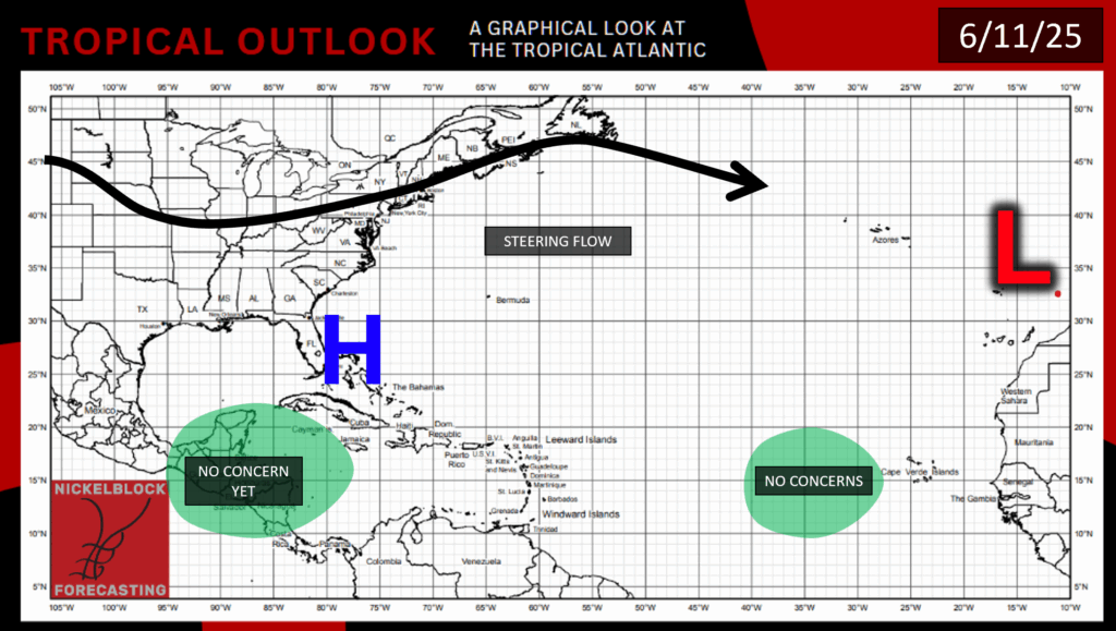
As you can see in the Tropical Outlook, there is an area of high pressure over the south Atlantic. This is a great spot for a high pressure area to sit on to prevent tropical action. With the combination of high pressure and a lack of moisture in the area, we can see why the NHC is not expecting any tropical activity within the next week. Sea surface temperatures in the Atlantic are starting to warm up for the summer, though, so it is likely that tropical activity will be happening, just not very soon.


