This weekend and next week we still have our regular summer weather of scattered afternoon showers, a thunderstorm here and there, and the muggy combination of high temperatures in the low 90s and high humidity. Although, the following week may bring us some dryer weather. Let’s get into the details!
Today’s setup
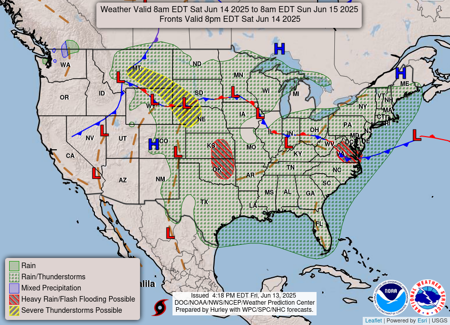
As you can see, there is a chance for rain and thunderstorms for our entire region. This is because of the trough located above us in Arkansas, Tennessee, and Kentucky and the low pressure system next to to bringing the soggy weather to our area. Humidity is pretty high and is forecasted to stay high for the next week, so we will most likely be seeing more scattered storms throughout the week.
This Weekend’s Outlook:
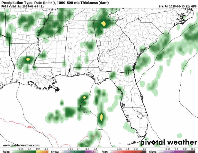
For today, we can expect a typical summer day: a nice, partly sunny morning, with some scattered showers and possibly a thunderstorm rolling in during the afternoon. On Sunday, showers will be scattered throughout the entire day. There are no major threats for severe weather, though, just keep an eye out for thunder and lightning if you plan on going outside. Here’s the forecast for precipitation for the weekend, notice the scattered showers throughout the weekend:
Here are the experienced, or “feels like” temperatures for this weekend:
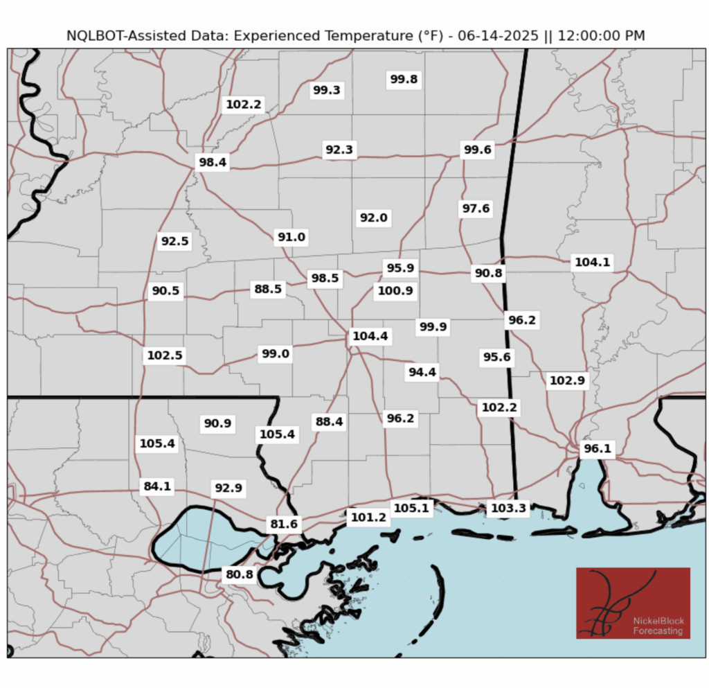
High temperatures this weekend will get up to about 90 degrees, but with the high humidity in our area, it will feel a good 10-15 degrees warmer than it actually is. So if you plan on being outdoors, be aware of how hot it may feel, and stay hydrated and take breaks while outside!
Next Week’s Weather:

This week, we are looking at our typical summer pattern of mostly sunny mornings, and then scattered showers and thunderstorms in the afternoon, although these popup storms will likely not pose any sort of severe threat. By the following week, though, we may see a longer stretch of days with no rain, and slightly higher temperatures.
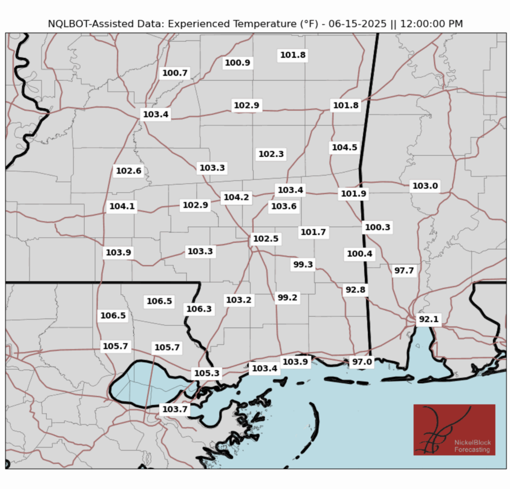
As usual, high temperatures this week will reach the low 90s, and along with humidity remaining high for the next week, it will tend to feel much warmer than it actually is. Check out the experienced temperatures (marked as ET on the forecast) and you can see that most days it will feel around 15 degrees hotter than the actual temperature. Once again, if you plan on being outside, definitely be careful and stay hydrated while outside.
Regional Day-to-Day Forecast:
Today: Partly sunny in the morning with a chance of showers and thunderstorms in the afternoon. Highs reaching 90 degrees. Chance of precipitation 60%.
Tonight: Slight chance of showers and thunderstorms early in the evening. Lows in the mid 70s. Chance of precipitation 30%.
Sunday: Chance of showers and thunderstorms throughout the day. Highs reaching 90 degrees during the day, and lows in the mid 70s at night. Chance of precipitation 80%.
Monday: Partly sunny in the morning with a chance of showers and thunderstorms in the afternoon. Highs reaching 90 degrees during the day and lows in the mid 70s at night. Chance of precipitation 70%.
Tuesday: Partly sunny in the morning with a chance of showers and thunderstorms in the afternoon. Highs reaching 90 degrees during the day and lows in the mid 70s at night. Chance of precipitation 60%.
Wednesday: Partly sunny in the morning with a chance of showers and thunderstorms in the afternoon. Highs in the low 90s during the day and lows in the mid 70s at night. Chance of precipitation 50%.
Thursday: Mostly sunny in the morning with a chance of showers and thunderstorms in the afternoon. Highs in the low 90s during the day and lows in the mid 70s at night. Chance of precipitation 50%.
Friday: Mostly sunny in the morning with a chance of showers and thunderstorms in the afternoon. Highs in the low 90s during the day and lows in the mid 70s at night. Chance of precipitation 40%.
Saturday: Partly sunny in the morning with a chance of showers and thunderstorms in the afternoon. Highs in the low 90s during the day and lows in the mid 70s at night. Chance of precipitation 30%.


