The Gulf of Mexico has awakened in the past few days, with Florida potentially at risk of tropical impacts, all while the Western Pacific continues to be a hurricane factory.
BARRY IMPACTS NORTHEAST MEXICO
In what was somewhat of a surprise, Tropical Storm Barry formed in the western Gulf of Mexico two days ago. But just as quickly as it formed, it weakened into a tropical depression, before hitting northeastern Mexico. All this storm really brought was some gusty winds and some minor flooding in the Tampico metro area.
FLOSSIE IMPACTING WESTERN MEXICO
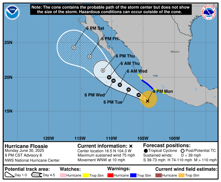
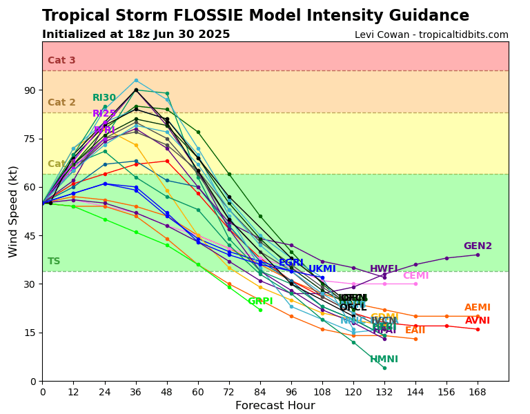
Meanwhile, the West Pacific continues to spin up storms. Hurricane Flossie is paralleling the coast of Mexico, and is likely to strengthen as the environment is low shear with high surface water temperatures. Sustained winds are 75 miles per hour, moving west northwest at 10 miles per hour, with a central pressure of 988 millibars. Some models do have this storm reaching Category 2 status in 12-24 hours. The one saving grace is that this storm is headed for a rather dry environment, which will prevent this storm form realizing its true potential.
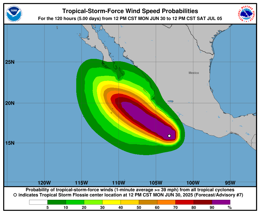
Depending on how strong the storm gets, the tropical storm force wind field could reach western Jalisco, Michoacan, and Colima for a short period of time this afternoon and evening. Rain from the storm could locally exceed 6 inches. Storm surge isn’t a massive concern but rough seas are still expected, with perhaps some waves impacting areas directly next to beaches.
Some models are having a low pressure steer this storm to an impact in Baja California, while most others have it ride the trade winds out into the Pacific. At this point in time, this storm will likely weaken to a tropical storm as it encounters drier upper-level air, but interests in northwest Mexico, potentially in a place like Cabo San Lucas, a summer tourist destination, should keep their eye on this storm.
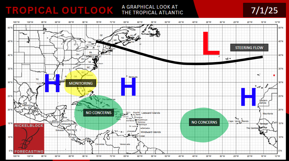
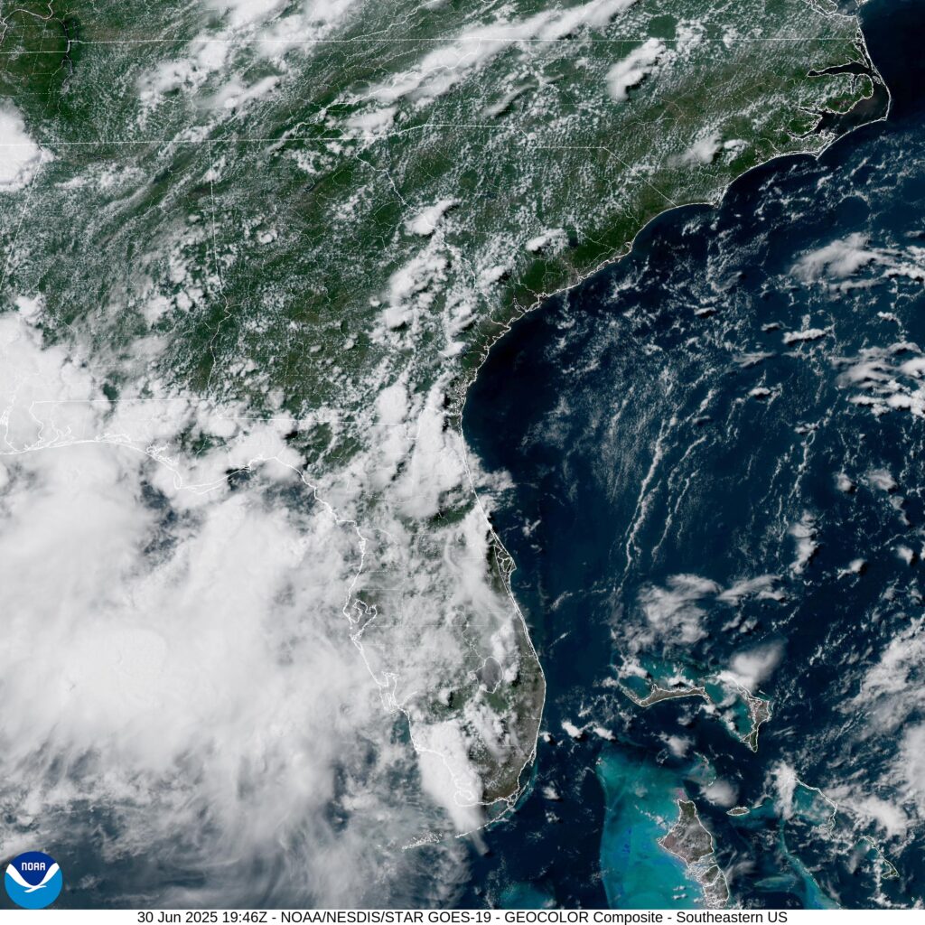
A 4TH OF JULY SURPRISE FOR FLORIDA?
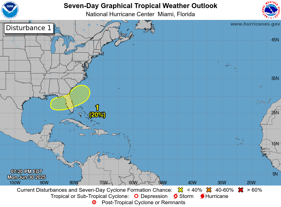
The NHC has highlighted an area surrounding northern Florida as a potential development region, north of a frontal boundary that could form over South Florida. Some ensemble members have a storm impacting central Florida in and around the 4th of July. All the traditional ingredients are there, warm ocean water, moisture, converging winds, pre-existing showers and thunderstorms, and even a break in the wind shear. The issue? Many of the highlighted area is over land, which is like poison to hurricanes. It would have to form either on the eastern or western fringe of the area. If it forms on the eastern fringe, it would likely ride a trough to the northeast, meaning no state besides Florida would be directly impacted. But even if it does form to the west and hits Florida, due to how little time it has, I doubt it would even reach hurricane status. Nevertheless, it is worth keeping an eye on this area.
EXTENDED OUTLOOK
Models are in agreement that at least one, potentially two more tropical storms will develop in the 5-15 day time frame that will travel in the same direction as Flossie, but likely further from the coast, which is good news. Wind shear may also enter the area, preventing these storms from intensifying too readily. Moisture and warm ocean water will be present.
The Atlantic basin outside the Gulf of Mexico is dormant for now. Temperatures remain too low off the coast of Africa where tropical waves like to form, and wind shear remains too high across the Caribbean. Some ensembles suggest it is possible we could get another short “fish storm” like Andrea off the coast of the Mid-Atlantic, but it would likely only be an issue for boats and vessels traveling between Europe and North America.


