Today will be mostly clear, with a slight chance of showers in sparse areas of our regions. This dry weather will stick around for a while, so we should have a nice, seasonable Independence Day. If you have outdoor activities or gatherings for the holiday, keep reading for my 4th of July Outlook for more details!
Overall Setup for Today:
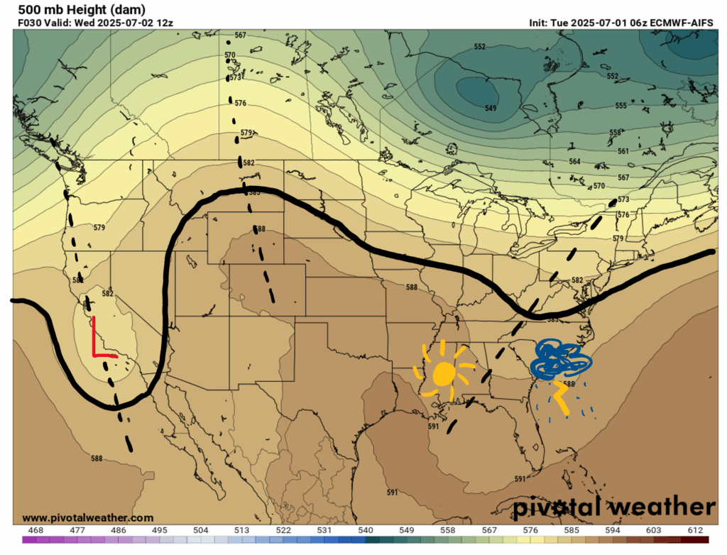
Looking at our 500 mb chart for this morning, we can see a trough with a closed low pressure area over California, a ridge over Montana and Wyoming, and finally another trough over the Virginias. Looking at that last trough, we can see a positively (leaning to the right) trough axis (the black dotted line I drew). To the left of the positively tilted trough we typically see clearer and drier weather, and to the right of the trough axis, not so great weather. This is also reflected in the surface chart for today:
Looking at our surface map, we can see the cold front that moved into our region yesterday is on its way out, so some people in our region may see a very brief shower today, but some longer periods of dry weather are right behind it.
Today’s Weather:

For a closer look at how hot it might “feel like” today, check out the experienced temperatures for today at noontime:
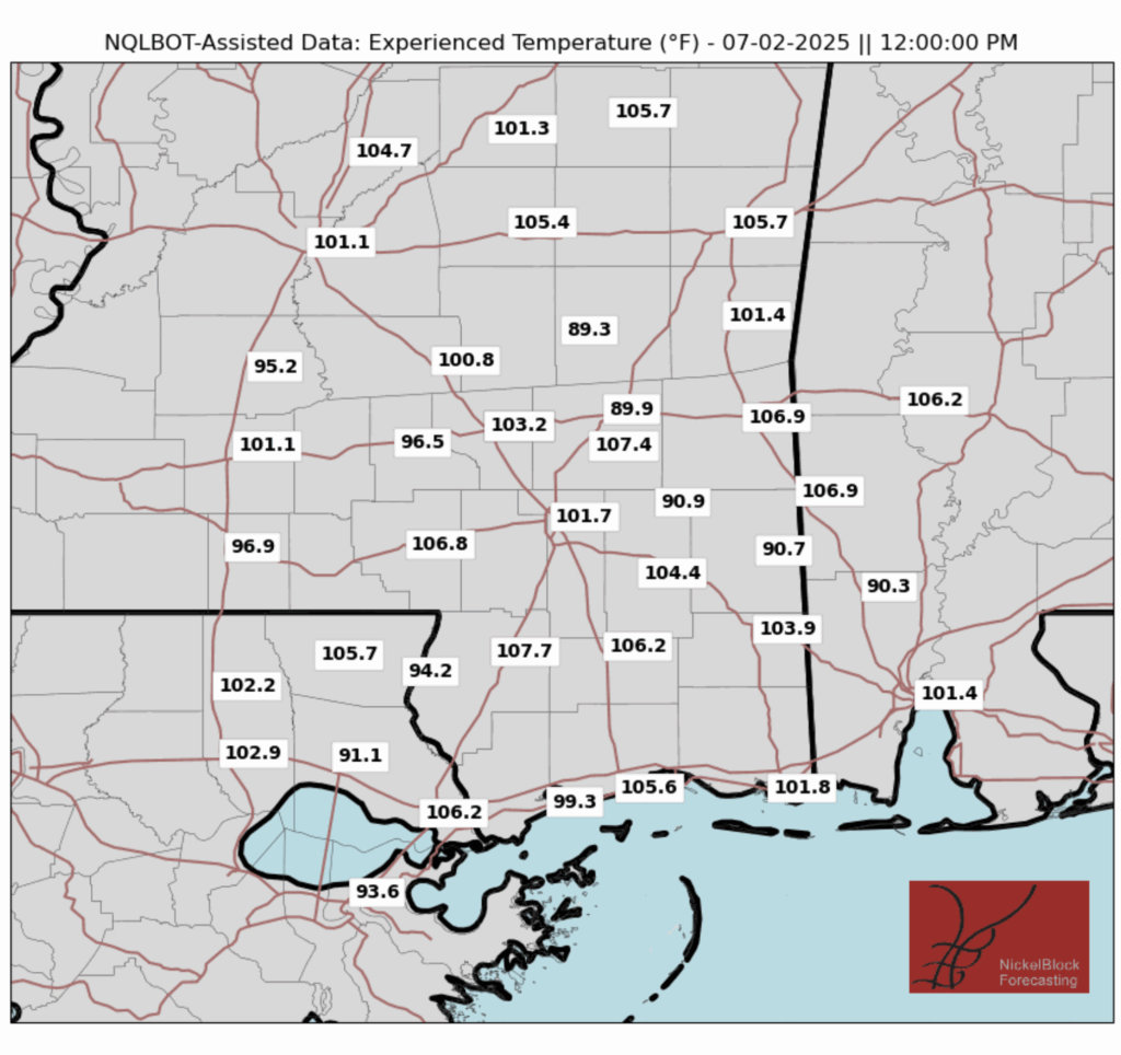
As usual, experienced temperatures in many areas will exceed 100 or even 105 degrees, so taking precautions to be safe in the heat may be necessary if you plan on being outside for much of the day today.
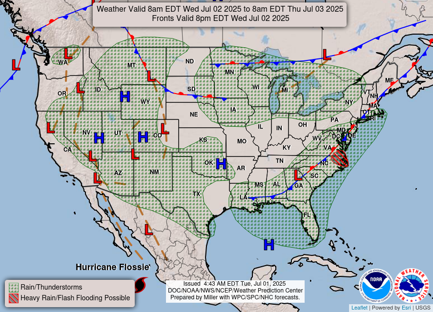
As for possible showers today:
As you can see, we have a few small, light showers scattered across the area in the afternoon hours, so there is a good chance that tomorrow will be a completely dry day, depending on your exact location.
4th of July Outlook:
If you have any outdoor Independence Day plans for this Friday, luckily it is looking to be a dry and clear day. Here are some more details:
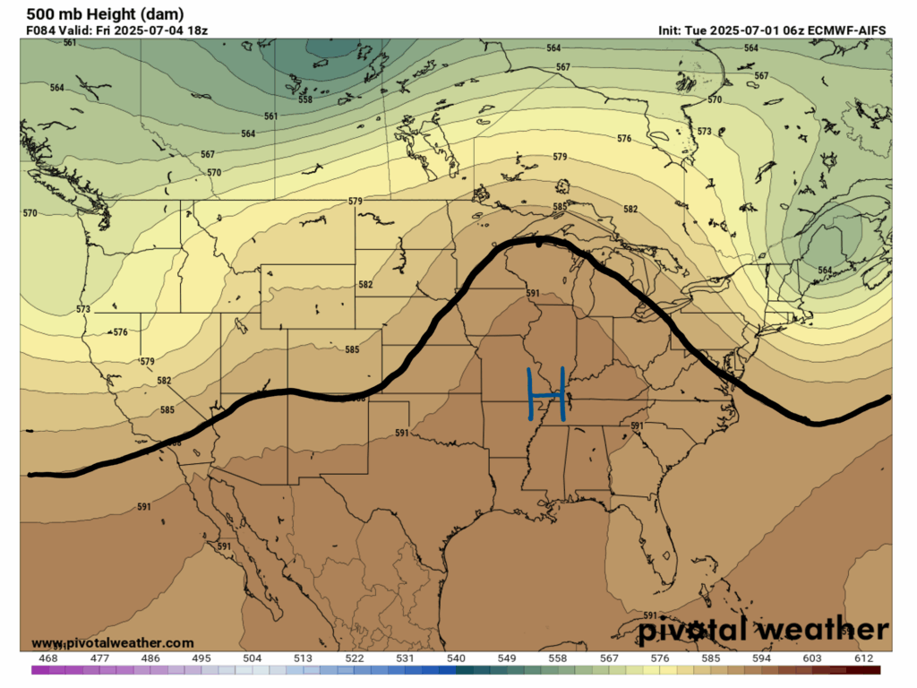
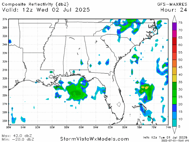
Our upper-level chart for Friday afternoon shows a big ridge building in over us, bringing us more clearer weather, with an area of high pressure over the region. This high pressure will keep us nice and dry – check out the radar for the 4th:
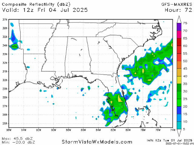
As you can see, we lucked out with a dry day, spared from most of the afternoon showers. So while rain and thunderstorms should not pose a threat, making sure to stay cool throughout the day will be important:
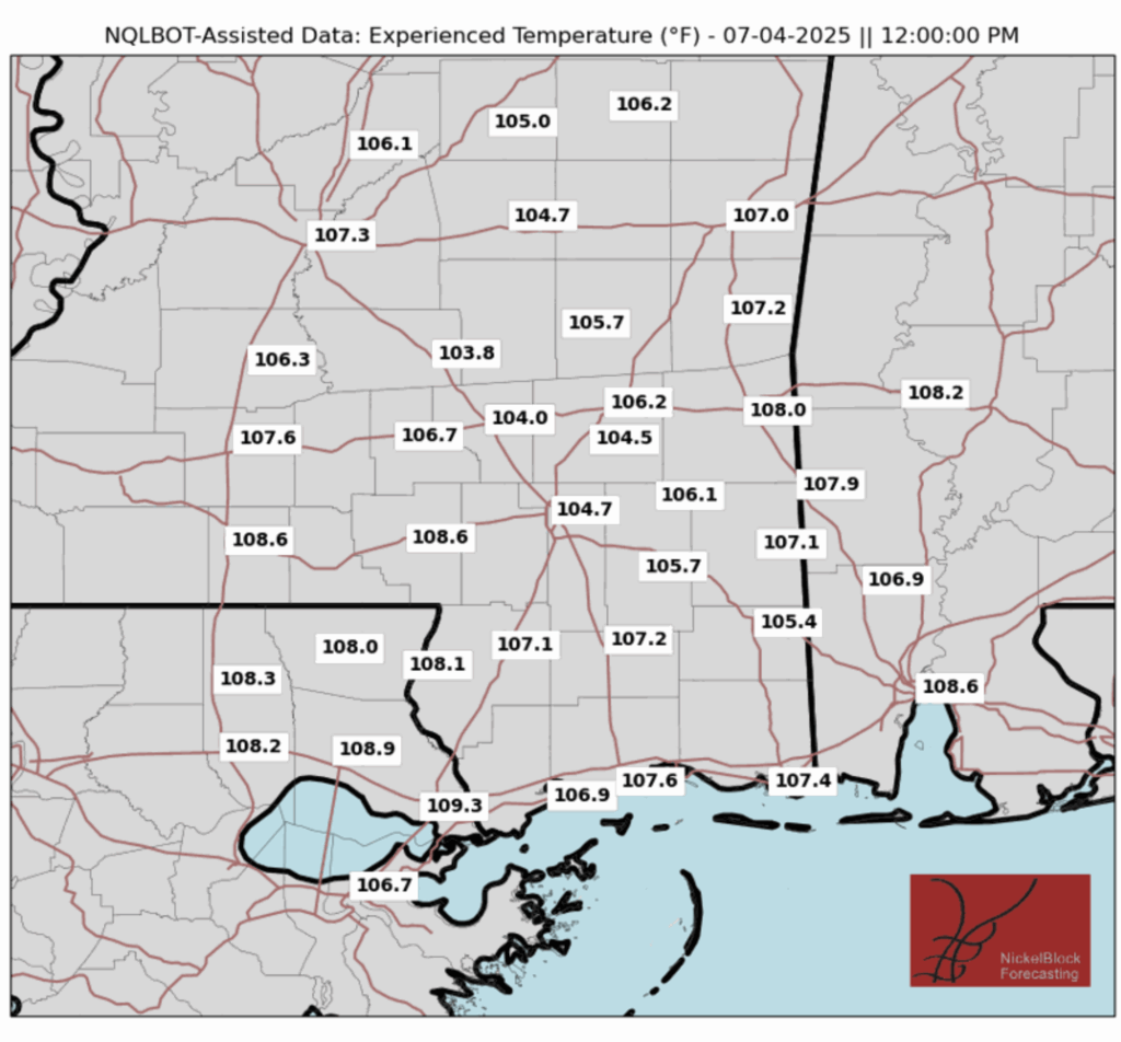
Actual temperatures will reach the mid 90s in some areas on July 4th, and combined with dewpoints reaching the high 60s, the “feels like” temperatures will be pushing 100-105 degrees. These temperatures will most likely not warrant an official heat advisory, but if you plan on being outside for much of your holiday, be sure to stay hydrated and take some breaks from the heat throughout the day.
Extended Outlook:

Looking at our 15-Day Forecast, we can see that dry weather is on its way, and here to stay for a while. There are still chances for storms, increasing as we move into the weekend and next week. Our typical temperatures will also remain, with high temperatures bouncing between the low to mid 90s, and low temperatures in the low to mid 70s.
Regional Day-to-Day Forecast:
Today: Mostly sunny during the morning, with a slight chance of showers and thunderstorms in the afternoon. Highs in the low 90s. Chance of precipitation 20%.
Tonight: Partly cloudy, then a slight chance of showers and thunderstorms. Lows in the low 70s. Chance of precipitation 20%.
Thursday: Partly cloudy. Highs in the low 90s during the day, and lows in the low 70s at night. Winds will be calm, around 5 mph.
Friday (4th of July): Mostly sunny. Highs in the mid 90s during the day, and lows in the low 70s at night. Winds will be calm, around 5 mph.
Saturday: Mostly sunny. Highs in the mid 90s during the day, and lows in the low 70s at night. Winds will be calm, around 5 mph.
Sunday: Mostly sunny during the day, with a slight chance of showers in the afternoon. Highs in the mid 90s during the day, and lows in the low 70s at night. Chance of precipitation 20%.
Monday: Mostly sunny during the day, with a chance of showers in the afternoon. Highs in the mid 90s during the day, and lows in the low 70s at night. Chance of precipitation 20%.
Tuesday: Mostly sunny during the day, with a chance of showers in the afternoon. Highs in the mid 90s during the day, and lows in the low 70s at night. Chance of precipitation 40%.
Wednesday: Mostly sunny during the day, with a slight chance of showers in the afternoon. Highs in the mid 90s during the day, and lows in the low 70s at night. Chance of precipitation 20%.


