We will be having a warm weather weekend, with temperatures ranging from the low to even high 90s during the day. There will be a chance for afternoon or evening popup showers both Saturday and Sunday. For the weekend and also moving into next week, it will be important to monitor and be prepared for some hot weather. Let’s get into the details:
Current Atmospheric Setup:
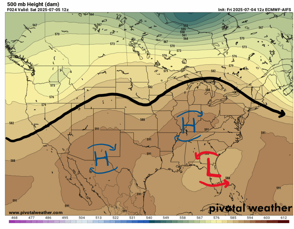
Looking at our 500 mb chart you can notice the low pressure area over the Southeast. The National Hurricane Center has denoted this low pressure area as a tropical disturbance, which will likely form into a tropical depression, bringing rain to the Southeast and East Coast over the next few days. If you would like more details on this disturbance, check out today’s tropical update!
Other than the low pressure area, there is also a ridge over the West, a small trough over the Midwest, and another ridge over the Great Lakes.
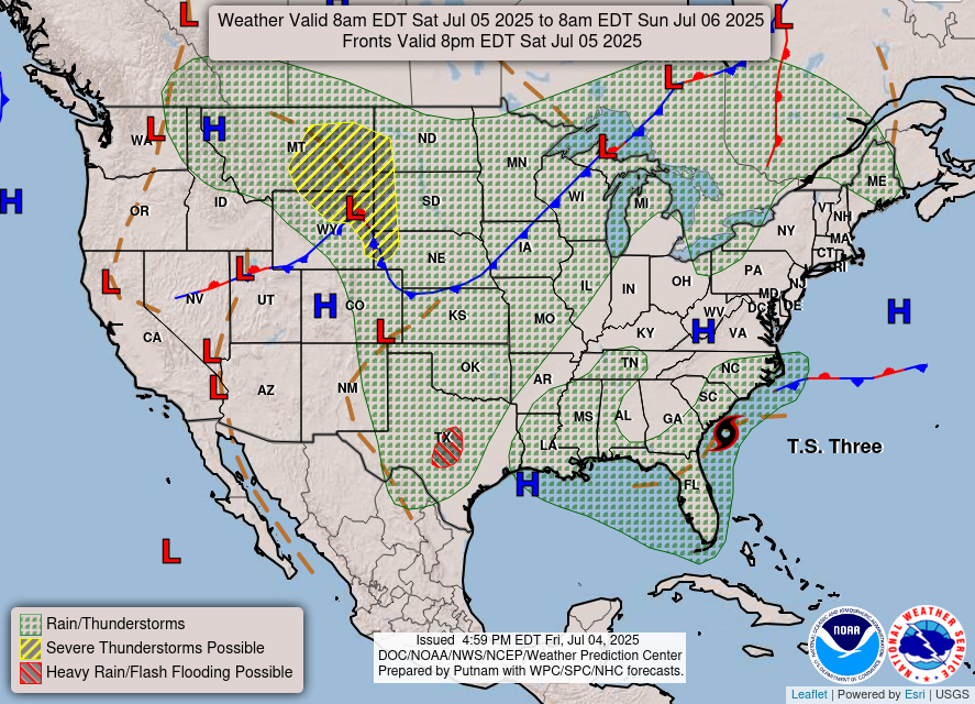
Looking at the NWS surface chart, we have rain and thunderstorms forecasted for our region, but these storms probably won’t be severe. With our current atmospheric setup, we can expect our typical summer weather pattern for afternoon/evening showers and thunderstorms, but heat indices may be high.
Weekend Outlook:
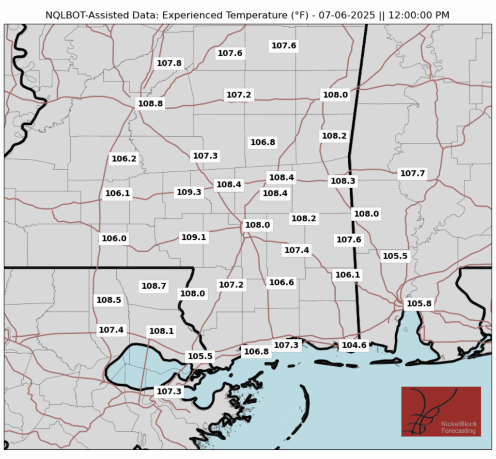
Today temperatures will be pretty seasonable, but will be increasing by a few degrees by Sunday. Check out the experienced, or “feels like” temperatures for this weekend:
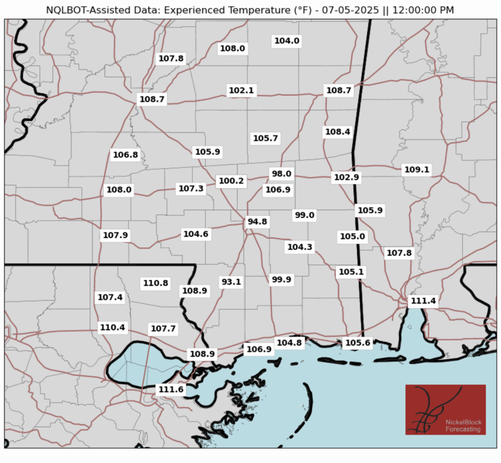
Tomorrow, experienced temperatures will exceed 105 degrees in most places across our region, so if you have any outdoor activities planned for Sunday, make sure to stay hydrated and be careful in the heat. These high heat indices will likely persist going into next week, so be prepared for that as well.
We can expect some scattered showers and possibly a thunderstorm both days this weekend, but it is unlikely that these storms will be long-lasting or severe:
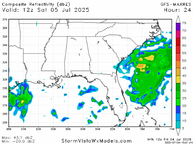
We can see the tropical disturbance east of Florida making its way up the East Coast, but luckily we will be mostly spared from its rainfall.
Beyond this Weekend:

Rain and storm chances should be lower this week, but some afternoon showers and thunderstorms cannot be ruled out. It will be important to continue to watch the heat index, with high temperatures and dewpoint increasing the “feels like” temperatures for the week.
Regional Day-to-Day Forecast:
Today: Sunny during the morning, with a chance of showers and thunderstorms in the afternoon. Highs in the mid 90s. Chance of precipitation 30%.
Tonight: Mostly clear. Lows in the mid 70s. Winds will be calm, about 5 mph.
Sunday: Sunny during the morning, with a chance of showers and thunderstorms in the afternoon and evening. Highs in the mid 90s during the day and lows in the mid 70s at night. Chance of precipitation 50%.
Monday: Mostly sunny during the morning, with a chance of showers and thunderstorms in the afternoon. Highs in the mid 90s during the day and lows in the mid 70s at night. Chance of precipitation 50%.
Tuesday: Sunny during the morning, with a chance of showers and thunderstorms in the afternoon. Highs in the mid 90s during the day and lows in the mid 70s at night. Chance of precipitation 50%.
Wednesday: Sunny during the morning, with a chance of showers and thunderstorms in the afternoon. Highs in the mid 90s during the day and lows in the mid 70s at night. Chance of precipitation 60%.
Thursday: Mostly sunny during the morning, with a chance of showers and thunderstorms in the afternoon. Highs in the mid 90s during the day and lows in the mid 70s at night. Chance of precipitation 50%.
Friday: Mostly sunny during the morning, with a chance of showers and thunderstorms in the afternoon. Highs in the low 90s during the day and lows in the mid 70s at night. Chance of precipitation 60%.
Saturday: Mostly sunny during the morning, with a chance of showers and thunderstorms in the afternoon. Highs in the low 90s during the day and lows in the mid 70s at night. Chance of precipitation 60%.


