We currently have two disturbances in the tropics – one in the Southeast Atlantic and another in the East Pacific. The Atlantic disturbance may bring some rain to the Southeast and up the East Coast, but it is unlikely that this disturbance will develop into something major. The East Pacific disturbance is likely to form into a tropical cyclone of some sort, but it is looking like it will veer off into the Pacific and avoid making landfall. Let’s first start with the Atlantic:
The Atlantic Disturbance
Here’s our current setup in the Atlantic:
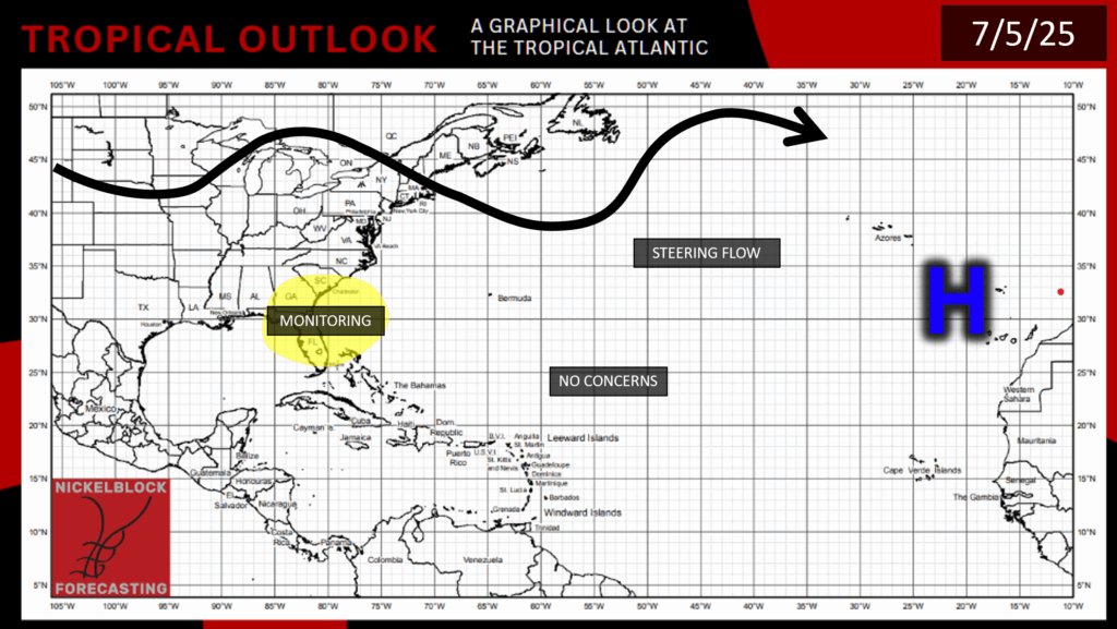
There is still a large area of high pressure west of the Sahara, but an area of low pressure has formed over the Southeast with surrounding showers and thunderstorms, so this area is one to watch.
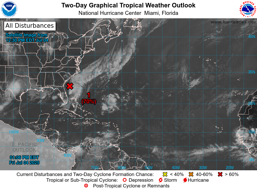
The storms surrounding this low pressure area are beginning to get themselves organized, so the disturbance has a 70% chance of development in the next 48 hours. This disturbance is likely to form into a tropical depression in the next couple of days, but probably wont last as a depression very long, especially after making potential landfall. Speaking of potential landfall, let’s take a look at where this disturbance might go:
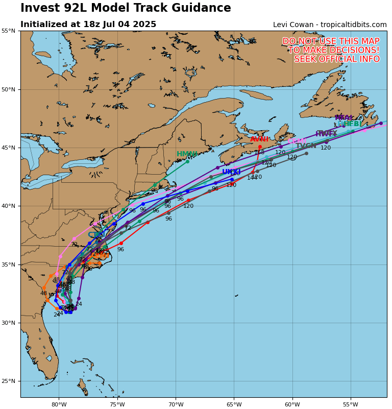
Based on these ensemble models, this disturbance is likely to travel up the East Coast over the next few days, crossing most of the Mid-Atlantic states. The main concern from this disturbance would be heavy rainfall and some rough surf on the coast, especially for Florida, Georgia, and the Carolinas:
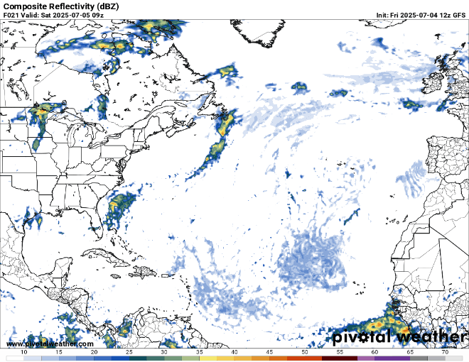
Notice all of the rain from the disturbance off the Southeast Atlantic coast that is occurring today. Heavy rainfall can cause flash flooding, especially in coastal areas. So if you happen to be in the Southeast, especially near the coast from Florida to North Carolina, keep an eye on the radar and watch for any flooding or storm surge.
Pacific Disturbance
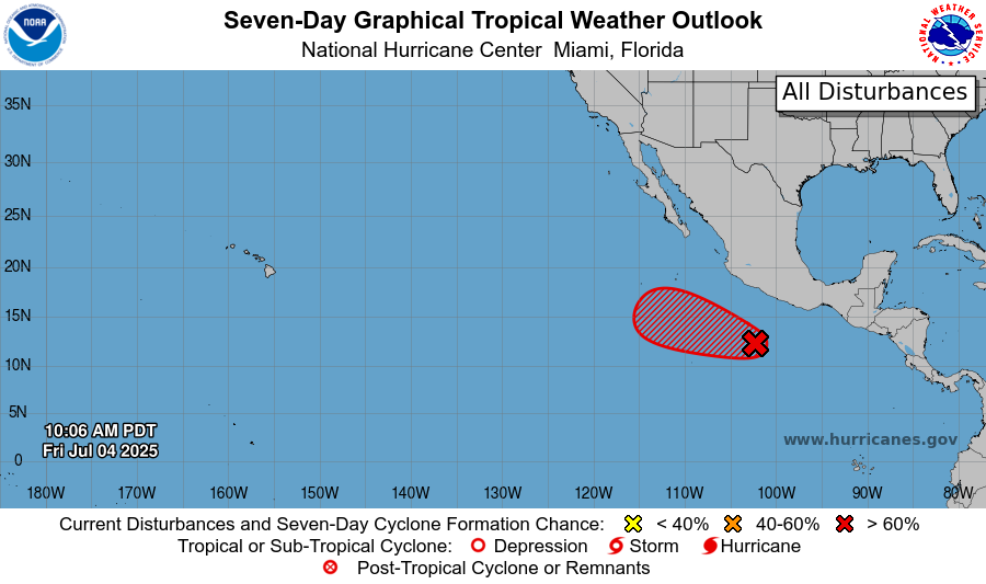
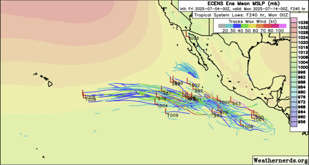
The disturbance that formed during Hurricane Flossie’s time has persisted in the East Pacific’s warm waters, and now has an 80% chance of development in the next week, and a 50% chance of development in the next 48 hours. Environmental conditions look good to support this disturbance’s development in the next few days. Fortunately, it is unlikely that the disturbance will make landfall regardless of whether it develops or not. Looking at the Euro ensemble models (a numerical weather prediction model from Europe) we can see that the disturbance should be moving off deep into the Pacific without impacting Mexico or Central America:
So, there shouldn’t be too much to worry about in the East Pacific, but if you are on the East Coast, keep an eye out for potential rain from that Atlantic disturbance. Stay tuned to NickelBlock for more tropical updates!


