After a delightful 4th of July weekend with limited rain and decent temperatures, things will return to normal for this time of the summer, with afternoon showers and thunderstorms possible. Rain chances will increase Wednesday through Friday.
TODAY
Fog is possible this morning due to a lower-level temperature inversion that could trap moisture.
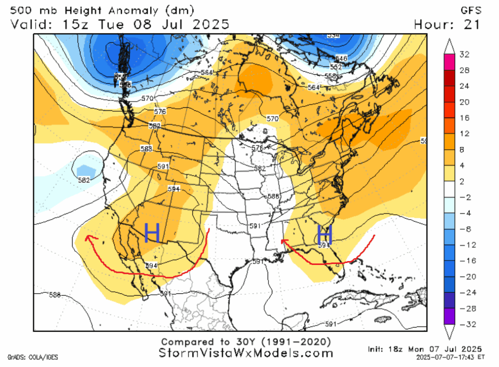
Zooming out to the synoptic scale, our forecast area is in between two ridges to the east and west, one along the eastern seaboard, and one in the Four Corners. The one to the east is a bit closer, so the net flow will be southerly, from the Gulf of Mexico, resulting in moister air. But the ridge is not too close to guarantee clear skies. Chances of rain will be between 30% and 40% for our forecast area, as some scattered storms could overcome the subsiding air.
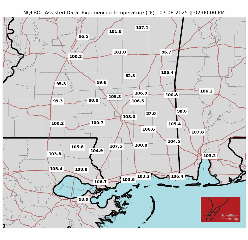
Dew points will be in the high 60s to low 70s, supplementing high temperatures in the mid 90s. Apparent temperatures will top out between 105 and 110 in the 1-3PM window in the Pine Belt, with conditions a few degrees colder in surrounding areas.
REST OF THE WEEK
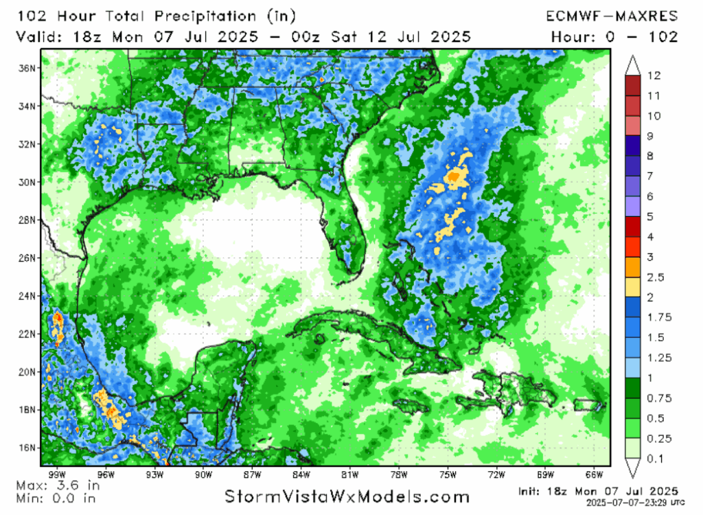
A trough will move into Arkansas and Tennessee on Wednesday, which will make the weather more unsettled down here. Winds will shift from southerly to westerly. The afternoon probability of precipitation will increase from Wednesday to Friday, to around 60 or 70%. Temperatures will remain the same, except in places where a thunderstorm will cool things down. While storms are expected to be sub-severe, high D-Cape values around 1,000 Joules per kilogram are in place. Any storm that forms may have strong gusty winds associated with its downdraft.
THIS WEEKEND AND BEYOND
It seems that the trough will abate this weekend, potentially signaling a return to more average conditions, both temperature and precipitation wise. Some guidance does show a surface high pressure forming in the northern Gulf Sunday into Monday, which would cause southerly wind, moisture advection, and potentially wetter conditions (especially further north where there’d be less sinking air).
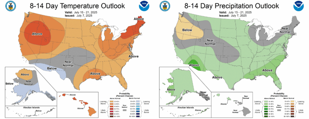
The CPC is calling for both warmer and wetter conditions next week as southerly flow and frontal activity, originating from a trough in the northern Plains, makes its way through. The GFS model also shows some tropical activity in the gulf on Thursday. That model is known to be schizophrenic with tropical storms in the long range, but it’s worth keeping an eye on.
REGIONAL DAY-TO-DAY FORECAST
Today: Fog possible early. Partly cloudy. Highs in the mid 90s. Chance of rain 40%. Gusty winds possible with some storms. South winds around 5 miles per hour.
Tonight: Mostly clear. Lows in the mid 70s.
Wednesday: Partly cloudy, chance of a thunderstorm. Highs in the mid 90s. Chance of rain 60%. West winds around 5 miles per hour. Lows in the mid 70s.
Thursday: Partly cloudy, chance of a thunderstorm. Highs in the mid 90s, except in areas with storms. Chance of rain 70%. West winds around 5 miles per hour. Lows in the low 70s.
Friday: Mostly cloudy, chance of a thunderstorm. Highs in the mid 90s, except in areas with storms. Chance of rain 60%. West winds around 5 miles per hour. Lows in the low 70s.
Saturday: Partly cloudy. Highs in the low 90s. Chance of rain 40%. Lows in the mid 70s.
Sunday: Partly cloudy. Highs in the low 90s. Chance of rain 50%. Lows in the mid 70s.
Monday: Mostly cloudy. Highs in the low 90s. Chance of rain 60%. Lows in the high 70s.
Tuesday: Partly cloudy. Highs in the mid 90s. Chance of rain 50%. Lows in the high 70s.
Wednesday: Mostly cloudy, chance of a thunderstorm. Highs in the mid 90s. Chance of rain 60%. Lows in the high 70s.
Thursday: Mostly cloudy, chance of a thunderstorm. Watching the tropics. Highs in the mid 90s. Chance of rain 70%. Lows in the high 70s.


