There are currently no areas of interest in either the Atlantic Ocean or West Pacific Ocean for the next 7 days. A layer of solid wind shear will finally put the “hurricane factory” south and west of Mexico out of business for the time being. Shear over the Caribbean remains high. Areas off the coast of Africa remain too cool and dusty for anything to form for now.
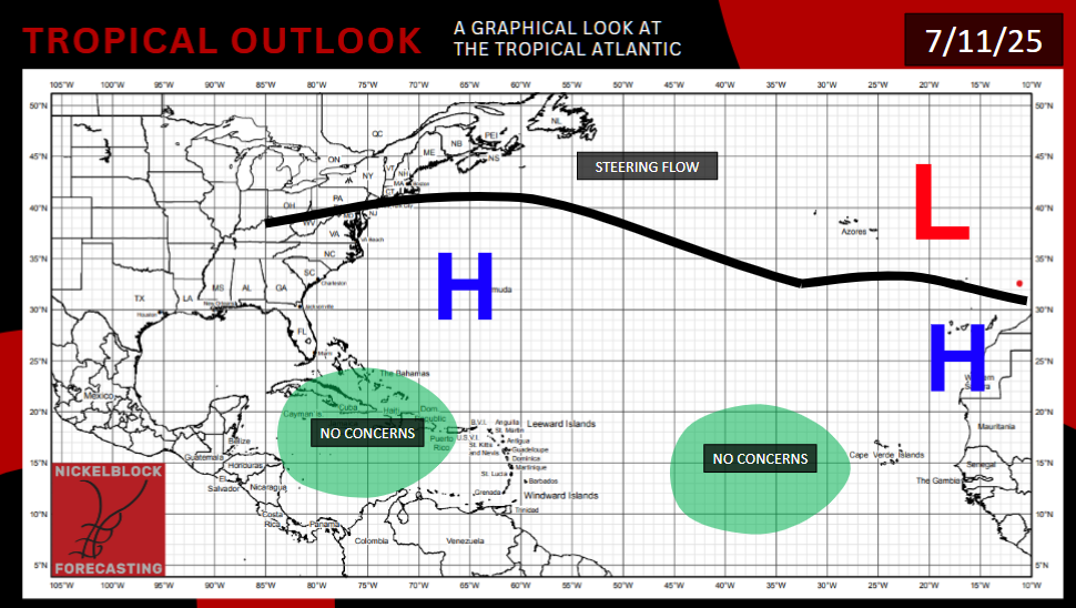
If there’s even a slight chance of anything tropical forming somewhere near the mainland United States, it would either be off the U.S. East Coast or in the Gulf of Mexico.
Some models are showing a signal for tropical development in the northern Gulf of Mexico, enough for NOAA to highlight the area as having a 20% development chance. The 12z GFS model run does show a system impacting the big bend of Florida this time next week, but the more recent 18z run doesn’t show anything. It’s worth keeping an eye on, but without a consistent model signal, there are still many fail modes that will probably make this whole “Gulf low” talk a nothingburger.
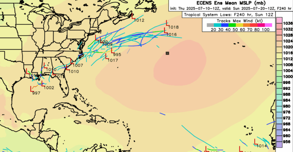
A couple of ECENS members want to form lows, that would potentially have tropical characteristics, off the coast of the Carolinas or the Mid Atlantic late next week. Even if anything does form, maybe there’d be some rain and light wind for nearby coastal areas. Besides that, it would mainly be a threat for fish and boats and not much else.


