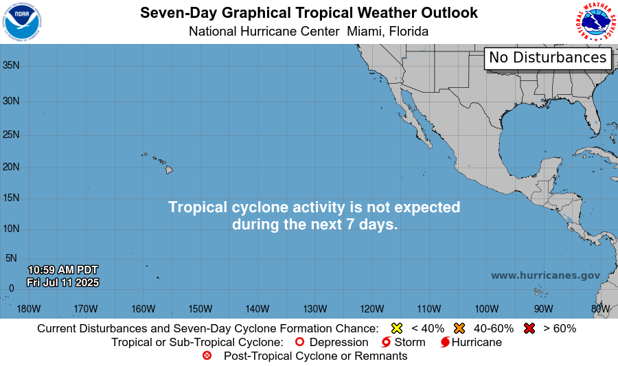
If you have been following our tropical updates or just tropical weather in general, you may have noticed that there has been a lull in tropical activity in the Atlantic and Pacific Oceans. Since my last tropical update on Wednesday, there has been no areas of concern from the National Hurricane Center (NHC) and there is still nothing going on today:
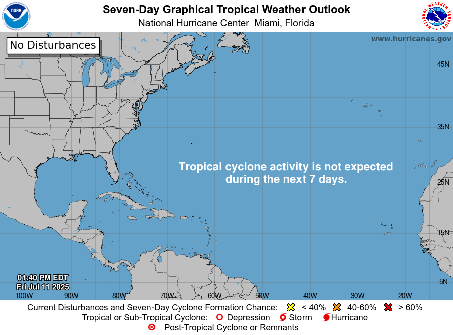
Current Atlantic Setup:
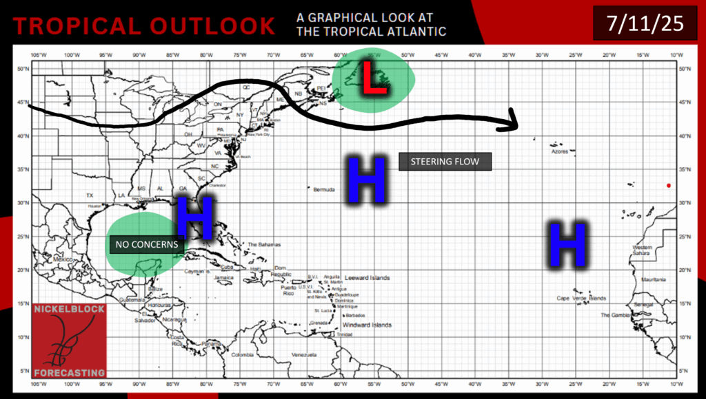
There are no concerns in the Atlantic Basin as of right now. We have high pressure spanning from West Africa, across the Atlantic with the Bermuda High, and over the Gulf and Caribbean. Based on our current sea-surface temperatures, I would expect that if something were to form it would probably be somewhere in the Gulf, off the Southeast Atlantic coast, or even in the Caribbean. Any other area would probably be too cold of sea surface temperatures for tropical development.
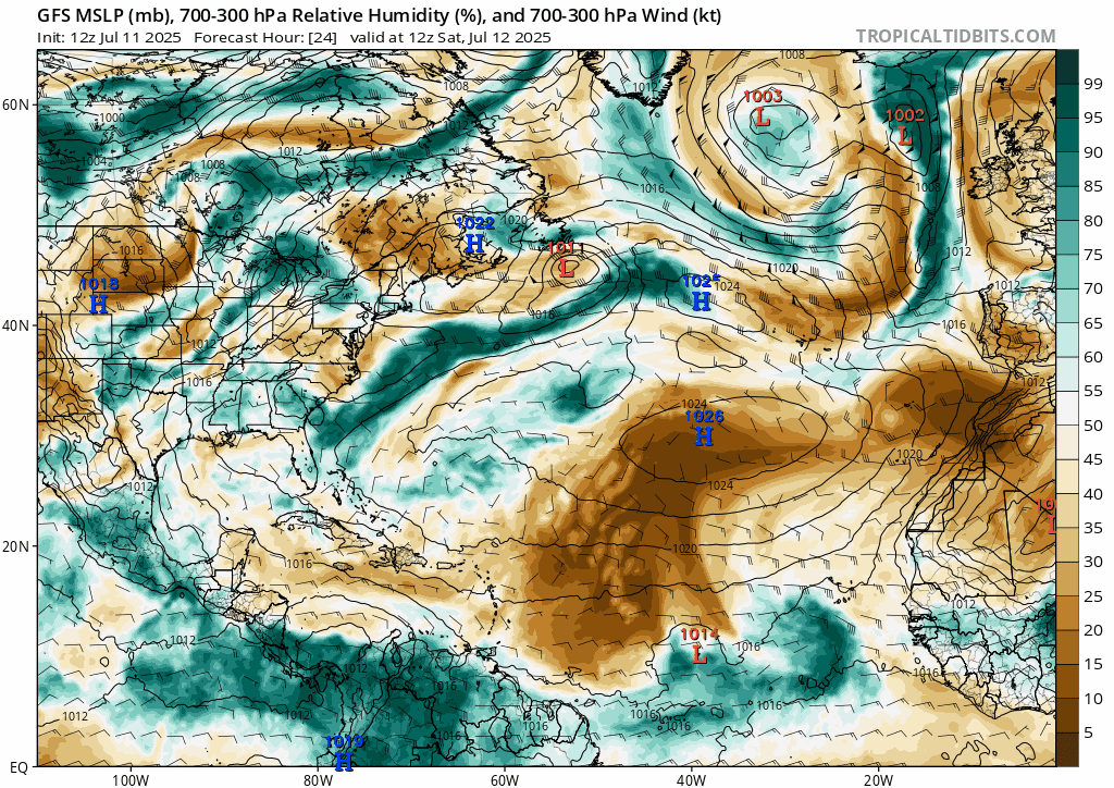
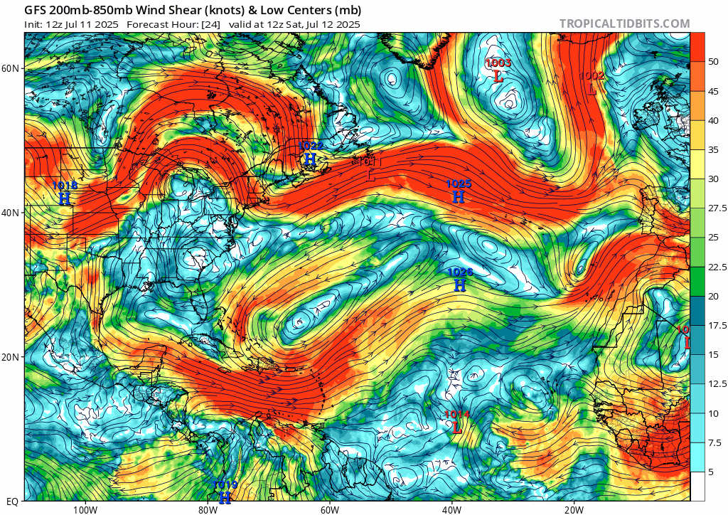
Looking at relative humidity in the mid-levels of the atmosphere, we can see the African Dust blowing our way from the Western Sahara, keeping much of the Atlantic dry and hurricane-free. Although, there is an area of high humidity from the Atlantic Coast that is projected to move over Florida and into the Gulf. I wouldn’t be too concerned about this, though, since we can see in the other model that wind shear in the Gulf and Southeast Atlantic coast will stay high, likely inhibiting any tropical development.
Current Pacific Setup:
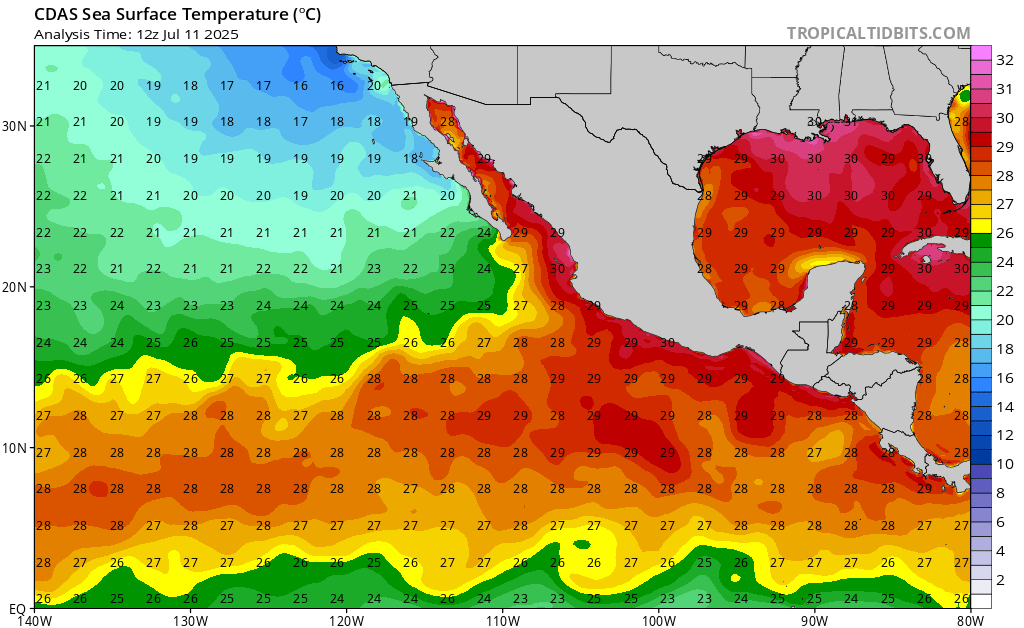
Sea surface temperatures in the East Pacific are slightly cooler than they have been, since the area has had so many tropical storms and disturbances come through this hurricane season, churning up some colder water.
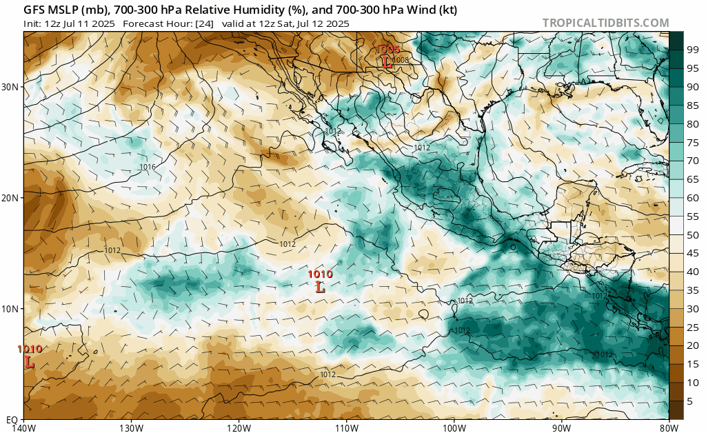
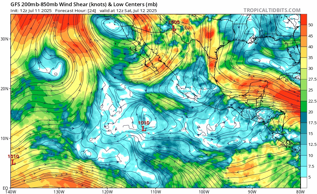
Most of the East Pacific will stay relatively dry for the week, with the exception of some moisture over Central America and some moving westward into the Pacific later in the week. Wind shear will also be low, especially toward the beginning of the week. By next weekend, wind shear will begin to pick up in some areas.
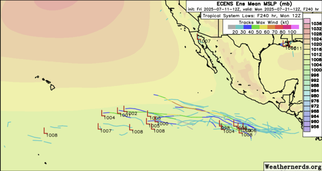
The Euro ensemble model shows some sort of development happening in the next week/week and a half. Whether this development happens or not, it is forecasted to move out deep into the Pacific anyways. With all this said, I think it is definitely possible that something could form in the East Pacific in the next 7 days, but as of now, I don’t think it would be anything major.
Stay tuned for more tropical updates!


