There are currently no systems in either the Atlantic or West Pacific basin. However, the NHC has outlined two areas of interest, and there are a few other potential development areas showing up in the models as well.
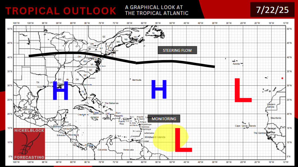
FIRST MID-ATLANTIC STORM? UNLIKELY
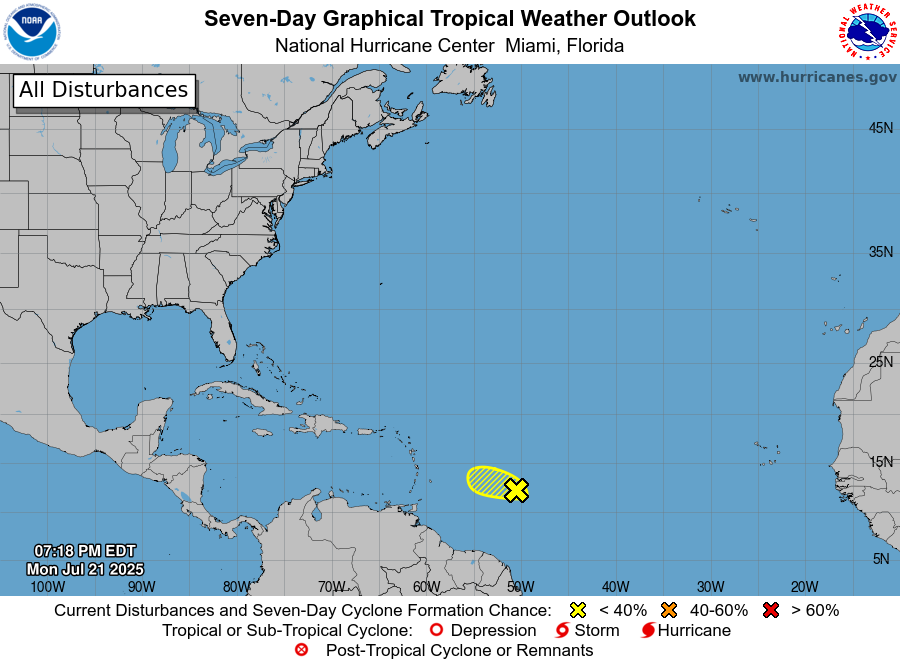
For the first time all year, the NHC has highlighted an area of interest in the middle Atlantic Ocean, around 400 miles to the north of French Guiana. Waters are finally warm enough for tropical development here. But the window for this system to develop is closing. It will soon move west into a region of high wind shear, Saharan dust aloft, and drier upper-level air in the coming days. The storm is behind schedule, appearing too disorganized to form into a depression or storm in time. As such, the NHC is only giving this system a 10% chance of tropical development at present. Even that may be gone by the time you read this. Regardless of development, this system could bring heavy rain to the Lesser Antilles.
LOOKING TO THE PACIFIC
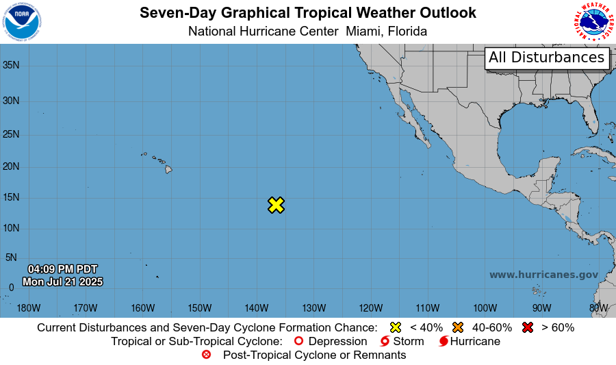
Similarly, there is a system in the Pacific, around 3,000 miles east of Guatemala, that is in even more dire straits. It is moving west into an area of cooler ocean water and heavy shear. This system does appear slightly more organized, but it is out of time. The NHC has, in it’s latest advisory, downgraded this system to a “near 0% chance of development”.
THREE OTHER AREAS TO WATCH
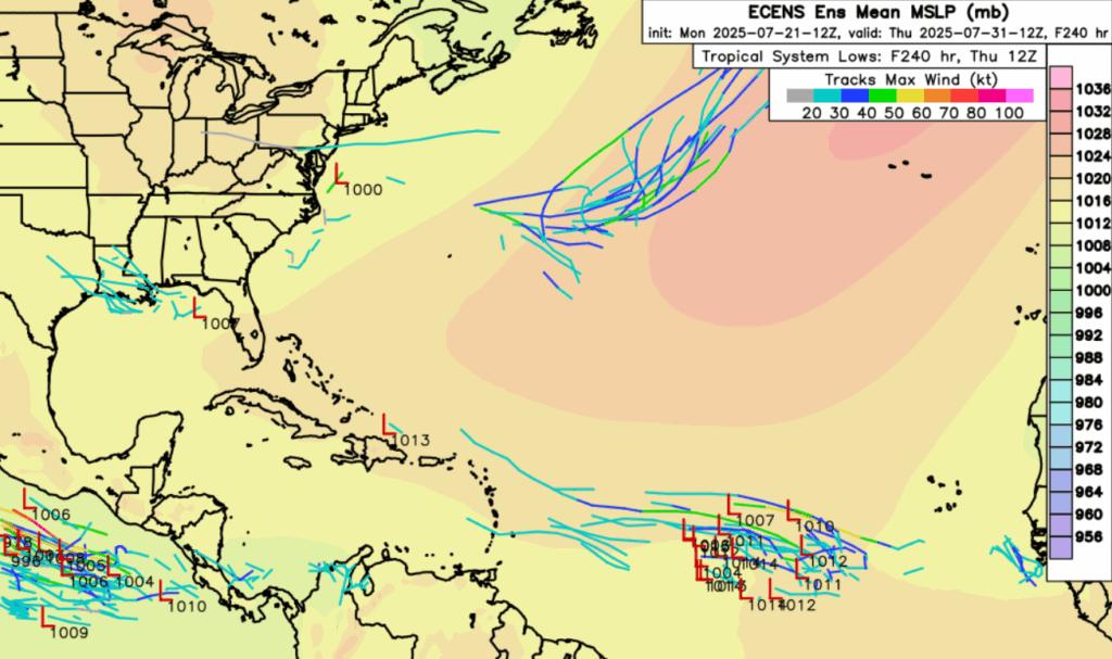
Looking at the medium-range models, such as the ECENS ensembles above, there is a signal for at minimum a tropical low pressure for the northern Gulf of Mexico Wednesday into Saturday. A ridge is developing over the eastern Continental United States, so if anything forms, it will likely hug the Gulf Coast, bringing rain to the region. Latest model runs don’t seem to want to turn this into a tropical storm, but we could potentially be in for a repeat of late last week along the Gulf coast.
Looking at the combination of 700mb humidity and 850mb vorticity in the 7-14 day time frame, two areas of interest emerge. In the Atlantic, there’s a region off the coast of Virginia and North Carolina where a storm could find a break in the shear and form. It would likely ride the Bermuda high out into the Atlantic, but some model runs do have the storm close to the coast on the initial approach.
There is also a potential that the Pacific Hurricane Factory gets going again in the 7-14 day time frame, with a storm potentially forming south of Mexico, and going northwest with the trade winds. The Weather Prediction Center has highlighted this area as having a 20% chance for tropical development, providing a qualitative support to the quantitative models.


