Across all counties of our forecast region, there will be either an Extreme Heat Warning or a Heat Advisory in place, so taking extra precautions or simply avoiding the heat altogether (if possible) will be extremely important today. We will be getting some heavier than usual rain on Friday and into the weekend due to another tropical disturbance. Let’s get into the details:
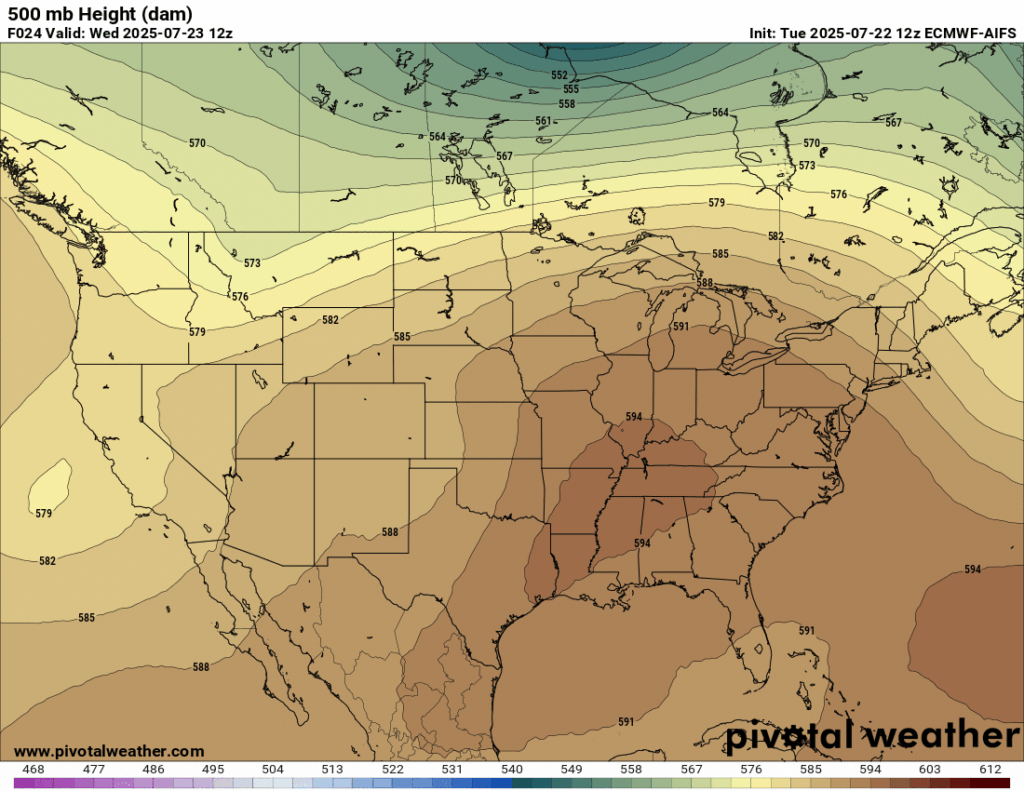
Looking at our upper-air chart, we have a low pressure area off of the coast of California, and an area of high pressure over the Southern US, creating a heat dome over us, helping to bring in the scorching temperatures.
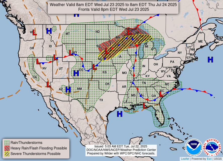
Now taking a look at the WPC’s surface chart for today, there is rain and thunderstorms forecasted for all of our forecast region, and there is a stationary front and low pressure system nearby, fueling the upcoming rainfall by the end of the week.

Today’s Weather
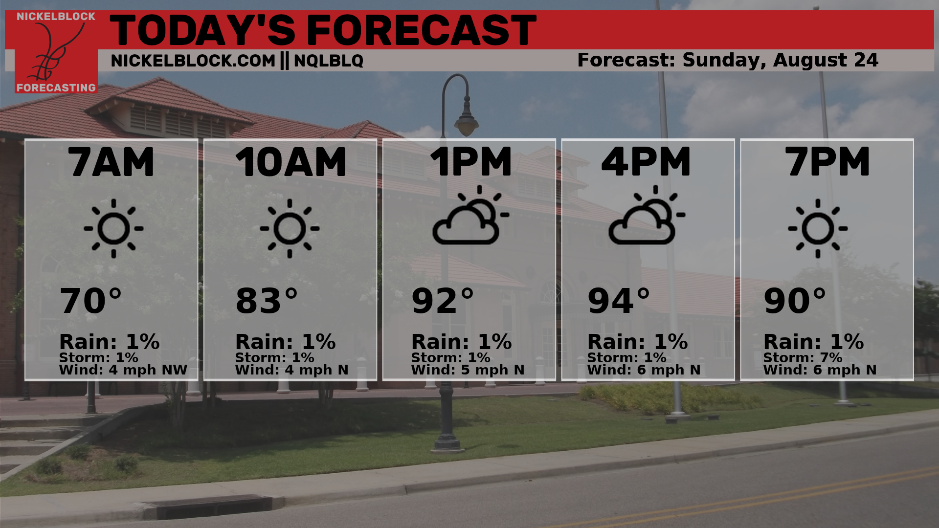
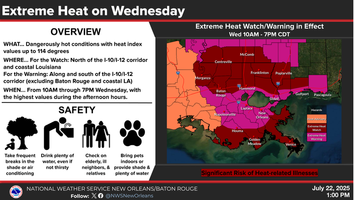
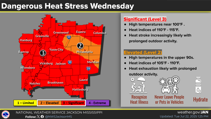
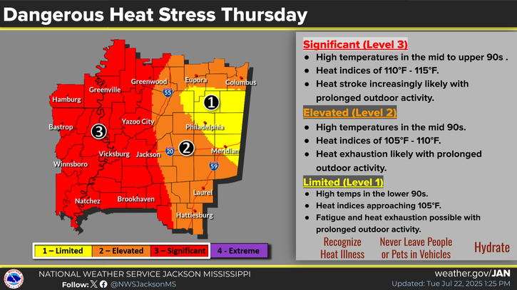
Today will be extremely hot, with heat indices in some areas forecasted to reach 115 degrees. It will be very important now more than ever to be extremely careful in the heat today. If you are able to stay in the air conditioning today, stick with that. If you need to be outside today, be sure to stay very hydrated and take lots of breaks in the shade while outdoors.
The local NWS offices have issued Heat advisories or Extreme Heat Warnings for our entire area, so be sure to take a look at the graphics below or check your local NWS office for the type of watch, warning, or advisory that has been issues for your specific area. Still, regardless of what has been issued, taking those extra safety steps are a must today.
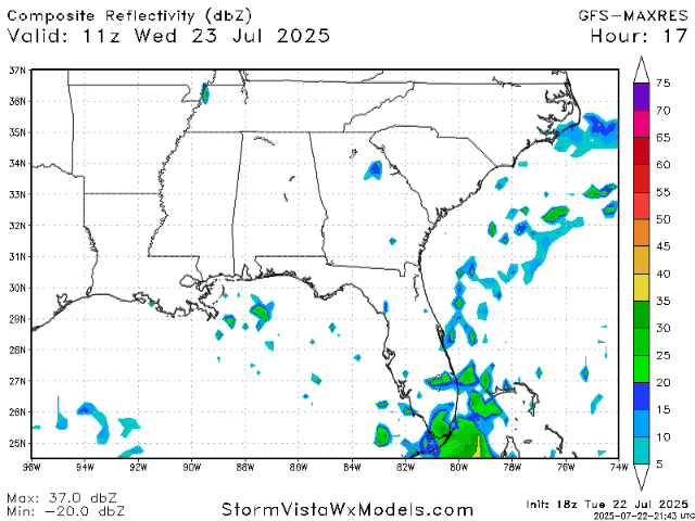
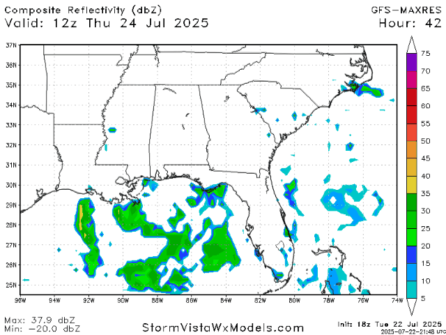
Looking at the precipitation radar, we will have some typical pop up showers throughout the afternoon and evening today.
Weather for the Rest of the Week:

Dangerous heat indices will continue for tomorrow, so everything said about the heat for today will also stand for tomorrow.
By Friday, the intense heat will break, but all-day showers and possibly a thunderstorm or two will be coming in due to the low pressure area and stationary front funneling in Gulf moisture toward us.
Here’s the radar for Thursday and Friday:
Looking Ahead

Looking at the long-range forecast, we will have a break from the heat for a few days, but by next week the heat will start to bump up again, due to another large ridge building in over us and creating anther heat dome.
Regional Day-to-Day Forecast:
Today: Sunny during the morning with a chance of afternoon showers and thunderstorms in the afternoon. Highs in the high 90s and heat indices up to 116 degrees. Chance of precipitation 30%.
Tonight: Chance of showers and thunderstorms early on in the evening, then mostly cloudy. Lows in the high 70s. Chance of precipitation 40%.
Thursday: Mostly sunny during the morning, then a chance of showers and thunderstorms in the afternoon and evening. Highs in the low 90s during the day and lows in the mid 70s at night. Chance of precipitation 70%.
Friday: Chance of showers and thunderstorms throughout the day. Highs in the low 90s during the day and lows in the mid 70s at night. Chance of precipitation 90%.
Saturday: Mostly sunny during the morning, then a chance of showers and thunderstorms in the afternoon. Highs in the low 90s during the day and lows in the mid 70s at night. Chance of precipitation 50%.
Sunday: Sunny during the morning, then a chance of showers and thunderstorms in the afternoon and evening. Highs in the low 90s during the day and lows in the mid 70s at night. Chance of precipitation 30%.
Monday: Sunny during the morning, then a chance of showers and thunderstorms in the afternoon and evening. Highs in the mid 90s during the day and lows in the mid 70s at night. Chance of precipitation 30%.
Tuesday: Sunny during the morning, then a chance of showers and thunderstorms in the afternoon and evening. Highs in the mid 90s during the day and lows in the mid 70s at night. Chance of precipitation 40%.
Wednesday: Sunny during the morning, then a chance of showers and thunderstorms in the afternoon and evening. Highs in the mid 90s during the day and lows in the mid 70s at night. Chance of precipitation 50%.


Not sure about the rain percentages on Tuesday and Wednesday of next week. Thinking the high will take back over after this weekend.