With a wave of tropical moisture approaching, there is a high probability of rain, which could occur all day today and tomorrow. Excessive heat, while not as bad as earlier this week, will still be a threat on Thursday until the rain arrives. Unfortunately for the heat haters among us, excessive heat will return next week.
TODAY
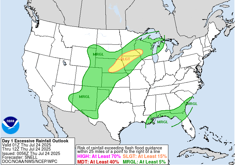
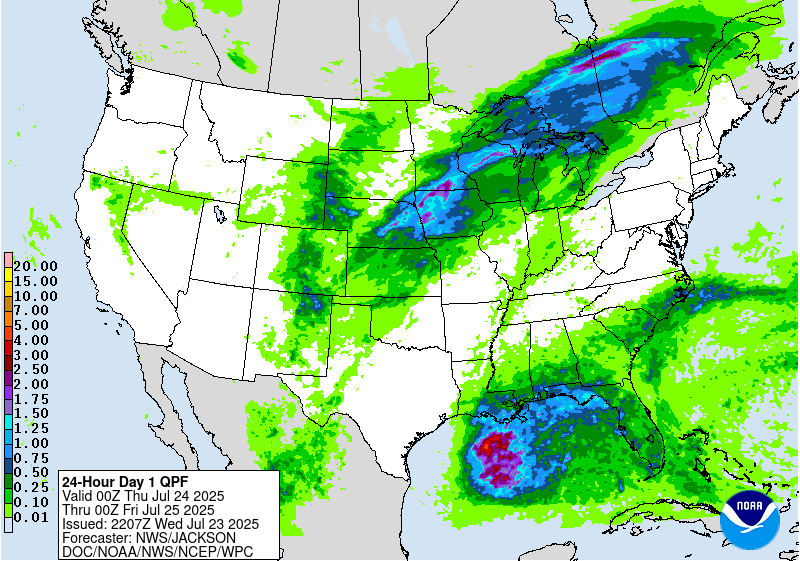
The National Hurricane Center has identified an area of interest in the Gulf of Mexico. While there are long odds of a tropical storm actually forming, what is very likely is that rainfall associated with tropical moisture will fall on our area. The center of the storm does appear to be heading further south than anticipated, which will keep the worst of the rainfall over the open ocean. Most, if not all, of the forecast area might escape with less than a half inch of rain today. Local spots will get more in thunderstorms. The Weather Prediction Center has issued a Marginal risk for flash flooding today and tomorrow for areas close to the coast.
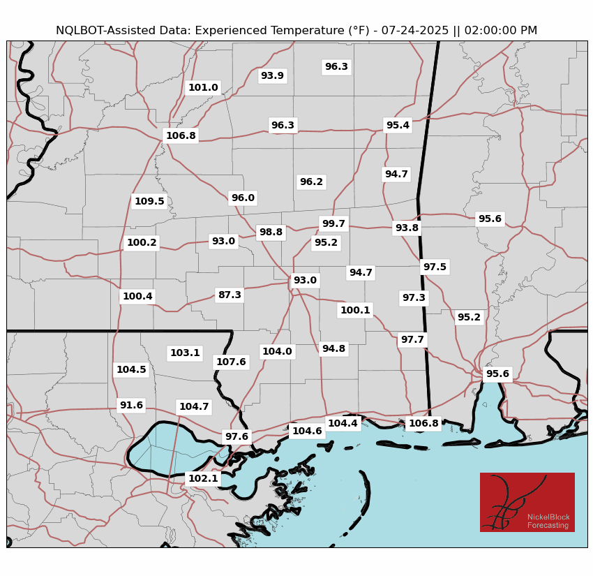
The high temperatures will largely depends on rain. If the rain reaches your area by noon, likely the case if you’re south and/or east of Hattiesburg, the rainfall will keep the mercury from reaching far past the 90 degree mark. The further north and west you go, the rain won’t start until mid-to-late afternoon, allowing temperatures to reach their fair weather maximum. In these locations, high humidity will lead to a period in the afternoon where the heat index will rise to dangerous levels, between 105 and 110 degrees in places. Notice how on the “apparent temperature” on the map below, the highest locations are in the western most areas.

Wind will blow from west to east at 5 to 10 miles per hour, potentially providing some relief. There will be plenty of instability up several thousand feet in our atmosphere, which will create a lightning threat. When thunder roars, go indoors.
REST OF THE WEEK
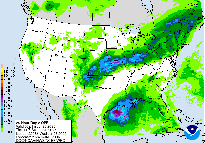
Conditions on Friday will be similar to today, but with high temperatures a bit lower as the ridge retreats slightly, and the wind a bit heavier, as the low pressure is expected to intensify as it gets more well organized. As a result, Friday will also contain the heaviest, most widespread rainfall, with chance of rain at 80% or above. Ambient rainfall will be between a third of an inch and a half an inch of rain for our area, with much larger amounts in thunderstorms.
Saturday will mark a day of transition, between the current weather pattern, which is being dominated by this tropical low pressure, and the weather pattern to come, which will be characterized by intense heat and low rainfall chances. Residual rainfall and thunder is still expected throughout the day Saturday, but winds will get lighter as the low pressure moves further away. High temperatures in the low to mid 90s are expected in areas that don’t get storms.
PREPARE FOR EXTREME HEAT
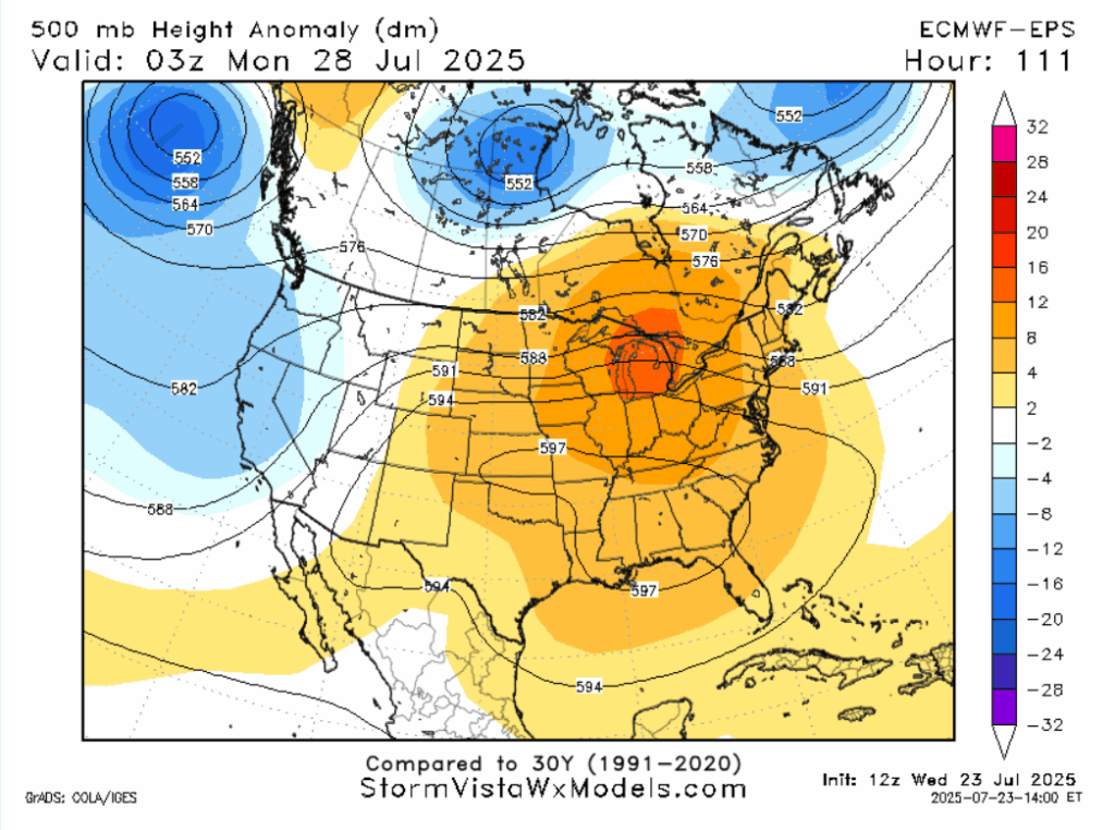
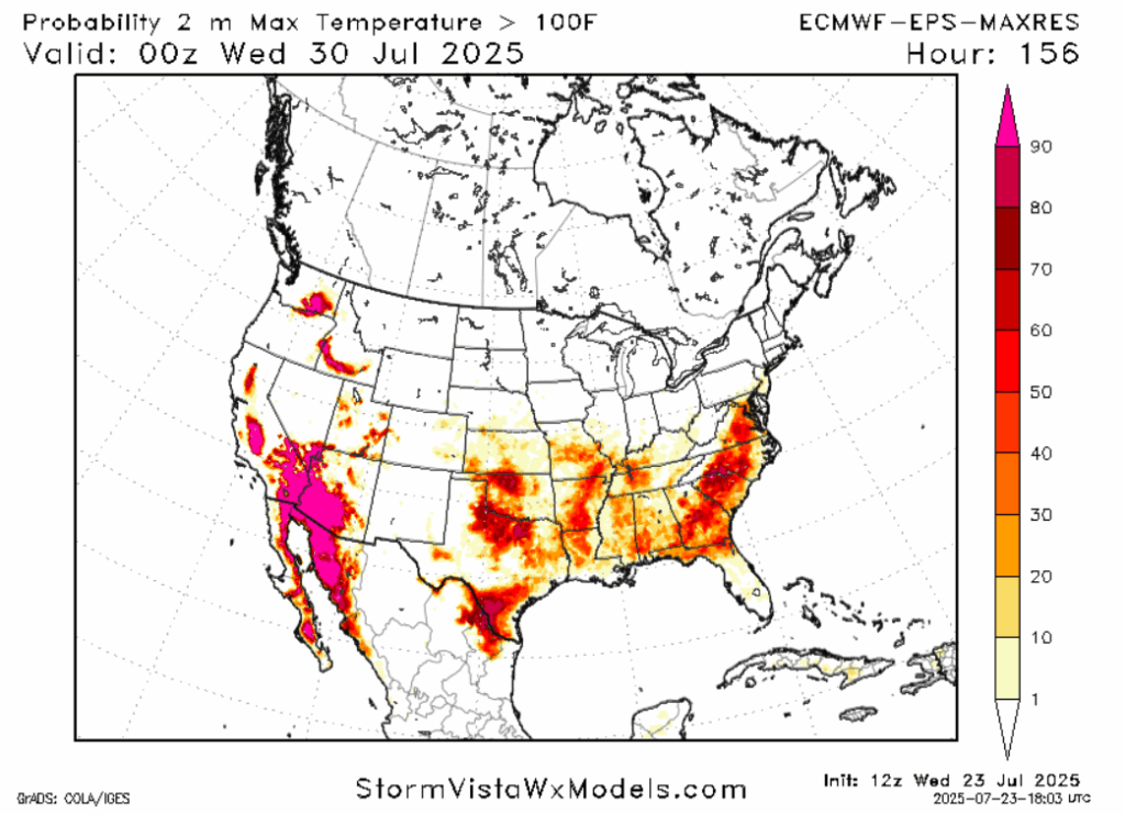
On Sunday, the “heat dome” returns to the eastern Continental United States. In the southeastern United States, this weather pattern could last most of the week. While we’re under the influence of this ridge, every day will have a similar pattern, with high temperatures in the upper 90s to potentially reaching 100 during the middle of the week. Diurnal heating will cause lift that will overcome the subsidence of the ridge in some areas, causing isolated thunderstorms. On any given day, the chance of rain is between 20 and 40 percent. Wind will be hard to come by in inland areas where sea breezes won’t have an impact. Things may cool later in the week, but it won’t feel any better as humidity associated with another tropical system approaches. Overall, prepare for a very hot time next week.
The WPC has highlighted the Gulf as having a 20% chance of developing a tropical storm late next week. We’ll be watching to see if and how this unfolds, but any potential system could provide both relief from the high temperatures, and flooding for the already saturated soil of our forecast area.
REGIONAL DAY-BY-DAY FORECAST
Today: Highs in the low to mid 90s. Rain and thunder likely, increasing in the late afternoon and early evening. Winds east at 5 to 10 mph. Chance of rain 70%.
Tonight: Rain and thunder possible early, giving way to mostly cloudy conditions. Lows in the mid 70s.
Friday: Highs in the low 90s. Rain and thunder likely. Chance of rain 80%. Winds south at 10 to 15 mph. Lows in the mid 70s.
Saturday: Highs in the mid 90s. Mostly cloudy, a thunderstorm possible. Chance of rain 60%. Lows in the mid 70s.
Sunday: Highs in the upper 90s. Mostly sunny. Chance of rain 30%. Lows in the upper 70s.
Monday: Highs in the upper 90s. Mostly sunny. Chance of rain 20%. Lows in the upper 70s.
Tuesday: Highs maxing out at 100. Mostly sunny. Chance of rain 20%. Lows around 80.
Wednesday: Highs maxing out at 100. Mostly sunny. Chance of rain 30%. Lows in the upper 70s.
Thursday: Highs in the upper 90s. Partly cloudy. Chance of rain 40%. Lows in the mid 70s.
Friday: Highs in the mid 90s. Partly cloudy, chance of a thunderstorm. Chance of rain 50%. Lows in the mid 70s.
Saturday: Highs in the mid 90s. Partly cloudy, chance of a thunderstorm. Chance of rain 50%. Lows in the mid 70s.


