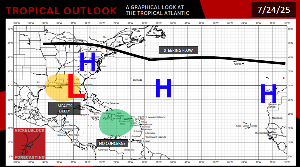
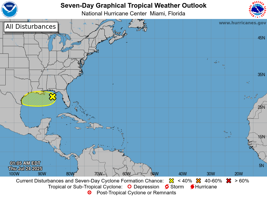
There are no current storms in either basin. Just like last week, there is a tropical wave off the east coast of Florida, that will move over the Floridian Peninsula into the Gulf of Mexico. There is also a system in the open Pacific Ocean.
FLORIDA INTO THE GULF
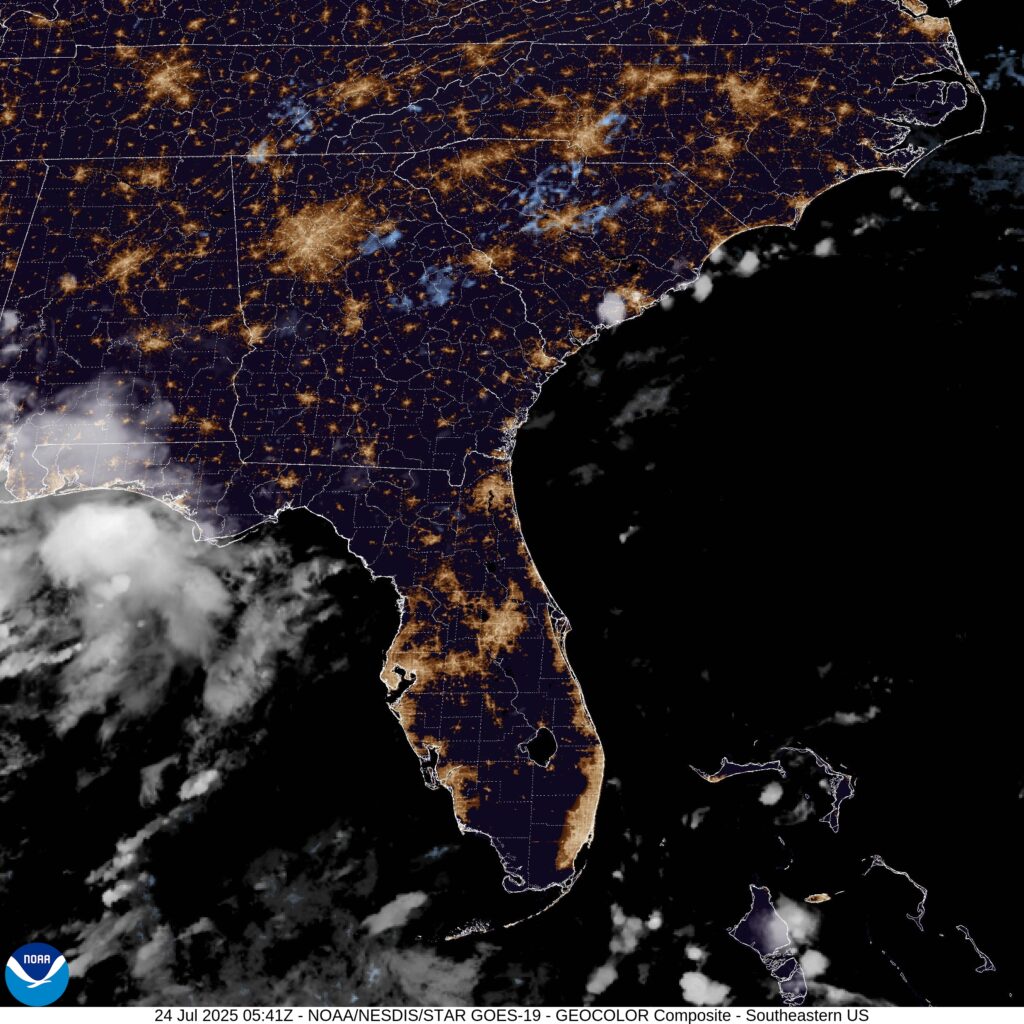
Land is like poison to tropical systems. If it wasn’t for the fact that this system just crossed a big peninsula, it would have a much better chance of tropical development. There’s a moist environment, with warm ocean temperatures, even the models do show some converging winds. Thankfully for the people of the Gulf coast, Florida acts as a buffer. The storm as it is, lies pretty disorganized, and going over land will make it even less organized. A modest layer of shear will interact with the system as it enters the Gulf. This storm will have to pull off the tropical equivalent of assembling a 100-piece puzzle with a rotating and shaking table, if it wants to become a tropical depression or storm. As such, the NHC has designated the area as having only a 10% chance of tropical development.
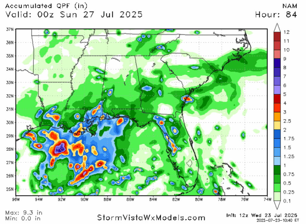
But even in the likely scenario nothing develops, we still have to contend with rainfall. The Weather Prediction Center has issued a marginal risk for flash flooding across the Gulf Coast today and tomorrow. Models show most areas along the coast will receive between a half an inch and an inch of rain, with local amounts of 2 to 4 inches. Models are often not the best this far out at pinpointing the very heaviest rainfall totals, so it’s possible some unlikely location will receive more rain.
PACIFIC
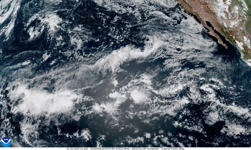
The NHC has highlighted a system between 1,000 to 1,500 southeast of Hawaii that is propagating to the west, over open water. It is entering an area of drier air aloft, modest wind shear, and warmer air aloft is present. These are all inhibiting factors. The NHC is currently giving this system a 30% chance of tropical development. Current satellite imagery looks promising enough, but I agree with the NHC. Current conditions mean that I’d probably lean towards this system being a nothingburger. Even if it forms, it will not threat land.
LOOKING AHEAD
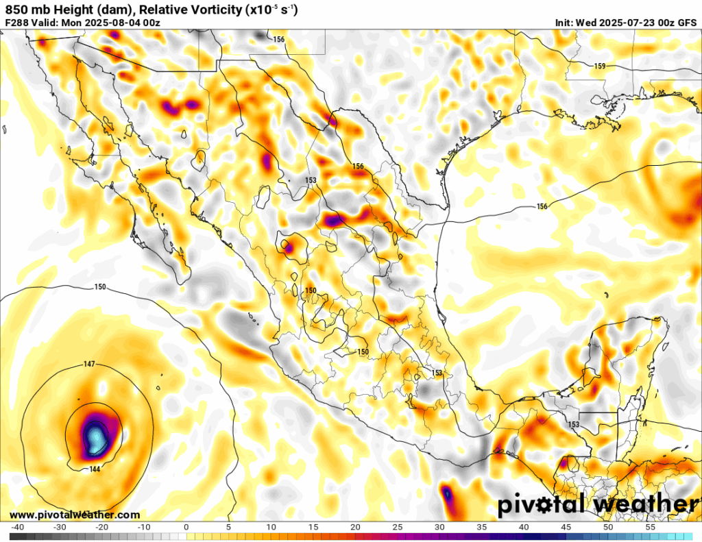
Both mainline medium-range models are indicating that a hurricane will form in the waters southwest of Mexico. If it forms, it will likely avoid land and move to the northwest. This would be in the 7-14 day time frame. The Weather Prediction Center has highlighted this area as having a 40% chance of tropical development, thanks to aloft moisture and light wind shear. There is also a weak model signal for another storm to form in the Gulf, moving east to west along a ridge axis, in the 6-10 day time frame.
It is also possible that we get out first Mid-Atlantic storm in that same time frame, as ocean waters are finally beginning to warm enough there, and the air aloft will be moist.


In regard to the ‘disturbance in the Gulf’, weren’t we watching this same movie this time last week?