The tail-end of the tropical system in the Gulf will bring us some scattered showers throughout the day today, and will subside by tomorrow and our regular afternoon popup showers will be back in action. There is a heat advisory out for much of our area today, so be careful if heading outside today if you avoid the rain. Next week, we can expect to see more mid to high 90s temperatures creating high heat indices, so an extreme heat warning/heat advisory or two would not be a surprise next week. Let’s get into the details:
Current Atmospheric Setup:
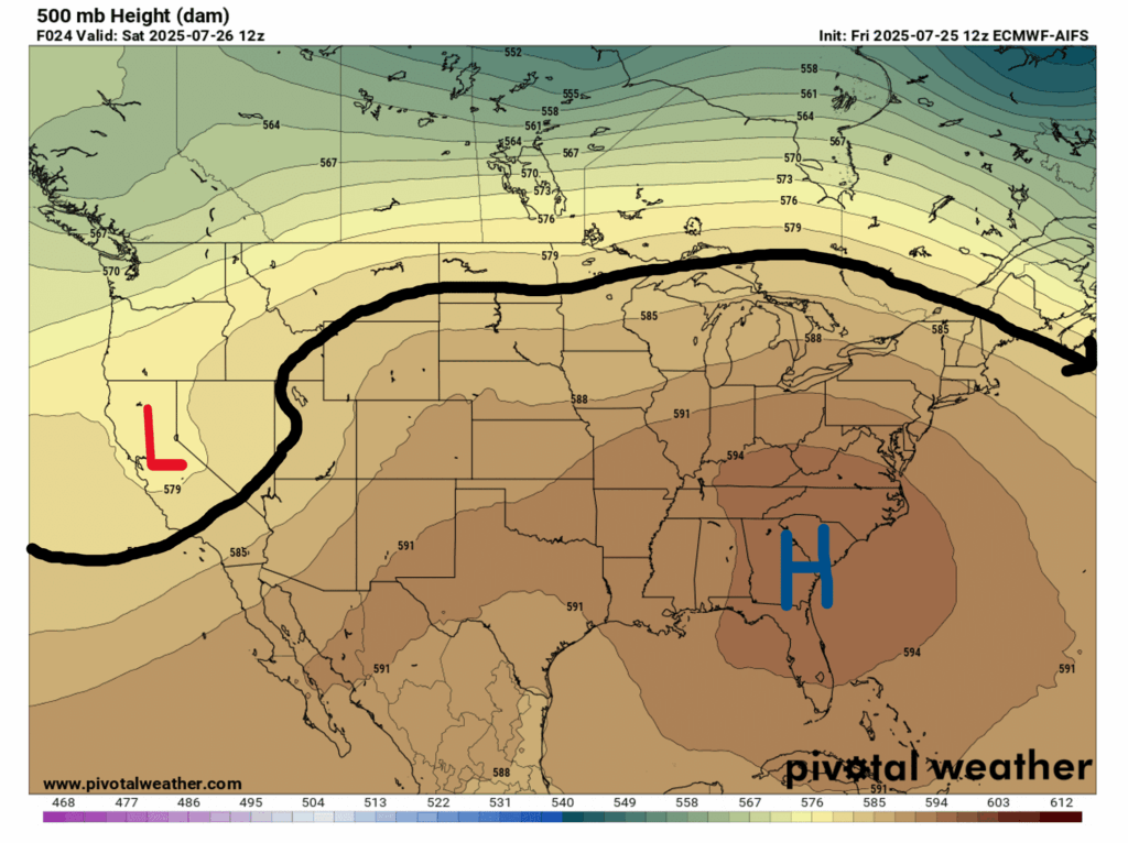
Starting toward the top of the atmosphere, we have a low pressure area over northern California, and a high pressure area over the Southeast. This large ridge is helping to heat things up, and the NWS Jackson office has even issued a heat advisory for today. Unfortunately, this heat dome will likely persist into next week.
Surface-wise, showers and thunderstorms are possible for our entire region, due to the passing tropical system. At this point, the system won’t develop much more and will weaken and eventually dissipate as it moves over land today.

This Weekend’s Weather:

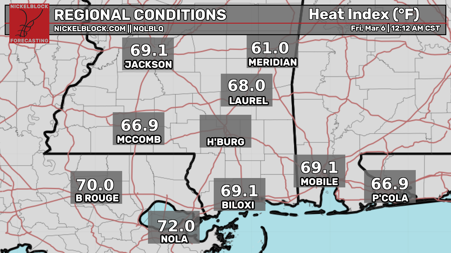
There is currently a Heat Advisory from 11am to 7pm today from the NWS Jackson office for northeast Louisiana, central, north central, northeast, northwest, southwest, and west central Mississippi. Temperatures will reach the mid 90s today, with heat indices breaking 105 degrees in some places. If you have outdoor activities planned for today, make sure to stay hydrated and take it easy in the shade when possible.
Check out the current heat indices here:
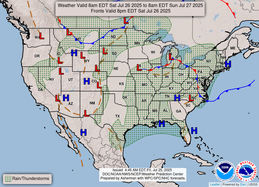
As for the rain, here is the radar for this weekend, as well as how much rain we can expect to accumulate from the tropical system today:
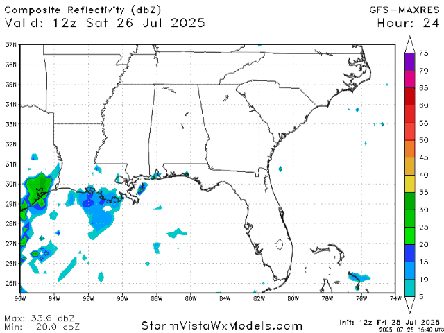
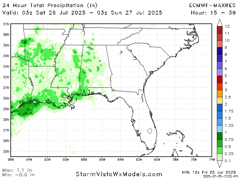
Looking at the radar for this weekend, today we can expect the remnants of the tropical system to bring us some scattered showers throughout the day, but nothing too crazy. The total accumulated precipitation for today amounts to an inch or less over our entire region. Some places may not even see rain today, but it is difficult to tell where exactly the rain will hit or miss. On Sunday the tropical system will be gone from our area, and we have some sparse popup showers and possibly a thunderstorm here and there throughout the late afternoon/evening.
Next Week’s Weather:

There will be a big ridge building in next week creating a large heat dome over our region and much of the CONUS, and unfortunately the humidity won’t be backing down a ton, so definitely be prepared for some high heat indices with heat warnings or advisories to go along with them.
Our regular summertime pattern of afternoon showers will be back for the week, and occasional thunderstorms cannot be ruled out either. Not every area across the board will receive rain or a storm every day, but many will, so keep an eye on the radar throughout the week if you have any upcoming outdoor plans this week.
Regional Day-to-Day Forecast:
Today: Chance of showers and thunderstorms throughout the day. Highs in the mid 90s, with heat indices 100-105 + degrees . Chance of precipitation 80%.
Tonight: Chance of showers and thunderstorms early on in the evening, then mostly clear. Lows in the mid 70s. Chance of precipitation 30%.
Sunday: Sunny during the day and a chance of showers and thunderstorms in the afternoon and evening. Highs in the mid 90s during the day and lows in the mid 70s at night. Chance of precipitation 30%.
Monday: Sunny and hot with highs in the high 90s. Winds will be calm, around 5 mph.
Tuesday: Sunny and hot during the day, with a chance of showers and thunderstorms in the afternoon. Highs in the high 90s during the day and lows in the mid 70s at night. Chance of precipitation 30%.
Wednesday: Partly cloudy during the day with a chance of showers and thunderstorms in the afternoon. Highs in the mid 90s during the day and lows in the mid 70s at night. Chance of precipitation 40%.
Thursday: Mostly sunny during the day with a chance of showers and thunderstorms in the afternoon. Highs in the mid 90s during the day and lows in the mid 70s at night. Chance of precipitation 50%.
Friday: Mostly sunny during the day with a chance of showers and thunderstorms in the afternoon. Highs in the low 90s during the day and lows in the mid 70s at night. Chance of precipitation 40%.
Saturday: Mostly sunny during the day with a chance of showers and thunderstorms in the afternoon. Highs in the low 90s during the day and lows in the mid 70s at night. Chance of precipitation 30%.


