The extreme heating plaguing our region will continue until Wednesday. Even after then, temperatures will remain high, but more moisture will result in higher rain chances during the afternoon. Some squall lines are possible later in the week, potentially bringing severe weather.
TODAY
The high pressure systems to our north and west, combined with ridging aloft, is keeping things quite warm. High temperatures will exceed 95 degrees in many areas. A northerly breeze will prevent heat indexes from reaching truly insane levels, but heat stress is still a big concern during the early afternoon.
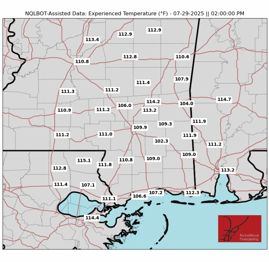
Despite unfavorable synoptic-scale conditions, certain models are showing thunderstorm formation. The atmosphere will be unstable aloft. Any group of air parcels at the surface that find a way to get above the cap could form into strong thunderstorms. It will take a lot of diurnal heating for these storms to form, so the greatest thunderstorm threat is the late afternoon to early evening. The chance of rain in a given area is about 40%. Downbursts, or an energy release from a storm that results in damaging wind, could be possible with the most intense storms.

THE REST OF THE WEEK
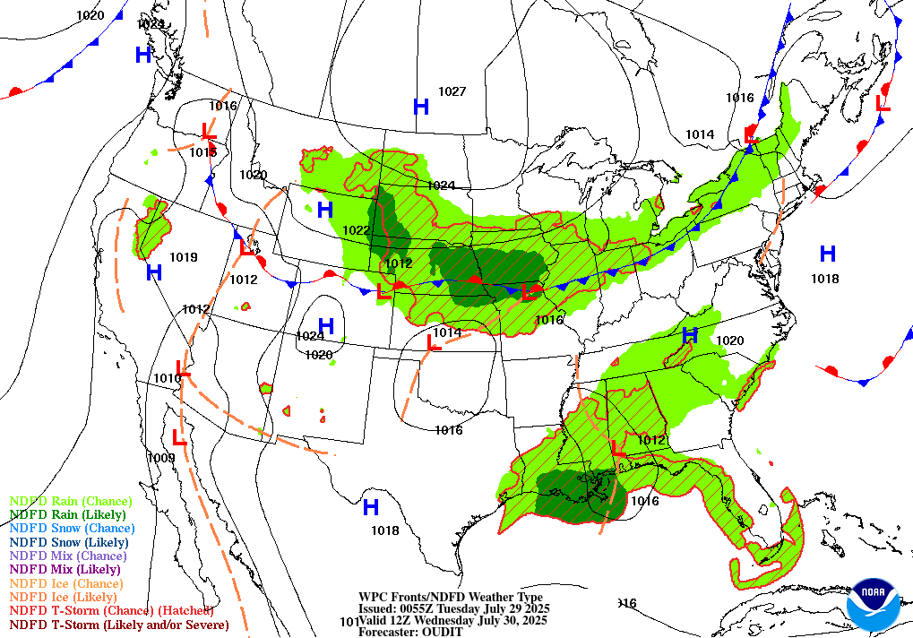
The Extreme Heat Warning will remain in effect on Wednesday, but we could get some relief later in the day. On the above map, we can see that a frontal boundary and low pressure will move through the area on Wednesday, allowing for much greater coverage of rainfall. Precipitable water will be above average, resulting in rainfall totals around a half an inch for the forecast area, with higher amounts likely in thunderstorms. Chance of rain will be between 80 to 90 percent. The NAM model is showing instability values of nearly 5,000 Joules per Kilogram on Wednesday. Despite the low wind shear, severe weather is possible in locations that can get enough diurnal heating. A lack of wind shear and a higher cloud ceilin will likely prevent tornado formation, but damaging wind, potentially associated with downbursts, frequent flooding, and heavy rainfall.
After Wednesday, another ridge will begin to build. Southerly flow will advect moisture from the Gulf of Mexico, increasing rain chances. High precipitable water values and instability will aid in a flooding threat. The WPC has issued a marginal risk of flash flooding every day this work week. Rain chances will be around 60% Thursday and Friday. High temperatures will remain in the mid 90s in areas that don’t receive a thunderstorm in the early afternoon.
The European Model does show a squall line or two moving through the area Thursday and/or Friday. Given the high atmospheric instability, this wouldn’t be surprising. These squalls would carry a threat of damaging winds, and add to the flooding risk. The SPC hasn’t yet outlined a severe risk at the time of writing, but I wouldn’t be surprised if they did issue one in the coming days.
THIS WEEKEND AND EARLY NEXT WEEK
Looking into the future, the signals exist for a return to more average temperatures this weekend into next week, limiting the excessive heat threat, as the ridge begins to weaken. Teleconnections are also in a transitory, moderate signal.
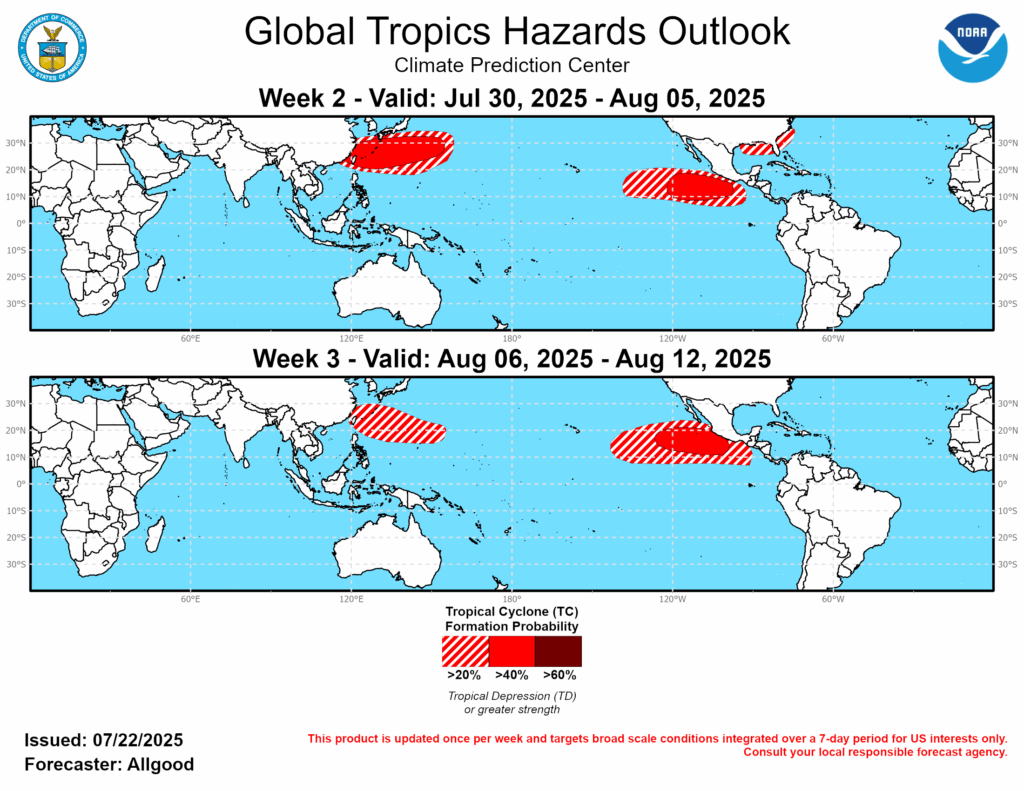
The WPC has highlighted the northern Gulf Coast as having a 20% chance of developing a tropical storm in this time frame. Even if a storm doesn’t develop, tropical moisture will likely make things wetter, especially into early next week. Around the middle of the week, temperatures will revert once again to being above average as the ridge returns.
A LOOK TO THE TROPICS
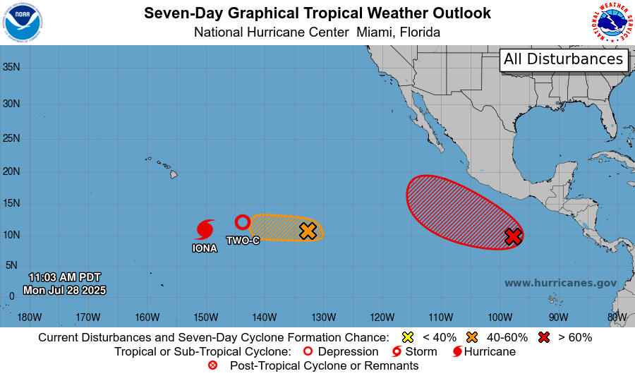
In the Pacific Ocean, hurricane Iona is a Category 1. It will likely increase in intensity a category or two in the coming days, before weakening by the weekend. It will go to the south of Hawaii, avoiding land impacts. A tropical depression behind it will also likely strengthen into a tropical storm. Two other areas of interest in the Pacific may spawn storms as well.
REGIONAL DAY-TO-DAY FORECAST
Today: Highs in the high 90s. Chance of scattered thunderstorms. Chance of rain 40%. Winds north at 5 to 10 mph.
Tonight: Lows in the high 70s. Mostly clear, rain possible late. Chance of rain 30%.
Tomorrow: Highs in the mid 90s. Rain and thunderstorms. A few storms may be severe. Chance of rain 80%. Winds light and variable, except in thunderstorms. Rainfall around a half an inch, with higher amounts possible in thunderstorms. Lows in the high 70s.
Thursday: Highs in the mid 90s. Mostly cloudy, chance of an afternoon or early evening thunderstorm. Chance of rain 60%. Winds from the south around 5 mph. Lows in the mid 70s.
Friday: Highs in the mid 90s. Partly cloudy, chance of an afternoon or early evening thunderstorm. Chance of rain 60%. Winds from the south around 5 mph. Lows in the mid 70s.
Saturday: Highs in the low 90s. Partly cloudy, chance of an afternoon thunderstorm. Chance of rain 40%. Lows in the mid 70s.
Sunday: Highs in the low 90s. Partly cloudy. Watching the tropics. Chance of rain 50%. Lows in the mid 70s.
Monday: Highs in the low 90s. Mostly cloudy. Watching the tropics. Chance of rain 60%. Lows in the mid 70s.
Tuesday: Highs in the mid 90s. Partly cloudy. Watching the tropics. Chance of rain 60%. Lows in the mid 70s.
Wednesday: Highs in the mid 90s. Partly cloudy, chance of a thunderstorm. Chance of rain 40%. Lows in the mid 70s.
Thursday: Highs in the mid 90s. Partly cloudy, chance of a thunderstorm. Chance of rain 30%. Lows in the mid 70s.


