With high temperatures in the upper 90s today, various Extreme Heat Warnings and Heat Advisories have been put in place across our region, and afternoon and evening showers can be expected as well. Let’s get into the details:
Overall Atmospheric Setup
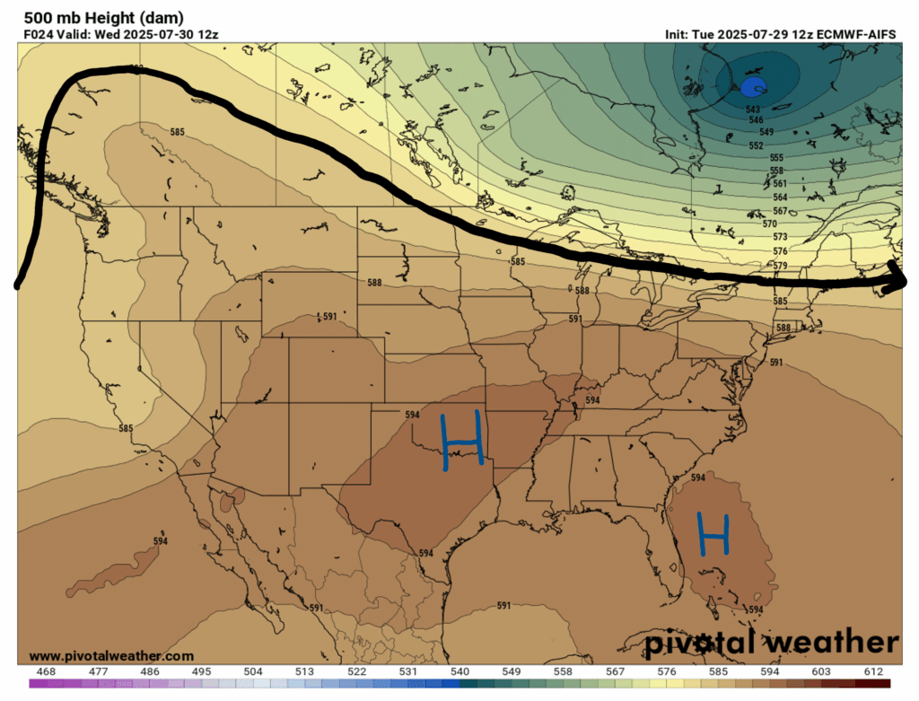
Starting way up in the atmosphere at 500 mb, we can see some large ridging over the Pacific Northwest and then we get into some more zonal flow moving East. This setup will cause high heat over much of the CONUS, including our forecast area.
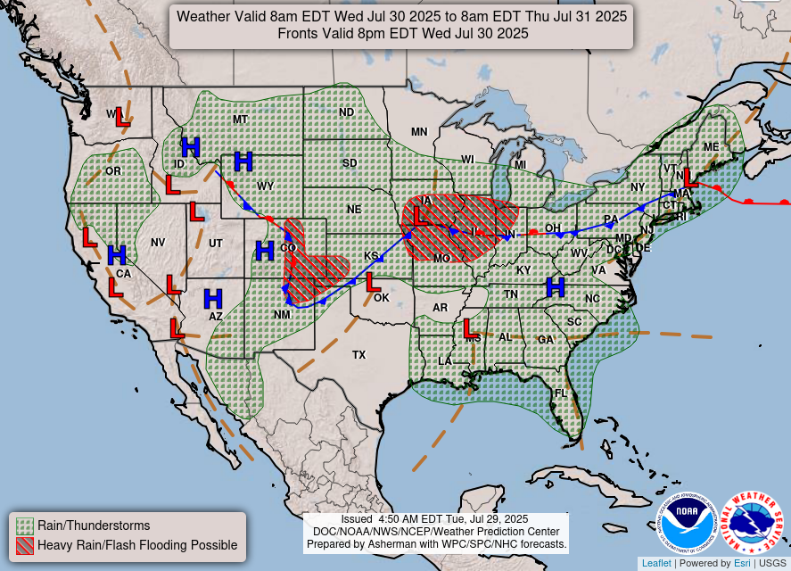
Now moving down toward the surface, there is some surface low pressure with some troughing throughout our area. This means that we can definitely expect some afternoon and evening showers and thunderstorms today. Tomorrow’s surface chart calls for a cold front moving our way, helping to solidify our typical end of day pop up storms.

Today’s Weather
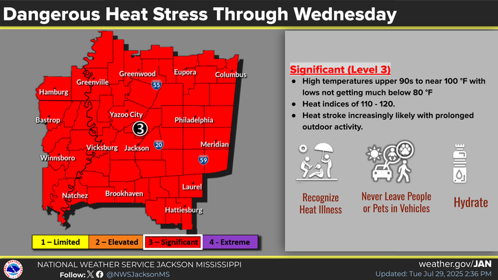
Today’s main concern will be high heat indices with the combination of high humidity and high 90s temperatures making it feel extremely hot outside. Take a look at the current actual temperature on the left vs. the current heat index on the right:

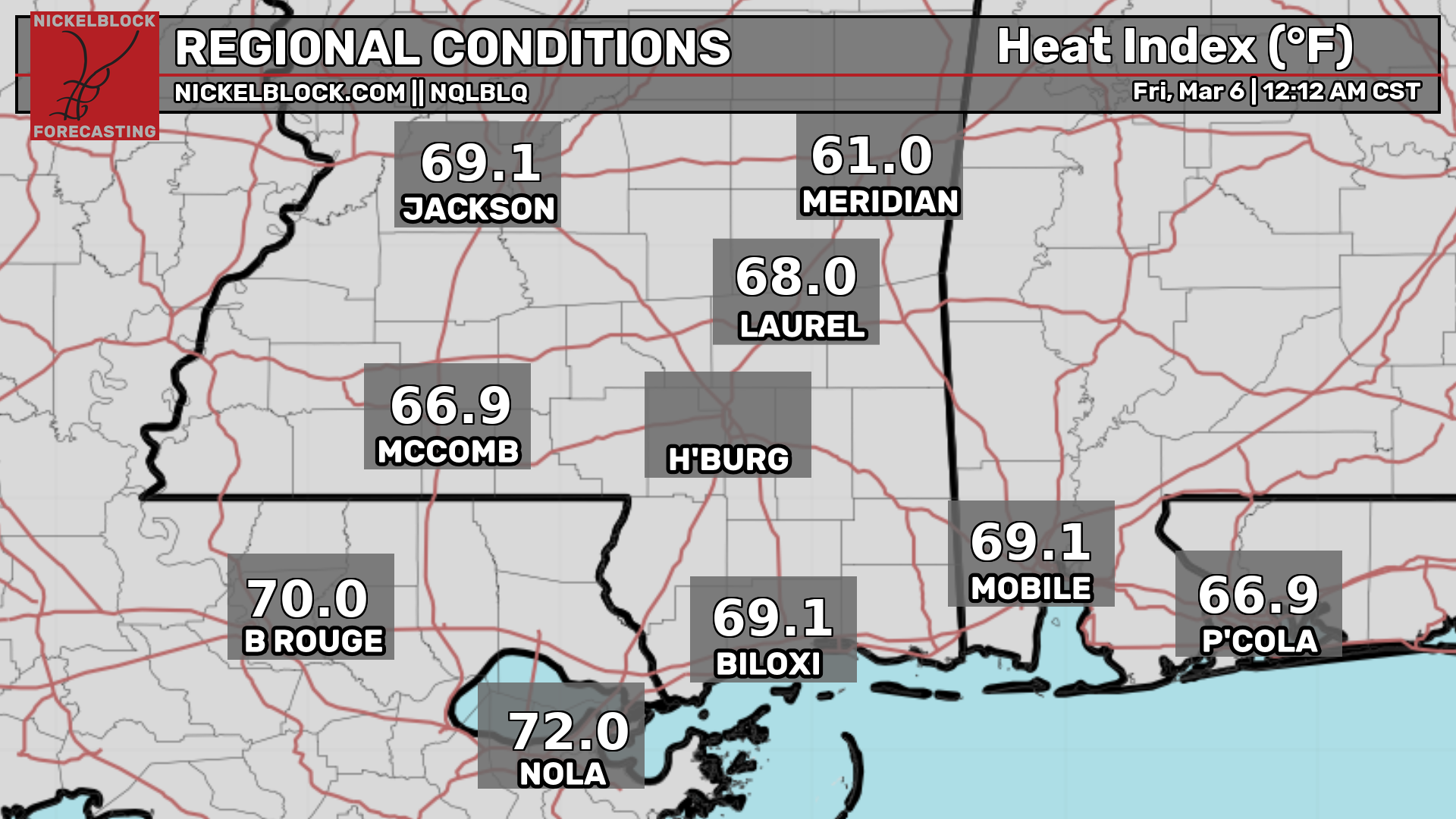
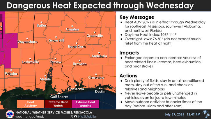
Due to these extreme heat indices, there are a few Extreme Heat Warnings and Heat Advisories in place today. The NWS New Orleans office has a heat advisory in effect from 10am to 7pm today. The NWS Jackson Office has an Extreme Heat Warning in effect until 8pm today, with forecasted heat indices up to 120 degrees! The NWS Mobile/Pensacola Office has a Heat Advisory in effect until 6pm today. Try to stay inside as much as you can today, and be extremely careful if outside today! Try to keep outdoor activities to early morning or early evening today if possible.
As for rain, here’s the radar for today:
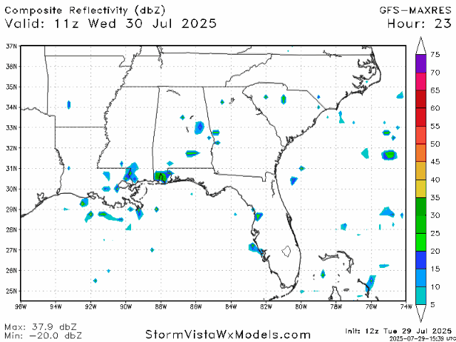
We can expect a few scattered showers and possibly a thunderstorm in the afternoon, increasing in the early evening and persisting until very early morning tomorrow.
Weather for the Rest of the Week

Tomorrow, temperatures will stay in the high 90s, then on Friday will move down a bit to the mid-90s. Both days it it likely that the “feels like” temperatures will reach about 110 degrees. Afternoon scattered showers will also persist, and a few thunderstorms cannot be ruled out either.
Weather for the Weekend and Beyond:

For this weekend, we can expect some lower temperatures toward the low 90s, but heat indices still getting up to 100-105 degrees, especially on Saturday. Both days we can expect a typical summer day for our area: Mostly sunny in the morning and then around 1pm and onward, scattered showers will begin to pop up around our region until later in the evening.
As for early next week, the weather should look similar to the weekend, with high temperatures also staying in the low 90s. Later next week, upper-level troughing over the Eastern US is forecasted, which could increase storm chances for our area depending on where this potential troughing sets itself up.
Regional Day-to-Day Forecast:
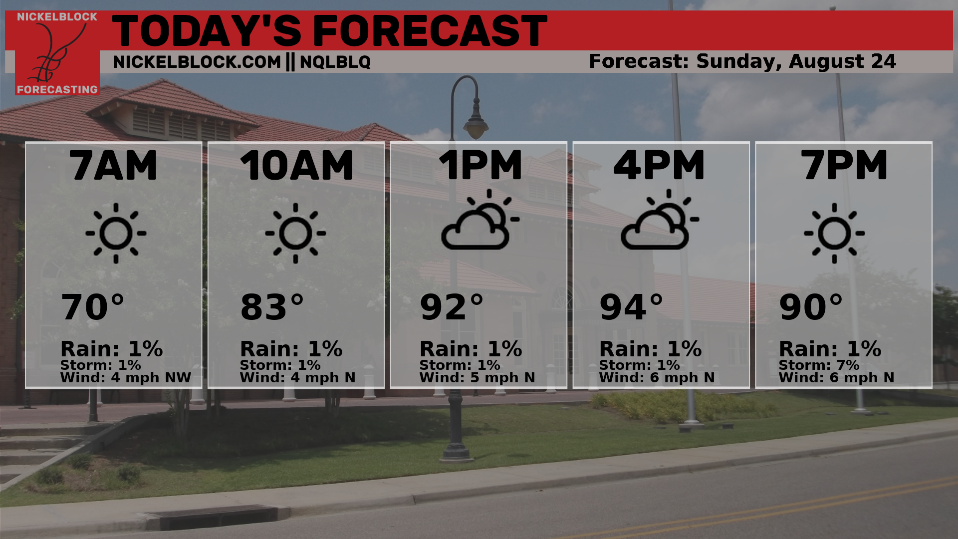
Today: Mostly sunny in the morning with a chance of showers and thunderstorms in the afternoon. Highs in the high 90s, with heat indices 110+ degrees. Chance of precipitation 50%.
Tonight: Showers early into the evening, then mostly clear. Lows in the mid 70s. Chance of precipitation 60%.
Thursday: Mostly sunny in the morning with a chance of showers and thunderstorms in the afternoon. Highs in the high 90s during the day and lows in the mid 70s at night. Chance of precipitation 50%.
Friday: Mostly sunny in the morning with a chance of showers and thunderstorms in the afternoon. Highs in the mid 90s during the day and lows in the mid 70s at night. Chance of precipitation 70%.
Saturday: Mostly sunny in the morning with a chance of showers and thunderstorms in the afternoon. Highs in the low 90s during the day and lows in the mid 70s at night. Chance of precipitation 50%.
Sunday: Mostly sunny in the morning with a chance of showers and thunderstorms in the afternoon. Highs in the low 90s during the day and lows in the low 70s at night. Chance of precipitation 40%.
Monday: Mostly sunny in the morning with a chance of showers and thunderstorms in the afternoon. Highs in the low 90s during the day and lows in the low 70s at night. Chance of precipitation 30%.
Tuesday: Mostly sunny in the morning with a chance of showers and thunderstorms in the afternoon. Highs in the low 90s during the day and lows in the low 70s at night. Chance of precipitation 30%.
Wednesday: Mostly sunny in the morning with a chance of showers and thunderstorms in the afternoon. Highs in the low 90s during the day and lows in the low 70s at night. Chance of precipitation 40%.


