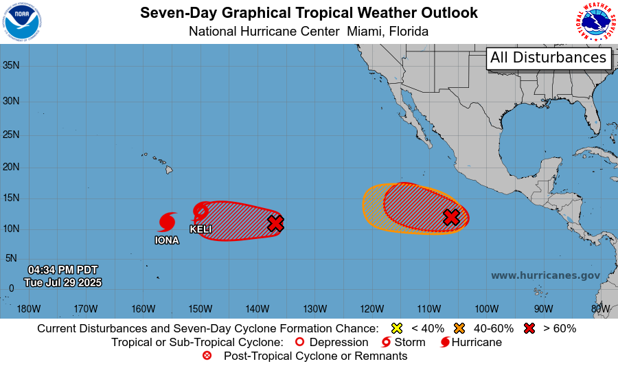
There is a lot to cover in the Pacific, including a major hurricane, tropical storm, and three other disturbances. Fortunately, Hurricane Iona, Tropical Storm Keli, and all of the disturbances are not expected to make landfall. Two of the three disturbances we can expect tropical storm development, but third would be a wait-and-see situation. There are no disturbances currently in the Atlantic Basin. Let’s take a closer look at each tropical event:
Hurricane Iona:
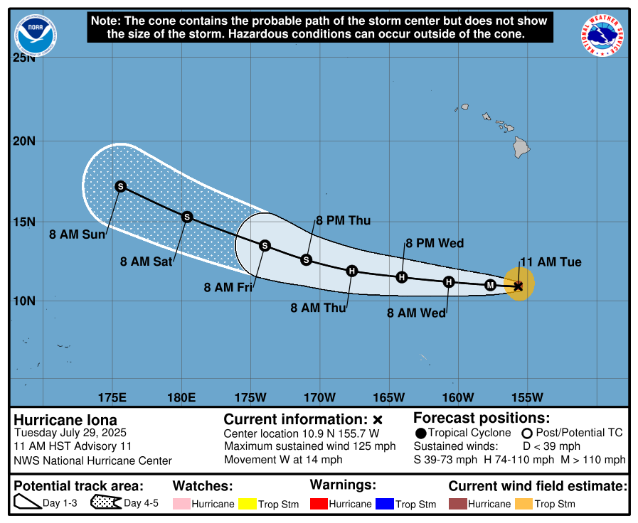
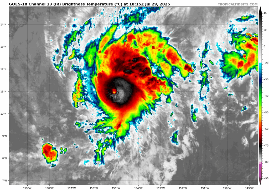
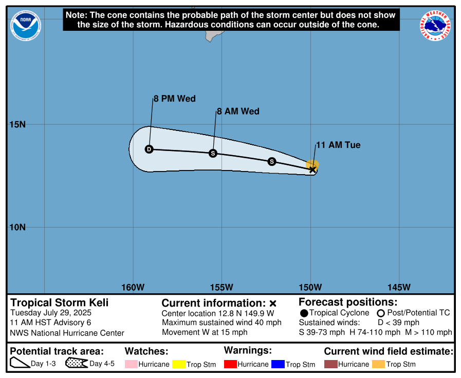
Hurricane Iona currently has a minimum central pressure of 957 mb and maximum sustained winds of 125 mph, putting Iona as a Category 3 major hurricane on the Saffir-Simpson Scale. If these intense winds increase to 130 mph, Iona will be considered a Category 4 major hurricane, but at this point is unlikely. The storm is moving westward at 14 mph, and luckily is forecasted to NOT make landfall or have any effects on Hawaii, as it is well outside of the forecast cone due to Iona’s small wind field:
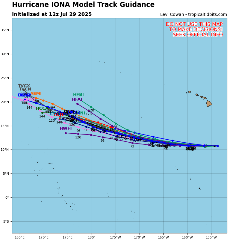
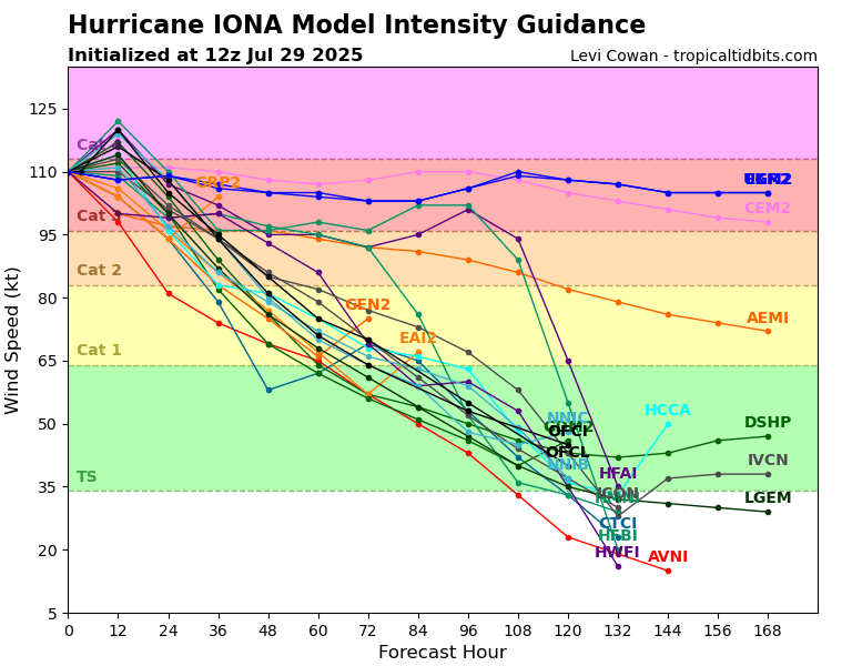
Looking at the forecasted tracks from various ensemble models, we can see that they align pretty closely with the National Hurricane Center’s (NHC) forecast track line for Iona. Also comparing the ensemble model intensity guidance and the NHC’s forecast, Iona has likely finished intensifying, and should be begin to weaken to regular hurricane status (Category 1 or 2) then to a tropical storm and then further weaken and eventually dissipate from there. This is because by later today, Iona will be moving into some more unfavorable conditions for tropical development, where there will be colder waters, drier air, and high wind shear.
Tropical Storm Keli:
Following right along in Iona’s tracks is Tropical Storm Keli. Keli is also moving westward at 15 mph with a minimum central pressure of 1006 mb. With maximum sustained wind speeds of 40 mph, Keli is just strong enough to be considered a tropical storm. Like Iona, Keli is not forecasted to make landfall, and its forecast cone reaches nowhere near the Hawaiian Islands, so effects on land can now be ruled out.
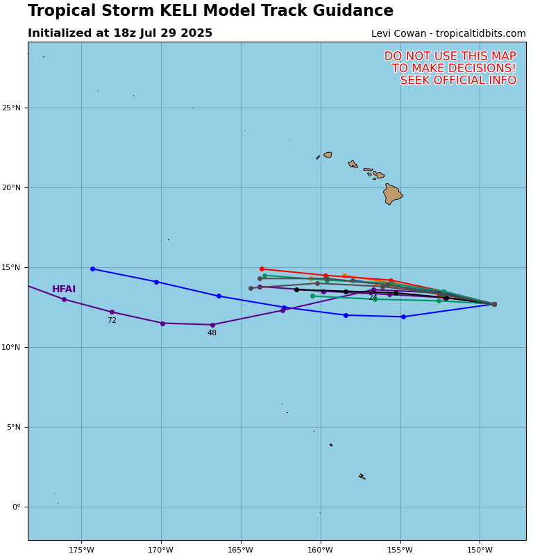
As Keli seems to be following in Iona’s footsteps, the tropical storm is not expected to make it very far without weakening, and at this point won’t intensify much more:
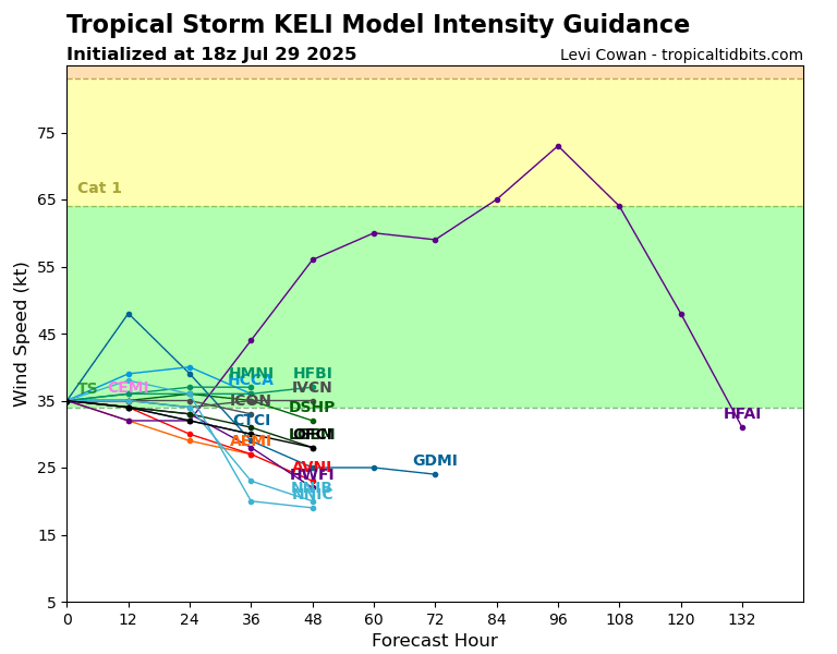
This is because Keli is moving toward the same area that Iona is moving into, where the environment is not very favorable for tropical development. So, it is likely that wherever Iona begins to fall apart and dissipate, Keli will shortly go down with it, probably in the next day or two.
Disturbance 1:
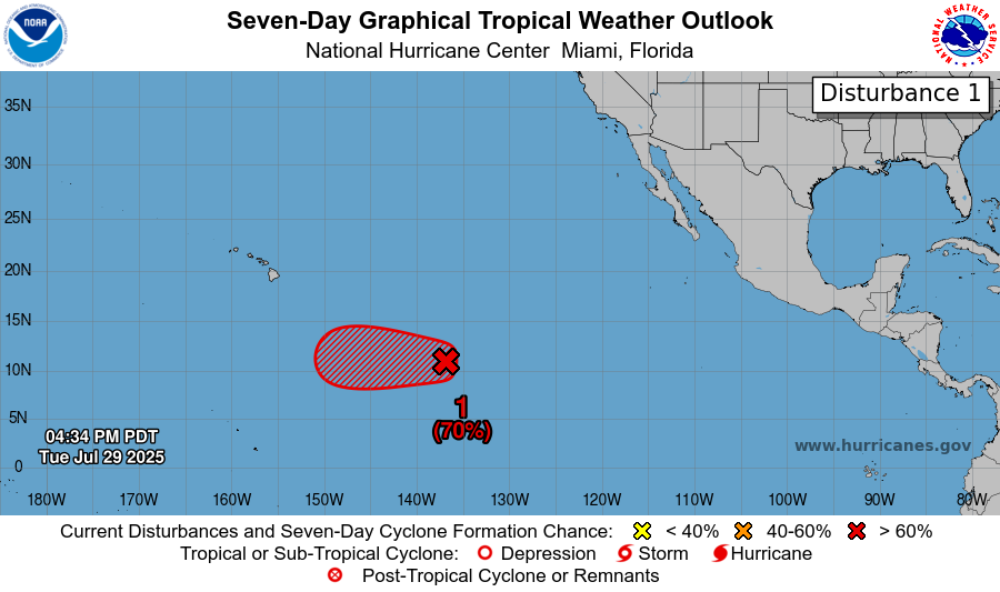
Now getting into the three disturbances, the first disturbance in the East Pacific has a 70% chance of developing in the next 7 days, and also a 70% chance in the next 48 hours. The likely path of this disturbance, now called Invest 98E, is development into a tropical depression in the next day or two, and then shortly after reaching the same environment with the unfavorable conditions that Iona and Keli are now approaching, weakening and eventually dissipating from there.
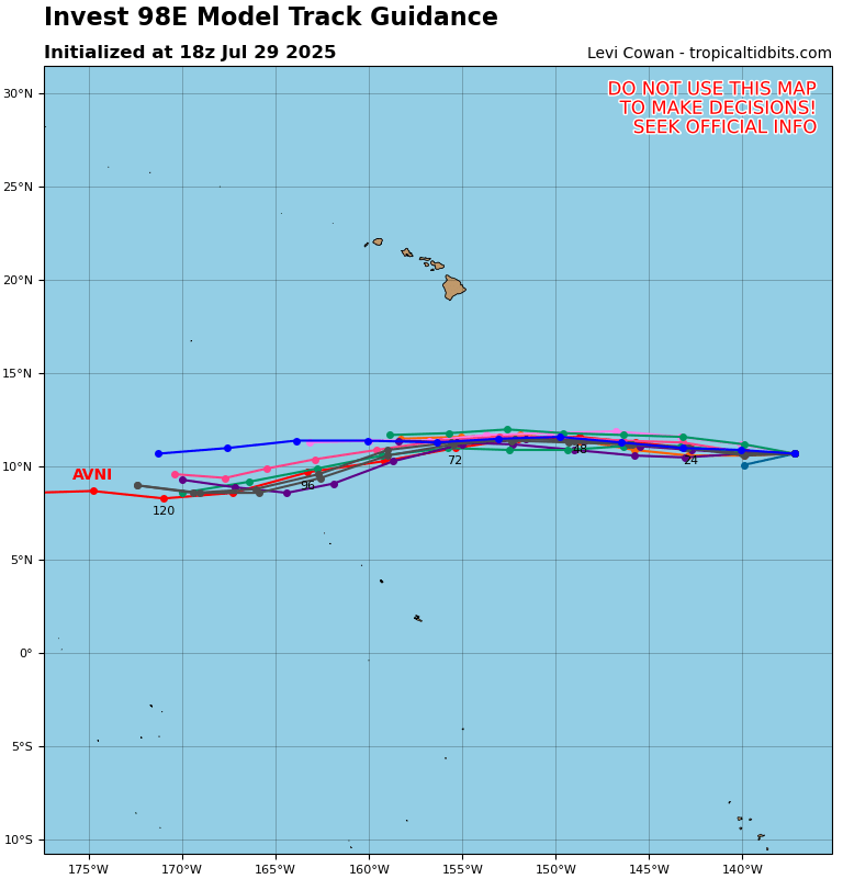
Looking at the potential tracks from the ensemble models, this disturbance is likely to be pushed further westward, being steered in a similar direction to the previous storms of Iona and Keli. This general track will again lead the disturbance to tropical storm-inhibiting waters.
Disturbance 2:
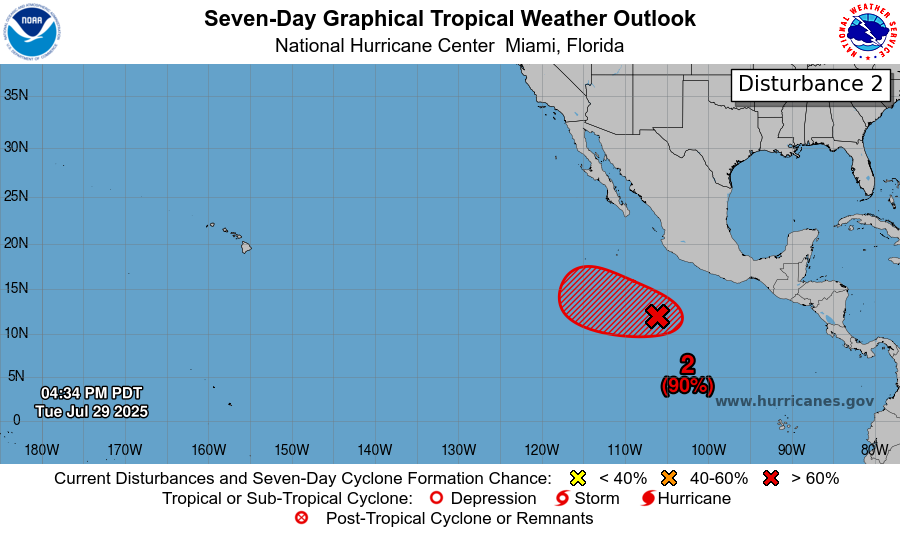
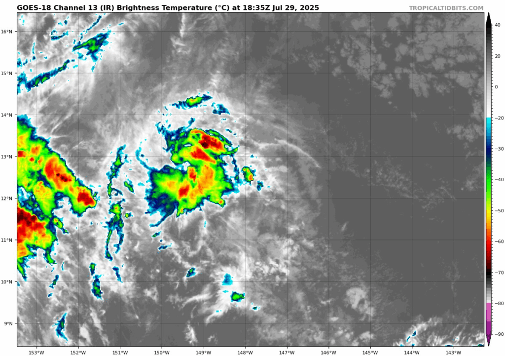
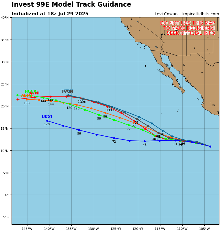
Now moving to the East Pacific, the second disturbance has a 90% chance of development in the next 7 days, and an 80% chance in the next 48 hours. Also known as Invest 99E, this disturbance is currently moving west-northwestward at 15 mph as a large low pressure area with bands of disorganized showers, which you can see here:
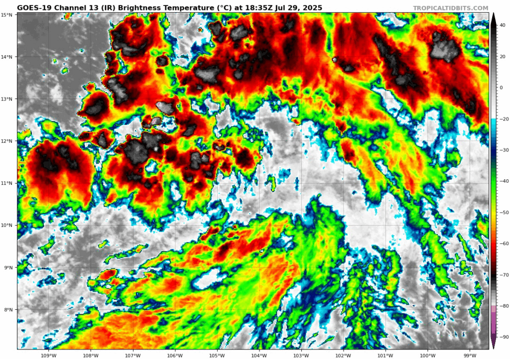
Environmental conditions are looking supportive of tropical development, and the low pressure area and showers are there, so development into at least a tropical depression in the next couple of days would not come as a surprise. Fortunately, this storm is also not expected to make landfall anywhere:
Disturbance 3:
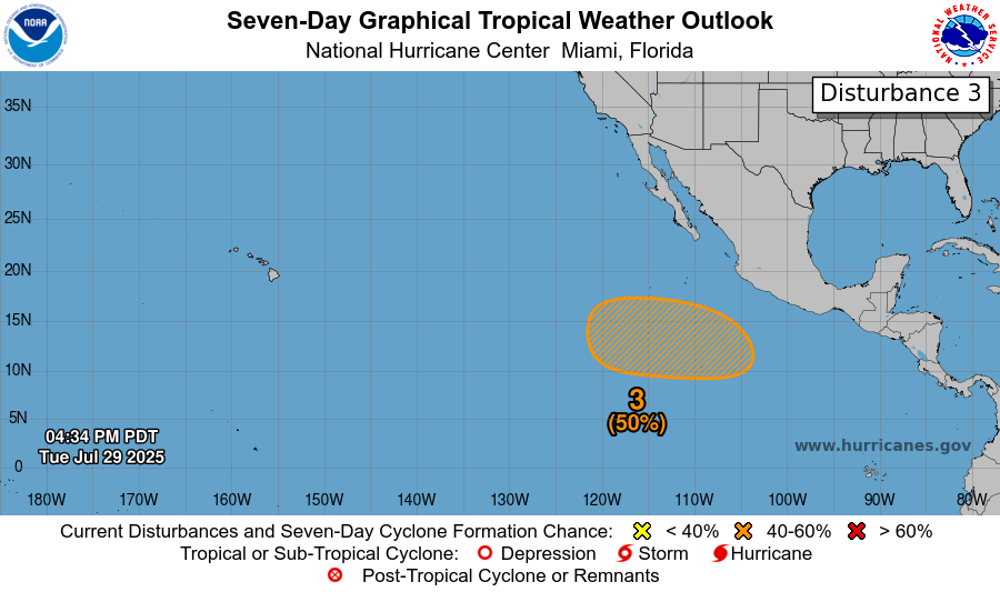
The third disturbance recently popped up on the NHC’s radar early Tuesday morning and has a 50% chance of development in the next 7 days, and no chance at development in the next 48 hours. The NHC is expecting that a low pressure area will form later this week or over the weekend. As covered in the Disturbance #2, environmental conditions could definitely favor tropical development in the next few days. So just like how the second disturbance developed, this third disturbance really only has a chance of development if the forecasted low pressure area does end up forming in the coming days, then we will see how environmental conditions have persisted along with it. Regardless, this system is slowly moving west-northwestward, so eventual landfall in unlikely at this point.
A Look at the Atlantic:
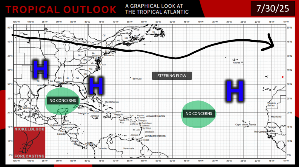
There are no active disturbances in the Atlantic as of today, and the NHC does not expect any tropical cyclones in the next 7 days. This doesn’t mean that disturbances won’t pop up somewhere in the Atlantic in the next week, though. Looking at our typical environmental conditions, we can see some little tropical waves coming off the coast of western Africa and moving westward across the Atlantic. We can also see stretches of high humidity coming of the Mid-Atlantic states and moving out into the ocean.
The ensemble models are also starting to pick up on these areas, but it looks like there are no immediate threats:
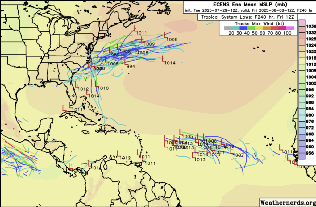
So for now we will have to wait and see if anything actually develops in the Atlantic, and we will keep you updated on all things tropical weather here at NickelBlock!


