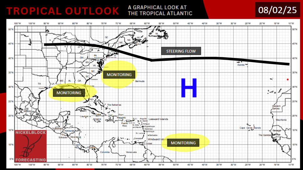
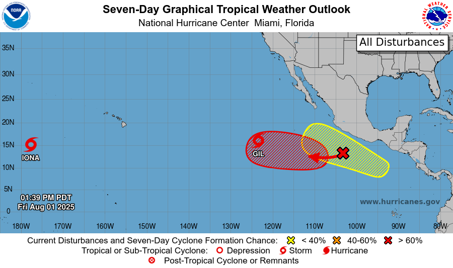
There are two storms currently in the Pacific basin, and two areas of interest for future development. Tropical Storm Gil has a shot at hurricane status this weekend, before it weakens back down to a tropical storm. Tropical Storm Iona is harmlessly churning in the deep Pacific and won’t dramatically strengthen before it gradually dissipates in the middle of next week. The Atlantic remains calm for now, but that quiet may be short lived, as models are showing the possibility of tropical formation in three areas. Late next week, Hawaii may be impacted by Tropical Storm Gil, as well as the storm expected to form behind it.
TROPICAL STORM IONA
Iona is currently located well to the west southwest of Hawai’i, with maximum sustained winds of 40 mph, a central pressure of 1006 mb, and is moving west northwest at 18 mph. It is moving north more quickly than before, closer to its demise. It will enter an area of cooler water and higher wind shear. As a result, this storm should continue to weaken. It may lose its tropical storm status altogether sometime this weekend. Early to middle next week, it should deform entirely as it treads over waters that are too cool.
TROPICAL STORM GIL
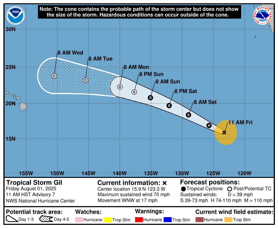
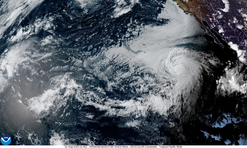
Gil is currently located well to the southwest of Cabo San Lucas, with maximum sustained winds of 70 mph, a central pressure of 993 mb on the dot, moving west northwest at 17 mph. The environment for this storm is slightly better, with warmer ocean water, but is still far from ideal. This storm has strengthened more than expected, and has a real chance at becoming a hurricane at some point this weekend. Early on the day on Monday, it will enter a wall of wind shear and cooler water which will weaken the storm. It is moving away from Mexican shores, but in the direction of Hawai’i. It would be, at worst, a tropical storm when it gets near Hawaii, making its closest approach during middle to late next week. Aside from the areas right near the beach that might be affected by a few big waves, rain and gusty wind would be the only threats to the island chain.
OTHER AREAS TO WATCH
An area of interest closer to Mexico is likely to develop in the middle of next week. Shear is expected to abate in the area after Tropical Storm Gil dissipates, allowing another storm to form in the same area next week. This area of interest has an 80% chance of developing according to the NHC. Like Gil, any storm that forms here will likely travel harmlessly to the west, keeping the storm center far away from any land.
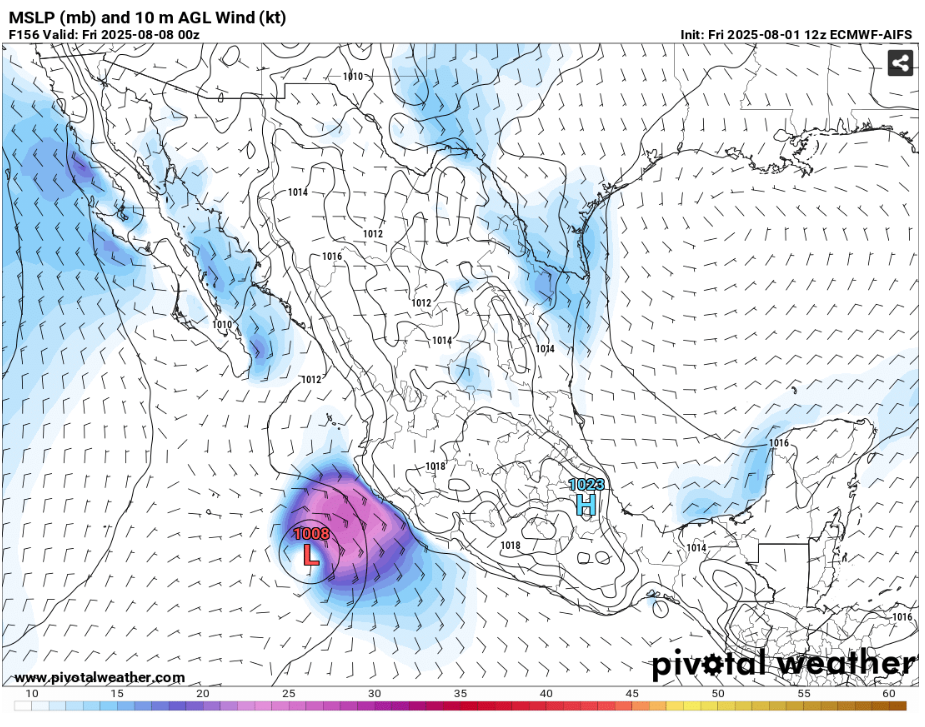
Some models like the ECMWF run above show a second storm forming behind the first area. There does seem to be ample moisture, shear, and water temperature for this to occur. If a storm does form, it would move parallel to the Mexican coast, but it’s approach would be a bit closer, potentially allowing for flooding rain, mudslides, gusty winds, and choppy sea to affect some coastal areas of Mexico. This would occur next weekend or early the week thereafter. The NHC is only giving this system a 30% chance of development in the next 7 days, although I expect that will increase a bit in the days to come as the storm’s “development window” fully shifts within the 7 day time frame.
7-14 DAY OUTLOOK
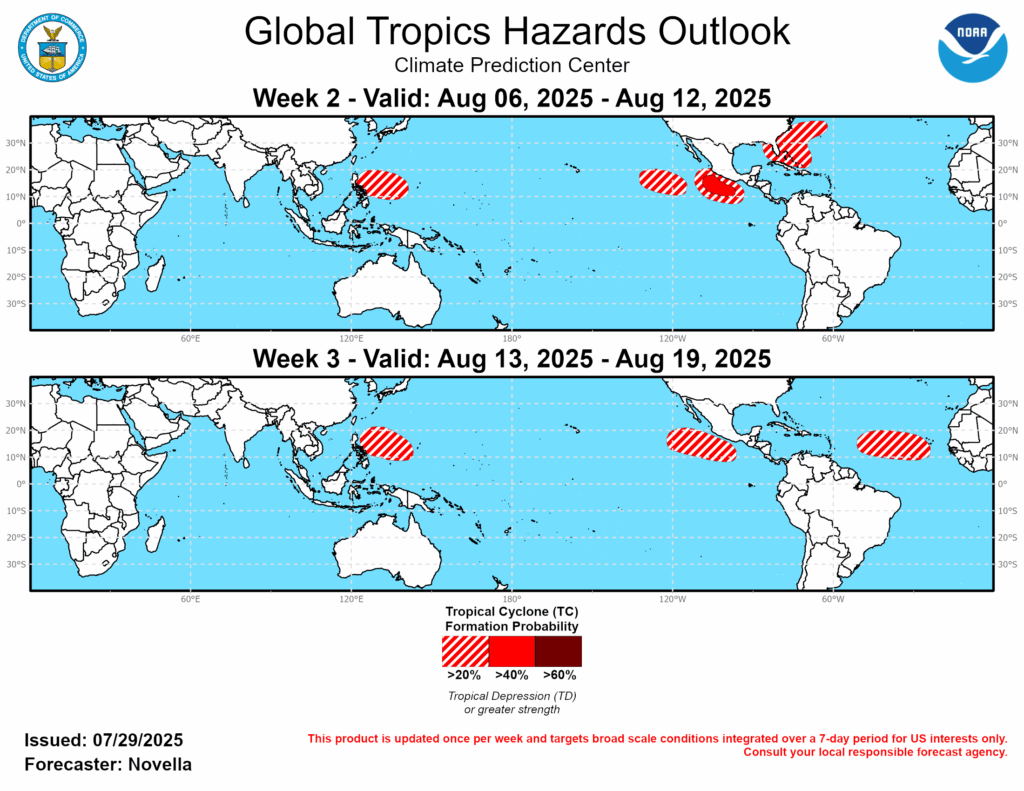
Moving to the Atlantic, there is some model support for a “blink and you’ll miss it” type storm off the East Coast of the United States. Anything that forms will likely ride a system out into the Atlantic. The only impact would be a rain band or two, and gusty winds in the coastal area of where it initially forms.
There is concern for the area shaded in the map above surrounding Florida. Potential exists for an area of low pressure to form that could then get tropical characteristics if it’s over the ocean. The surface of the ocean is sufficiently warm. If we see a break in the wind shear and enough moisture is present aloft, we could see a system form here. I wouldn’t say a storm here as a particularly likely scenario at this point, as a lot of factors must align.
Recently, there’s been an uptrend in the ECENS model run for a storm to form in the Tropical Atlantic, then move into an area north of the Caribbean, potentially towards Florida. This is a rare scenario where the European Model is forecasting a storm to form, and the GFS is laying off. It’s worth keeping an eye on, but at present, signals are very mixed.


