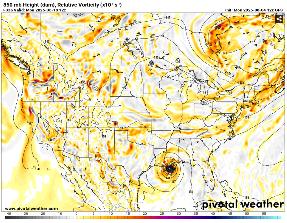
We’re getting to that time of year. It is probable, if you haven’t already, that you will soon see several posts or videos showing images of a reputable model forecasting a major hurricane strike somewhere on the Atlantic or Gulf coasts. Yes, both mainline medium-range models (ECMWF and GFS) are showing a powerful hurricane approaching the U.S. mainland – in 13 days. These models, particularly the GFS, are, by design, very wild past the 14 day time frame. There’s a reason many in the industry refer to the evening GFS run as the “happy hour” run. If you see a doomsday forecast of a Category 5 super hurricane bearing down on your town 2 weeks from now, be very skeptical. Whether or not there is even a hurricane at all is a big question mark, and if one forms, there’s no way to accurately predict strength and location this far out.
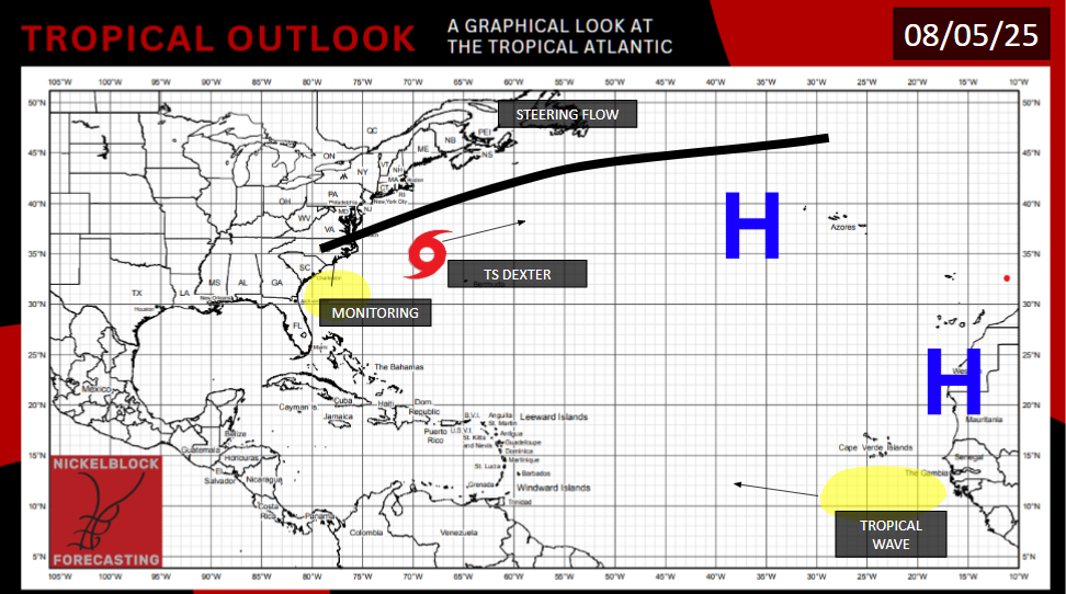
TROPICAL STORM DEXTER
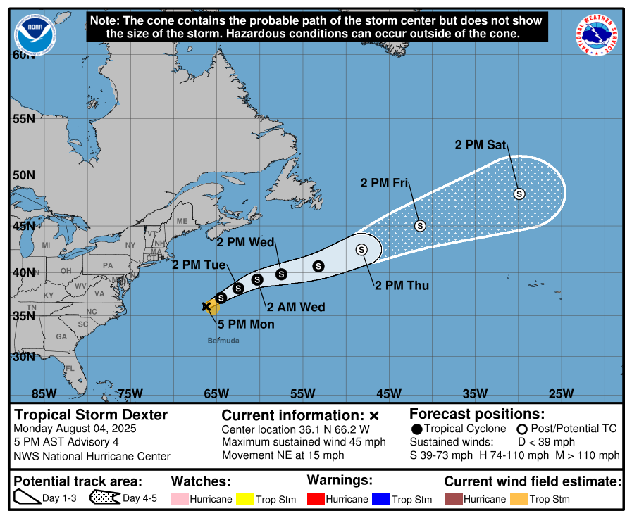
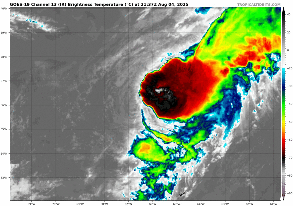
Tropical Storm Dexter has formed due east of North Carolina and due south of Maine. It has maximum sustained winds of 45 mph, a pressure of 1002mb, and is moving northeast at 15 mph. On the outlook map we make for all of our forecasts, you will always see a black line to the north called the “steering flow”. Dexter will likely get caught up in said steering flow, causing it to move quicker and more easterly, far away from any land. Being dragged across cooler waters and heavy wind shear, it will gradually lose it’s tropical characteristics, and be reduced to an extratropical low pressure late this week or early next week. Said low pressure could bring some rain to the British Isles.
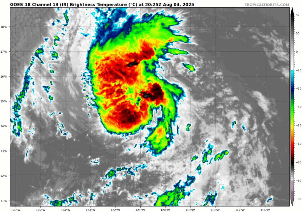
TROPICAL STORM HENRIETTE
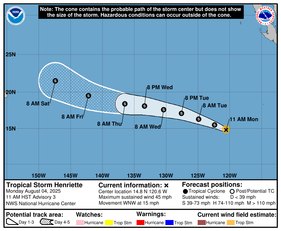
Switching gears to the Pacific, a new storm is hot off the presses. Henriette has just achieved Tropical Storm status, and is 900 miles southwest of Cabo San Lucas. It has maximum sustained winds of 45 mph, a pressure of 1004mb, and is moving west northwest at 15 mph. It is expected to strengthen a little more, but it is moving towards a drier, cooler area. There had been concerns about this storm passing close to Hawaii this weekend. While that is still in the cards, a mid-level trough may steer this storm north away from Hawaii, avoiding any impacts.
AREAS OF INTEREST – ATLANTIC

Off the coast of Georgia, the NHC has highlighted an area with a 30% chance of tropical development, which would occur later this week into the weekend. A low pressure is expected to enter the area and interact with tropical moisture. Regardless of any tropical development, the low pressure will move north into the Carolinas Sunday into Monday, bringing lots of rain and choppy surf. Due to the limited time frame this storm would have to work with, I wouldn’t expect an intense storm, maybe a Category 1 hurricane at worst, if one even forms.
The big orange area of interest in the deep Atlantic is the one that is causing the models to go crazy. The Atlantic is finally warm enough, and an environment of light shear will potentially allow a tropical wave off the coast of Senegal and Guinea-Bissau to potentially undergo tropical development. There will be some shear this wave has to fight through. If a storm develops, there is a very wide spread of outcomes of this system. It could, for all we know, be curved by the Bermuda High far away from land. Down the line, and we’re talking about past the 14 day time period, the entire Gulf and Atlantic coasts, as well as northern Cuba, is theoretically in the cards for impacts from this storm. Stay tuned to Nickelblock Forecasting and official sources for more information.
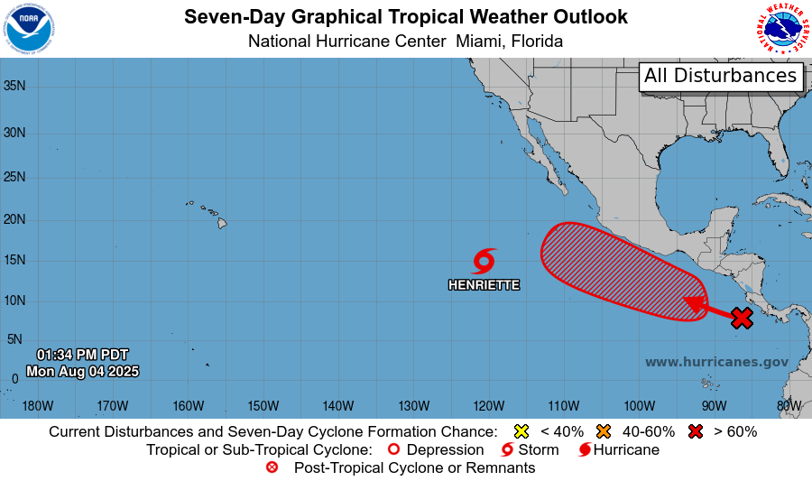
Looking at the Pacific, models favor storm formation near the Mexican coast. We will likely see it as soon as Thursday, definitely by this weekend. The storm will move parallel to the coast from Oaxaca to Jalisco, bringing a deluge of rain to the area. Flooding is a concern here.
In the 7-14 day time frame, some models are suggesting another storm will form in the Pacific near Mexico. Thankfully, the most likely formation area is further away from the coast, limiting rainfall on land.
In conclusion, a switch has been turned on in the Atlantic, and the tropical season is fully underway. But in the immediate future, interests in southern Mexico should keep tabs on conditions along the Mexican coast.


