As we’re getting later into the summer, hurricane season is really starting to ramp up now, and there is quite a lot going on across the Pacific and Atlantic Oceans. In the Atlantic, we have Tropical Storm Dexter and two other disturbances. In the Pacific, there is Tropical Storm Henriette, as well as one disturbance. Let’s take a closer look at each tropical event:
Current Atlantic Setup:
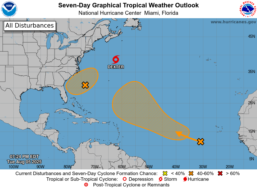
Starting off in the Atlantic, here are the locations of the current tropical systems in the Atlantic Basin from the National Hurricane Center (NHC)
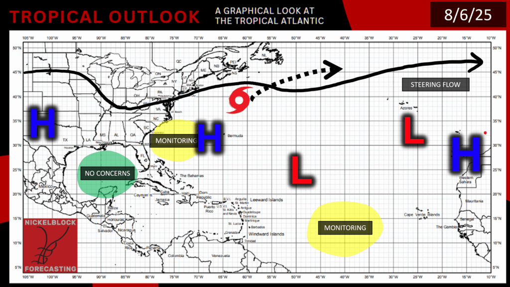
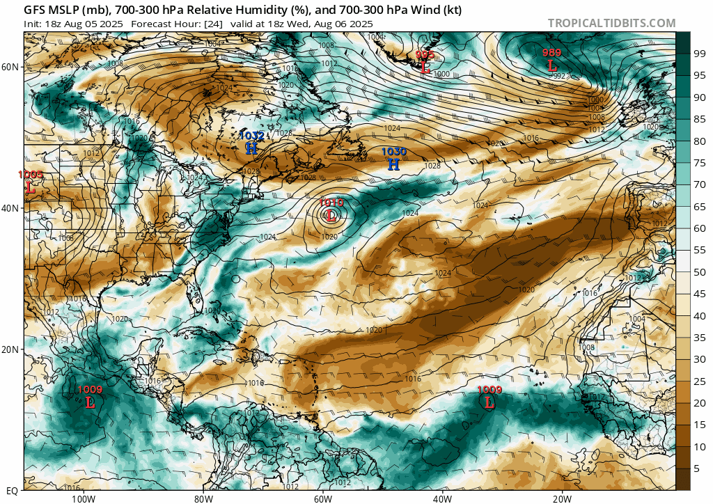
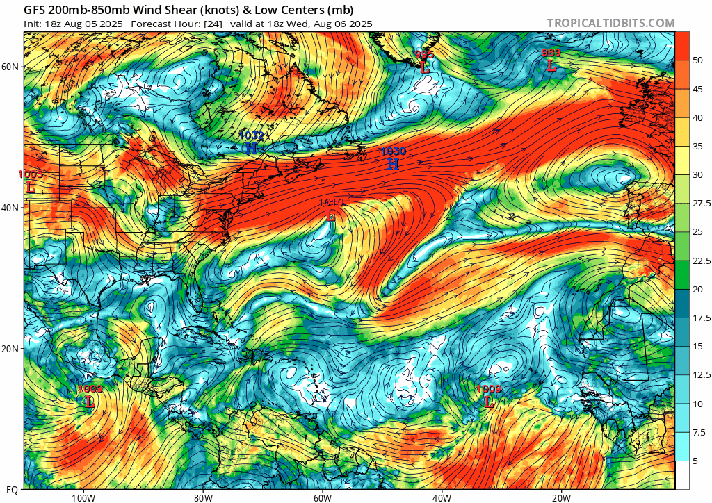
In the upper-air of the atmosphere, there are three areas of high pressure: one over Texas, the “Bermuda High”, and another over Western Sahara. There are two areas of low pressure at 500mb: one over the Azores and another in the middle of the Atlantic. I have marked Tropical Storm Dexter and where it’s headed, as well as the two disturbance areas in the Atlantic. There are no concerns as of right now in the Gulf.
Tropical Storm Dexter:
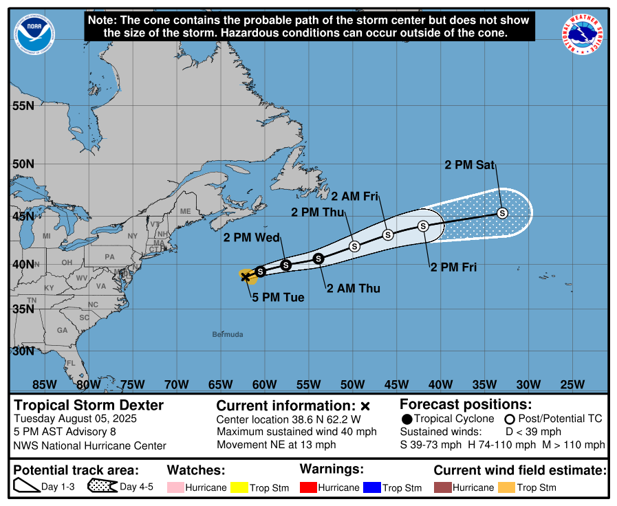
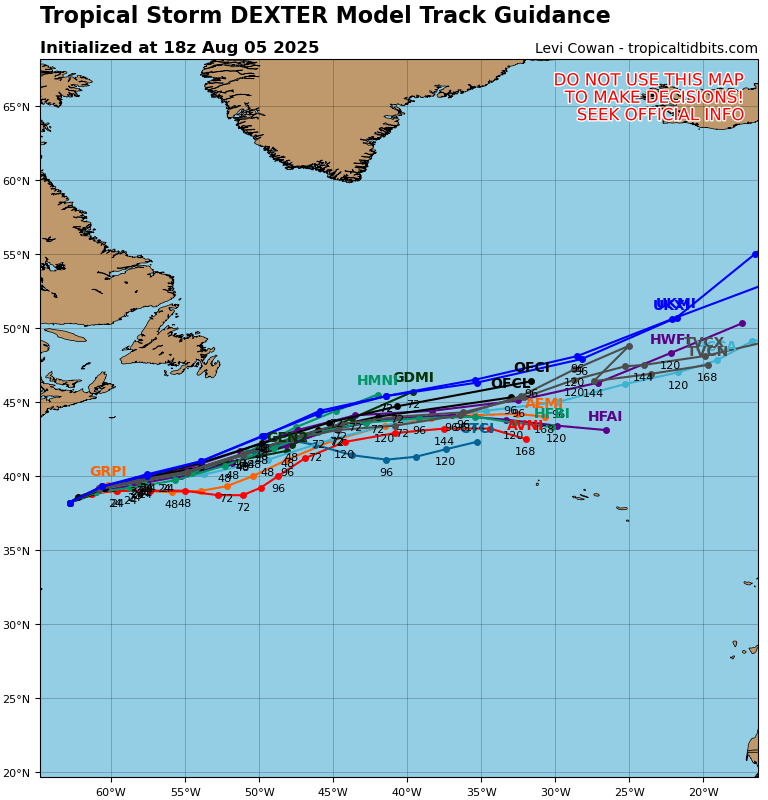
Per the NHC forecast, Tropical Storm Dexter is being steered Northeast at 13 mph by the Bermuda High and the general steering flow. Dexter has a minimum central pressure of 1005mb and maximum sustained winds at 40 mph. The NHC’s forecast track aligns pretty closely with the ensemble model tracks, so fortunately landfall and any effects on land will very likely be avoided.
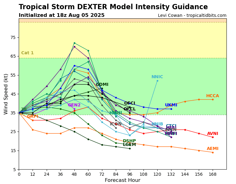
As for how intense this storm will become, it’s looking like Dexter will re-intensify for the next 2 days and then really start to weaken after that point into an extra-tropical cyclone, then further weaken into a low from there.
Atlantic Disturbance #1:
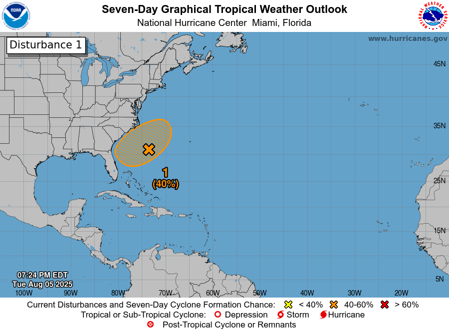
The first disturbance in the Atlantic is located off the coast of Georgia and the Carolinas, and has a 40% chance of development into a tropical cyclone of some sort in the next 7 days. Its chance for development in the next 2 days is really low, at 10%.
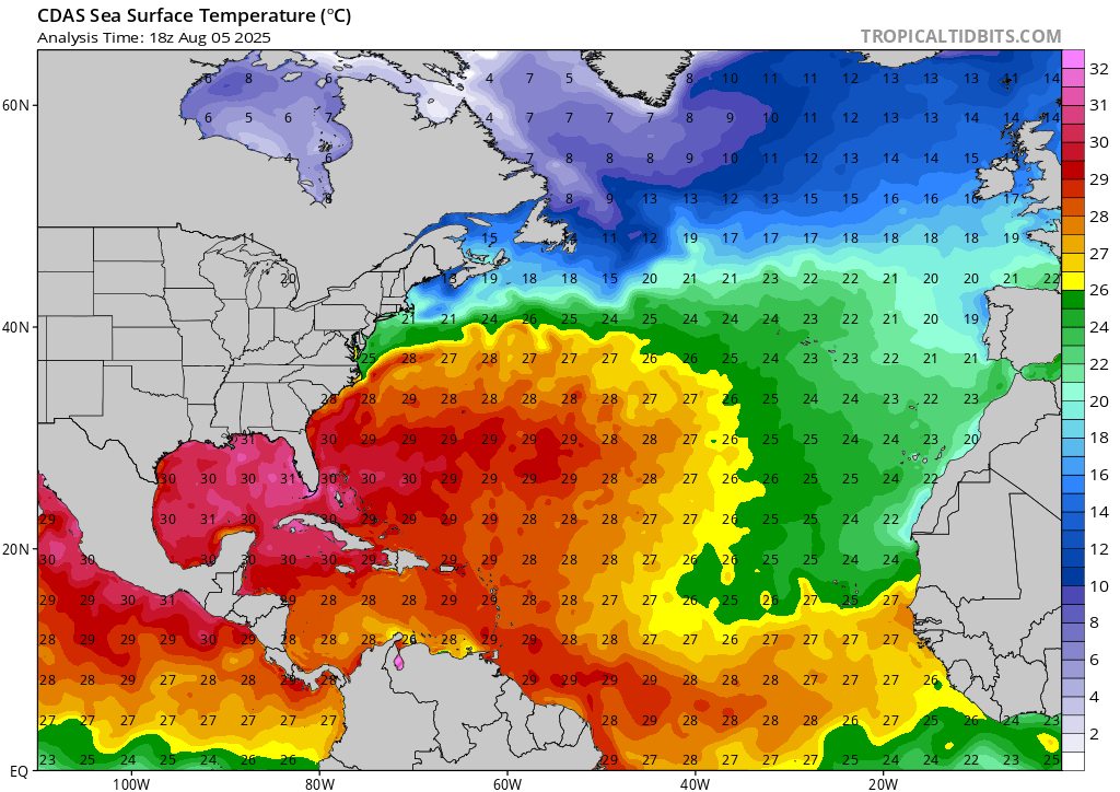
This area is highlighted because toward the surface there is some troughing going on, which typically indicates that an area of low pressure will form in that spot. So, this disturbance’s development depends on whether this low pressure forms, and if environmental conditions like warm sea surface temperature, high moisture, and low wind shear are present. Looking at these conditions, further development would not be surprising if the disturbance can find a solid pocket of low wind shear.
So, we will have to wait and see if the low pressure area does in fact form over the next couple of days for this disturbance.
Atlantic Disturbance #2:
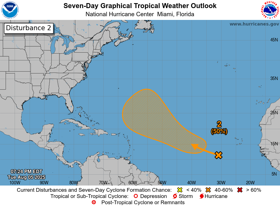
This second disturbance is also a wait-and-see situation, but a bit more long term. It has a 50% chance of development in the next seven days, and no chance at all in the next 48 hours. This disturbance formed from a tropical wave where there are large areas of showers and thunderstorms, but these storms are still very disorganized. Looking at the same conditions we looked at for the first disturbance but in this specific area, some gradual development over the next few days is definitely possible.
It’s important to note that the GFS Model often likes to spin up major hurricanes in the southeastern US in the long term, but the likelihood of this actually happening is very slim. So, be skeptical if you see things online about models showing blowout hurricanes over a week or a couple of weeks away, and if you are unsure, using sources like the National Hurricane Center is always a safe bet.
Current Pacific Setup:
Now moving onto the Pacific, here you can see where the NHC has marked Tropical Storm Henriette and the disturbance.
Tropical Storm Henriette:
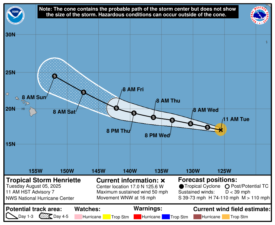
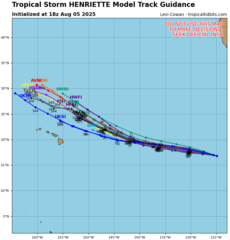
Tropical Storm Henriette is currently moving west-northwest at 16mph, and luckily is forecasted to miss Hawaii. Again, the NHC’s forecast track and the ensemble model track guidance align very closely. The effects of Henrietta, like high winds, extend about 70 miles from the center of the storm, so Hawaii also very likely won’t experience any effects from Henrietta on land.
Henrietta currently has a minimum central pressure of 1003 mb and has maximum sustained winds of 50 mph.
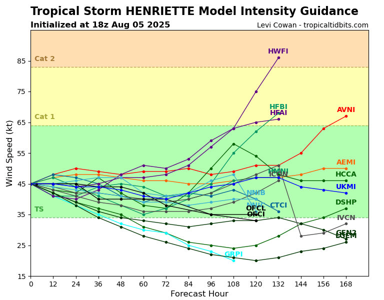
It’s looking like Henriette is done intensifying for the most part, and will stay steady or weaken over the next few days. After Day 4 the models get a bit wacky, which is not surprising, so it is pretty safe to say that later into the week and into the weekend Henriette will start to weaken.
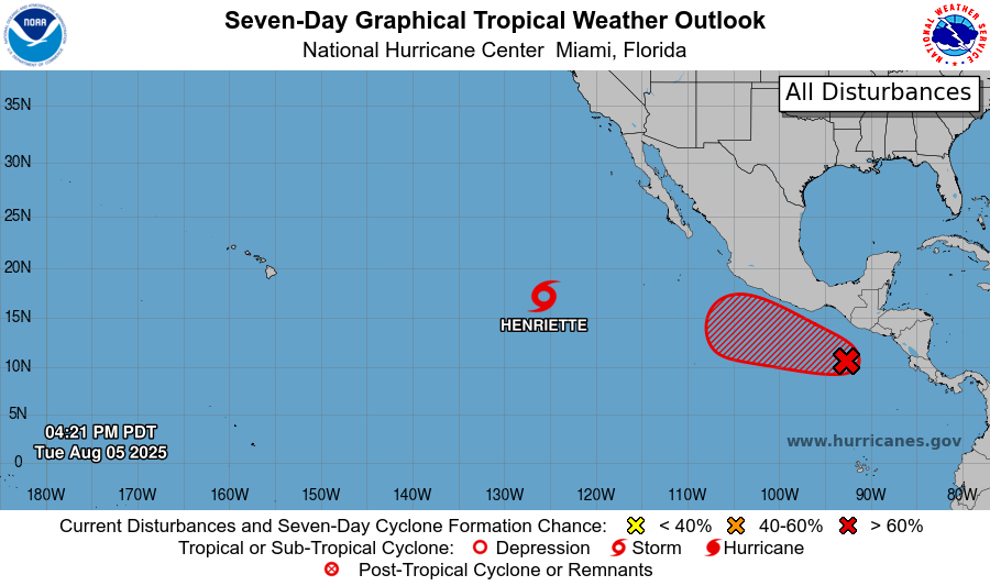
East Pacific Disturbance:
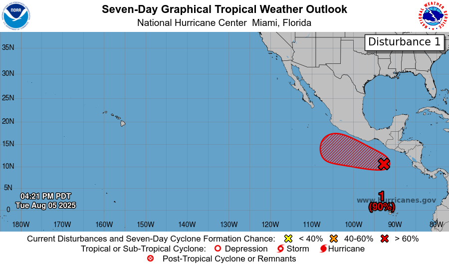
Lastly, there is one other disturbance off the coast of Mexico and Central America that is moving west-northwestward at around 15 mph. It has a 90% chance of development in the next 7 days, and an 80% chance of development in the next 48 hours. Unlike the disturbances in the Atlantic, this area of disorganized showers and thunderstorms is already associated with an area of low pressure, so tropical cyclone development is more imminent. Environmental conditions are also pointing toward tropical development.
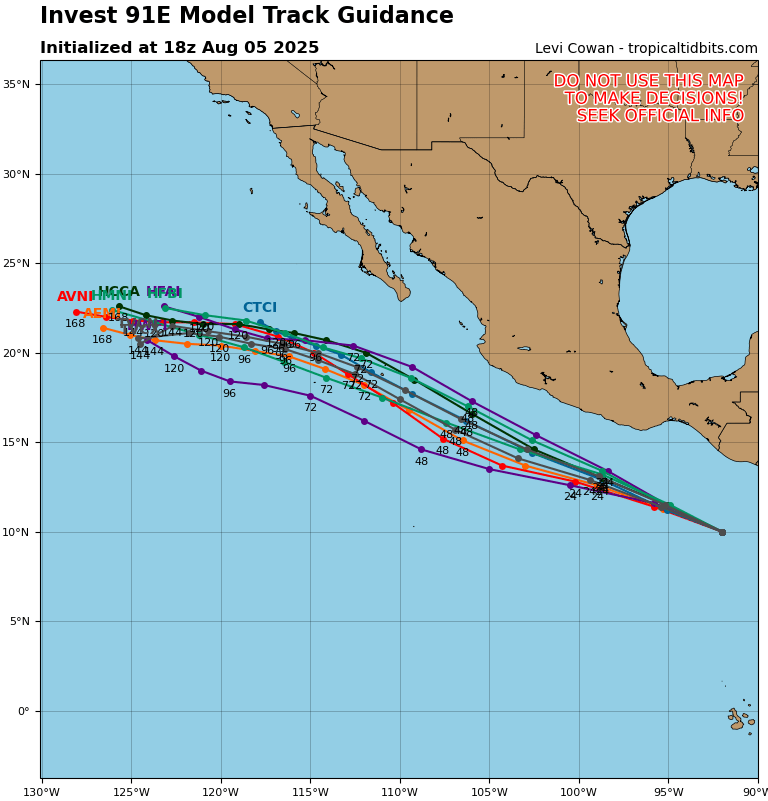
Looking at the forecasted storm tracks from various ensemble models, this system will likely get steered further westward, fortunately avoiding landfall on Mexico.
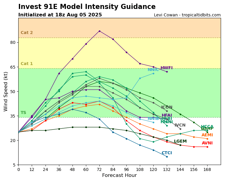
Because this system is still in the disturbance stage, it still has quite a bit of developing to do. It’s development will likely peak by Friday, then gradually weaken.
We will continue to monitor these areas and the rest of the tropics, so stay tuned for more tropical updates!


