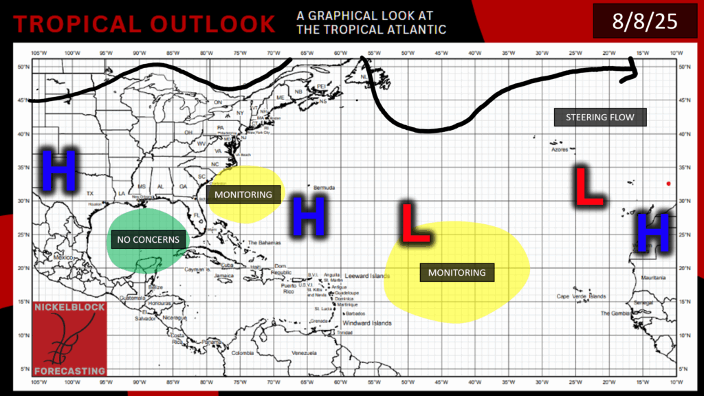
There are still quite a few systems in the tropics today, and it’s looking like we’ll be busy for a while. Dexter has just made its way out of tropical and post-tropical status, and has disbanded to some remnant storms. There are still two other disturbances in the Atlantic Basin and two Tropical Storms, Henriette and Ivo, in the Pacific. Let’s start off in the Atlantic and take a closer look at what’s going on:
Current Atlantic Situation:
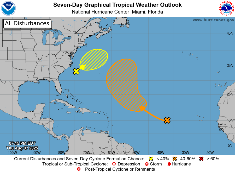
In this graphic, the first disturbance is marked in yellow and the second disturbance (96L) is in orange.
Looking at our current Atlantic setup, there are two areas of concern: one off the Southeast Atlantic coast, and another right in the middle of the Atlantic Basin. Here’s the details on each one:
Disturbance 1:
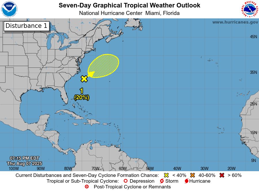
This first disturbance now only has a 20% chance of development into a tropical cyclone of some sort in the next 7 days, and only 10% chance of development in the next 48 hours. Long-term development of this system is unlikely at this point because by early next week, certain environmental conditions are not looking to good for tropical development. This disturbance is moving northeastward, which means it’s headed toward colder waters, which will helping inhibit further development. The disturbance is also moving toward an area of high wind shear, which will help to disrupt this storm’s organization and also keep it from developing. Over the weekend there could be some slight development, since an area of low pressure is forecasted to form where the disturbance is headed. Luckily, it’s looking like this disturbance won’t have any effects on land at this point.
Disturbance 2:
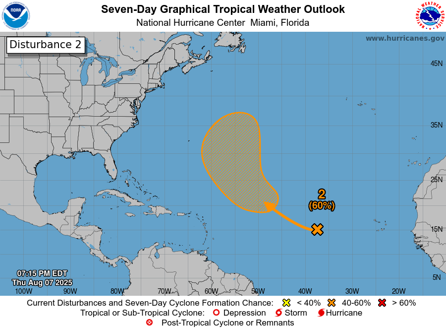
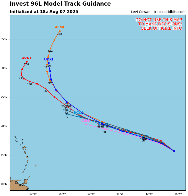
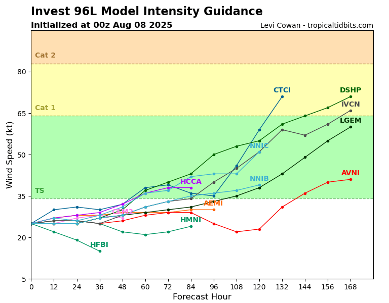
The second disturbance, also known as Invest 96L, currently has a 60% chance of development in the next 7 days, but only a 10% chance in the next 48 hours. It is also looking like it won’t have any effects on land, with the Bermuda High helping to steer it away from the Caribbean and the United States. As I mentioned in my tropical update on Wednesday, this disturbance was formed from a tropical wave coming off the coast of western Africa, and is still pretty disorganized. This situation is likely a slow development, and we will have to wait a few days for the previously mentioned environmental conditions to line up in a way to support this storm’s development, which we can see in the ensemble model intensity guidance here:
The National Hurricane Center (NHC) predicts that this disturbance could form into a tropical depression by next week.
Current Pacific Setup:
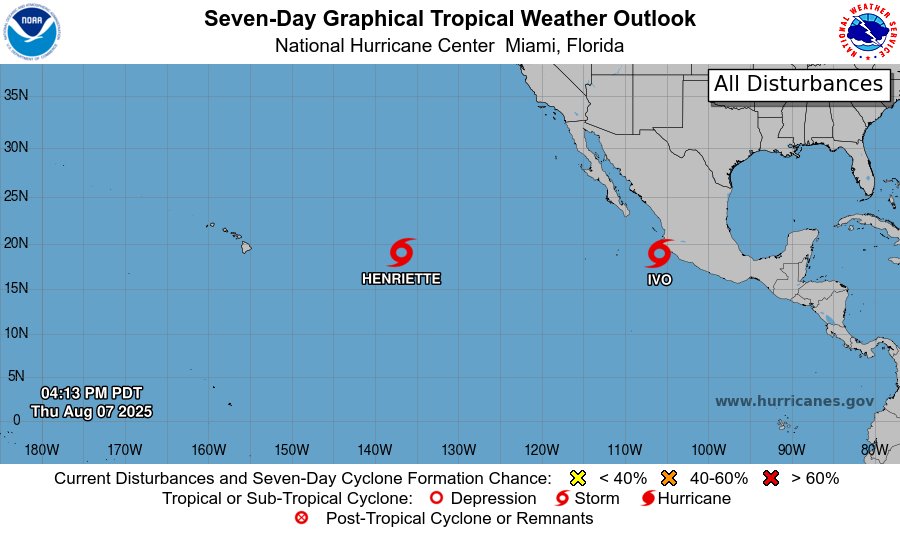
Here you can see the two tropical storms in the Pacific. As of right now, there are no other disturbances in the Pacific.
Tropical Storm Ivo
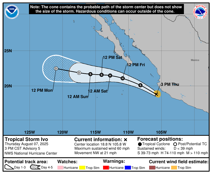
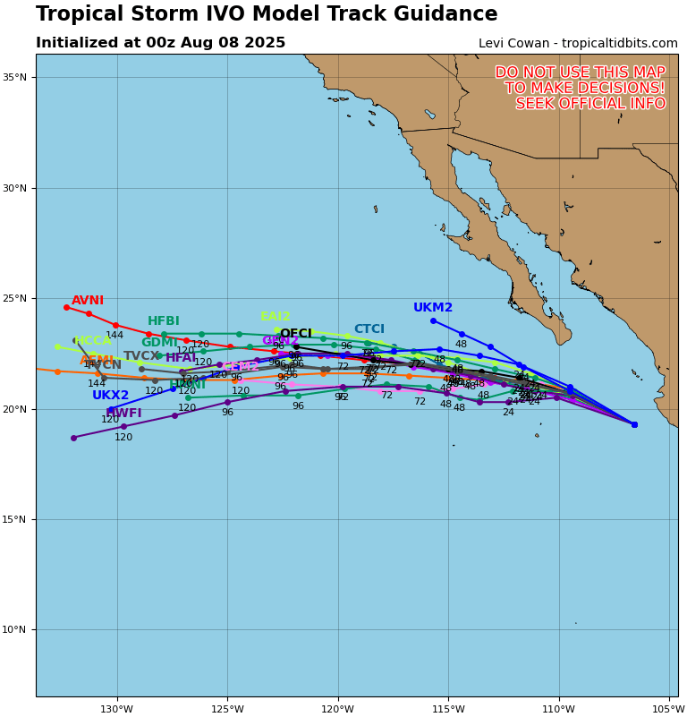
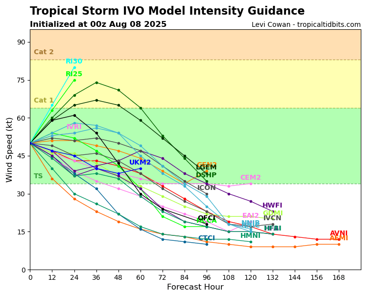
Tropical Storm Ivo is currently moving northwest at 21 mph, fortunately avoiding direct landfall on México. Because the storm is staying over the warm East Pacific waters in conductive conditions, further development is expected for Ivo and is also expected to reach hurricane status today. Although the tropical storm is not making direct landfall, Baja California and much of the southwestern coast of México may see some effects from Ivo, including high winds, heavy rainfall, and dangerous surf conditions.
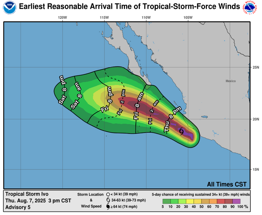
This morning, there is a low chance that the southern tip of Baja California will experience some tropical-storm-force winds. Winds are considered tropical-storm-force if they are at or above 39 mph, and in Ivo’s case these winds extend about 45 miles from its center.
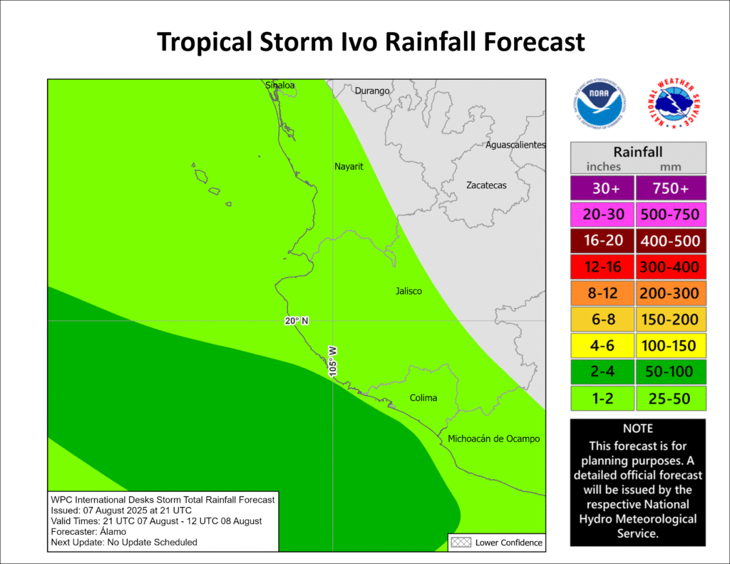
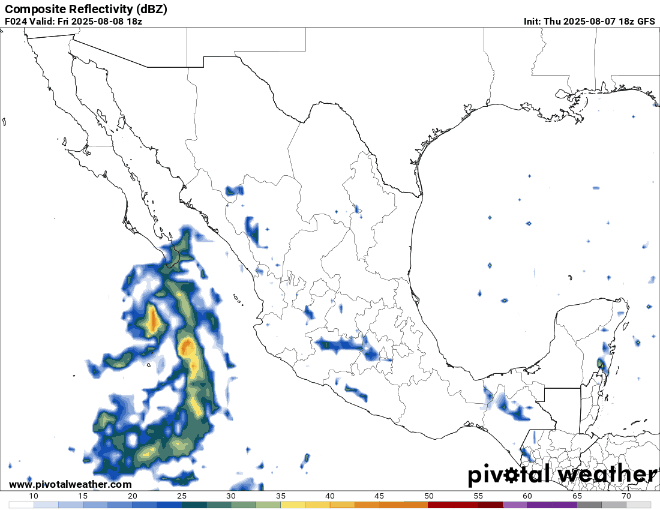
Much of the southwest coast will also experience rainfall from this storm, with states including Nayarit, Jalisco, and Sinaloa receiving 1-2 inches of rain, but could be heavier in some areas. Surf conditions will also be very rough for the next couple of days.
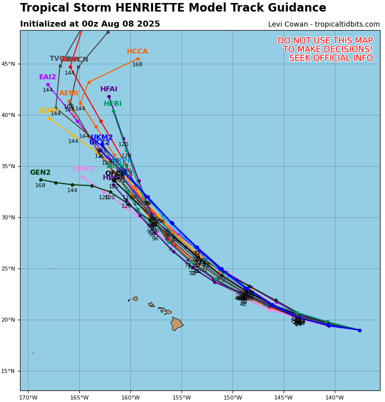
Tropical Storm Henriette
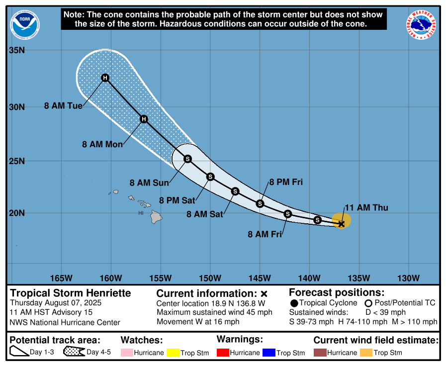
Tropical Storm Henriette is still going strong, and is even forecasted to strengthen into a hurricane by Monday morning. Henriette is currently moving over some tough conditions, including cold ocean waters and dry air, so if Henriette pushes through, which the NHC thinks it will, then in a couple of days it will find itself in some warmer and wetter conditions, so development into hurricane status would be likely
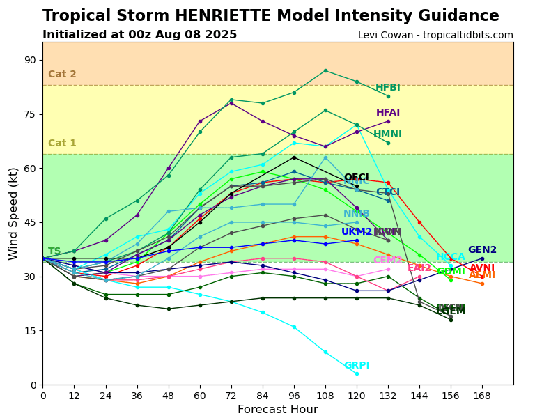
The model guidance shows Henriette staying stagnant for the next 48 hours, then intensifying for a few days. I would lean toward Henriette weakening a bit more intensely over the next 2 days since the conditions that it’s currently in simply cannot supporting tropical activity very well.
Anyway, we will continue to monitor these areas and keep you updated on all things tropical here at NickelBlock!


