A small, short-lived tropical disturbance will bring rain to the Gulf Coast throughout the day today, but future development of this system is no longer a possibility. The main concern for the foreseeable future is high heat indices, as temperatures will bounce around form the low to high 90s, in combination with high humidity.
Today’s Atmospheric Setup
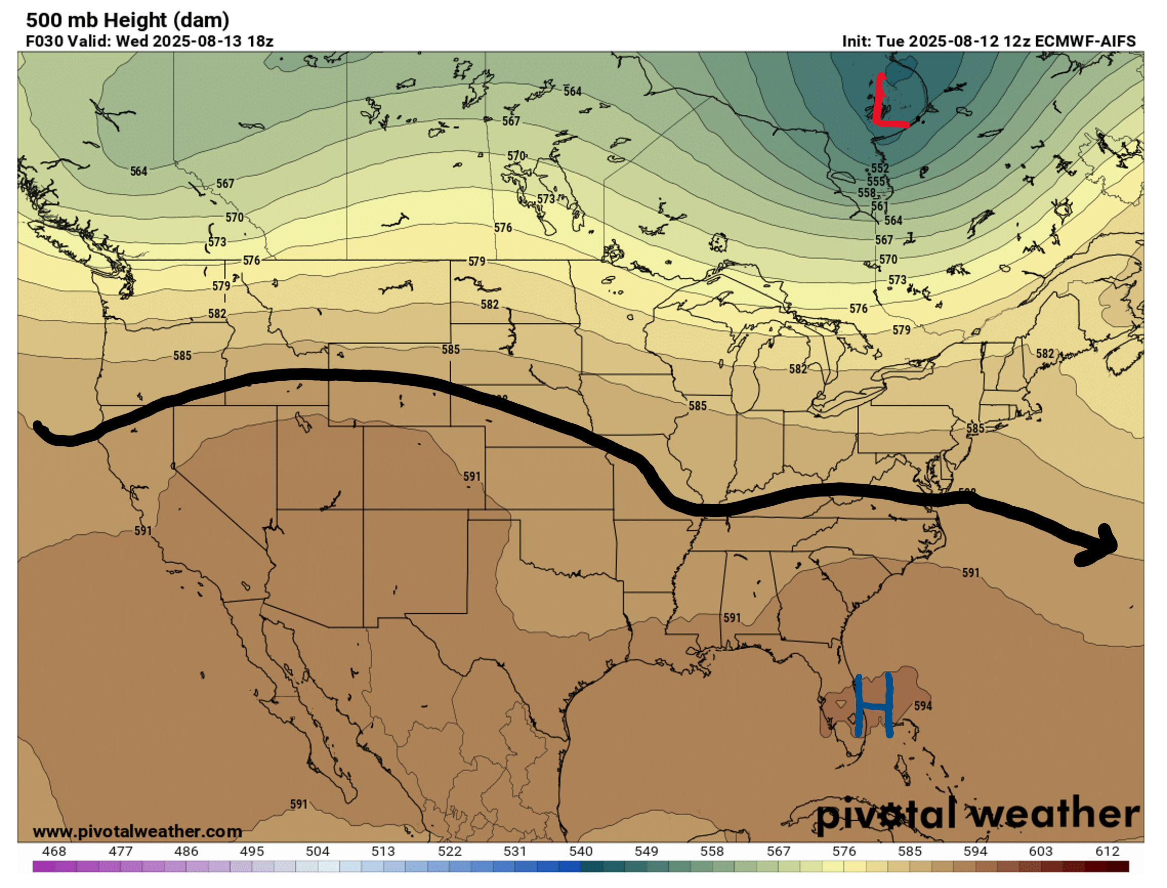
Looking at our 500 mb chart, there is some mild troughing to our left, helping to increase rain chances. This troughing pattern will continue until Thursday, and then on Friday some ridging will start to build in to our left and then move eastward.
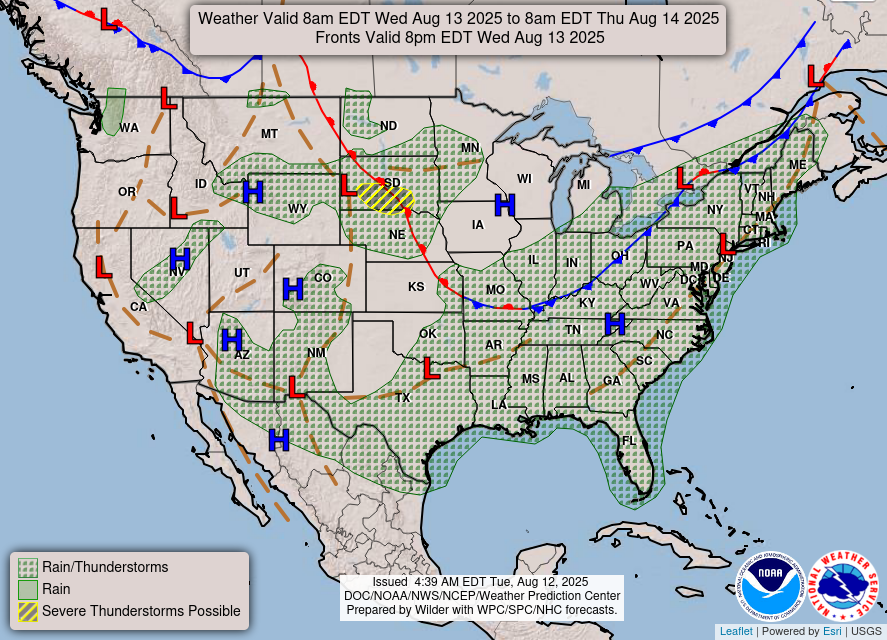
Now looking toward the surface, we can see that rain and thunderstorms are forecasted for us today. There is a small disturbance in the Gulf that will start to move over the coast and then dissipate, so all day rain on the Gulf Coat can be expected for today. Tomorrow there will be some surface-level troughing in our region, solidifying more rain chances for the rest of this week.

Today’s Weather
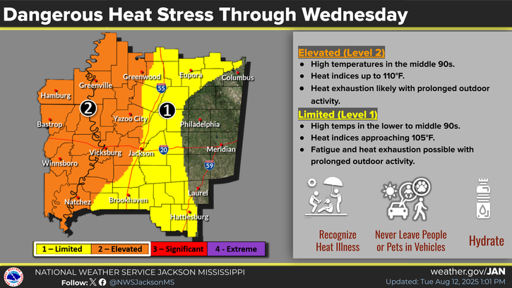
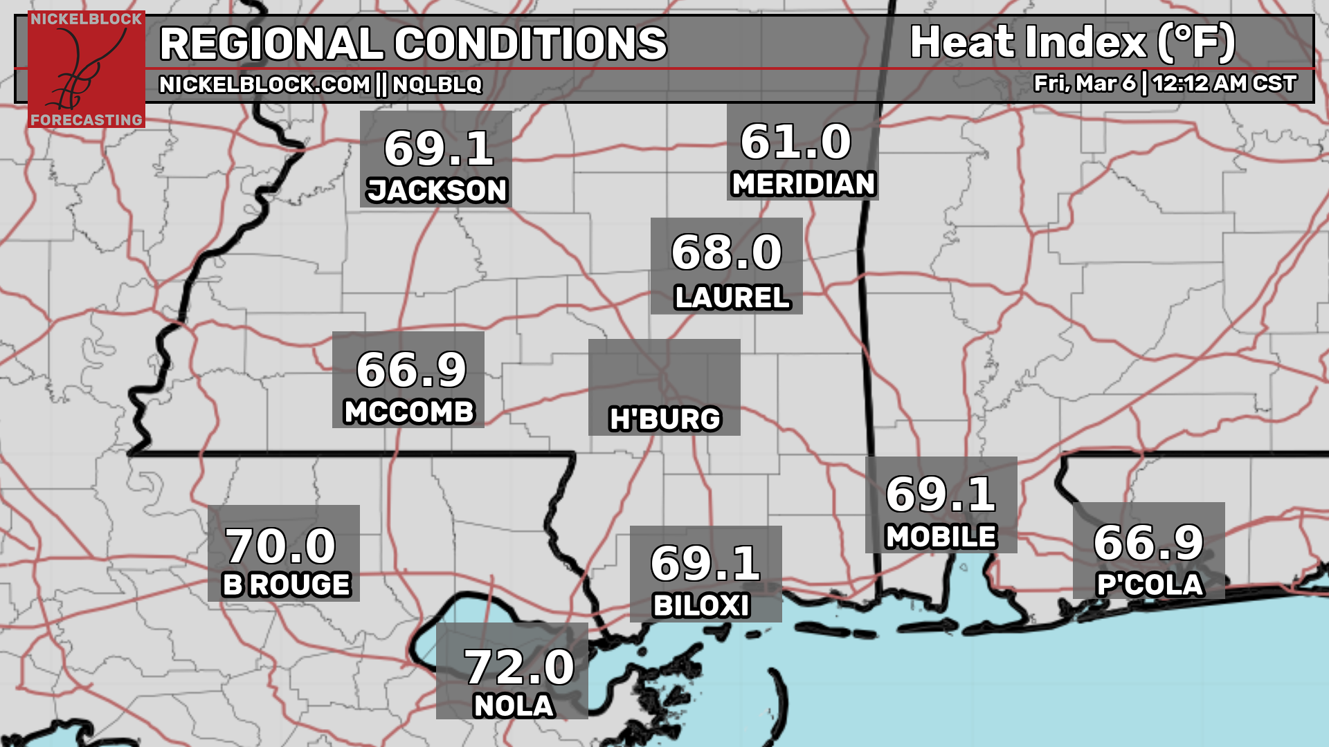
Today’s main concerns will be high heat throughout our region and some persistent showers along the Gulf Coast. Temperatures will reach to low to mid 90s today, and high humidity will make it feel much hotter than it actually is. There are no active heat warnings, but heat safety precautions should still be taken.
For current temperature and heat indices for your location:

If you are on the Gulf Coast, you can expect rain throughout the morning and afternoon, then subsiding by the evening, around 8 or 9pm. These persistent showers are due to a surface trough over the Gulf, but because this system will move over land today and dissipate, there is no need to worry about any tropical development. Further inland, the majority of showers will remain in the afternoon. Here’s the radar for today, as well as how much rain is expected to fall today:
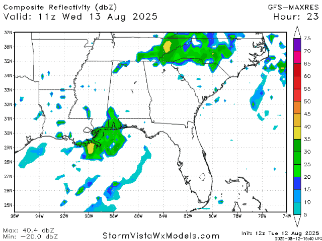
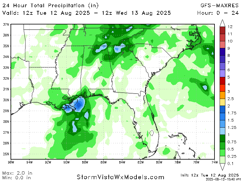
The majority of the Gulf Coast can expect to get about an inch of rain today with the exception of areas south of New Orleans receiving 2 inches maximum. Anywhere inland can expect less than an inch of rain, with some areas seeing no rain at all.
Weather for the Rest of the Week/Weekend

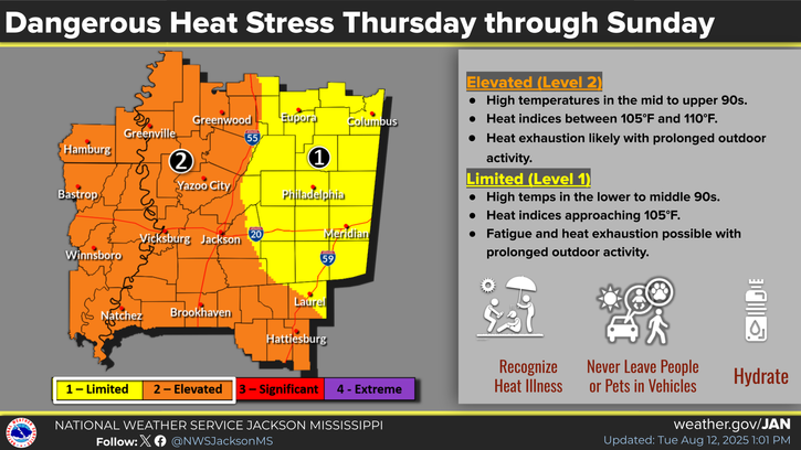
As for the rest of this week, heat will still be the main concern. There aren’t any kinds of heat warnings issued yet, but keep an eye on your local NWS Office because it is likely that they will put out heat advisories closer to the day(s) that they are in effect for.
Tomorrow and Friday is when the upper level weather pattern will begin to change, and chances for precipitation will sit from 50%-60% in any given location in our forecast area.
Looking Ahead to Next Week:

Going into next week, we can expect some lower rain and thunderstorm chances for our area. This is due to a ridging pattern that will start to build in over the weekend, and hang around for practically the entire week. Because of this incoming ridging, temperatures will continue to sit around the mid 90s as well.
Regional Day-to-Day Forecast;
Today: Chance of showers and thunderstorms throughout the day, especially along the Gulf Coast. High temperatures in the low 90s with heat indices 105+ degrees. Chance of precipitation 80%.
Tonight: Chance of showers and thunderstorms early in the evening, then mostly clear. Lows in the mid 70s. Chance of precipitation 30%.
Thursday: Mostly sunny during the day with a chance of showers and thunderstorms in the afternoon. Highs in the low 90s during the day, and lows in the mid 70s at night. Chance of precipitation 60%.
Friday: Mostly sunny during the day with a chance of showers and thunderstorms in the afternoon. Highs in the mid 90s during the day, and lows in the mid 70s at night. Chance of precipitation 50%.
Saturday: Mostly sunny during the day with a chance of showers and thunderstorms in the afternoon. Highs in the high 90s during the day, and lows in the mid 70s at night. Chance of precipitation 40%.
Sunday: Mostly sunny during the day with a chance of showers and thunderstorms in the afternoon. Highs in the mid 90s during the day, and lows in the mid 70s at night. Chance of precipitation 40%.
Monday: Mostly sunny during the day with a chance of showers and thunderstorms in the afternoon. Highs in the mid 90s during the day, and lows in the mid 70s at night. Chance of precipitation 30%.
Tuesday: Mostly sunny during the day with a slight chance of showers and thunderstorms in the afternoon. Highs in the mid 90s during the day, and lows in the mid 70s at night. Chance of precipitation 20%.
Wednesday: Mostly sunny during the day with a slight chance of showers and thunderstorms in the afternoon. Highs in the mid 90s during the day, and lows in the mid 70s at night. Chance of precipitation 20%.


