Today is going to be a hot one, and unfortunately the heat won’t be letting up for a few days due to upper-level weather patterns. This pattern does mean that rain chances during these days will be lower, though. So, let’s get into the details:
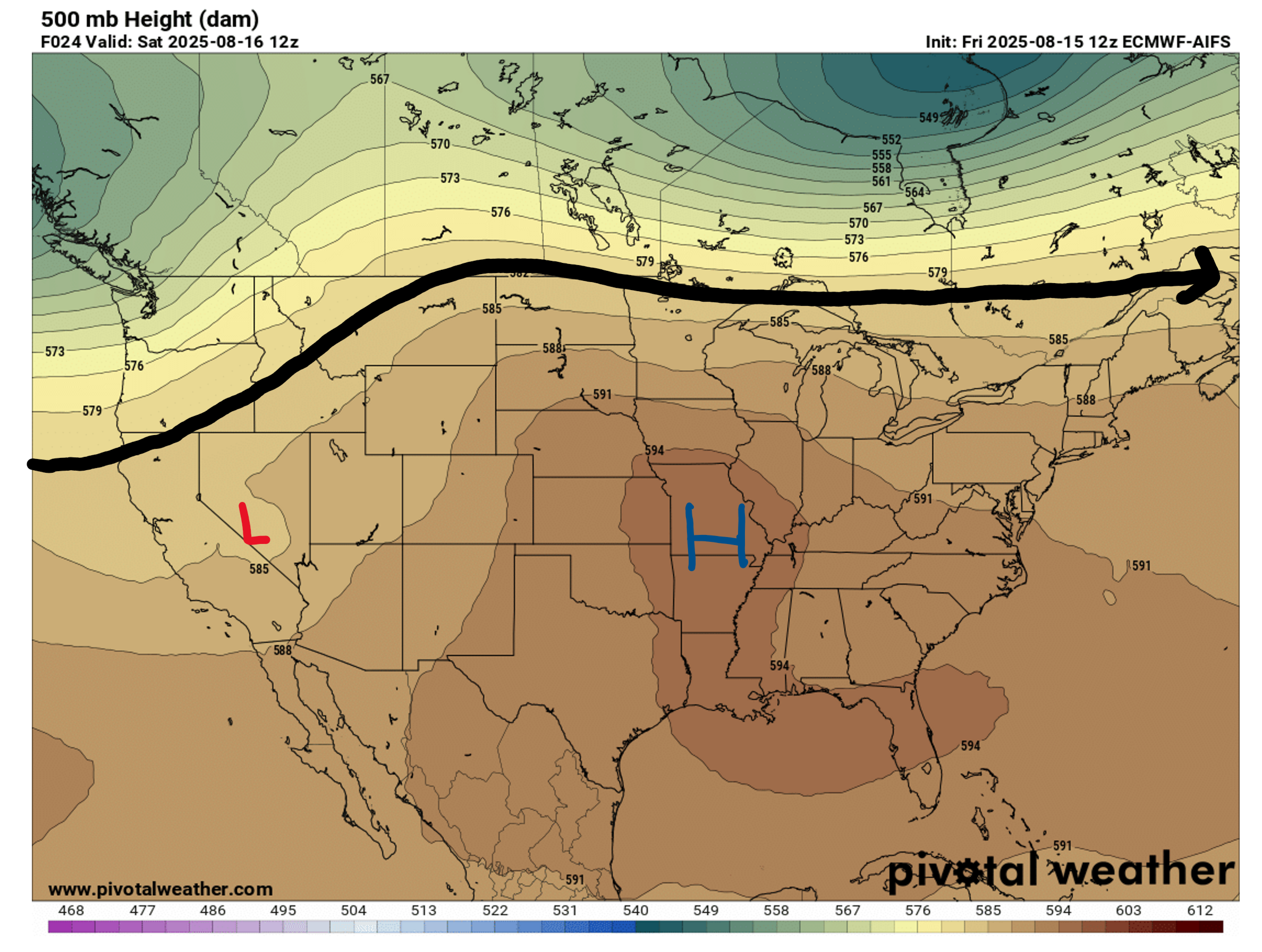
Up in the 500 mb level, our area is under a ridge of high pressure, indicating some nicer, but hotter, weather for today. This ridging pattern will persist until mid-week next week, which means that the hot weather will likely stay put until then. Then, some troughing will start to form above us, increasing rain chances and helping to cut some of the heat.
Now moving down to the surface, we still have some regular afternoon shower and thunderstorms forecasted, but a nearby surface high pressure may help keep a lot of these storms at bay.

This Weekend’s Weather:

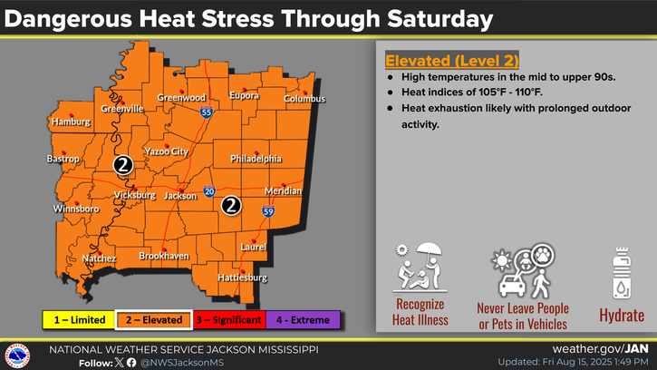
Today there is a heat advisory in effect for our region, including practically all of Mississippi and eastern Louisiana. Temperatures will reach the mid to high 90s today with heat indices breaking 110 degrees in some areas. Actual temperatures will most likely reach even higher tomorrow, so I would not be surprised if another heat advisory is issued for Sunday. So if you plan on taking advantage of the sunny weather this weekend, make sure you are taking those extra steps of staying hydrated, taking breaks in the shade or air conditioning, etc. to stay safe in the heat.
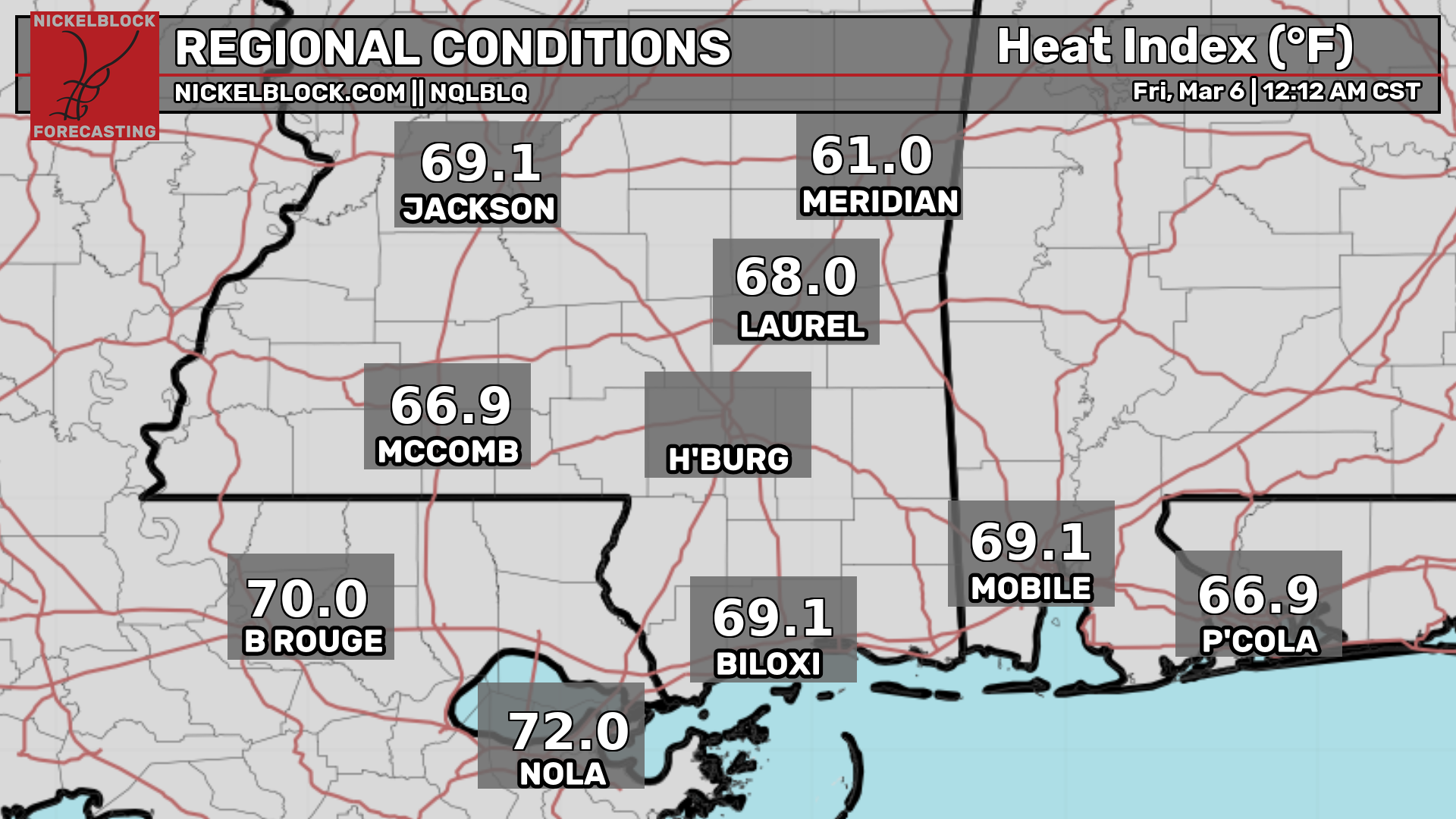
For the current temperature and heat index for your specific location, check out the graphics below:

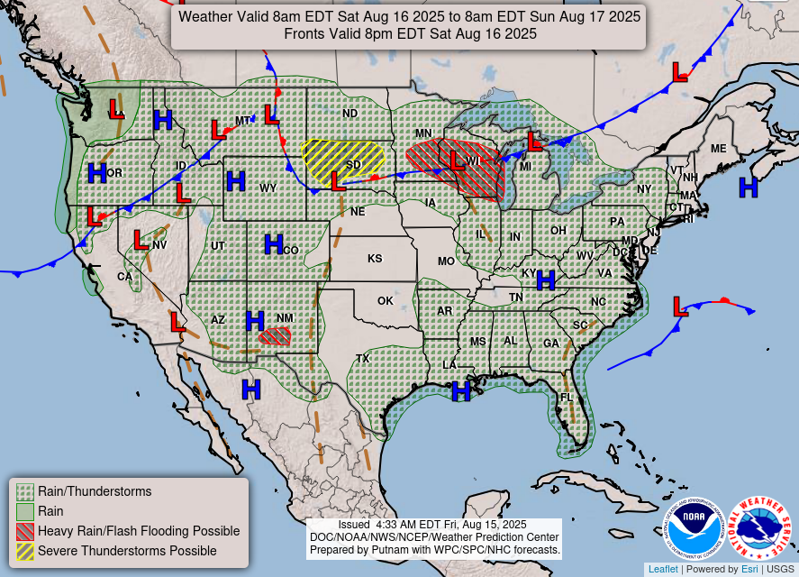
As for precipitation, rain chances will be minimal, with about a 20%-30% chance of rain and thunderstorms anywhere in our forecast region this weekend. Today, the rain will start up around 3pm then dissipate by 9 or 10pm. Tomorrow the storms will start around 4pm, then die down about the same time as tonight.
Weather for Next Week and Beyond

Unfortunately, the high heat will stick around until around Wednesday next week. Temperatures will be stuck around the mid-to-high 90 degree mark, so more heat advisories are probably in store.
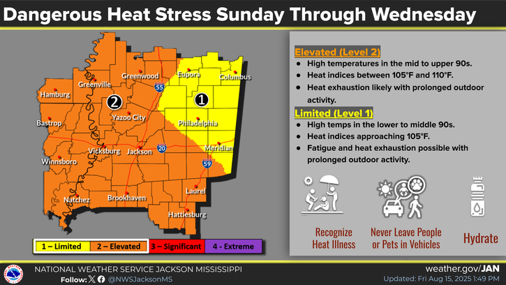
As I mentioned before, by around Thursday, the overall weather pattern will change, and some troughing should allow for some relief to the heat, but also higher rain and storm chances.
As a last note, this is my final local forecast here at NickelBlock, and I have really enjoyed interning here this summer and forecasting for this area. I really appreciate everyone who has taken the time to read any of my forecasts, and I hope you found them helpful! Also, if you have been concerned about Hurricane Erin, check out my latest tropical update!
Regional Day-to-Day Forecast:
Today: Mostly sunny during the day with a slight chance of showers and thunderstorms in the afternoon. Highs in the mid 90s with heat indices 110+ degrees. Chance of precipitation 20%.
Tonight: Slight chance of showers and thunderstorms early in the evening, then mostly clear. Lows in the mid 70s. Chance of precipitation 20%.
Sunday: Mostly sunny during the day with a slight chance of showers and thunderstorms in the afternoon and evening. Highs in the high 90s with heat indices 105+ degrees during the day with lows in the mid 70s at night. Chance of precipitation 30%.
Monday: Mostly sunny during the day with a slight chance of showers and thunderstorms in the afternoon and evening. Highs in the high 90s during the day with lows in the mid 70s at night. Chance of precipitation 30%.
Tuesday: Mostly sunny during the day with a slight chance of showers and thunderstorms in the afternoon and evening. Highs in the high 90s during the day with lows in the mid 70s at night. Chance of precipitation 20%.
Wednesday: Mostly sunny during the day with a slight chance of showers and thunderstorms in the afternoon and evening. Highs in the high 90s during the day with lows in the mid 70s at night. Chance of precipitation 30%.
Thursday: Mostly sunny during the day with a chance of showers and thunderstorms in the afternoon and evening. Highs in the mid 90s during the day with lows in the mid 70s at night. Chance of precipitation 40%.
Friday: Mostly sunny during the day with a chance of showers and thunderstorms in the afternoon and evening. Highs in the low 90s during the day with lows in the mid 70s at night. Chance of precipitation 50%.
Saturday: Mostly sunny during the day with a chance of showers and thunderstorms in the afternoon and evening. Highs in the low 90s during the day with lows in the mid 70s at night. Chance of precipitation 50%.


