Hello everyone, and thanks for checking out my final tropical update here at NickelBlock! Erin is now considered a Category 1 hurricane as of yesterday, and is forecasted to strengthen. As far as land impacts, it may effect some of the Caribbean islands, but so far is looking to turn away from the East Coast. One other disturbance in the Atlantic has popped up, but its chances for development look slim. The Pacific is quiet for now as well, with no active disturbances or tropical systems. So, lets take a closer look at what’s going on in the tropics:
The Current Atlantic Setup
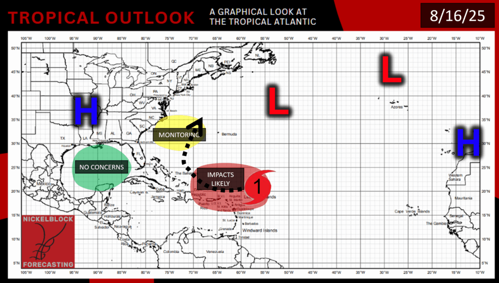
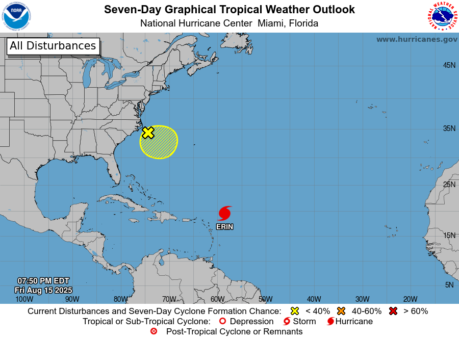
In the Atlantic we have of course Hurricane Erin and now another disturbance off of the coast of North Carolina. Fortunately, this disturbance should not be a huge concern. It is currently moving very slowly toward the southeast as a messy system of showers and thunderstorms that is associated with a broad low pressure area. It only has a 10% chance of development in the next week, as environmental conditions won’t look too good for tropical development in that area, with dry air and high wind shear rolling in by Monday. With current conditions, the disturbance could develop a little bit over the weekend, but by early next week, I think that this area will be off of the National Hurricane Center’s radar.
Hurricane Erin Update:
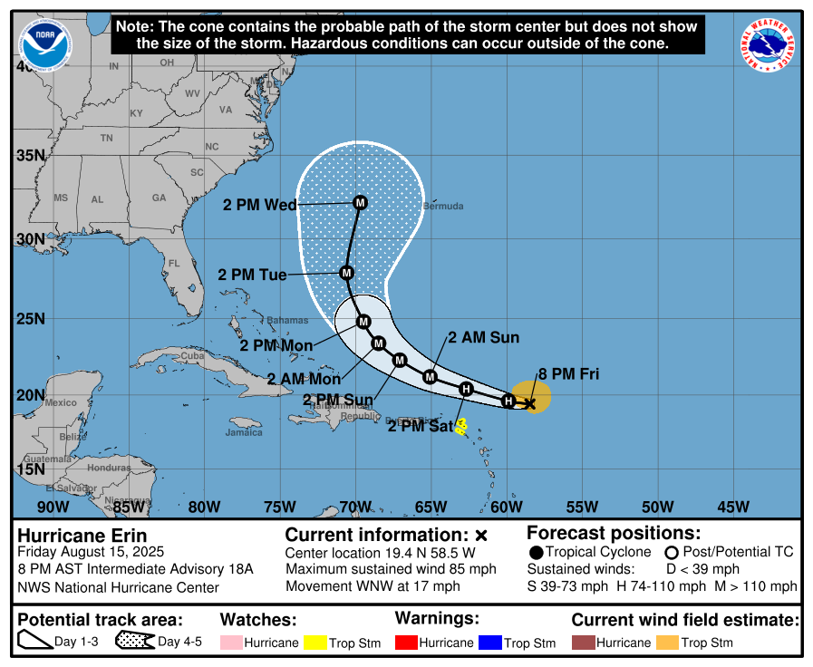
Hurricane Erin is still a category 1 storm, with maximum sustained winds at 85 mph, and is moving west-northwestward at 17 mph. Erin is forecasted to become a major hurricane (category 3 or above) overnight tonight/Sunday morning. A more northern turn is expected from Erin by next week, which means that it should miss making direct landfall anywhere in the Caribbean/US East Coast. The models are generally in agreeance with this northern movement:
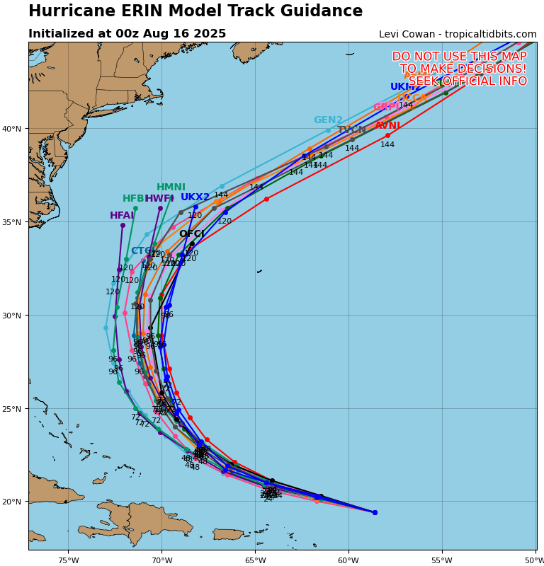
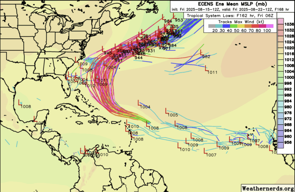
Comparing a whole set of different models versus picking out just one model with its ensembles (the Euro on the right) it is looking like landfall can be ruled out for now, with the Euro tracking a bit more to the west than most of the other models.
Here we can see that although Erin is so far not forecasted to make landfall, it is definitely not done intensifying:
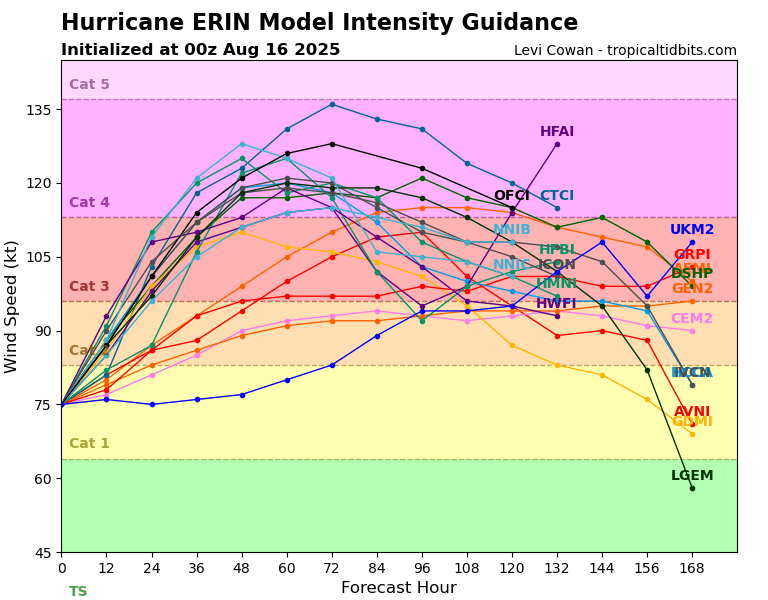
It’s pretty safe to say that Erin will strengthen into at least a major hurricane, but anything above a category 4 is highly unlikely.
Hurricane Erin’s Possible Impacts
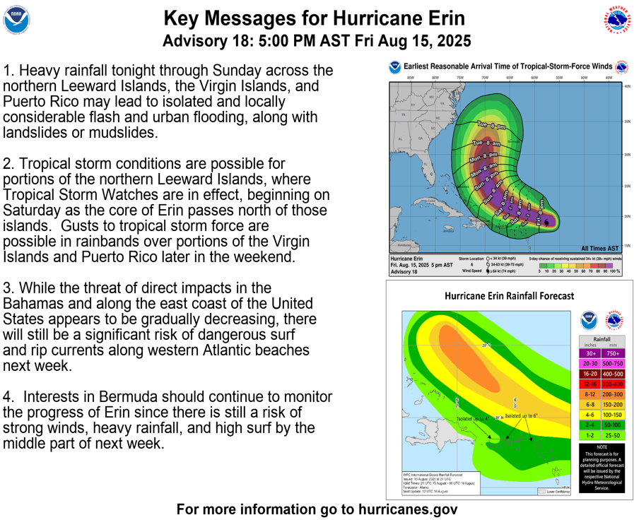
Although Erin probably won’t be making direct landfall anywhere so far, its the outer bands of the storm affecting the Leeward and Virgin Islands, Puerto Rico, and the Dominican Republic over the weekend that are causing concern.
There is a slight chance for tropical-storm-force winds over the weekend in these areas, as well as a decent amount of rainfall. In steeper terrain, these conditions could cause mudslide activity. The NHC forecasts 2-4 inches for Puerto Rico and the northern Leeward Islands, with up to 6 inches in localized areas through Tuesday. For the Dominican Republic and the rest of the affected Caribbean islands, they can expect 1-2 inches with 4 inches possible in localized areas through Tuesday.
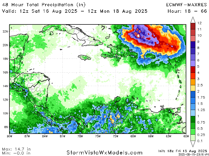
Over the weekend, the Euro ensemble system shows generally less than 2 inches of rain across the board for the previously mentioned areas, so hopefully impacts on communities in these areas will be minimal.
As Erin moves north over the next week, it is looking like the main concern will be Erin chopping up the water and causing some rough surf for the East Coast, causing dangerous conditions on the beaches.


