We are right on time with our line of storms. As noted earlier this morning, they would be crossing the Louisiana / Mississippi border between 10p and 11p…. and here we are at 11p and they are now into SW Mississippi and draped down into parts of southeastern Louisiana.
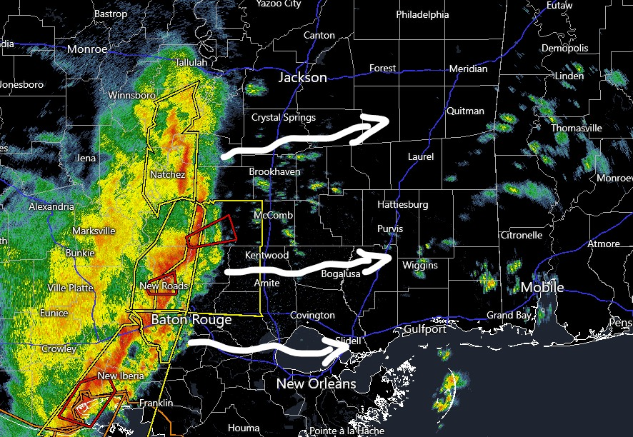
These storms will continue to plow eastward through the night. Expect these to make it to the I-59 corridor around 3a. And into Alabama around 6a.
Notice there are a few Severe Thunderstorm Warnings associated with this line as well as a few Tornado warnings (as of the time of this posting). The threat for severe weather will continue through our area.
I expect to see a Tornado Watch issued shortly. The Storm Prediction Center has highlighted parts of the area for the likelihood of a Tornado Watch by midnight.
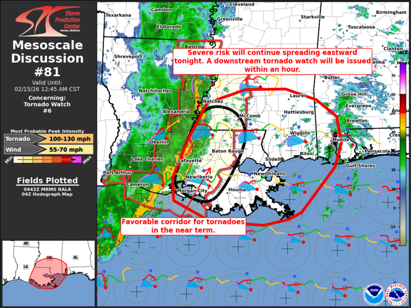
One note is that the SPC is watching parts of the area with the risk for tornadoes with wind speeds up to 130mph — that is up to an EF-2 tornado. Same as I was showing earlier tonight.
The difference tonight is that the potential top speed for a straight-line wind gust is up to 70mph — a full 10mph higher than anticipated earlier today.


