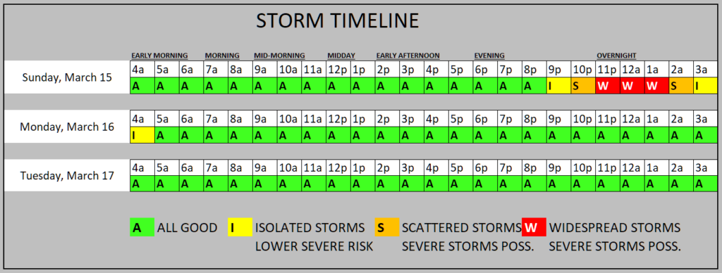
Model guidance has slowed things down (barely) now showing the line to run about an hour slower than we were thinking earlier today. No major changes to things, but we do have some added clarity with the evening / overnight 00z models starting to render.
The latest HRRR model is showing a few storms firing ahead of the line.
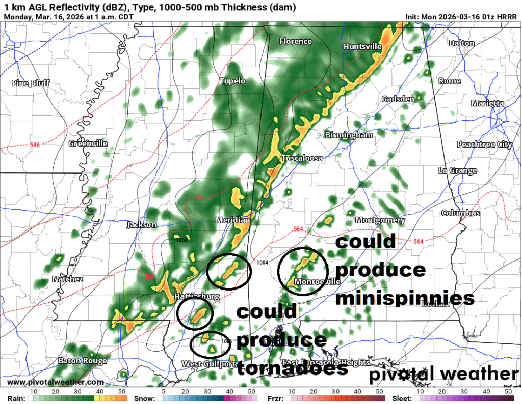
This means the risk for low-topped supercells way ahead of the line with a chance for some “minispinnies” to develop. Minispinnies are my completely made-up term for extremely weak and brief tornadoes. These are often EF-0s and develop and dissipate before the NWS can even issue a warning.
It also means the risk for some bonadfide (albeit not terribly well organized) supercells just ahead of the line with the risk for producing tornadoes. These could be up to EF-2 in strength.
When looking at the map above, try not to focus on the exact spots I’ve circled. The locations are irrelevant. Instead, notice the density. Just one or two storms well ahead of the line and two or three directly in front of the line.
This means, we don’t anticipate there to be a deluge of massive tornadoes. Or even a blitzkrieg of smaller tornadoes.
Model guidance shows just a handful of storms that may have the potential to produce a tornado. Not a guarantee. A potential.
And again, focusing on density – not location – we can look at the Updraft Helicity Streaks to see where the computer shows the density of strongest storms. On the map below, we normally look to see where the blues and yellows show up. In this case we have a bunch of grays. So we really need to lean into the density.
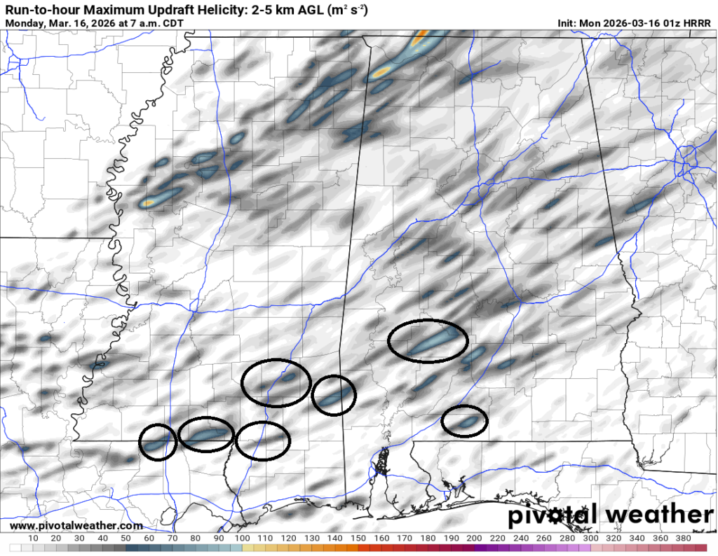
For our area, most of the clustering is across parts of southern Mississippi. But again, not a ton of “strong” streaks, so even the risk shown here from the guidance about how strong the storms will be is lower.
I really want to stress here: e are talking about potential, not a guarantee.
Looking at our area specifically…. If we were to line up all of the model guidance (not just the few maps I’ve shown here) we would see a composite of data suggesting the risk for any tornadoes and some of the strongest storms to be inside the orange with an even higher bump in likelihood of the strongest storms inside the red.
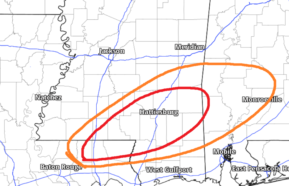
But, as you read this, please keep in mind the “strongest storms” doesn’t mean “definitely a tornado” or “certainly an EF-2 tornado in your neighborhood” of even “I’m not circled, so I don’t need to worry” but rather “the potential is highest in these places for something to happen”
The timeline, as mentioned, hasn’t changed really changed aside from being about an hour later. But even this (from earlier) still looks reasonably good for a timeline.
Hang in there, friends. And make sure you have a way to get alerts from the NWS! And download our app!
Follow those links to download the app from your app store. Remember! The only place to find our app is IN your app store. No download links. No third-party websites.
If you didn’t get it from your app store… you don’t have the REAL NickelBlock Forecasting app!


So happy you still look out for us here in mississippi. We sure miss you but thankful you still look out for us. Thank you!!!