Greeting from Starkville, Mississippi! I’m at the Mississippi State Southeast Severe Storms Symposium.

I had a chance to listen to a few great presentations today from some NWS meteorologists, a few researchers, and even James Spann!
But that isn’t why I’m here. Sadly.
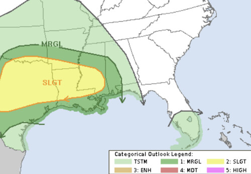
The Storm Prediction Center has highlighted parts of the area with the potential for severe weather as we head through next week. There may be multiple rounds possible, too. I know, this isn’t what anyone wants to hear at this point.


So far the area is winning the Tornado Warning Olympics. And I’m certain that it is a competition none of us want to be winning. The map below is a running tally of how many tornado warnings have been issued by each NWS office. The NWS Mobile, AL office is winning with 56 warnings and the Jackson NWS office is at 53.

And now there is a chance for more storms during the next seven days
While there are three separate maps above, the SPC is showing a chance for severe weather late Monday and into Tuesday morning and again on Wednesday afternoon across sections of the area.
So far, even with the SPC Risk at “Slight” at this point, I’m not overly concerned about the threat for widespread severe weather. This has the look of more of a wind and hail event than it does of a tornado event. And the cluster of storms on Tuesday morning would likely be along the warm front which may help to limit the tornado threat and the storms on Wednesday along the cold front may lack forcing which would limit the overall coverage of storms.
So this is far from a slam dunk.
Looking at the ECMWF computer weather model shows a big cluster of disorganized storms on Tuesday and a cold front, behind a dryline with reduced low-level moisture, on Wednesday.


Neither of the above maps, to me, look terribly threatening from a widespread severe weather potential. Pockets of severe weather? Sure. A handful of storms that pose a potential to produce brief tornadoes, Sure.
While nothing, at this point, that screams any kind of severe weather outbreak. There are definitely some whispers about the potential for some severe storms in the mix.
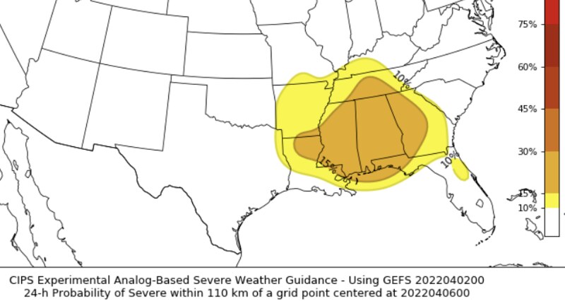
One of the pieces of evidence suggesting – at least a few – severe storms is the CIPS Analogs.

I will say, though, there is still a bit of computer model discrepancy. While the Euro (above) shows a cluster on Tuesday, the GFS shows a more solidified line of storms. And then on Wednesday where the Euro shows a few storms along a cold front, the GFS shows almost nothing.
Starting on Tuesday morning, here is a look at the GFS Skew-T data.
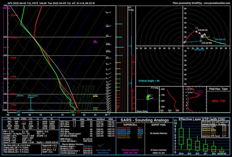
This looks a bit more conducive for tornado development than the European data, but it also doesn’t ‘scream’ tornadoes. This type of sounding would be more likely to produce EF-0 or EF-1 tornadoes, not EF-3, EF-4, no EF-5 tornadoes.
Then on Wednesday afternoon? The Skew-T data shows wind and hail as the main threat with a very low chance for tornadoes.

So, as you can tell, there is still a bit to figure out. Unlike this last event when we knew a few days out mostly how things were going to shake out it was just a matter of timeline and potency, this time it is a bit more up in the air.
So hang in there and please check back for updates. I’ll try to get another post on the blog tomorrow!


