Hey everyone! Our current situation in the tropics is the fallout of Alvin, which has been downgraded to Post-Tropical Storm Alvin. There is an area to watch just behind Alvin, and the Atlantic might be brewing something.
Post-Tropical Storm Alvin
Tropical Storm Alvin has decreased in strength and organization rapidly the past few days. Alvin is now Post-Tropical, meaning it no longer possesses tropical storm characteristics. There are a few reasons why Alvin fell apart so quickly. Here’s why:
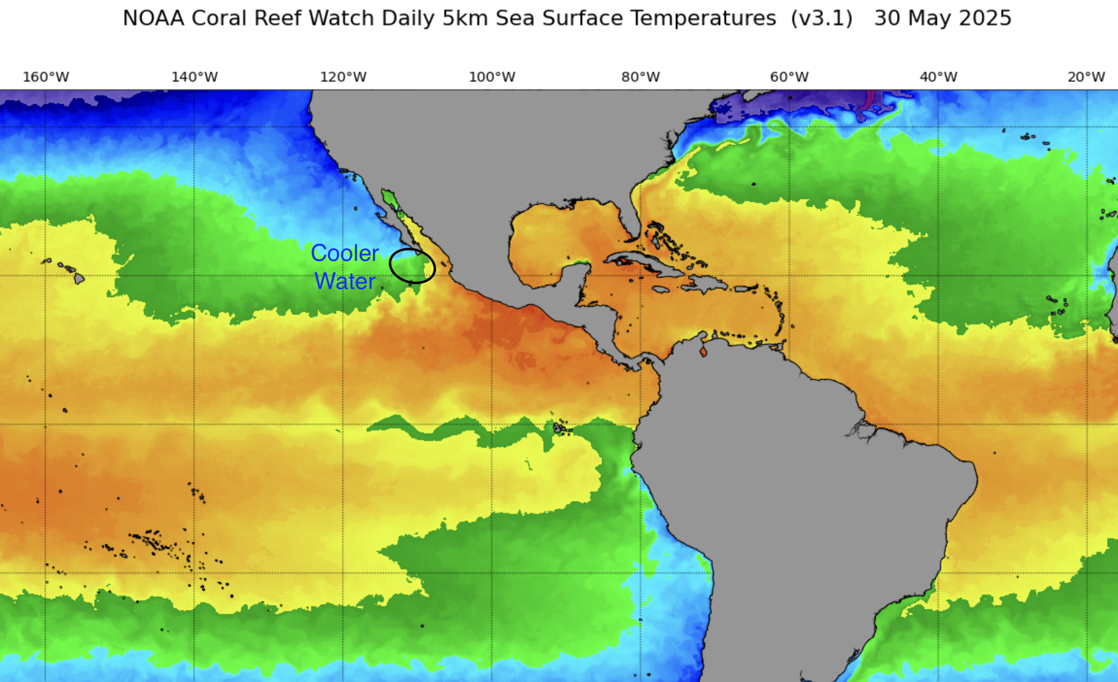
Alvin moved into much colder ocean temperatures in the last few days. This is like driving a car and running low on gas – if you don’t fill it back up with fuel, the car won’t run. This is like tropical systems – if you take away the warm ocean temperatures and move it to a cooler area of the ocean, you are taking away the fuel for it to keep its energy. These tropical systems are essentially heat engines!
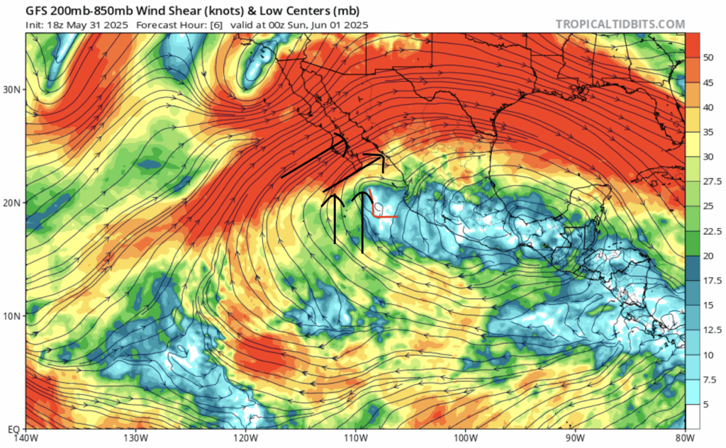
While Alvin was weakened by the cooler ocean temperatures, it was also torn apart by violent wind shear. The change in direction and speed with height of the winds, or shear, was so intense that it pulled Alvin apart. It was not able to regain it’s strength due to both of these limiting factors.
Remnants of Alvin
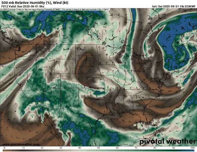
The moisture remnants from once Alvin will move into the southwest US on Monday, and move into the plains by Tuesday and Wednesday – bringing a severe weather and flood threat as an area of low pressure forms in the plains at the same time as the moisture arrives.
Area to Watch Behind Alvin
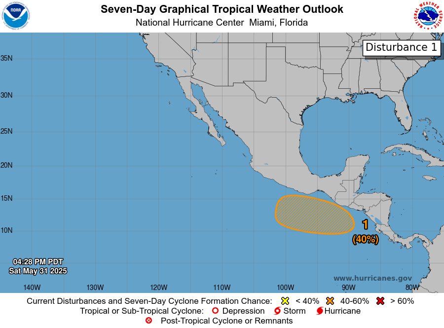
Just behind Alvin is an area to watch from the National Hurricane Center (NHC). While no tropical development in expected in the next 48 hours, there is a 40 percent chance of development in the next 7 days. Just like Alvin was in the beginning stages, the area to watch is comprised of a cluster of showers and thunderstorms that is expected to form into an area of low pressure. The sea surface temperatures in the region it is meandering in is very warm, unlike where Alvin is now. Shear is moderate, so it doesn’t have that in it’s favor. We will be keeping a close eye on this to see if we see it develop into a tropical storm by mid-week.
Watching the Gulf
According to recent model guidance, there is some chance of something forming in the Gulf by next week, at the beginning of the second week of June. Not all models agree, so please take this with a grain of salt.

Above is a look at the ECMWF (European model) Ensembles map, showing the different ensemble members placement of low pressure systems for the second week of June. As you can see, there are some members bringing in a strong low pressure system to the Gulf Coast. The “strong” low pressure in this map is defined as having a maximum low pressure of 990mb, meaning systems with pressure lower than 990mb. The lower the pressure, the stronger the system typically is. Whether this turns into a tropical system, or not, is still uncertain, but it’s important to note that there is a potential, at least according to these ensemble members, that something could form in the second week of June.
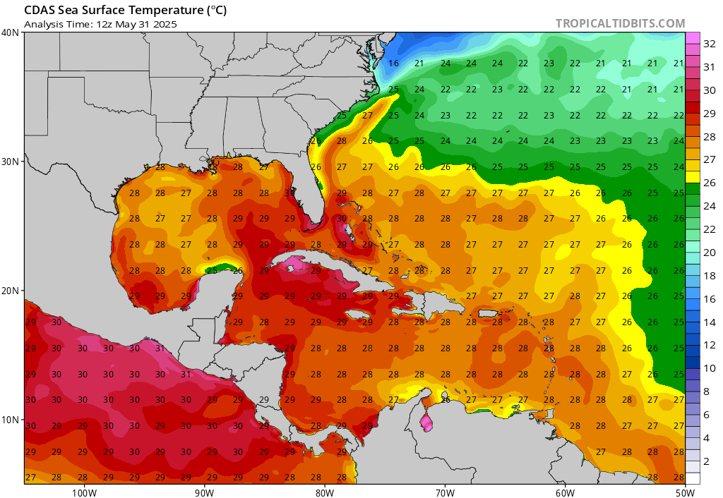
There is plenty of warm water in the Gulf, so there’s lot’s of fuel for a potential system to feed on.
Continue to check back for the latest updates!


