Our current setup in the tropics is a clear Atlantic Basin, Potential Tropical Cyclone FOUR-E and an area to watch in the Eastern Pacific, and a clear central Pacific. Let’s dive into the details:
Atlantic Basin Setup

Things are looking quiet in the Atlantic Basin. There are showers and thunderstorms over Central America, but they do not pose a tropical cyclone threat at the moment. Large scale high pressure from the “Bermuda High” is allowing for large scale sinking air, and also dry air, suppressing any development. There is a low pressure off the coast of Africa currently, but will move to the east, and eventually the northeast. This will not be tropical in nature and will not cause any threats.

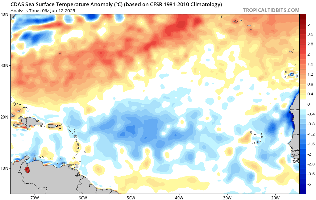
Ocean temperatures are warmer than average in the western Atlantic, especially here in the Gulf. The opposite could be said for the eastern Atlantic, with much cooler than average ocean temperatures. This early in the Hurricane Season it is normal for the main development region to be closer to home, so we are keeping a close eye on any convection in the Gulf. We will be watching any tropical waves from Africa a little later on in the season.
Eastern Pacific Setup
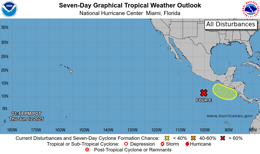
The Pacific Hurricane Season is in full swing! Post-Tropical Cyclone Cosme has officially diminished and is off of our radar. We are tracking two areas to watch – in the same development region as our past two named storms. The first is newly named Potential Tropical Cyclone FOUR-E (in red). The second is an area to watch, just behind 93E (in yellow).
Eastern Pacific: Potential Tropical Cyclone Four-E
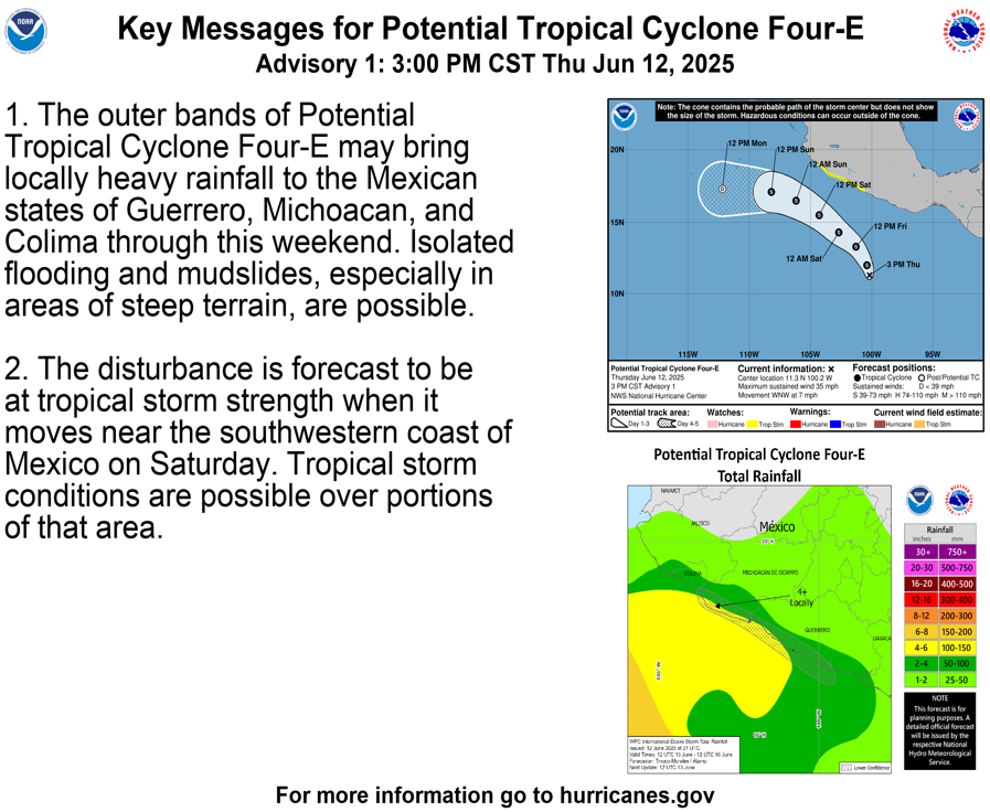
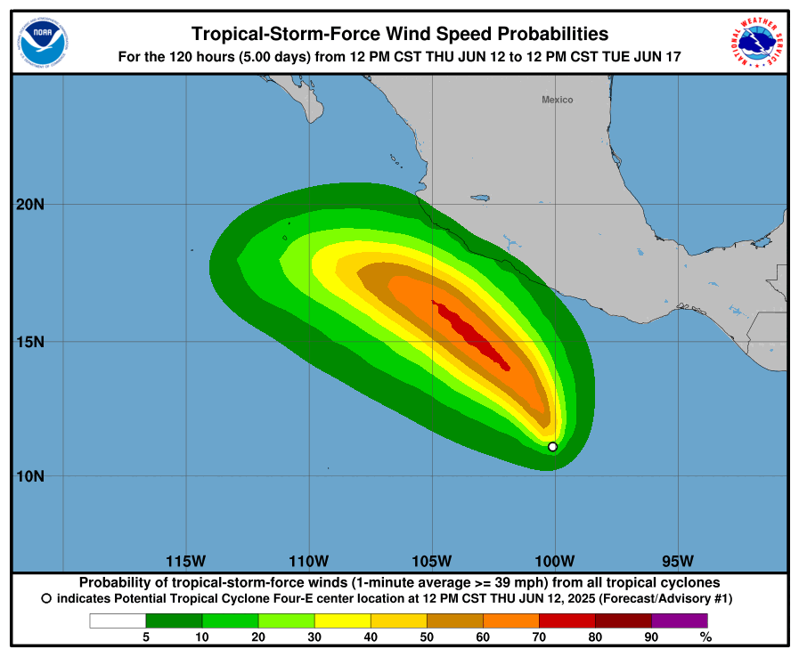
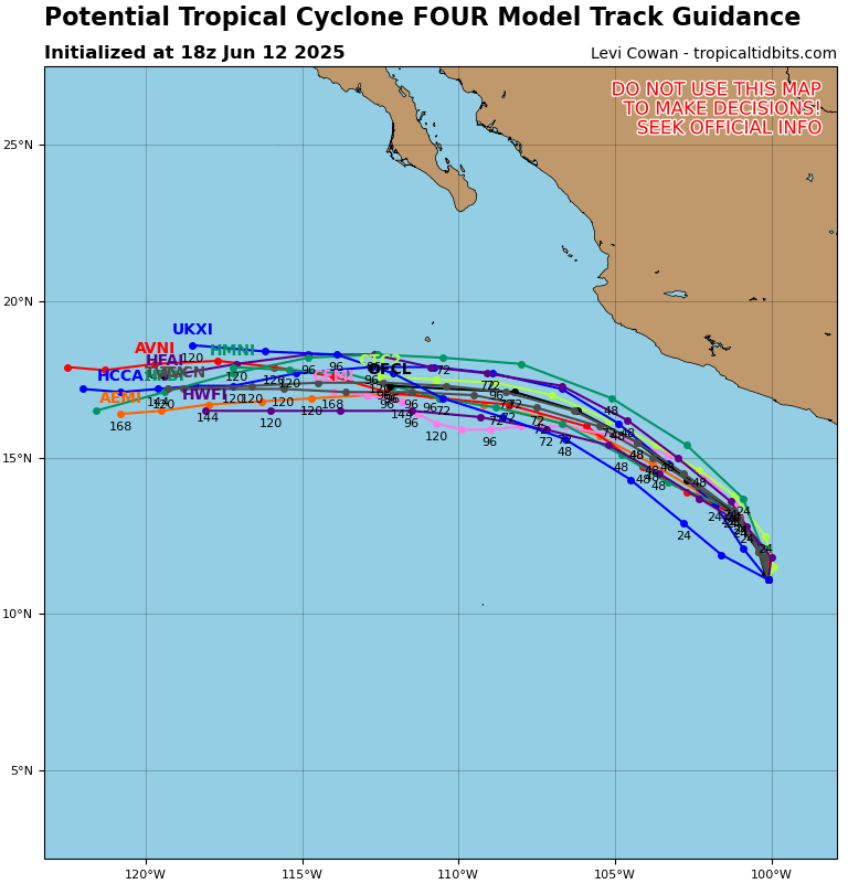
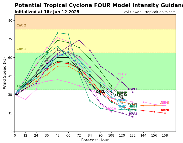
Invest 93E has been upgraded to Potential Tropical Cyclone Four-E. Current conditions are maximum sustained winds of 35 mph, which is 4 mph away from Tropical Storm status. Models are in agreement that it will continue to move to the northwest and not pose any landfalling threat to Mexico. Rough surf, rip currents, and rain will be the main threat. Tropical storm wind threat is low for the west Mexican coast, with only a 5-10 percent chance of tropical storm sustained winds when the system moves close to the coast. Most models have this storm developing into a tropical storm by today or tomorrow, with a few going for a category 1 hurricane. Waters are very warm in this region, so it’s not completely out of the question for this to rapidly intensify even more. It is expected to quickly weaken though after about 3-5 days.
Eastern Pacific: Another Area to Watch
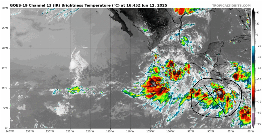
Just behind Invest 93E is an area to watch. Active convection is generating clusters of showers and thunderstorms just off the western coast of Central America. The NHC is giving this area a 0 percent chance of development in the next 48 hours and only a 20 percent chance in the next 7 days.
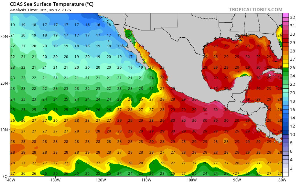
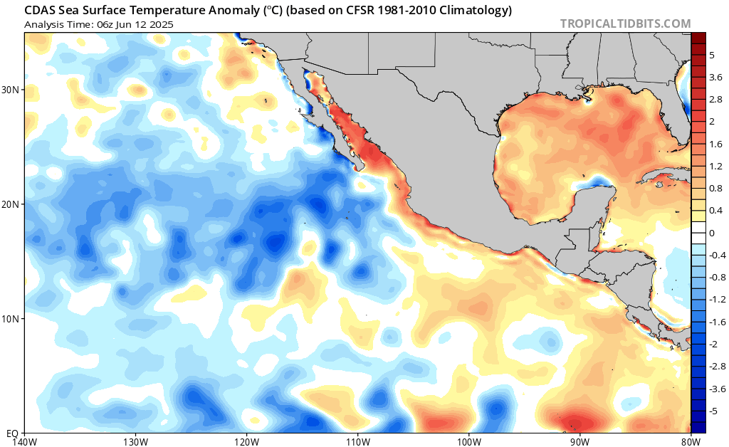
The convection is currently sitting over extremely warm sea surface temperatures, which also happens to be warmer than average as well. This is the main fuel for this system, but it doesn’t have the most hope for development. The reason why is because it is modeled to get ripped apart by wind shear before it could even develop to begin with. We will be keeping our eye on this area for any development in the next week.
Continue to check back for the latest updates


