Tropical Storm Dalila is punching the western Mexican coast with heavy rain and tropical storm force winds. Invest 94E is meandering just behind it, and has the potential to make a landfall as either tropical storm or hurricane Erick in the next week. All while the Atlantic is clear! Let’s dive into the details:
Atlantic Basin Setup

High pressure is still dominating the Atlantic Basin. It’s very hard for for any systems to develop under the large scale downward forcing from the high pressure systems. The high pressure is expected to stick around for at least the next week or two. I wouldn’t expect any tropical development in the Atlantic until July.
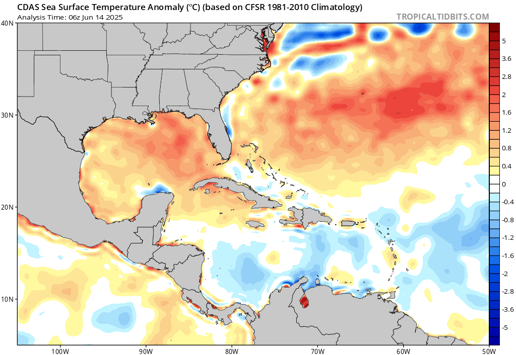
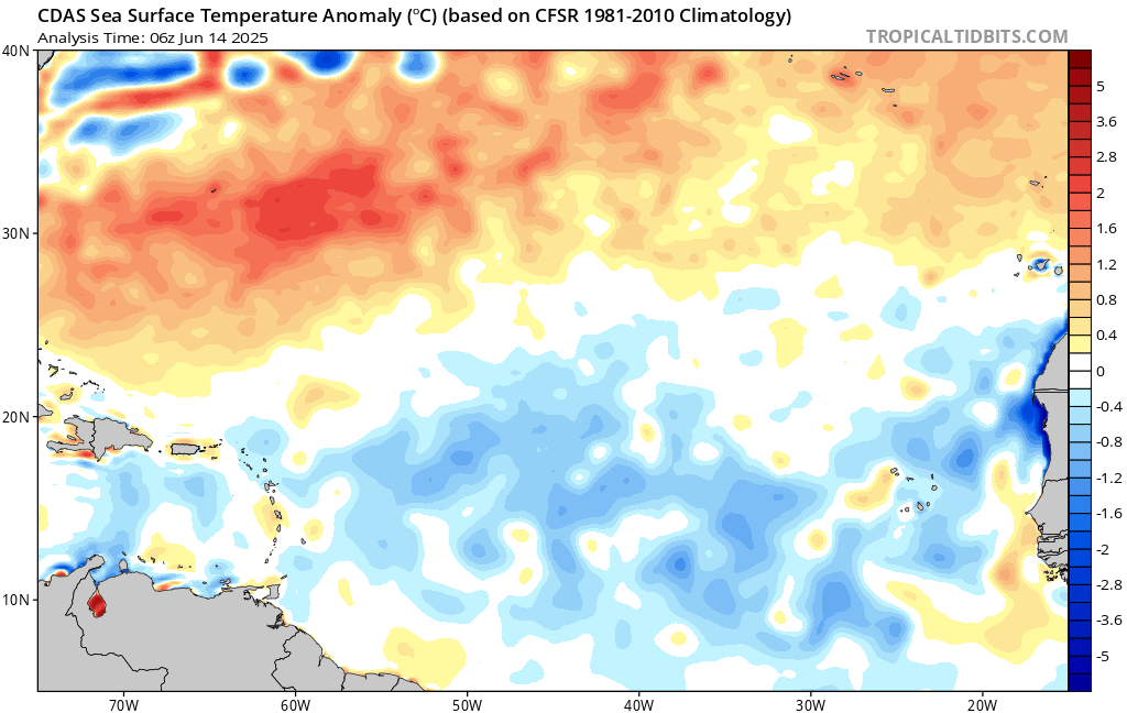
Similar to the last update, the sea surface temperatures are cooler than average over the western Atlantic. These cooler sea surface temperatures mixed with large scale high pressure suppress tropical development. Sea surface temperatures in the western Atlantic in the Gulf are plenty warm enough. If a system were to form, I would expect it to form in the Gulf, which usually develop quickly and rapidly intensity – at least in the recent years.
Eastern Pacific Setup
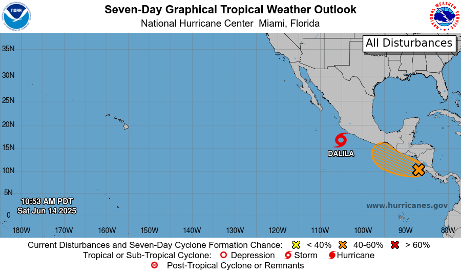
Potential Tropical Cyclone FOUR-E has recently developed into Tropical Storm Dalila. An area of watch exists just behind it, with an increased chance of development to 50 percent in the next 7 days!
Eastern Pacific: Tropical Storm Dalila
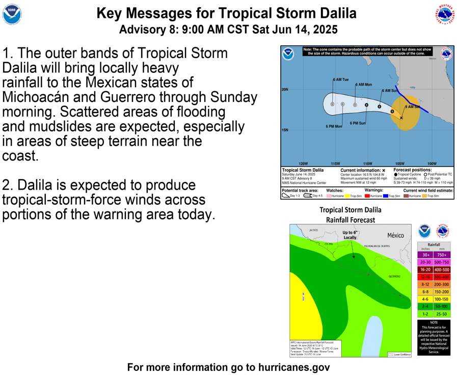
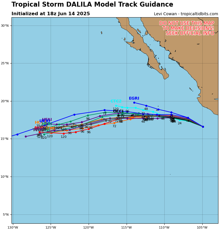
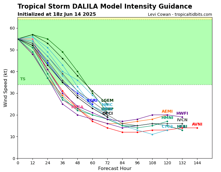
Currently, Dalila has maximum sustained winds of 65 mph, a minimum pressure of 993 mb, and is just 40 nautical miles offshore of the western Mexican coast. Dalila will weaken over the next 2 days or so, expected to weaken into a tropical depression. The storm will move off to the northwest, then eventually west southwest, at a slow 10 mph. Tropical storm warnings are in effect for the Mexican states of Michoacán and Guerrero due to the tropical force wind field that extends into the region. Areas of flooding and mudslides are possible with steep terrain near the coast.
Eastern Pacific: Invest 94E
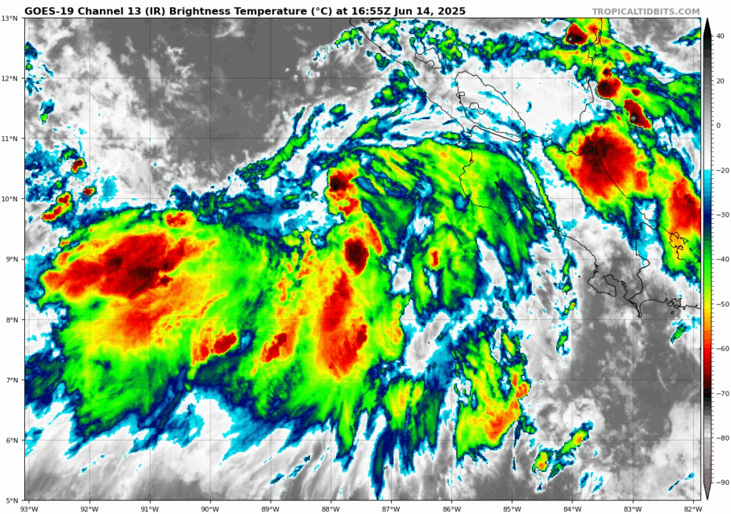
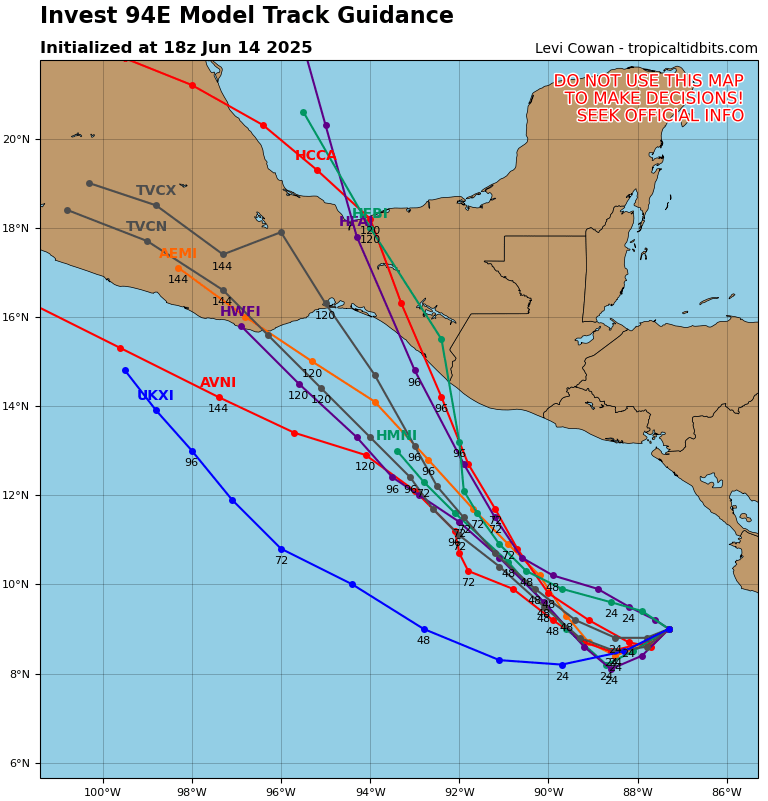
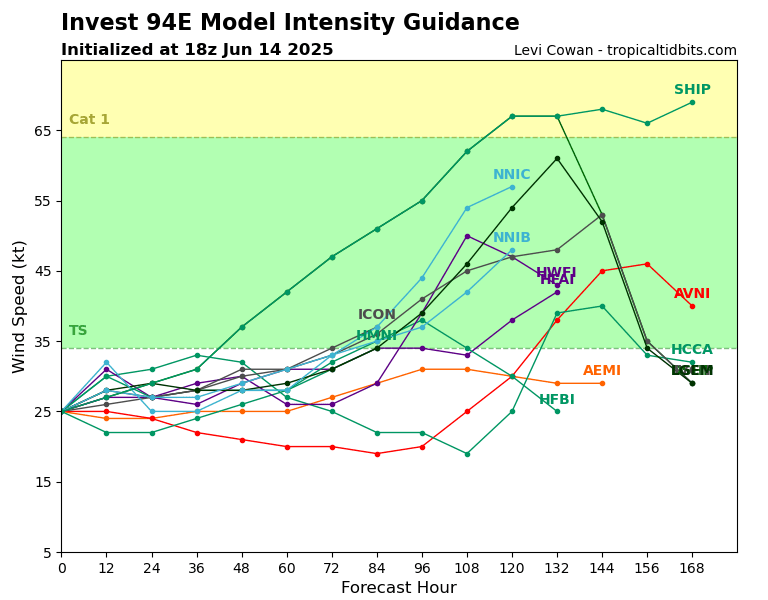
Invest 94E is slowly organizing off the southern coast of Mexico. Most model guidance shows the system tracking to the north northwest, with a possible landfall between eastern Oaxaca and western Chiapas by mid to late week. There’s growing confidence that it will become a tropical storm in the next day or two, but most probable in the next 3-5 days. A few models suggest it could strengthen further, possibly approaching hurricane strength before landfall, but that’s still uncertain.
If development continues, we could be seeing our next named storm, Erick. Heavy rain, gusty winds, and localized flooding will be concerns along the southern Mexican coast. We’ll keep watching for changes over the next few days.
Continue to check back for the latest updates!


