Former Tropical Storm Dalila is now moving out into the Pacific, and is now just a remnant low. The storm dropped heavy rain and caused a few mudslides along the southern-most coast of Mexico.
The tropical factory keeps on producing. It is very possible if not likely that sometime today, a new tropical storm will form south of Guatemala, it’s name will be Erick. This storm is of concern because, unlike the 4 other tropical storms so far in this region, this one is likely to impact land. This is because the remnant low that used to be Delila will steer the storm closer to the Mexican coastline.
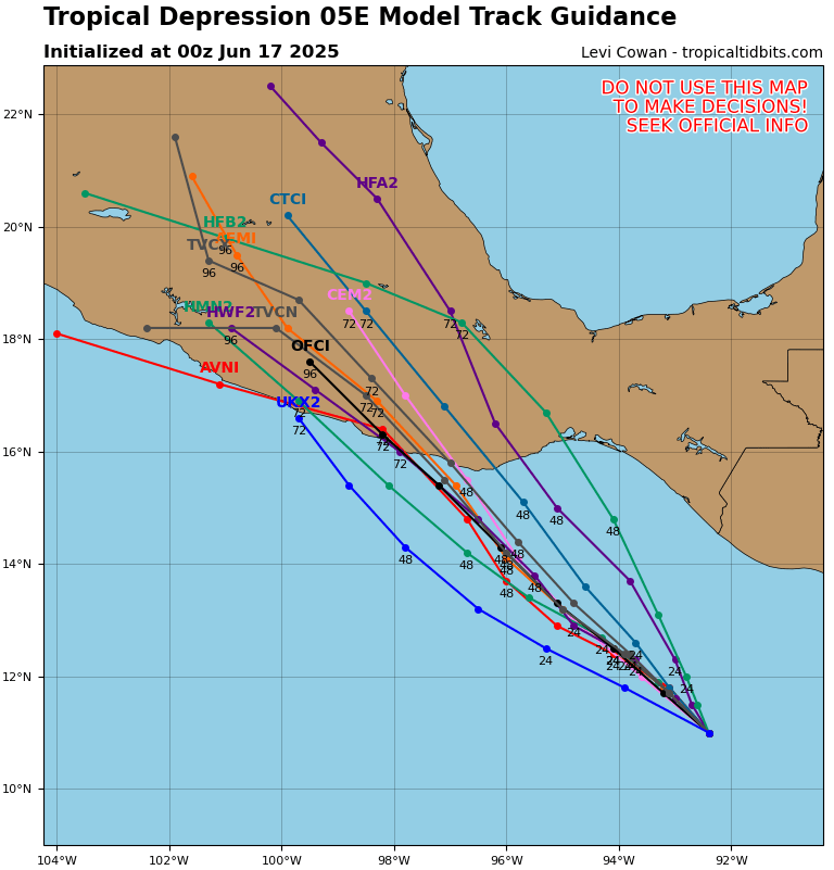
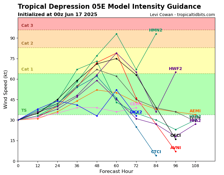
The storm could make landfall as a strong Tropical Storm or Category 1 hurricane Thursday night or Friday morning, but preparations should be completed by Thursday morning, as tropical storm force winds may extend up to 100 miles out from the storm’s center.
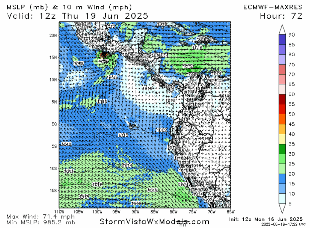
The storm will impact many of the same areas that were impacted by Dalila, heightening the risk for mudslides and flash flooding. Due to warm ocean waters and light shear, it will peak in intensity just prior to making landfall. Areas to the east of the landfall area will be vulnerable to storm surge, and anywhere close to the eye may experience wind damage similar to a weak tornado, especially given the underdeveloped nature of this region.
LOOKING AHEAD
The rugged Mexican countryside will likely severely weaken Delila, but the system could still trigger severe weather and flooding in coastal areas of southern Texas and southwestern Louisiana next week.
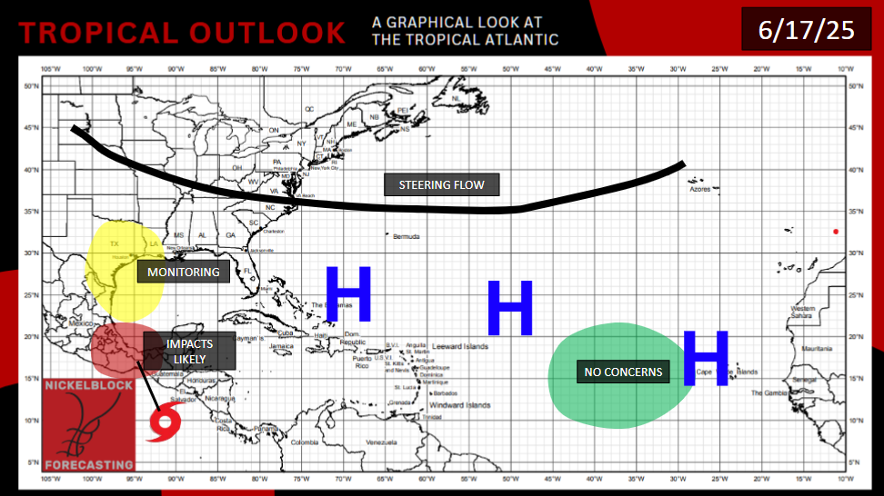
High 700mb humidity and 850mb vorticity, combined with history, suggest that yet another storm could form south of Central America in the time frame of this weekend. It would likely be steered by Erick out into the Pacific.
As far as the Atlantic Ocean, ocean water remains too cold and Saharan dust too oppressive to expect tropical formation in the near future. It is looking like we’ll go through June without a single named storm. This is not too rare, only 6% of Atlantic basin hurricanes occur in June anyways.


