Chances for another tropical system in the east Pacific are increasing from the past few days. Tropical storm Flossie has an 80 percent chance of developing within the next 7 days, but should not directly make landfall in Mexico.
Atlantic Basin Setup

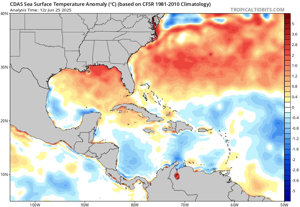
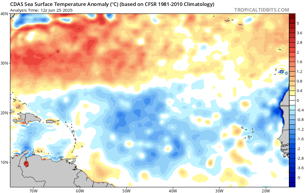
The Atlantic saw a brief tropical storm earlier this week, Andrea, but she did not cause any impact to land and dissipated fairly quickly. The basin is expected to be quite for the next 7 days. The gulf is trending warmer than average, which could rapidly intensify any passing low pressure system. Off the coast of Africa, ocean temperatures are still too cold to support tropical systems. Saharan dust and large-scale high pressure has also prohibited any development that could make it’s way to the CONUS.
Eastern Pacific Setup
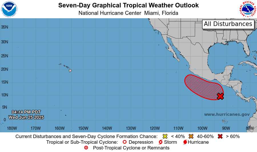
Currently in the eastern Pacific, there is an area to watch in the same region where Alvin, Barbara, Cosme, Dalila, and Erick formed. If this were to turn into a tropical system, it would be named Flossie.
Eastern Pacific: Invest 95E
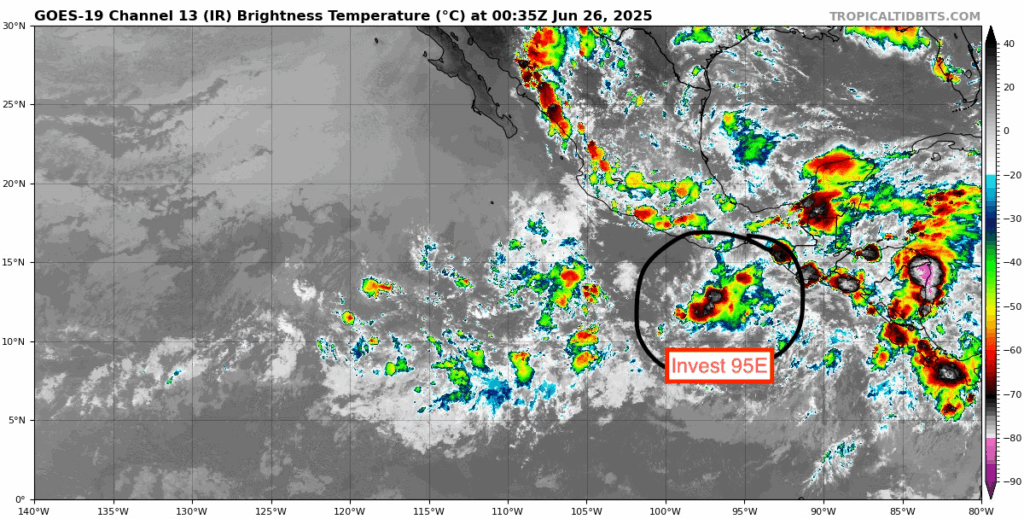
Currently, Invest 95E is a few hundred miles to the south of the coast of Guatemala. Environmental conditions are favorable for tropical development. The NHC is giving this a 40 percent chance of tropical development in the next 48 hours, and an 80 percent chance in the next 7 days. Current minimum pressure is 1007 mb and winds at 25 knots.
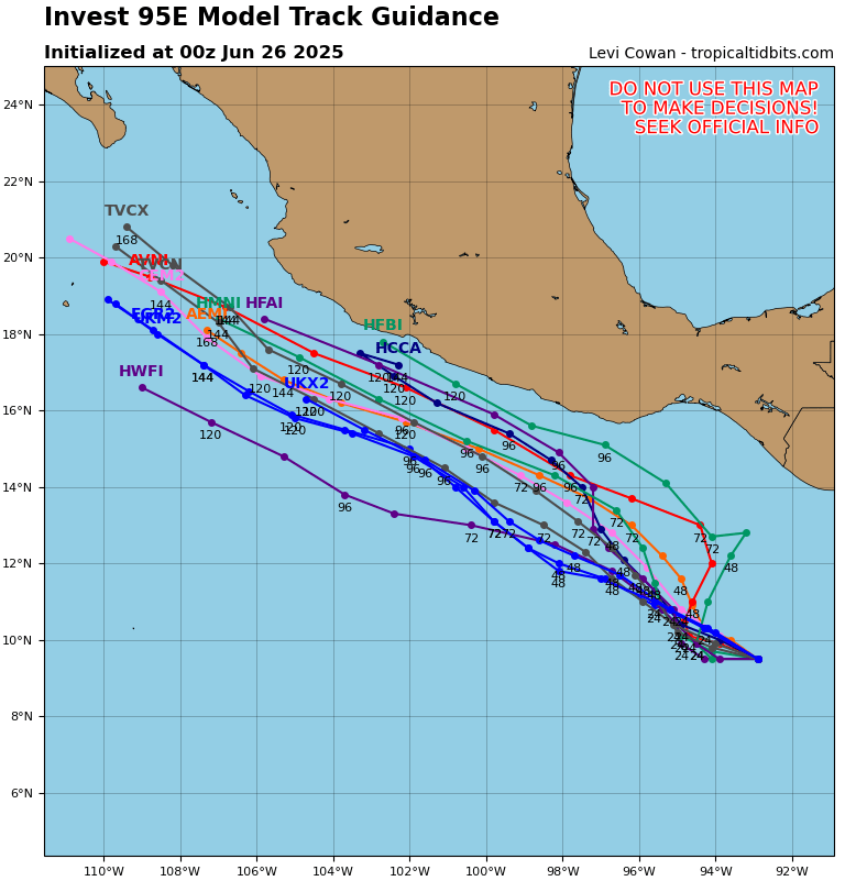
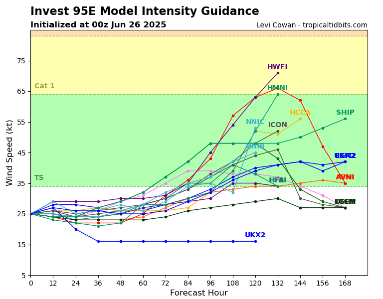
Current model guidance has the system moving to the northwest parallel to the Mexican coastline, staying as a tropical storm. This could become a category 1 hurricane briefly, but most models have it only as a tropical storm. The limiting factor for this system is the intense wind shear filled environment that it will move into as it tracks to the northwest. Although sea surface temperatures are very warm in the development region, it will essentially be ripped apart before having the chance to rapidly intensify.
Continue to check back for the latest updates!


