The Atlantic has taken us by a surprise, with our second named storm expected to be named today or tomorrow as a tropical storm. Plus, the eastern Pacific could see their sixth named storm in the next day or so as well. Let’s look at the forecast:
Atlantic Basin Setup
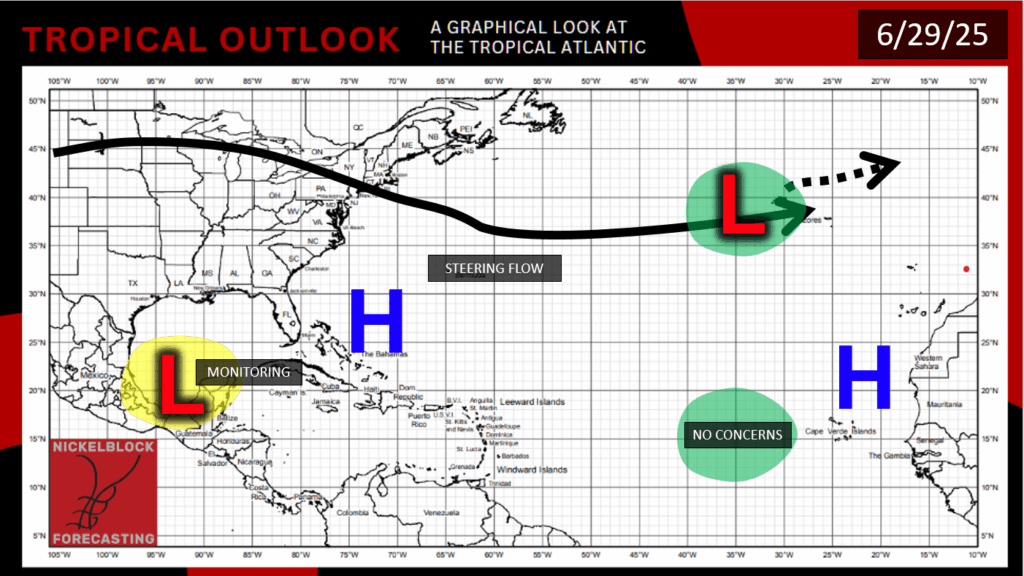
The Atlantic Basin in the open Atlantic and off the coast of Africa is quiet, but closer to home, Tropical Depression Two (TD2) has formed yesterday in the southwestern gulf. Asides from TD2, there is a low pressure way out in the middle of the north Atlantic that is not expected to develop and will move out to sea.
Atlantic Basin: Tropical Depression Two
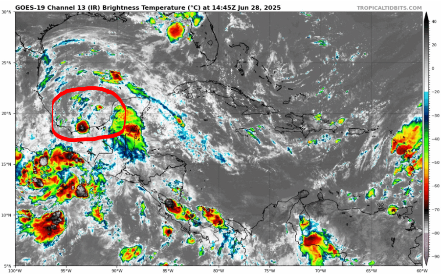
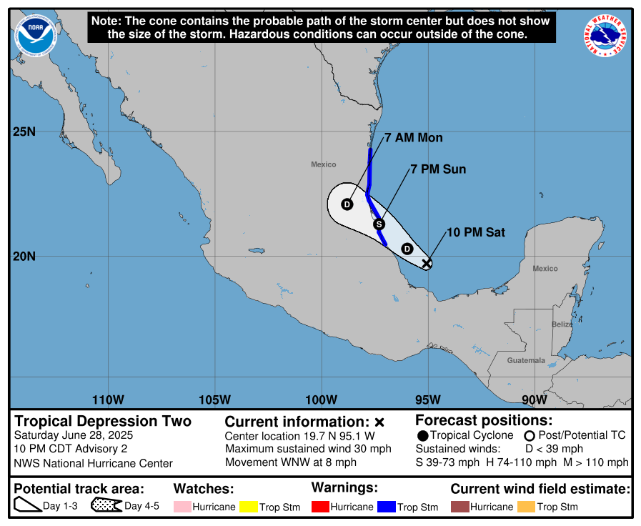
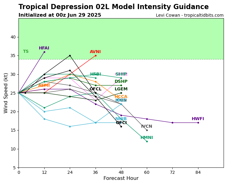
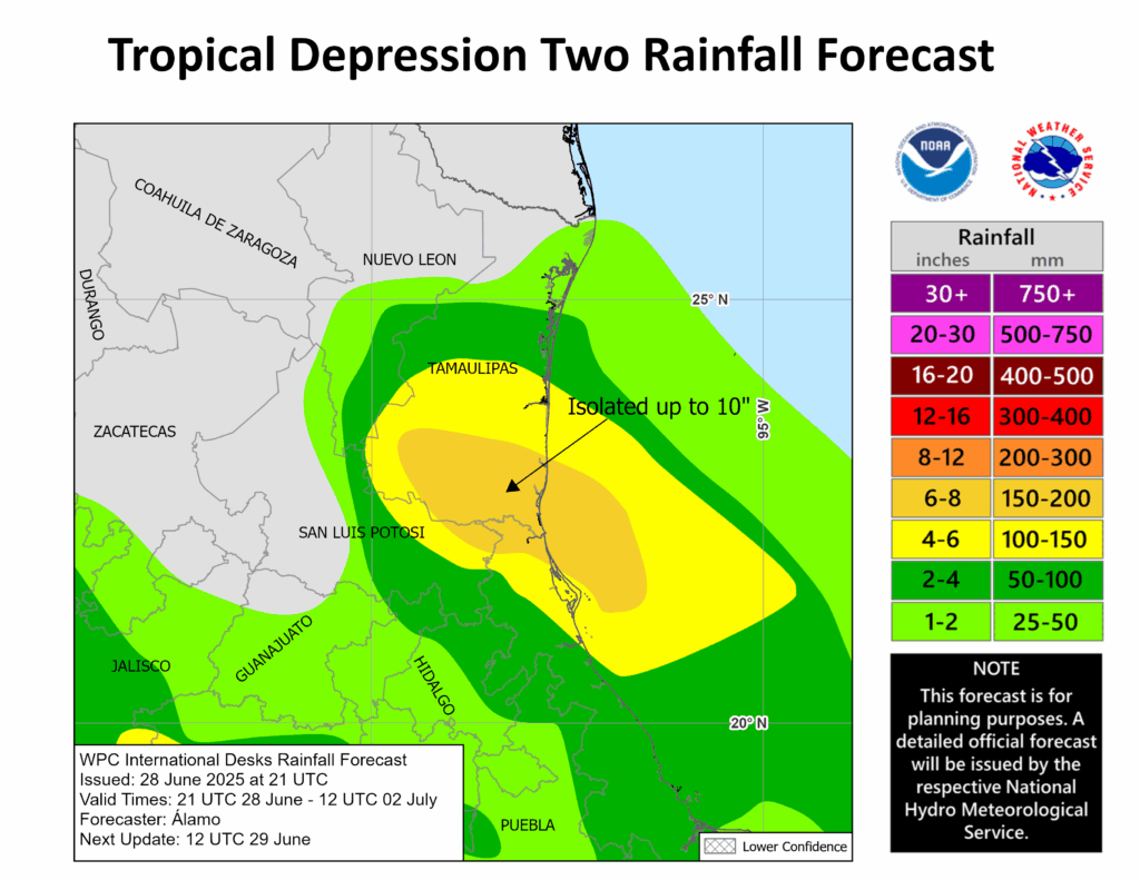
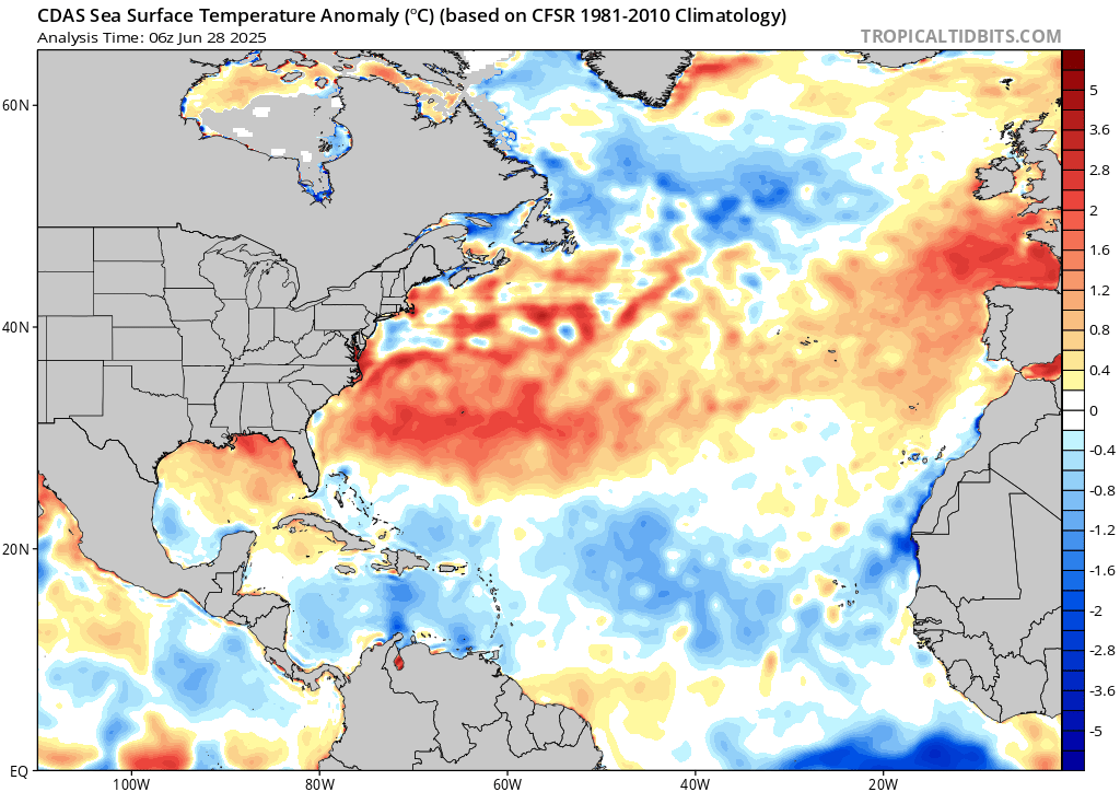
Tropical Depression Two (TD2) is expected to make landfall tonight in the gulf coast of Mexico, somewhere near Tamaulipas. Tropical storm warnings are in effect for the area, as heavy rain and tropical storm forced winds are expected to make an impact. The organization of convection around TD2 is not the best – plus cooler than average sea surface temperatures over it’s development region will make it hard to intensify much further past tropical storm status. Flooding rain up to 10 inches will cause mudslides and life threatening flooding. We will give you the latest as the new advisories come in.
Eastern Pacific Setup
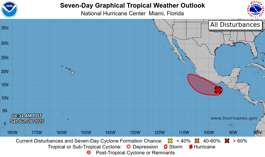
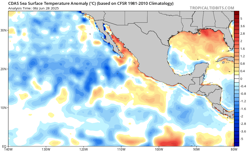
Currently in the eastern Pacific, we have Invest 95E off the southern Pacific coast of Mexico, which has a very high chance of development. The system will move into an environment with warmer than average sea surface temperatures, so it has a good chance of becoming a tropical storm or hurricane very soon.
Eastern Pacific: Invest 95E
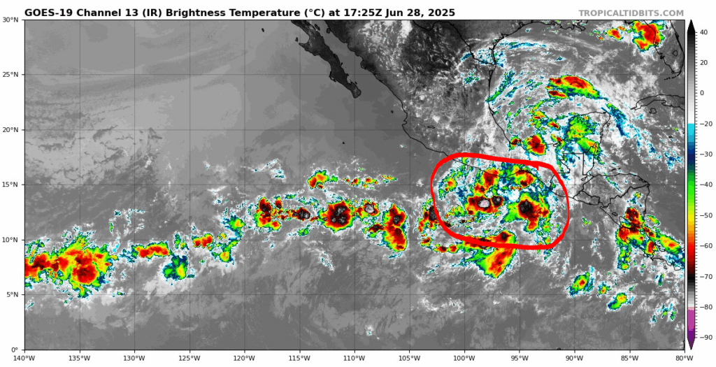
Convection has become more organized over time, but it currently lacks a well-defined circulation.
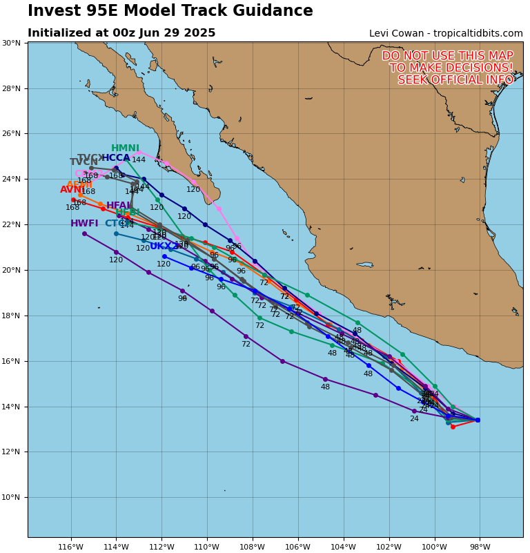
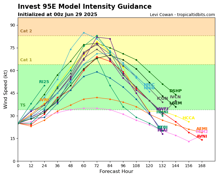
All models agree that the storm will travel to the northwest and shouldn’t make landfall with the mainland of Mexico, but they do not agree with the intensity. Some are going for only a tropical storm at it’s peak, while others are going for a category 1 Hurricane, and one going for a low end category 2. We will await the NHC’s official cone if this does become a tropical depression in the coming days.
Continue to check back for the latest updates!


