The Pacific has had a busy start to the Hurricane Season. That could not be said for the Atlantic. Here’s a look at all of the details:
Atlantic Basin Setup

Things are very quiet currently in the Atlantic Basin. Looking at the pressure systems and steering flow above, there is a low-pressure system off the coast of Africa, which is forecasted to meander for a few days and then move out of sight into Europe – all while staying a non-tropical system. No other areas of low pressure are currently a threat in the eastern Atlantic, therefore no concerns there. In the western Atlantic, there are also no concerns. The low-pressure system over Texas will travel to the northeast into the main steering flow, keeping it away from developing further in the Gulf – good news there!
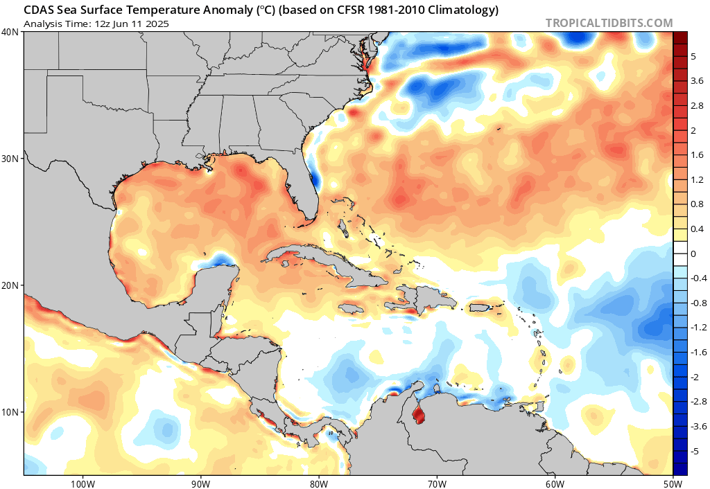
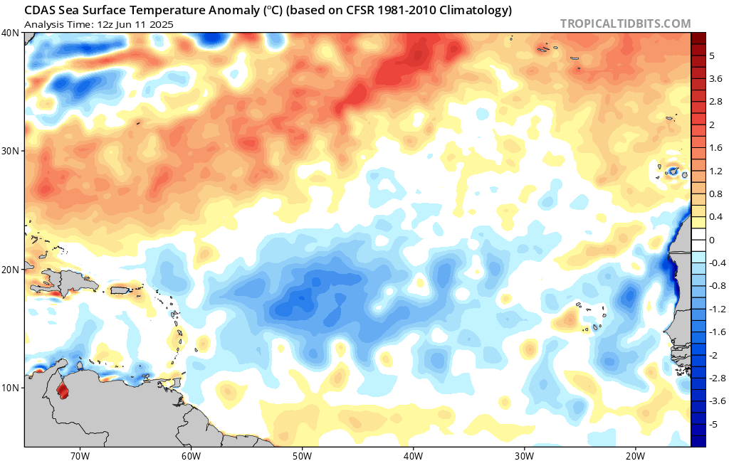
We most likely will not see any activity for a little while in the eastern Atlantic, as ocean temperatures are below average for much of the region. The western Atlantic, though, is above average. So, if something were to form, I would expect it to be in the Gulf, closer to home. In fact, most tropical systems form in the Gulf earlier on in the Hurricane Season because of the regional ocean temperature trends!
Eastern Pacific: Post-Tropical Cyclone Cosme
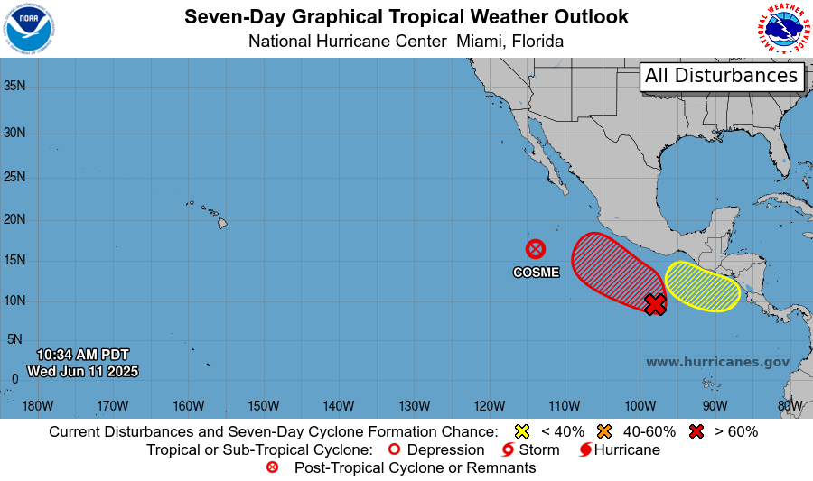
Currently in the eastern Pacific, there is a lot going on. Cosme has weakened and has been downgraded to a post-tropical cyclone. There are also two areas to watch; the one highlighted in red (Invest 93E) and the one highlighted in yellow just behind it.
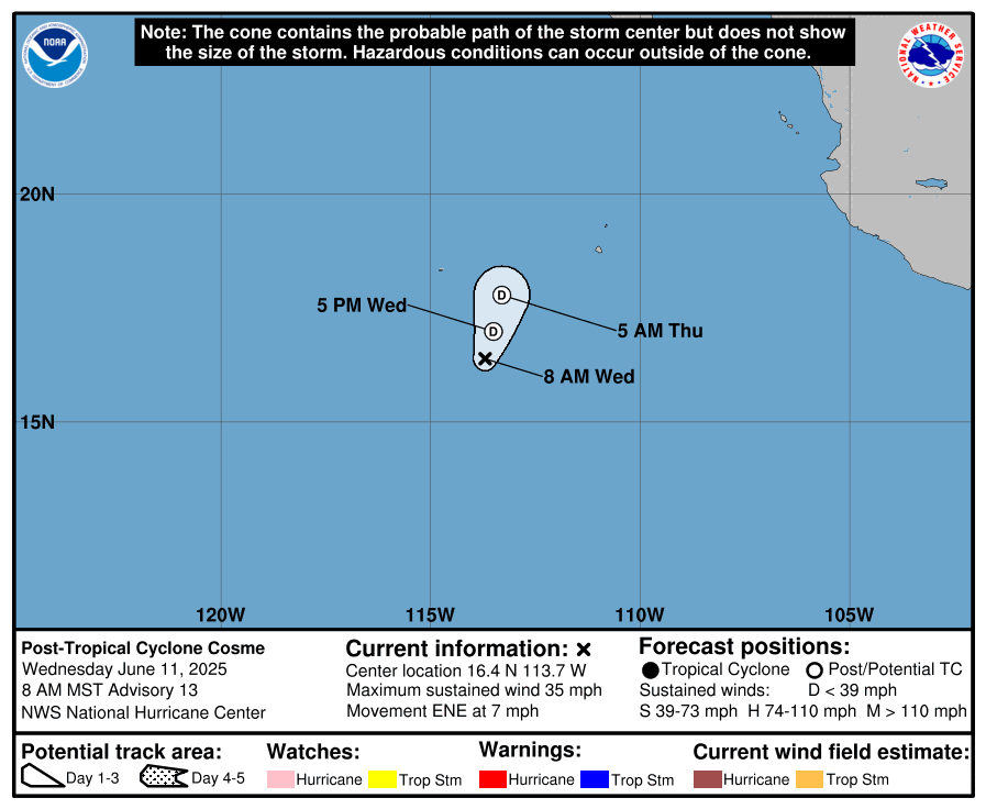
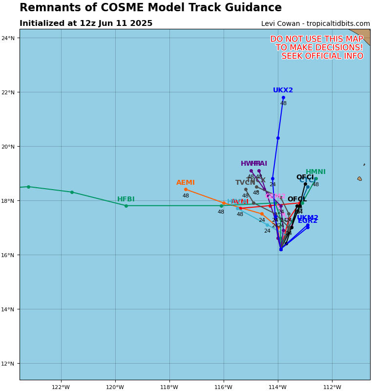
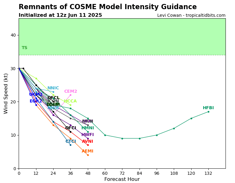
Looking at Cosme, winds are currently down to 35 mph and it is moving to the ENE at 7 mph. It is expected to continue to weaken in the next day or two and simply meander as a moisture plume, causing no threat to anyone.
Eastern Pacific: Invest 93E
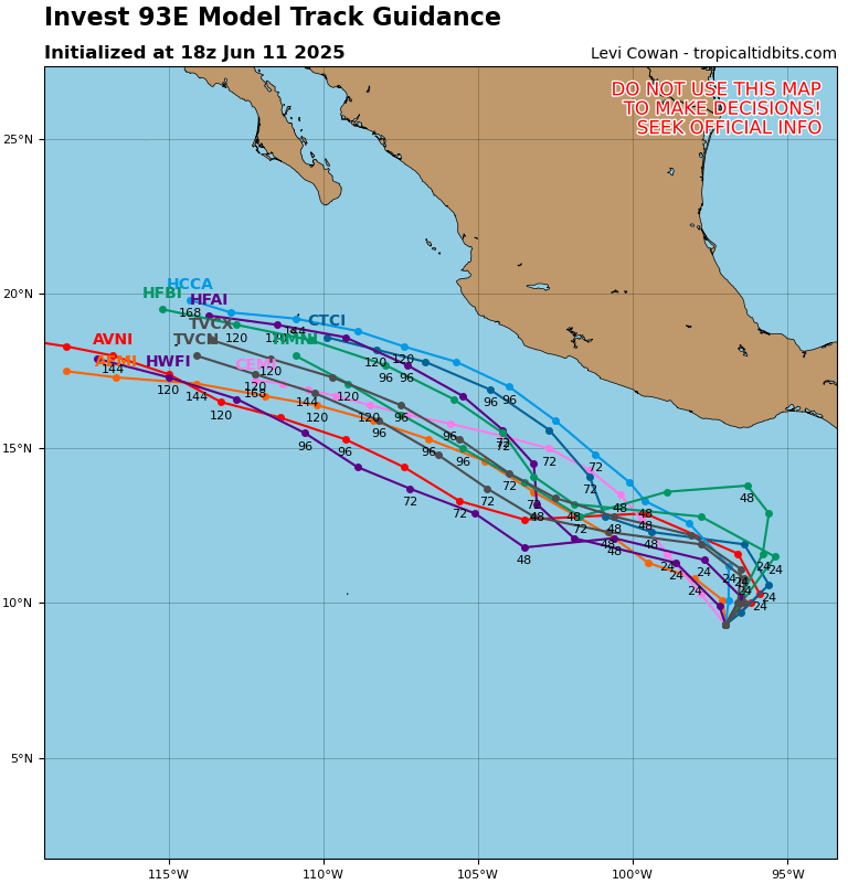
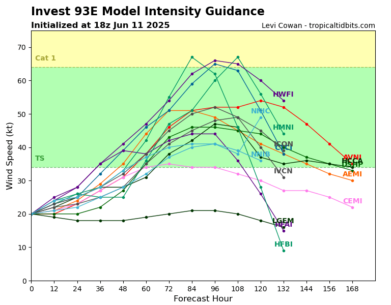
Invest 93E has a 60 percent chance of development in the next 48 hours, and a high 90 percent chance in the next 7 days. Models are in agreement that it will continue to move to the northwest and not pose any landfalling threat to Mexico. Most models have this storm developing into a tropical storm by the end of the week into the weekend, with only a couple of them going for a brief low-end category 1 hurricane. It should quickly weaken after about 3-5 days.
Eastern Pacific: Another Area to Watch
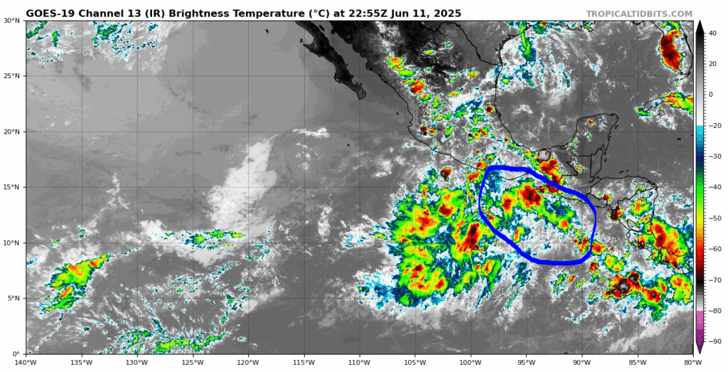
There is another area to watch just behind 93E. This one does not currently have an Invest name but is expected soon. It has pretty low chances of developing into a tropical system, with a 0 percent chance in the next 48 hours and a 20 percent chance in the next 7 days. If it does develop, it should follow similar tracks to its predecessors.
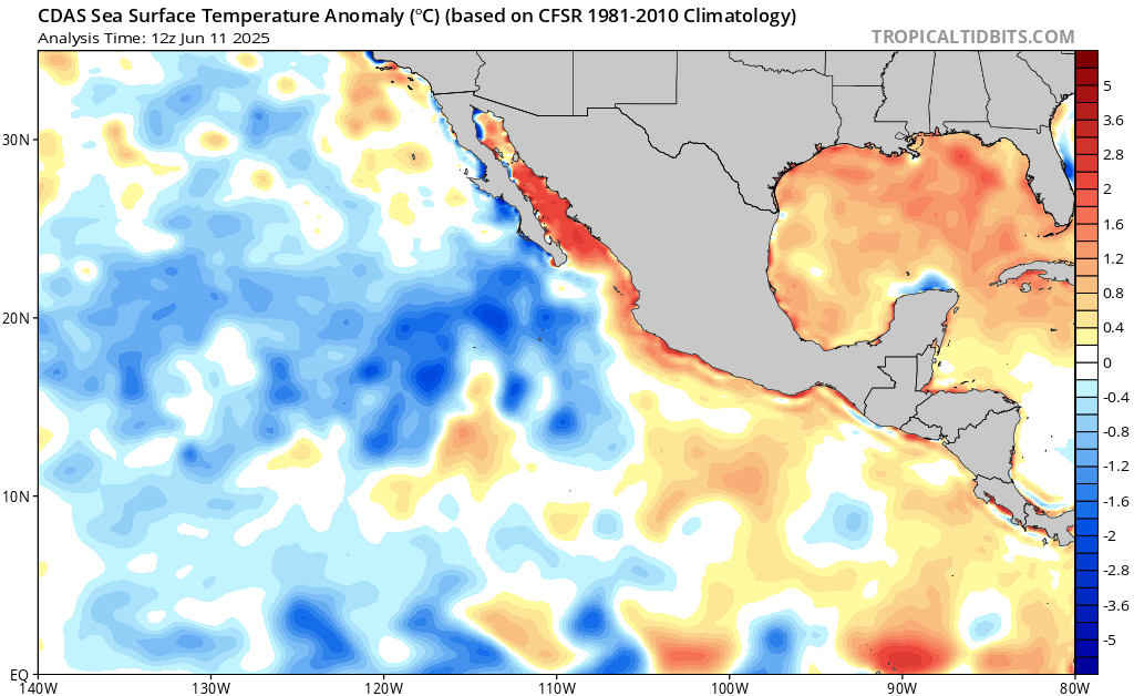
The main fuel for these systems so far in the east Pacific has been the warm sea surface temperatures off the coast of southern Mexico. The areas in orange have been the main development region thus far. However, the tracks of these systems have been into the colder waters of the Pacific, which diminishes further development. I would expect more of these brief low-end tropical systems for the coming weeks – at least until the waters warm more, where they would become more intense!
Continue to check back for the latest updates!


