Hey everyone! Our current situation in the tropics is an area to watch in the Eastern Pacific. The Atlantic is quiet for now, but we are monitoring the basin very closely. Here’s a look at the details:
Atlantic Basin Setup

The current setup in the Atlantic basin is a large area of high pressure in the central Atlantic (known as the Bermuda High), a cluster of showers and thunderstorms off of Central America and the penninsula of Mexico, and no probable development off of Africa in the next 7 days.
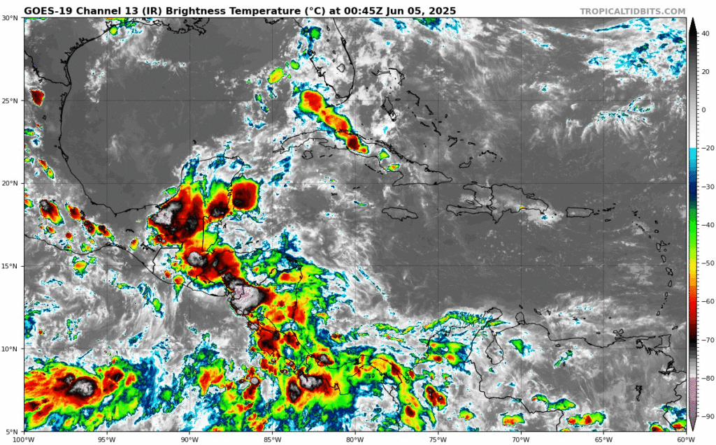
The cluster of showers and thunderstorms are currently sitting over the Mexican penninsula and Central America, but is currently not showing any threat of becoming a tropical system, at least in the next 7 days. If something were to develop, I would expect it to turn to the north, and then the east – following the flow of the Bermuda High and likely being swept up by an incoming trough.
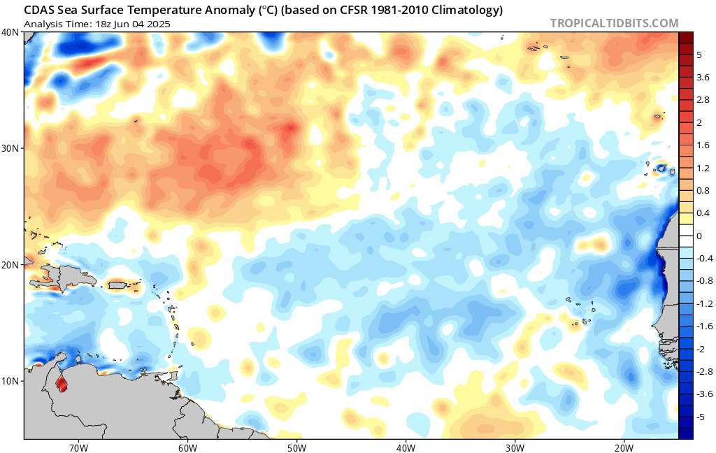
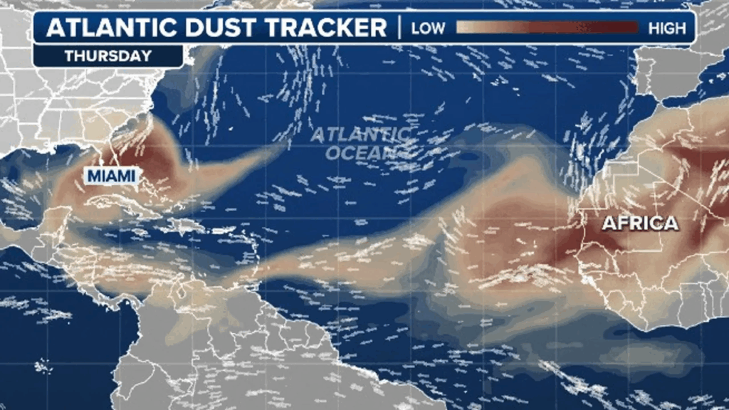
You may be wondering why we aren’t seeing any tropical waves originate from Africa yet. This is because sea surface temperatures are much cooler than average, as usual in this region this early in the hurricane season. We see these waters warm more towards the latter end of the season. Not only are the water temperatures not favorable for tropical convection, but we have been seeing lots of African dust coming from Africa, which dries up the air and doesn’t allow for showers and thunderstorms to form in the first place.
Eastern Pacific
The NHC still has an 80 percent chance of tropical development for the area to watch of the western coast of Mexico. A tropical storm is likely to form this weekend, and would be the second named Pacific tropical storm, Barbara.
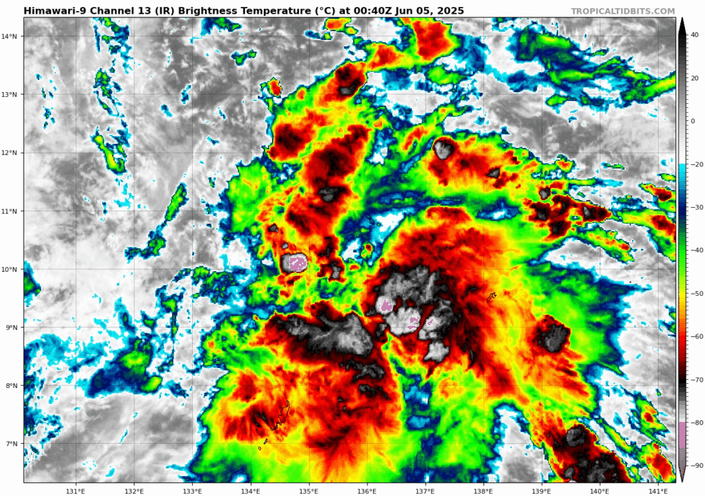
The area to watch, formally known as Invest 92W, is becoming more organized with it’s increased convection around a low pressure. More organization is expected in the coming days, due to very warm sea surface temperatures in the likely development area.
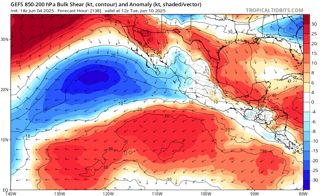
Soon to be Barbara is expected to stay a tropical storm, possibly up until around next week, where it will enter an environment full of highly anomalous wind shear – meaning she will be ripped apart before becoming a threat to land. This system has similar characteristics to once named Alvin, so it should have a similar outcome.
Continue to check back for the latest updates!


