We will start to see the first round of rain from Invest 93L later today. We will see the bulk of the rain on Friday and Saturday and the potential for some impressive rain totals when all is set and done. While there is a small chance it does develop into a weak tropical depression or storm, but current guidance given the track of the storm keeps it sub-tropical. Let’s look at what’s going on:
Atlantic Basin Setup
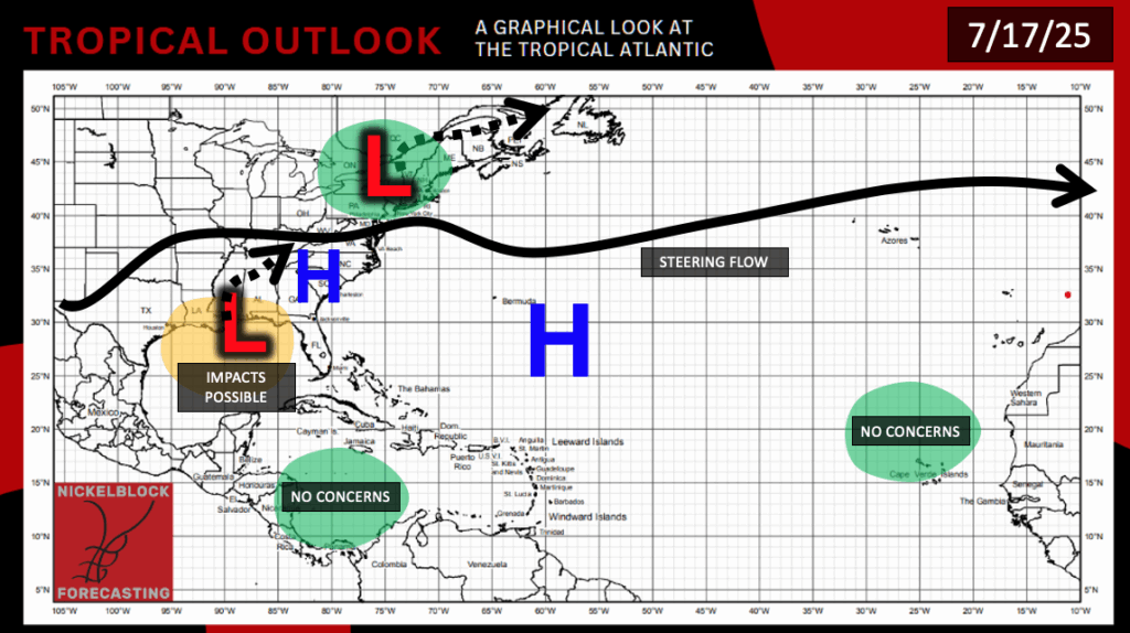
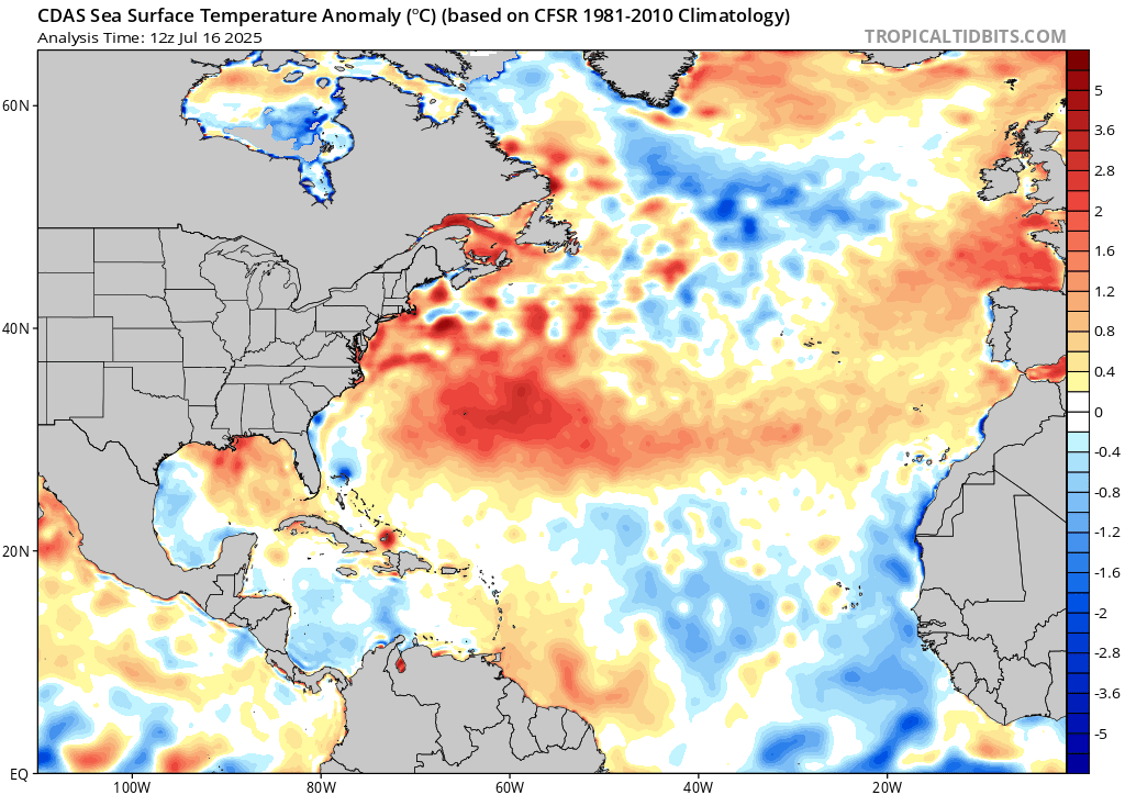
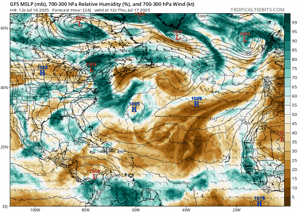
Currently in the Atlantic, all of our attention is on the Gulf, as Invest 93L brings heavy rain to our area through the next few days. Other than 93L, there is no other areas that we are watching for development. While ocean temperatures are very warm, there is still a very stubborn Bermuda High that is spreading out dry air that suppresses any development.
Invest 93L
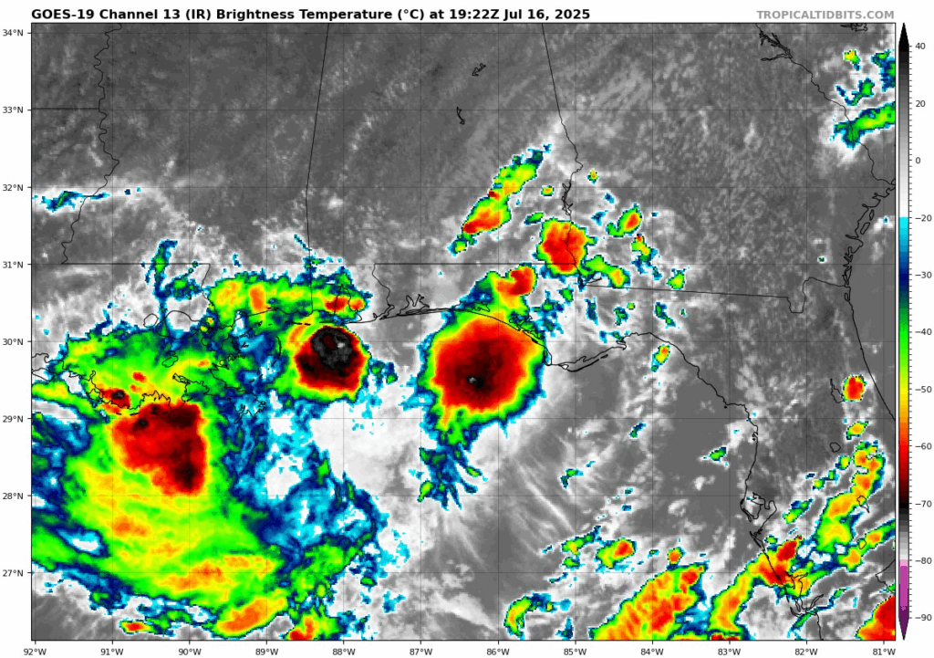
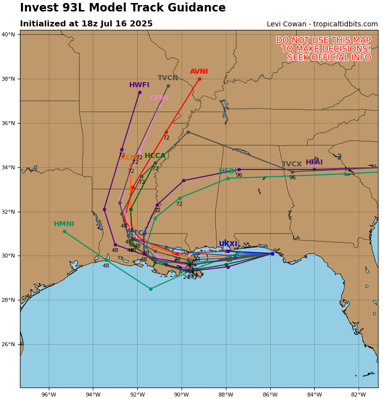
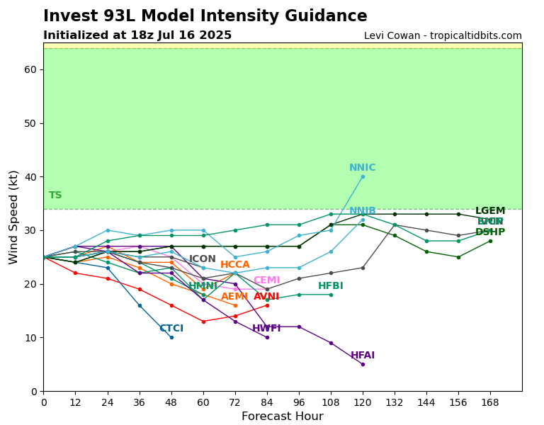
Invest 93L will likely stay sub-tropical, meaning it likely will not stregthen into a tropical depression or tropical storm. Luckily for us, the track of the low pressure has stayed mostly onshore of the Florida panhandle and the track is due west, which gives it less time to stregthen over the extremely warm Gulf waters. If it had moved to the southwest deeper into the Gulf and then turned into our coastline, it would have likely become more organized and strengthened into a tropical storm or even a hurricane.
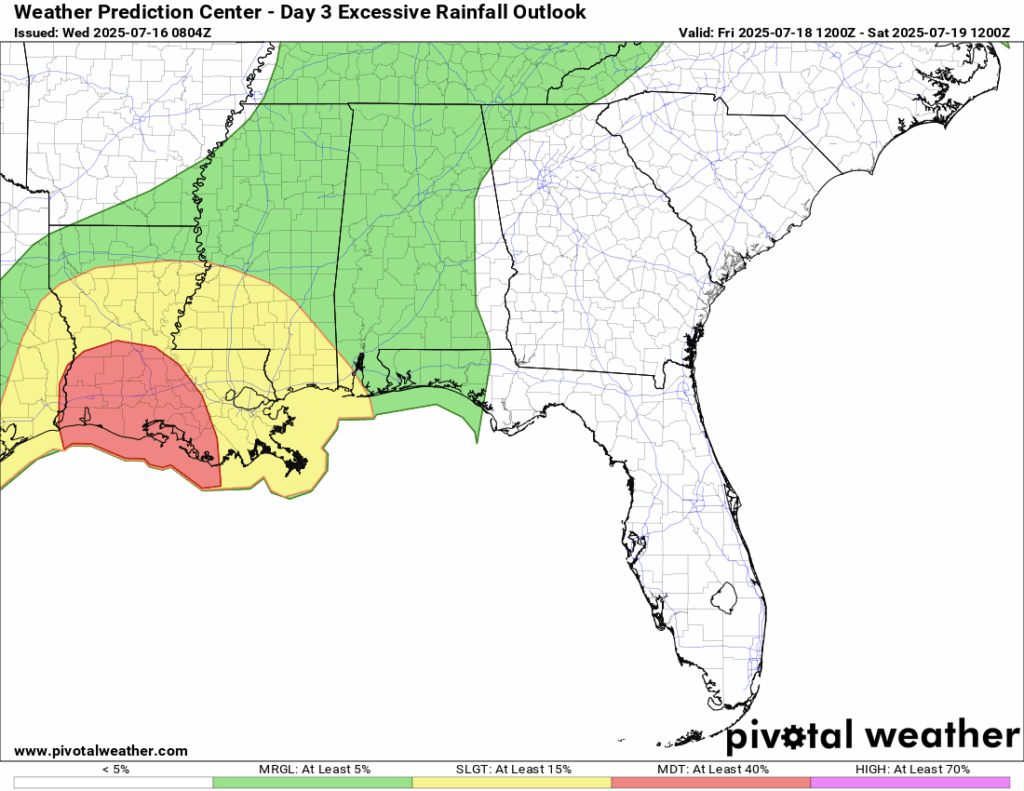
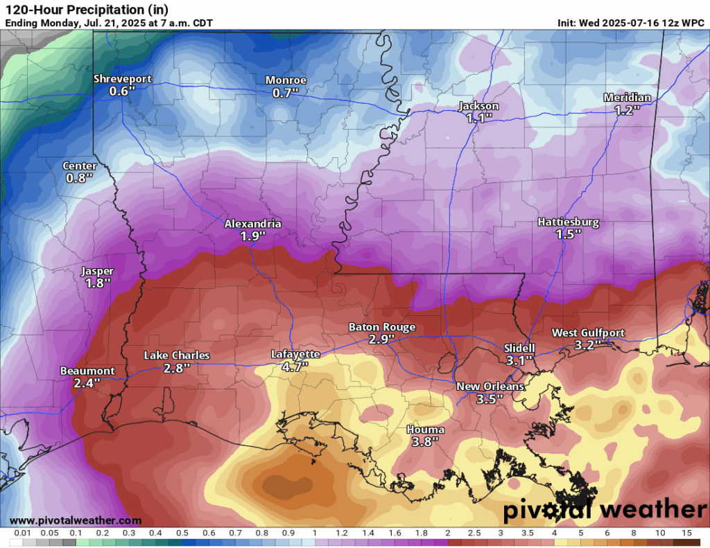
The center of low pressure will likely move into southeastern Louisiana by later today and bring with it heavy rain. As you can see from the Weather Prediction Center’s (WPC) total accumulated rainfall forecast through Monday morning, as much as 3-5 inches of rain is what most areas will see, but some areas could see up to a foot possible when things are all set and done. Current guidance has the bulk of the highest rain totals in southern Louisiana, but it all depends where those heavy rain bands set up. The WPC has a Slight (at least 15 percent) chance of excessive rainfall and flash flooding for our general area. For areas further in southwest Louisiana, the WPC is more concerned with heavy rainfall rates of 2-3” per hour, which could cause some major flash flooding. Ensure you have a plan in place if you live in a low lying area and heed all NWS warning when they come through.
Eastern Pacific Setup
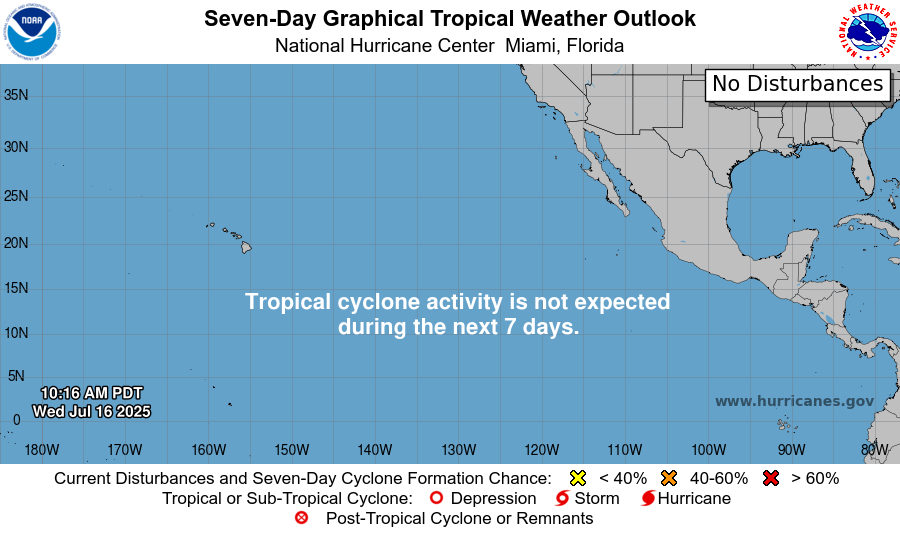
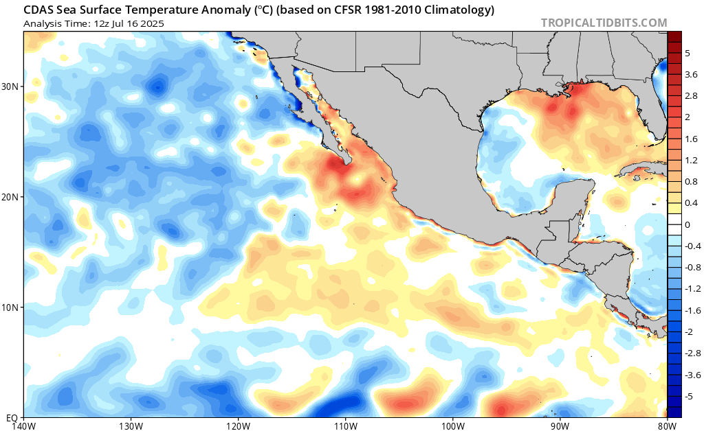
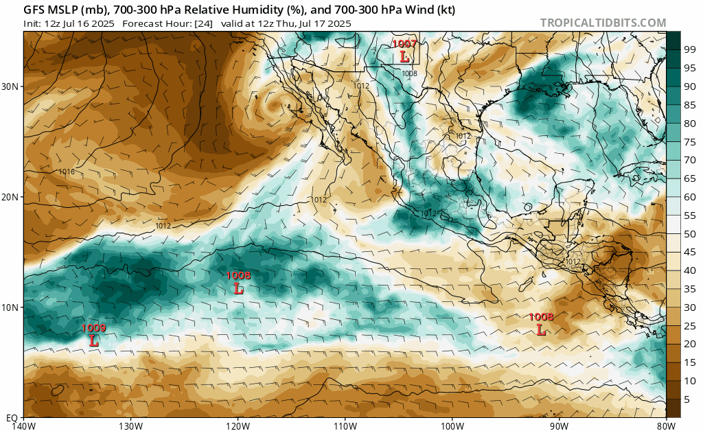
The Eastern Pacific is still quiet! This is definitely a change from just a few weeks ago, where we had back to back tropical systems being named. Thankfully most of those did not impact land, but some did and caused flooding. There are no areas to watch currently highlighted by the NHC. Sea surface temperature anomalies have risen, meaning they are warming up after a little bit of a lull. If you take a look at the mid-level relative humidity for the next week or two, there are some areas of high moisture that could spin something up, and it is certainly possible that something does develop.
Continue to check back for the latest updates!


