Hi everyone! For your tropical update, we have three areas to talk about. In the Gulf, there is a low chance at a weak tropical depression forming and moving into the northwest Gulf coast. The biggest impact will be the rain associated with it, but other than that, it’s not too much to worry about. There is also some model guidance showing a tropical wave forming in the Atlantic and potentially tracking east towards the CONUS. For the Pacific, we are watching a tropical disturbance which could develop by next week to the south of Hawaii. Let’s look into the details:
Atlantic Basin Setup
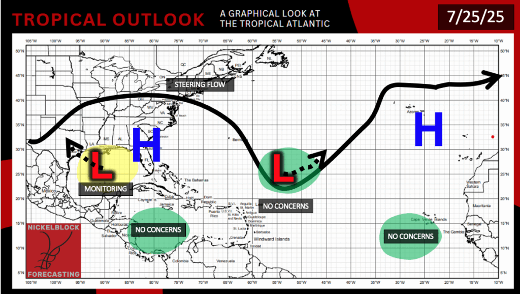
The Atlantic does not have anything too major to look at currently. As mentioned above, there is that low pressure system in the Gulf that is, at this point, very weak and not showing any good signs of developing or streghtening any further. There is no concerns in the Carribean sea or off of Africa, given the dry air and high pressure that is over the regions. There is a low pressure in the central Atlantic, but not anything that is expected to develop or touch any land.
Tropical Disturbance – Gulf
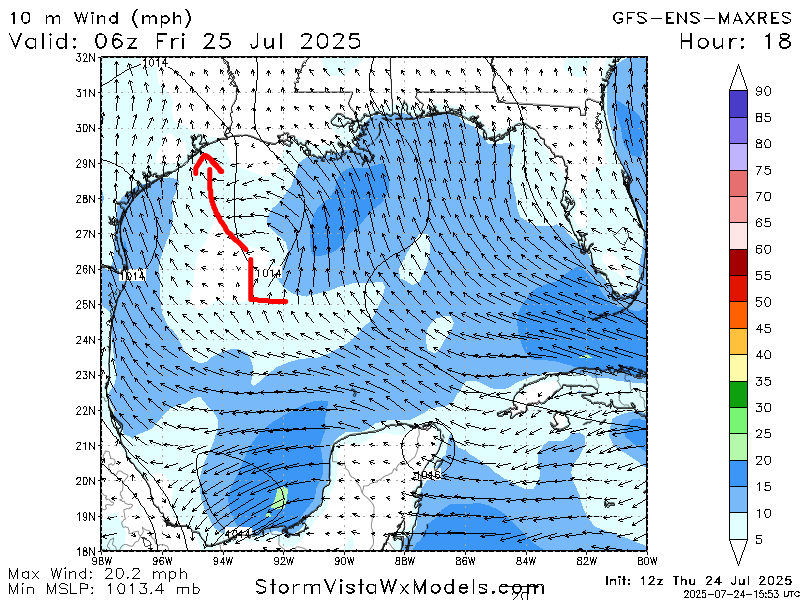
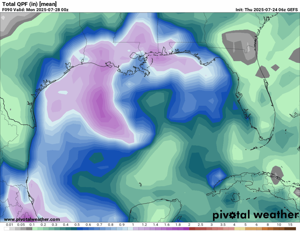
Tropical development at this point is very unlikely for this “tropical” disturbance. There is only a 10 percent chance of this somehow developing in the next 48 hours or the next few days. Over the next few days, this low pressure system shown in the first image, which is fairly weak, will move to the northwest somewhere in northern coastal Texas or southwestern Louisiana. This is expected to bring some rain to the area this weekend, with the GEFS model showing a general 1-2 inches, with some higher amounts possible.
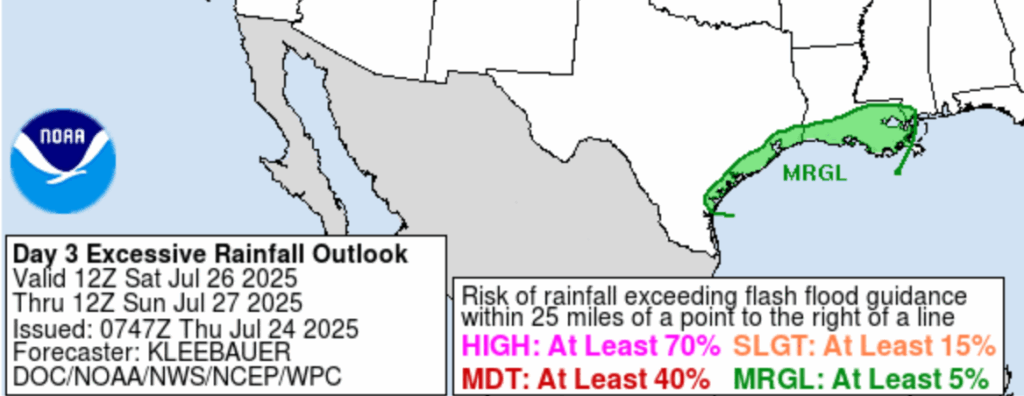
The Weather Prediction Center (WPC) has put out a Marginal risk zone for flash flooding for this Saturday, which is when the peak of the rainfall is expected. Overall not a huge threat, but there is at least a 5 percent chance. Upgrades to this risk are certainly possible as we get closer.
Area to Watch – Atlantic
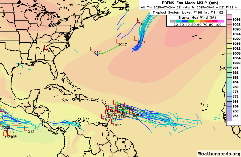

Models have been hinting on something potentially forming in the Atlantic by late next week. This tropical wave off of Africa is classified as a Kelvin Wave. A whole bunch of Saharan dust is currently spinning around the Atlantic, in the potential development region as shown by the Spaghetti models above. While it’s possible for these systems to survive with surrounding dust, it’s not easy for them to form with the dust in the environment, because it is so dry. Sea surface temperatures are relatively warm, but are technically cooler than average. We will keep you updated if anything changes, but for now there is nothing to worry about.
Eastern Pacific Setup
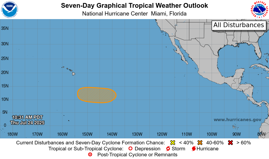
Currently in the Pacific, there is a tropical disturbance with a medium chance of development (40 percent) in the next 7 days. This is the closest a tropical disturbance has moved near the Hawiian islands this season, but any development would stay to the south of the island chain. The GFS shows a very moist low pressure moving to the west and potentially forming a tropical depression mid-week. This is not expected to effect any land, but just to move off into the open waters of the central Pacific.
Continue to check back for the latest updates!


