Hi everyone! The Pacific is on a roll with back to back storms. There’s currently 5 areas we are looking at today there. The Atlantic is looking quiet currently, but are monitoring the Main Development Region for possible development in the next week or so. Let’s look into the details:
Atlantic Basin Setup
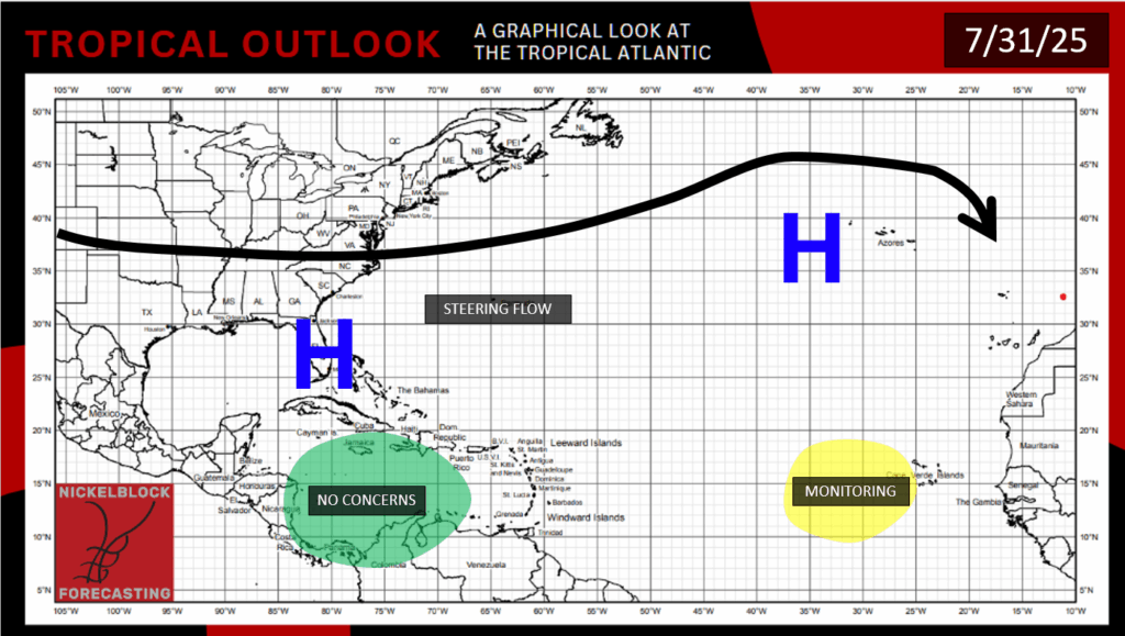
The Atlantic is quiet for now, but we are still watching closely for potential development in the Main Development Region off of Africa. Dry air and hostile winds are making it hard to develop right now, but it might move into a more conducive environment for development in the next week.
Potential Development – Atlantic
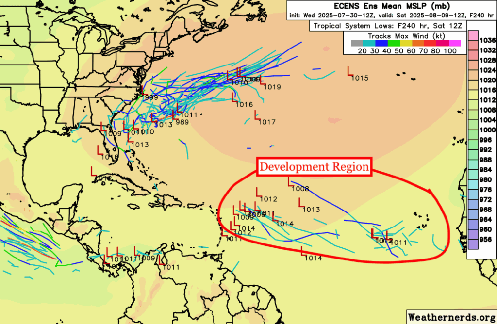
Models are still hinting at an area of low pressure forming off of Africa and moving into the Carribean by next week. This is still very far out, but we know that there is a ton of dry/dusty air in this region that makes it hard for any convection, as well as there being increased windshear in the region. Sea surface temperatures are relatively warm in the development region, but not nearly as warm as they become during peak season, which is late August and September. Right now, there’s nothing to worry about, but we will always give you the latest updates.
Eastern/Central Pacific Setup
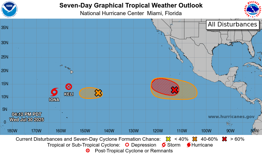
Tropical activity is heating up across the Eastern and Central Pacific. We currently have Tropical Storm Iona and the remnants of Keli south and west of Hawaii. Just behind Keli is an area to watch with a medium chance of development. Closer to Mexico, an area of low pressure has a high chance of development over the next 7 days and could become our next named storm. In the same slightly larger area, another disturbance has a medium chance of forming as it moves westward. We’ll be watching these areas closely over the coming days.
Tropical Storm Iona – Pacific
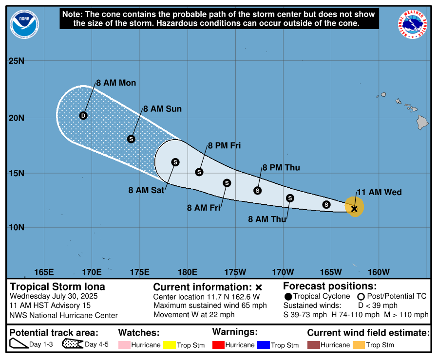
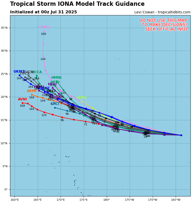
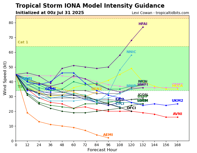
From west-to-east, the first storm we are tracking is Tropical Storm Iona. This was downgraded from Hurricane Iona yesterday as it has entered an area of increased wind shear and cooler ocean temperatures. It will likely stay a tropical storm through the weekend but will eventually weaken as it travels to the northwest. Iona reached Category 3 out of 5 status on the Saffir-Simpson scale with maximum sustained winds at 125 mph. This was a violent one, and we are fortunate that this stayed to the south of the Hawiian islands.
Remnants of Keli – Pacific
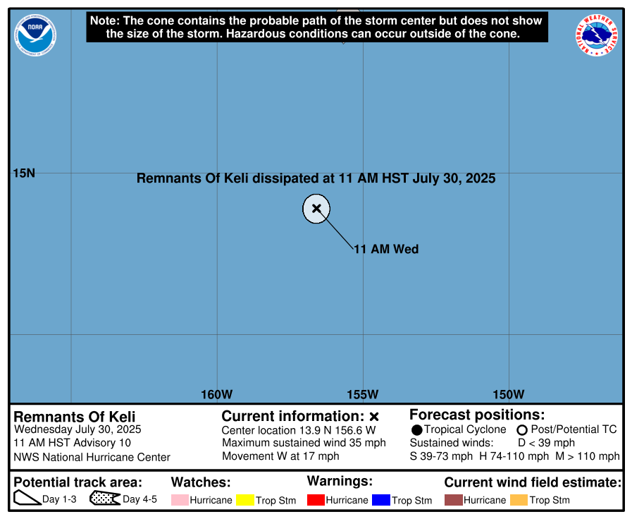
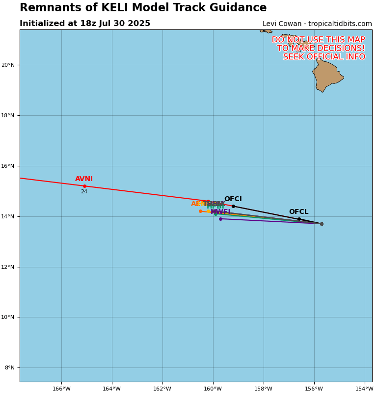
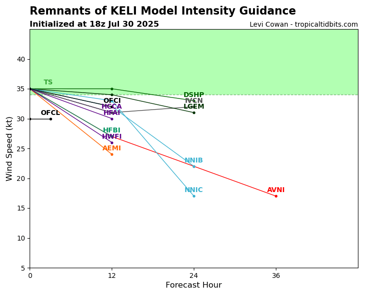
What once was Hurricane Kelly, then Tropical Storm Kelly, is now simply the remnants of Keli. Its remnants and moisture will still spin as an area of low pressure to the west for the next few days, but it will not be tropical in nature anymore.
Invest 92C – Pacific
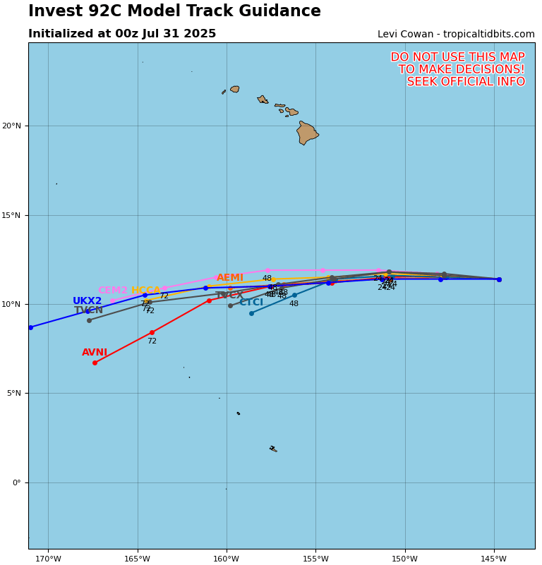
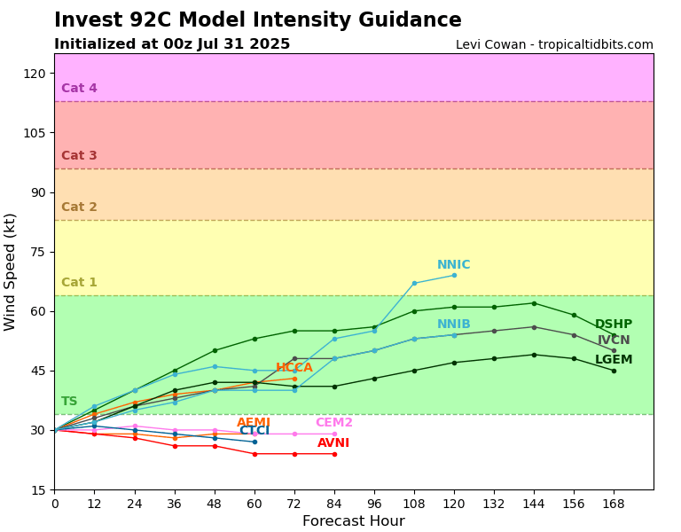
To the east of what was Keli, we have Invest 92C, which currently has a 40 percent chance of development in the next 2-7 days. I would expect this to become at least a tropical depression in the next few days, and it will track to the west southwest away from Hawaii.
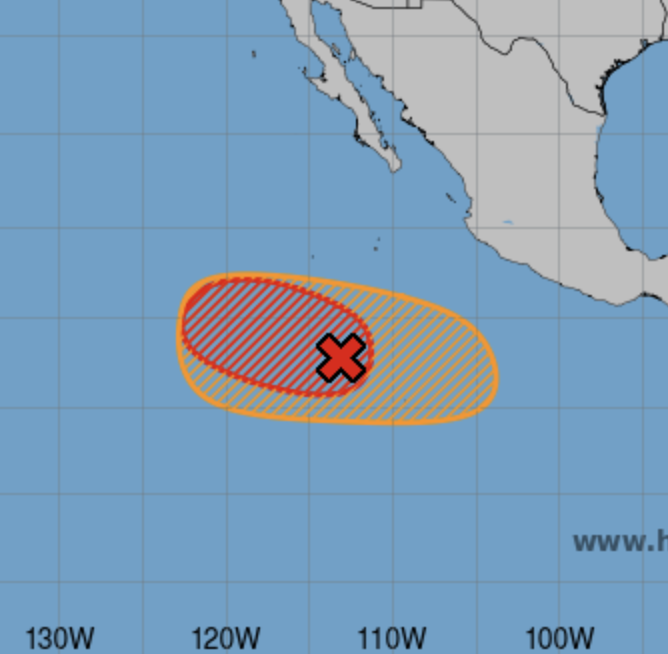
Invest 99E – Pacific
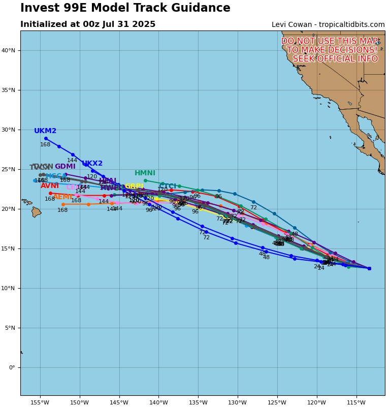
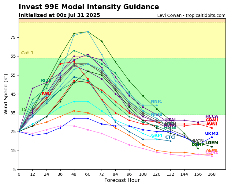
Closer to Mexico, we have Invest 99E from the NHC, which has a very high chance of development in the next 48 hours, 90 percent. This is expected to travel to the northwest in the coming week. Just before it nears Hawaii, it is expected to weaken down to a weak tropical storm or tropical depression, so impacts would likely just be some increased rain and high surf.
Area to Watch – Pacific
Finally, we have the last disturbance currently sitting in the Pacific. This one is right over the same, but slightly larger, area as Invest 99E. There is a zero percent of chance of development in the next 2 days, and a 60 percent chance in the next 7 days.
Continue to check back for the latest updates!


