Tropical storm Chantal has made landfall in central/northern South Carolina this morning, bringing heavy rain, storm surge, and gusty winds. Moisture remnants from Chantal will be felt even after weaking into a tropical depression later today into the mid-Atlantic and northeast by mid-week. Let’s look at the forecast:
Atlantic Basin Setup

Our Atlantic Basin setup is showing our first red-highlighted “Impacts Likely” marker for the CONUS this hurricane season with Tropical Storm Chantal. No other areas of concern are likely in the next 7 days. Let’s look at Chantal’s impacts:
Atlantic: Tropical Storm Chantal
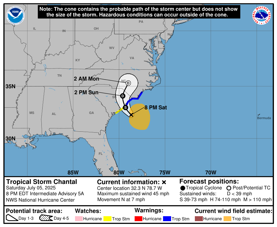
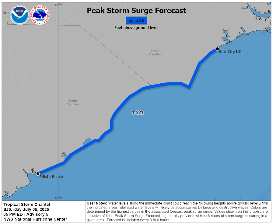
Tropical Storm Chantal is making landfall this morning in central/northern coastal South Carolina with winds from 30-40 mph, heavy rainfall, and up to 2 feet of above ground storm surge. Heavy rainfall will cause a threat of flash flooding through Monday, especially in urban areas, the NHC says. Through the next few days, life threatening rip currents will be a concern up into the mid-Atlantic and northeast.
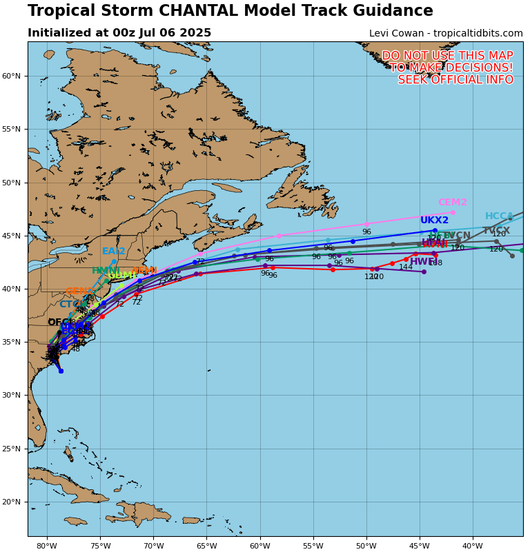
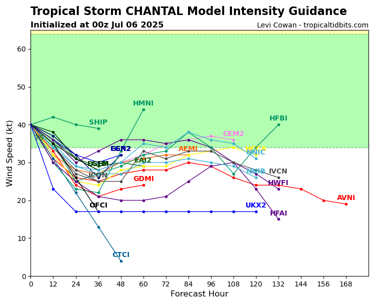
After weakening into a tropical depression later today, models are in agreement that it’s remnants will track off of the northeast coast and exit by mid-week, brining rain and a Marginal threat of flash flooding in the northeast.
Eastern Pacific Setup
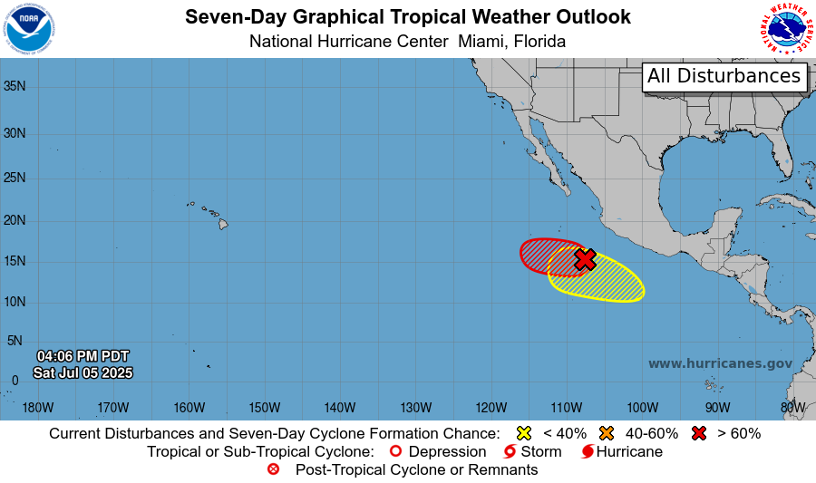
In the eastern Pacific, we are running through named storms very quickly. We have Invest 96E, which has a 60 percent chance of tropical development in the next 48 hours and a 70 percent chance in the next 7 days. We also have an area to watch right over 96E, which has lower chances of development – only 0-20 percent.
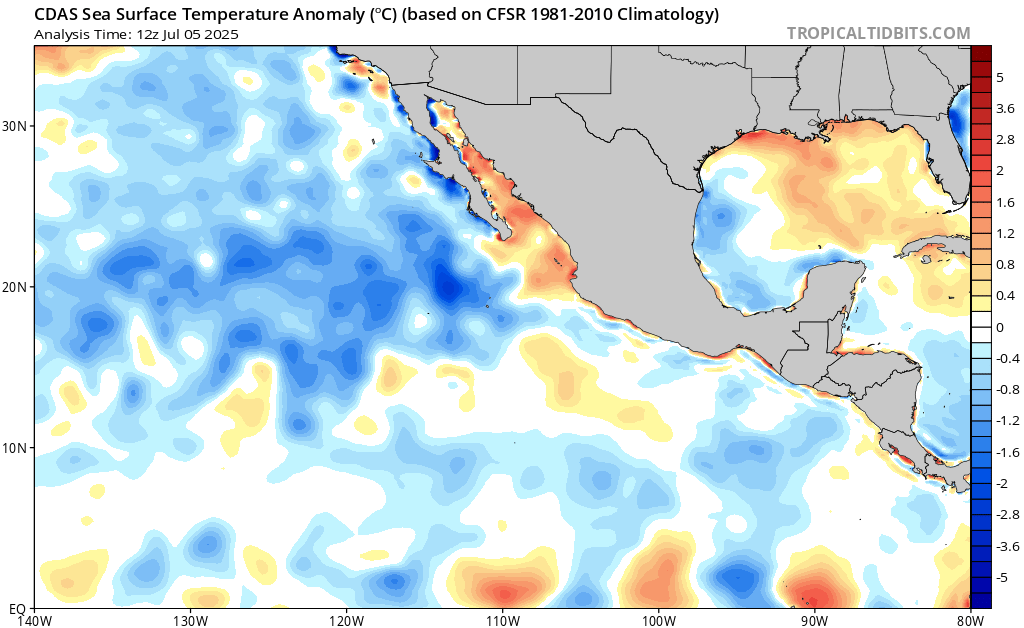
Sea surface temperatures are responding to the increased tropical activity in the basin. With each system we have seen, they have churned up the sea, upwelling deeper cooler waters which is bringing the basin closer to average, and in some spots cooler than average. This is why these systems will not become anything too significant if they do develop – their fuel is limited.
Eastern Pacific: Invest 96E
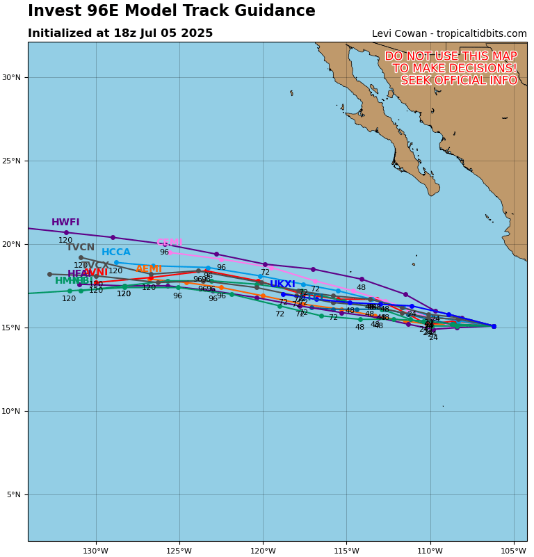
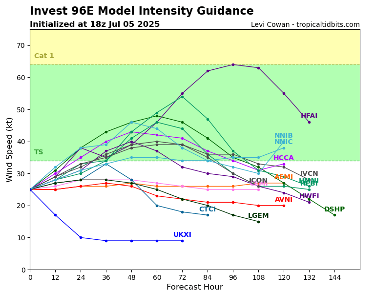
Invest 96E has a decent chance of development, with a majority of the models maxing it out as a tropical storm in the next few days and taking it right out to sea to the west.
Eastern Pacific: Area to watch

Just around 96E is another area to watch by the NHC. This one is not yet an Invest, given its low 0 percent chance of tropical development in the next 48 hours and 20 percent chance in the next 7 days. If this were to form, models have it tracking a similar path to 96E. We will be keeping an eye on both of these systems.
Continue to check back for the latest updates!


