Hi everyone! We’re tracking three areas in the Atlantic. One is off the coast of Africa and could slowly develop as it moves west. The other is off the Southeast U.S. coast with low chances of forming as it drifts north. Tropical Storm Dexter is slowly strengthening and could briefly become a hurricane before weakening and transitioning into a non-tropical system later this week in the open north Atlantic. The Gulf and Caribbean are quiet for now. In the Pacific, Tropical Storms Ivo and Henriette are expected to stay over open water. Let’s look into the details:
Atlantic Basin Setup
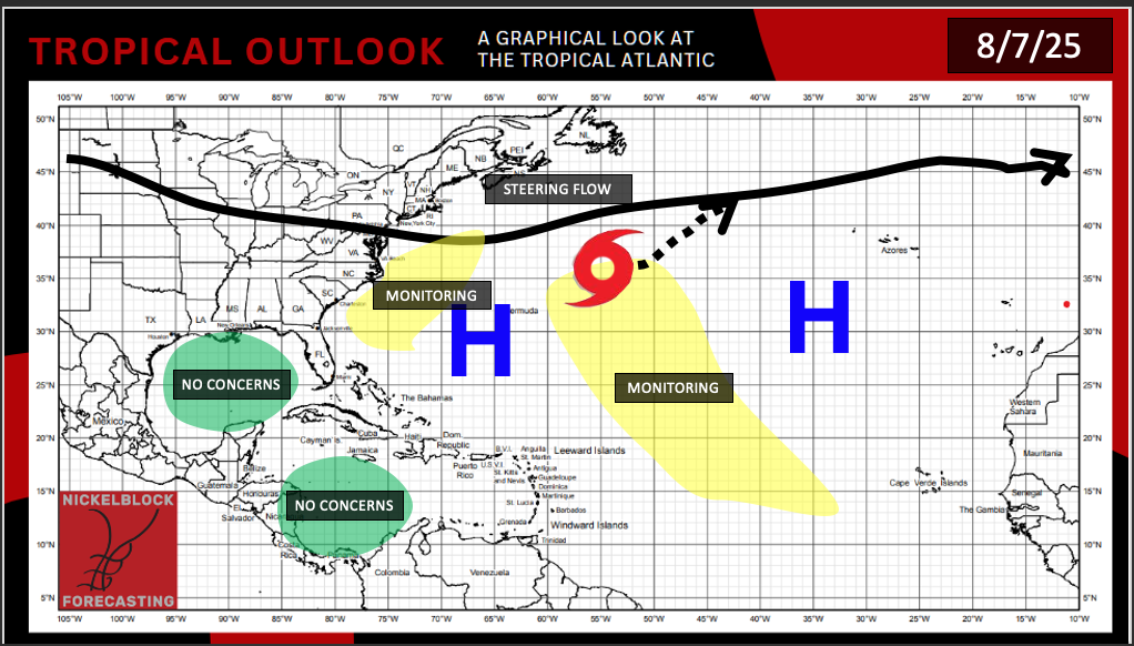
Here’s a look at the latest tropical outlook in the Atlantic. We’re currently monitoring two areas in the Atlantic for possible development. One is in the eastern Atlantic and the other is closer to the Southeast U.S. coast. Neither pose an immediate threat at this time, but we’ll be watching how the high pressure and steering flow set up. The Gulf and Caribbean remain quiet with no concerns for now.
Tropical Storm Dexter – Atlantic
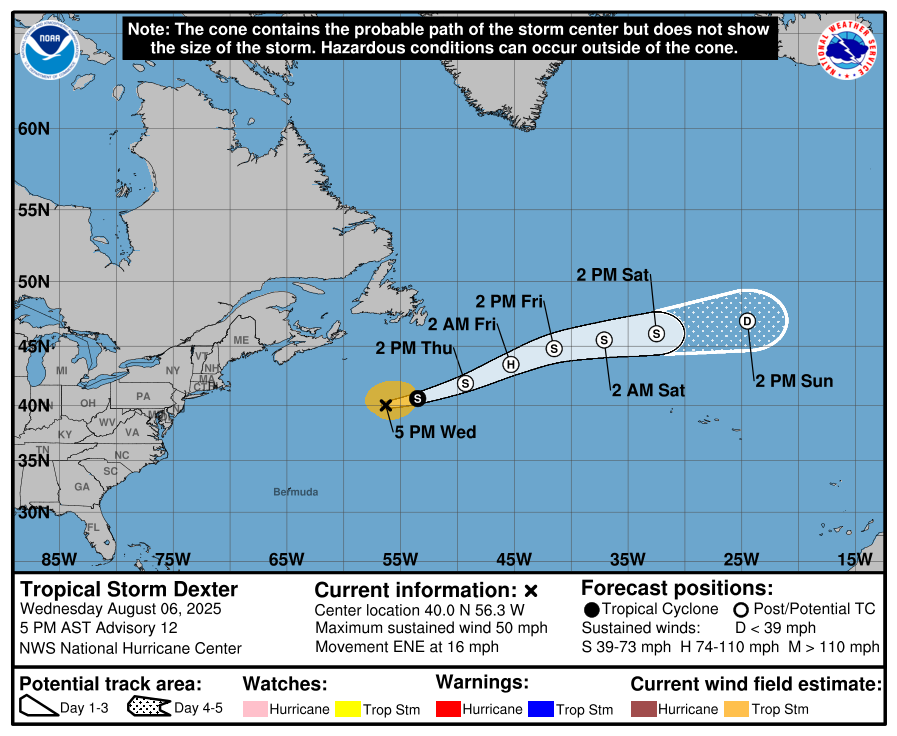
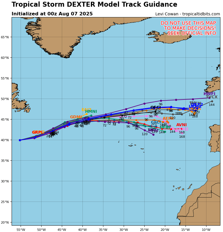
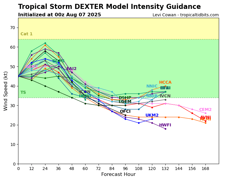
Tropical Storm Dexter is currently out in the open Atlantic, moving east-northeast at 16 mph with winds of 50 mph. It’s dealing with strong wind shear and starting to lose its organization from it’s center low. Dexter is expected increase it’s strength, though, to a weak Category 1 Hurricane by Friday. It’ll slowly weaken and linger into early next week as it stays out to sea. No threat to land is in the forecast.
Invest 96L – Atlantic
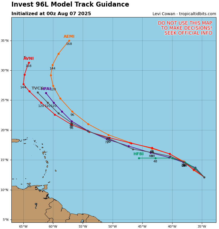
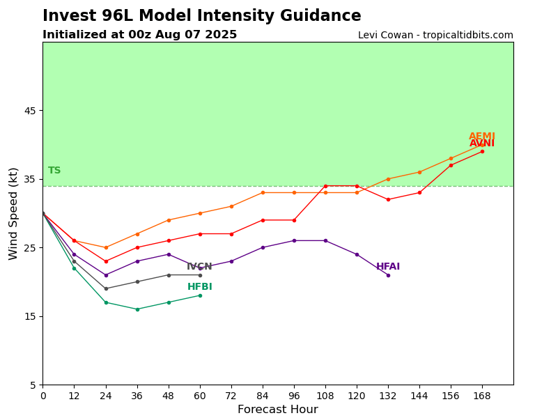
A tropical wave out in the eastern Atlantic is kicking up a large area of disorganized showers and storms. Conditions could gradually become more favorable, and there’s a chance a tropical depression forms later this week or over the weekend as it tracks west-northwest to northwest across the central Atlantic. Some long-range model runs bring it closer to the southeast, but that’s still way out and highly uncertain. A lot will depend on where high pressure sets up over the Atlantic. For now, development odds sit at 30% over the next 2 days and 60% over the next 7.
Area to Watch – Atlantic
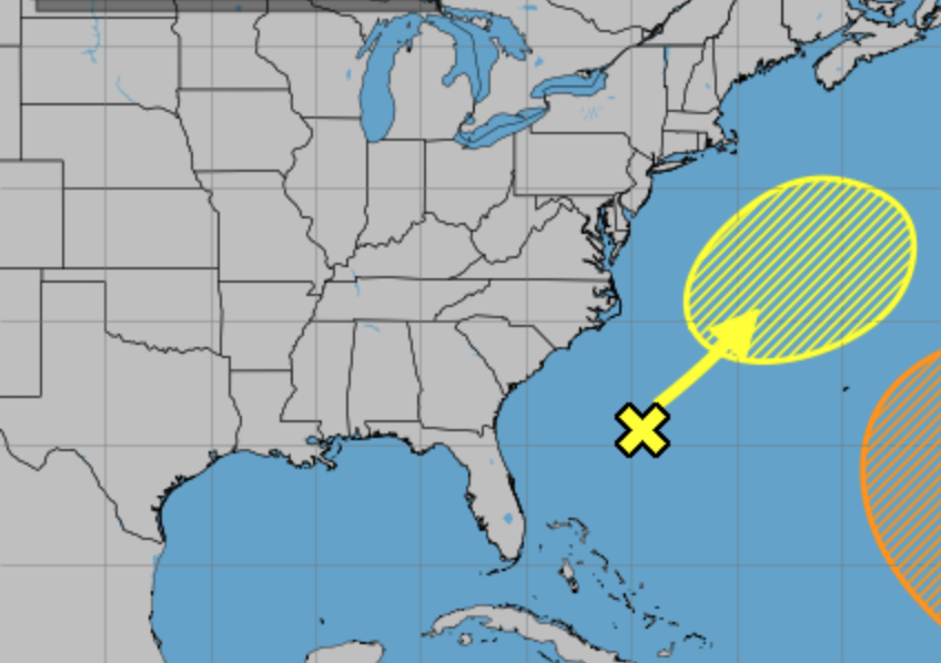
Closer to home, there is an area to watch with a 30 percent chance of tropical development in the next 7 days. A weak area of low pressure sitting a few hundred miles off the Southeast coast is kicking up some disorganized showers and storms. There’s a low chance this could slowly develop into a tropical or subtropical system over the weekend into early next week. Either way, it’ll track north to northeast and stay well offshore of the East Coast. This could be seen in the video above, which shows a piece of energy, wrapped in plenty of moisture, traveling northeast and forming something more organized, potentially a tropical depression or storm.
Eastern/Central Pacific Setup
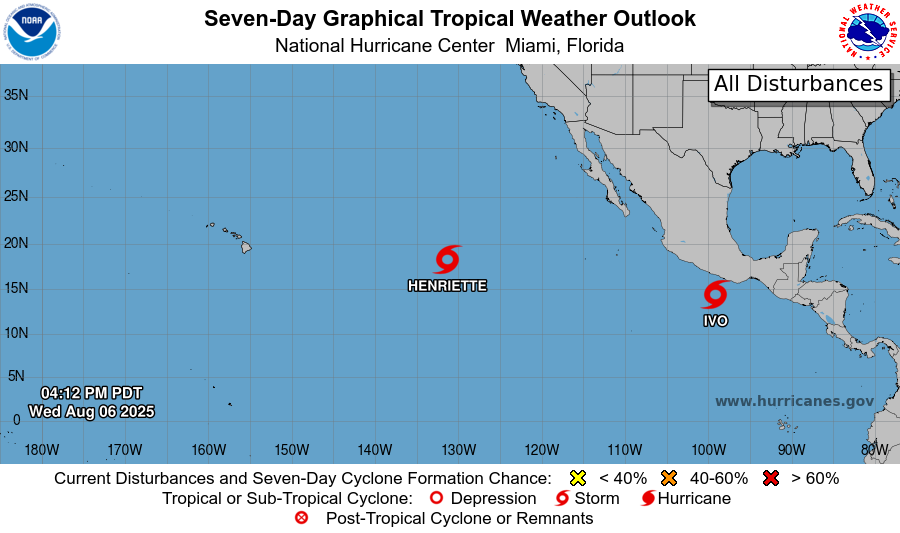
There are currently two named storms in the Eastern Pacifc; Tropical Storm Henriette and Tropical Storm Ivo. Both are not expected to make landfall anywhere, but could impact surrounding land with some rain. Let’s look into each storm:
Tropical Storm Henriette – Pacific
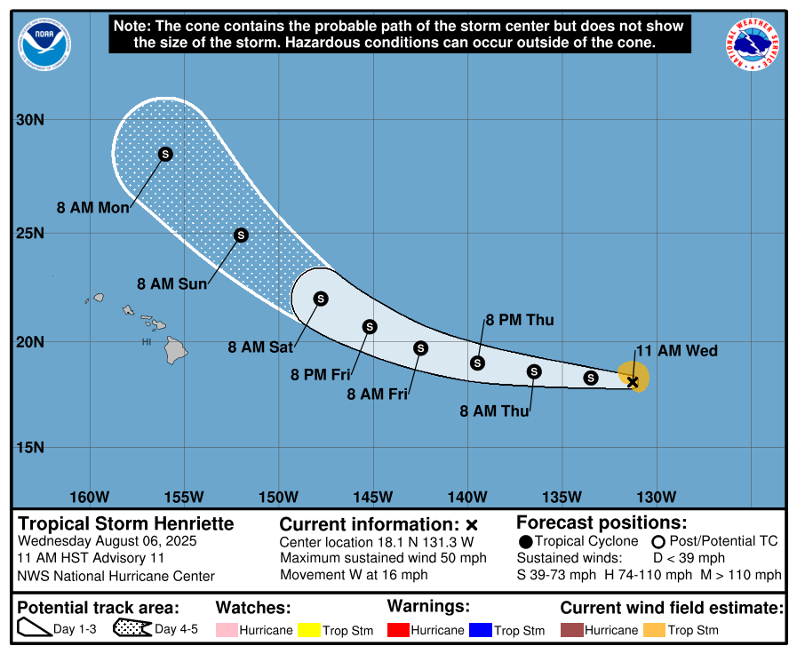
Henriette is a weak tropical storm, with maximum sustained winds at 50 mph, moving to the west northwest at 16 mph. It is losing quite a bit of its organization with it’s convection visibilly winding down. The storm is expected to gradually weaken over the next few days, but could increase strength a little bit after passing by Hawaii, due to an energy transfer from a passing trough.
Tropical Storm Ivo – Pacific
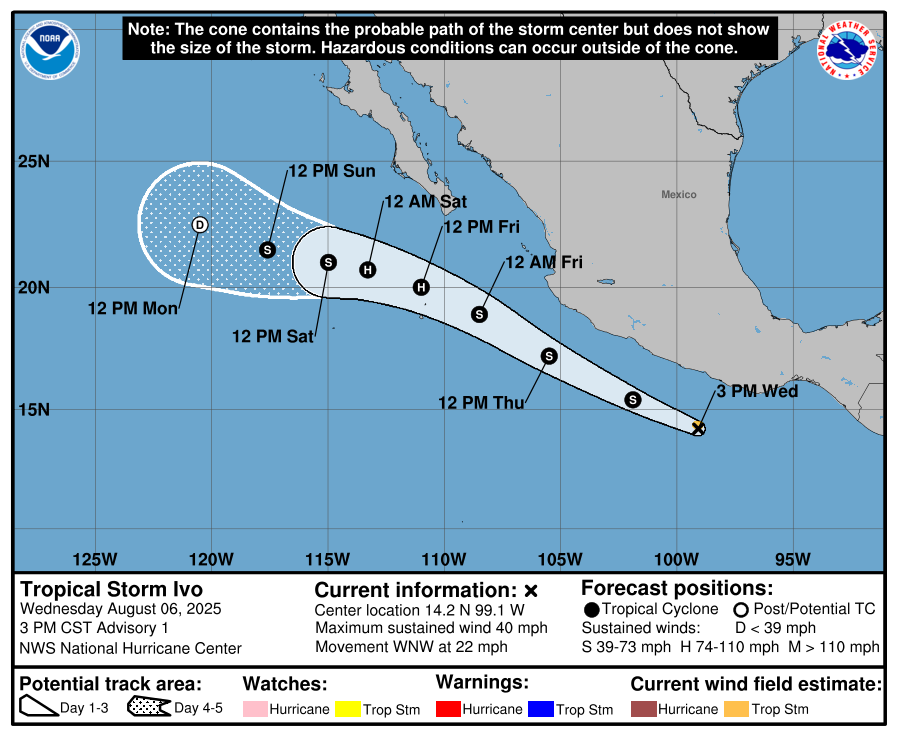
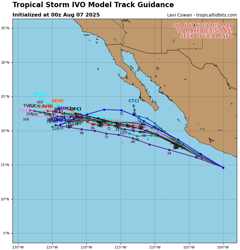
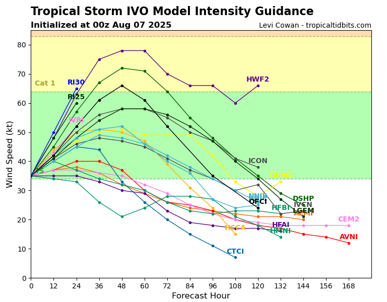
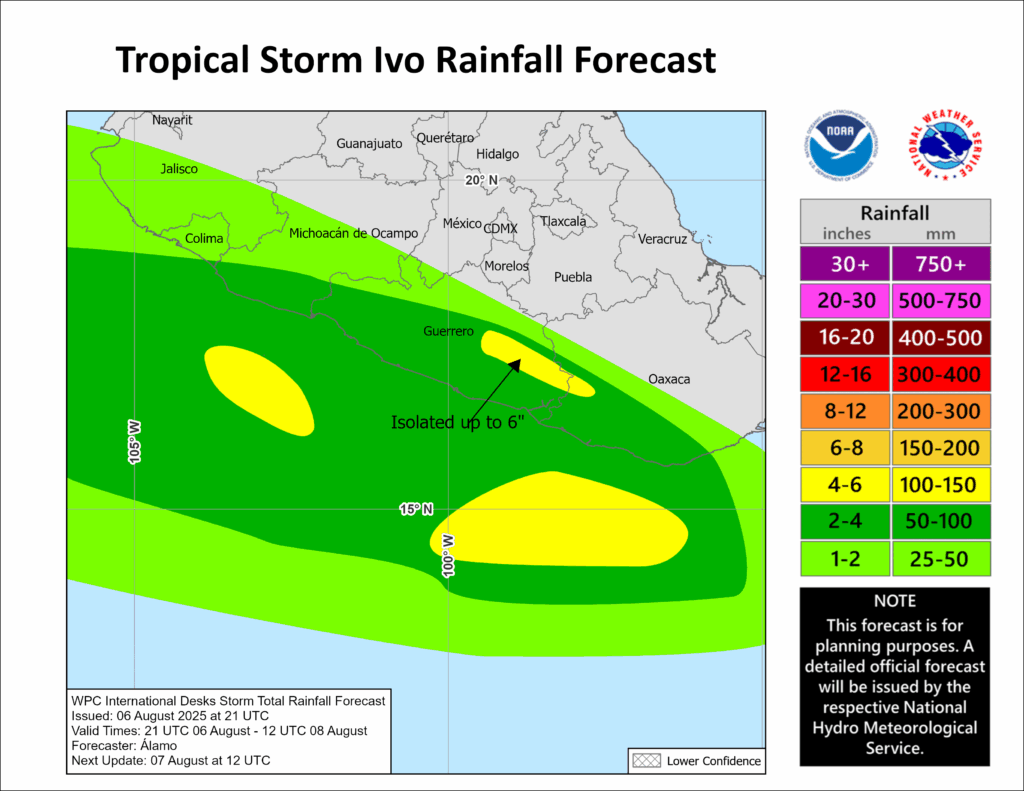
Tropical Storm Ivo currently has maximum sustained winds of 40 mph, moving west northwest at 22 mph. There is a lot of convection with the storm, and it is expected to strengthen in the coming days to a Category 1 Hurricane by Friday. The limiting factor for the storm not rapidly intensifying into a major hurricane is the high wind shear and stable environment it will travel into. While landfall is not expected, heavy rainfall and isolated tropical storm wind gusts are the likely impacts for the southwestern Mexican coast. Up to 6 inches locally could fall, which poses the threat for flooding and mudslides.
Continue to check back for the latest updates!


