If you look further up northwest around Arkansas to Missouri, you’ll notice a High (5/5!) risk for tornadoes and severe weather! There is a very optimal setup for tornadoes and historic flooding in the mid-South to the Mississippi/Ohio River valley. If you know anyone in that part of the country, contact them and make sure they’re safe because this will be a chaotic next several days for them.
If you haven’t noticed, it’s quite warm and humid outside. This is thanks to the inflow of moisture from the Gulf of Mexico due to the surface low clashing with an Atlantic high. This will lead to an optimal setup across the western part of the Deep South for severe weather closer to the weekend. We’ll see a slight chance of storms by Friday and a chance for severe weather Saturday evening into Sunday morning.
Tonight will be muggy as we’ll fall into the low 70s with some patchy fog possible into the morning hours. Thursday will be another warm and humid one with a mix of clouds and highs in the mid 80s. Winds will pull out of the south southeast around 10-15mph and wind gusts up to 30. Overnight, we’ll have a cloudy one with lows in the low 70s again. Friday will have a slight chance of storms moving in from the south especially in the afternoon. These look to be conditional, but still something to watch out for. We’ll reach the mid 80s and windy again.
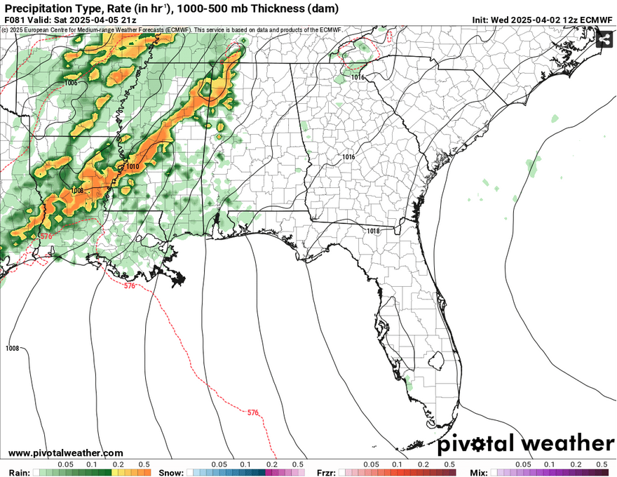
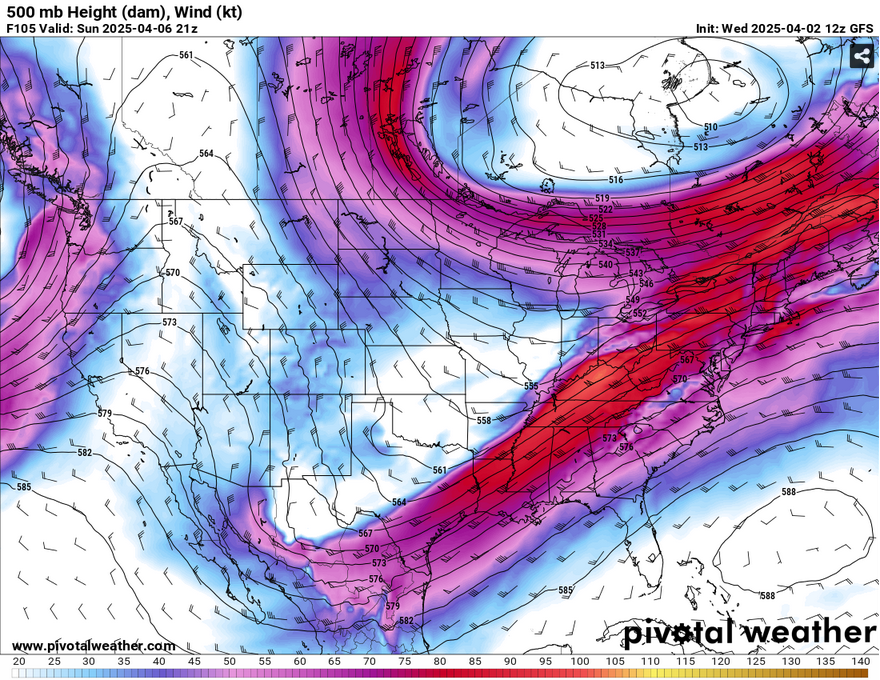
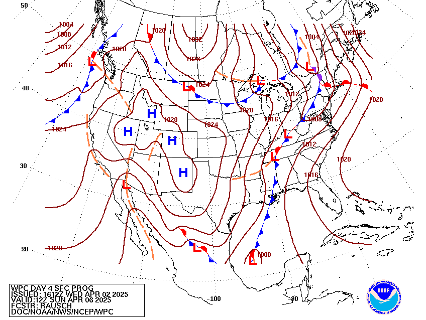
Starting Saturday, the Storm Prediction center has put us under a slight risk for severe weather. While most of it will be to our northwest in the ArkLaMiss part of the Mississippi River valley, we’ll likely see some storms. Judging by the GFS and European model output, the main concern for us may be some cells that form ahead of the storm in the afternoon and evening. Both models differ on the timing of the main line. The line looks to weaken a bit as it stalls over us from the evening to overnight hours.
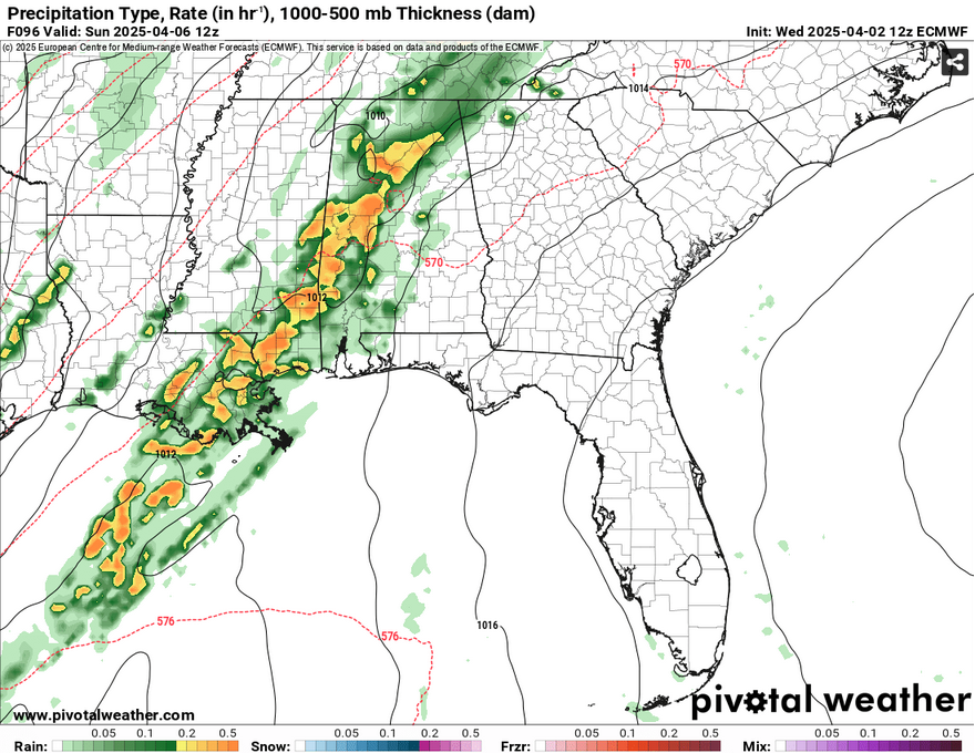
Our main concern for these storms would be heavy rain, localized flash flooding, straightline winds, and a possible tornado. I wouldn’t be surprised if we see a possible tornado in the leading cells as well as the main line, so please stay prepared going into Sunday morning. The rest of the line looks to hang around into the afternoon hours before the main cold front moves in. Afterwards, we’ll see temperatures begin to cool down. We’ll see highs in the low 70s and winds shift from the south to the northwest.
The cooler weather is thanks in part to the trough that will bring the severe weather. This thing is fairly amplified, and an amplified ridge is soon to follow from the western US keeping the north winds blowing. While this won’t last forever, it’ll feel much better outside next week than it has for most of this week.
Afterwards, Monday will be quite cool with temperatures in the upper 40s in the morning with partly cloudy skies. Overnight, we’ll dip even further into the mid 40s. Tuesday will be a milder one with temperatures reaching the upper 60s to around 70 with north northwest winds and barely a cloud in the sky. Overnight, the temperature will reach the mid 40s again with winds shifting to the east. Wednesday will be a similar story with fair skies and temperatures reaching the low 70s with east winds.
[wpcode id=”41179″]
Regional Day-to-Day Forecast
This Afternoon – Mostly sunny, with a high in the mid 80s. South wind around 20 mph, with gusts as high as 35 mph.
Tonight – Increasing clouds, with a low in the low 70s. South southeast wind 10 to 15 mph, with gusts as high as 30 mph.
Thursday – Patchy fog before 8am. Otherwise, cloudy, then gradually becoming mostly sunny, with a high in the mid 80s. South southeast wind 10 to 15 mph, with gusts as high as 30 mph.
Thursday Night – Increasing clouds, with a low in the low 70s. South southeast wind 10 to 15 mph, with gusts as high as 25 mph.
Friday – A 20 percent chance of showers and thunderstorms after 1pm. Mostly cloudy, with a high in the mid 80s. South southeast wind 10 to 15 mph, with gusts as high as 25 mph.
Friday Night – Mostly cloudy, with a low around 70. South southeast wind 10 to 15 mph, with gusts as high as 25 mph.
Saturday – A slight chance of showers, then a chance of showers and thunderstorms after 1pm. Some of the storms could be severe. Mostly cloudy, with a high in the mid 80s. South wind 10 to 20 mph, with gusts as high as 30 mph. Chance of precipitation is 30%.
Saturday Night – A chance of showers and thunderstorms, then showers likely and possibly a thunderstorm after 1am. Some of the storms could be severe. Mostly cloudy, with a low in the mid 60s. South wind 10 to 15 mph, with gusts as high as 25 mph. Chance of precipitation is 70%.
Sunday – Showers and possibly a thunderstorm, mainly before 3pm, then a chance of showers and thunderstorms after 3pm. High in the low 70s. Southwest wind around 10 mph becoming northwest in the afternoon. Winds could gust as high as 20 mph. Chance of precipitation is 80%.
Sunday Night – A 40 percent chance of showers, mainly before 3am. Mostly cloudy, with a low around 50.
Monday – A 20 percent chance of showers. Partly sunny, with a high in the upper 60s.
Monday Night – Partly cloudy, with a low in the mid 40s.
Tuesday – Sunny, with a high near 70.


