Hello everyone! I hope you all enjoyed Memorial Day weekend! Severe weather continues to be the main story for the southern CONUS, with severe weather likely for the region through Wednesday. Troughing in the east will keep the region cooler than average and will come with an increased chance of rain, while ridging out west will keep the region hot and dry – until the pattern flips next week. Let’s take a look at the setup:
[wpcode id=”41149″]
Today’s Overall Setup
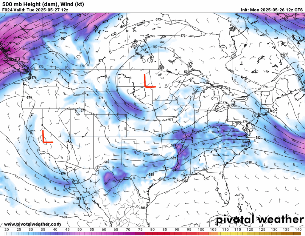
Taking a look at the mid-levels of the troposphere, there is overall messy setup, with areas of low pressure over the northern plains and over the west coast. Mid-level winds and troughing are sufficient for supporting the severe weather expected in the MS/AL/GA region, as well as the area in southwestern Texas.
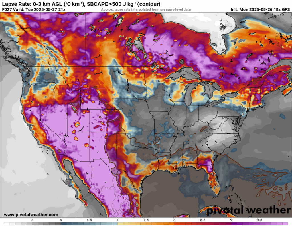
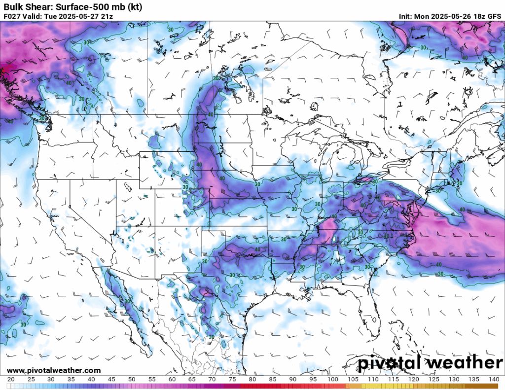
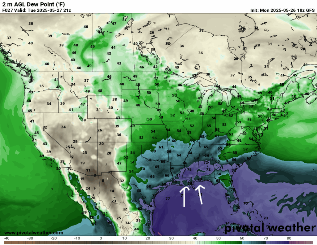
Wind shear is present to get those supercells going, but not the highest, so the tornado risk is lower, but still not zero. Dew points well into the 60’s and 70’s are also helping the environment become primed for some deep moist convection. Lapse rates are elevated in the region, meaning the atmosphere is unstable, so any air that rises will continue to rise, which forms those tall 40K feet cumulonimbus clouds!
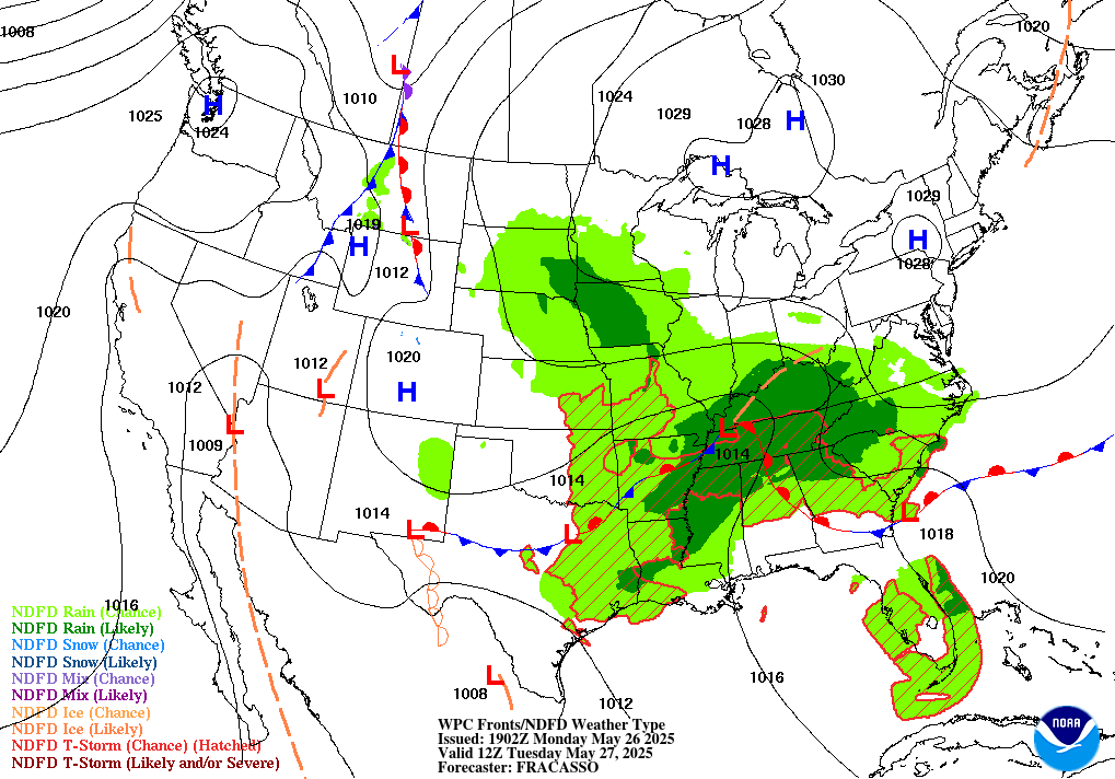
The forecast surface analysis for 12z today from the WPC shows a series of low pressure systems from west Texas through the Tennessee Valley, extending to the South Carolina coast. These low pressures are linked through cold fronts and stationary fronts, which is the lifting mechanism that will be firing up the severe storms through the day today and into Wednesday. These boundaries will be slow moving – which will keep the southeast wet and keep up the chances for severe weather for at least the next 2-3 days.
[wpcode id=”41149″]
Southern Severe Weather
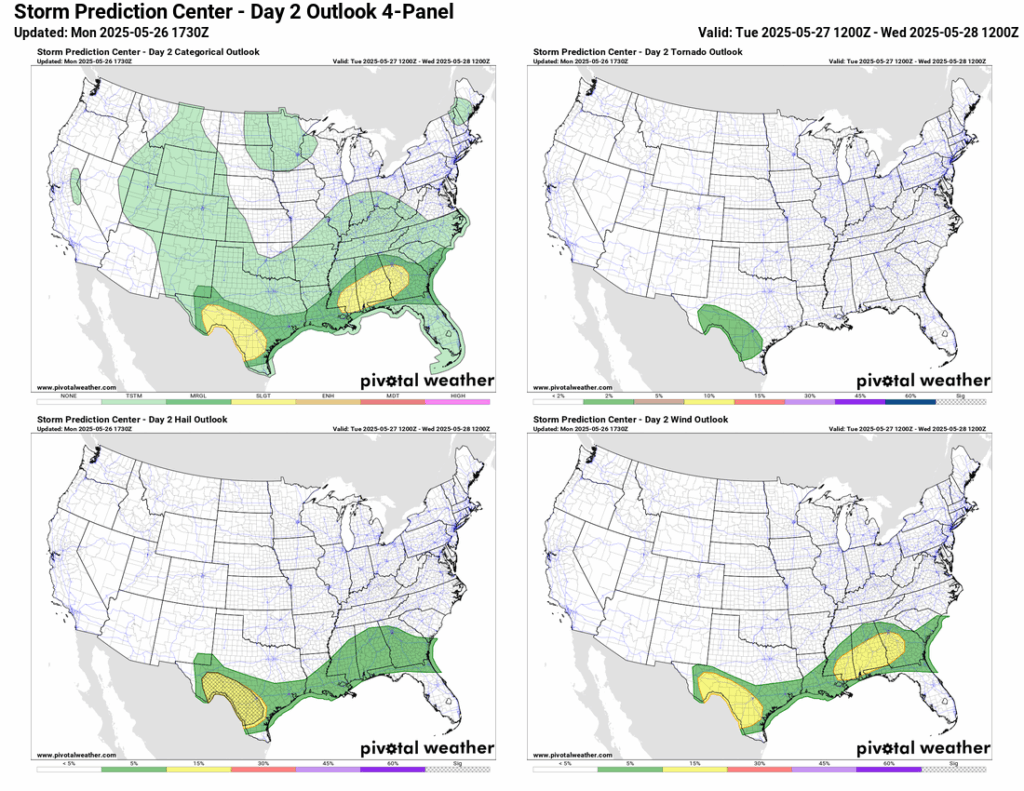
The above 4-Panel plot shows the SPC Severe Storm Risk for Tuesday, showing a Slight (2/5) risk of severe weather for parts of MS/AL/GA as well as southeastern Texas. While the tornado risk seems to be low, almost minimal in the southeast, there will still be a risk of severe large hail and damaging winds for the highlighted areas. Hail risk is maximized in southeastern Texas, where we have a hatched 15% risk of hail – hatched meaning there is a 10% or greater chance of two-inch or larger hail within 25 miles of a point
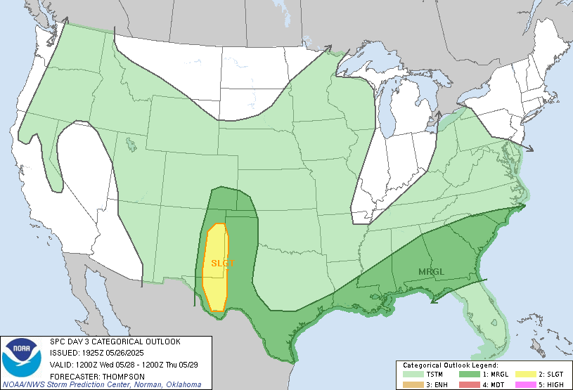
As we can see above, Wednesday seems to be another day of severe weather for the south. The southeast has decreased it’s threat to a Marginal (1/5) risk, and the Slight (2/5) risk has changed shape in eastern New Mexico and extreme western Texas – due to a classic dryline setup that will be taking place. Non-severe thunderstorms are possible in the light green shaded areas, which covers most of the country – mostly due to that unsettled pattern mentioned earlier. We will be keeping our eye on the severe weather for the next few days, so stay tuned for the latest updates!
[wpcode id=”41149″]
Western United States
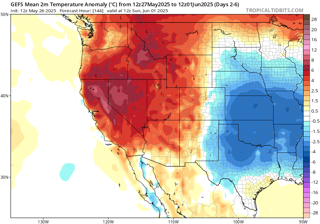
The ridge in the west will persist all of this week through Sunday, keeping the lid on the atmosphere and temperatures 5-15 degrees warmer than average. Early next week, the ridging will move east and troughing will advect to the west coast as the overall pattern shifts. This is when you can expect a cool down and less of that extremely dry desert heat! While it will still be hot, it will not be nearly as hot as this week will be.
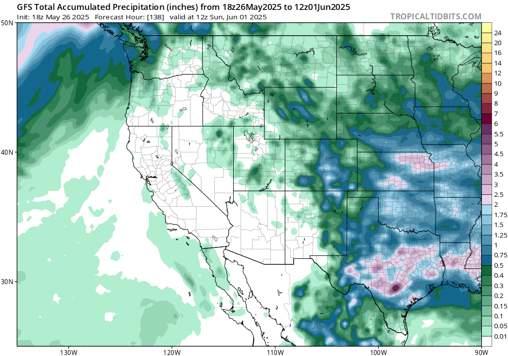
In terms of precipitation, very little precipitation is expected in the western CONUS, with just light amounts of precipitation to the west of the Rockies. The dryness is again due to the ridging in the region, which means there won’t be much rain to alleviate the extreme heat!
[wpcode id=”41149″]
Central United States
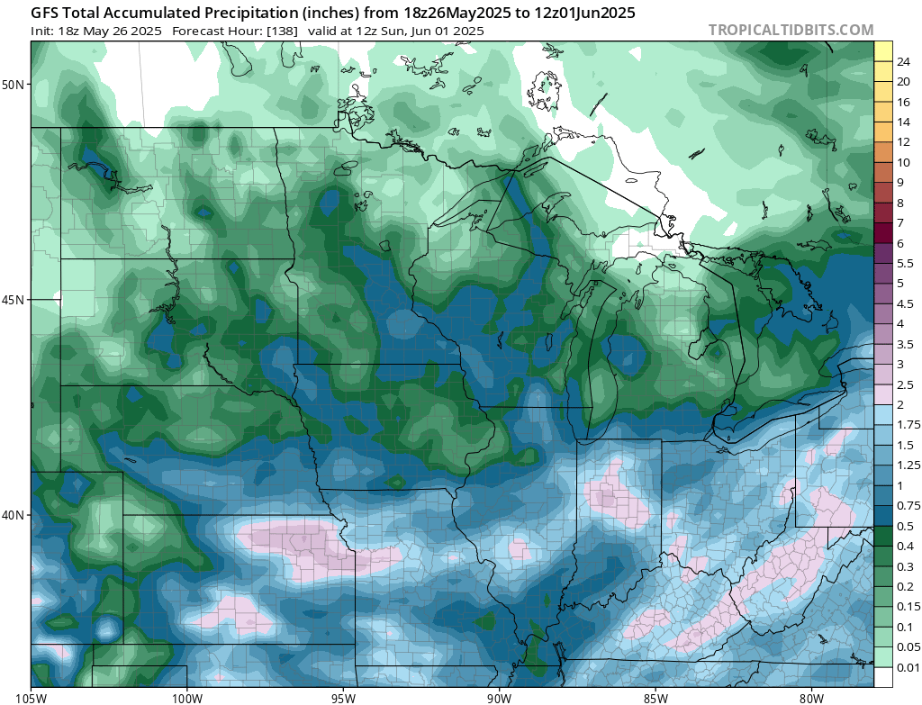
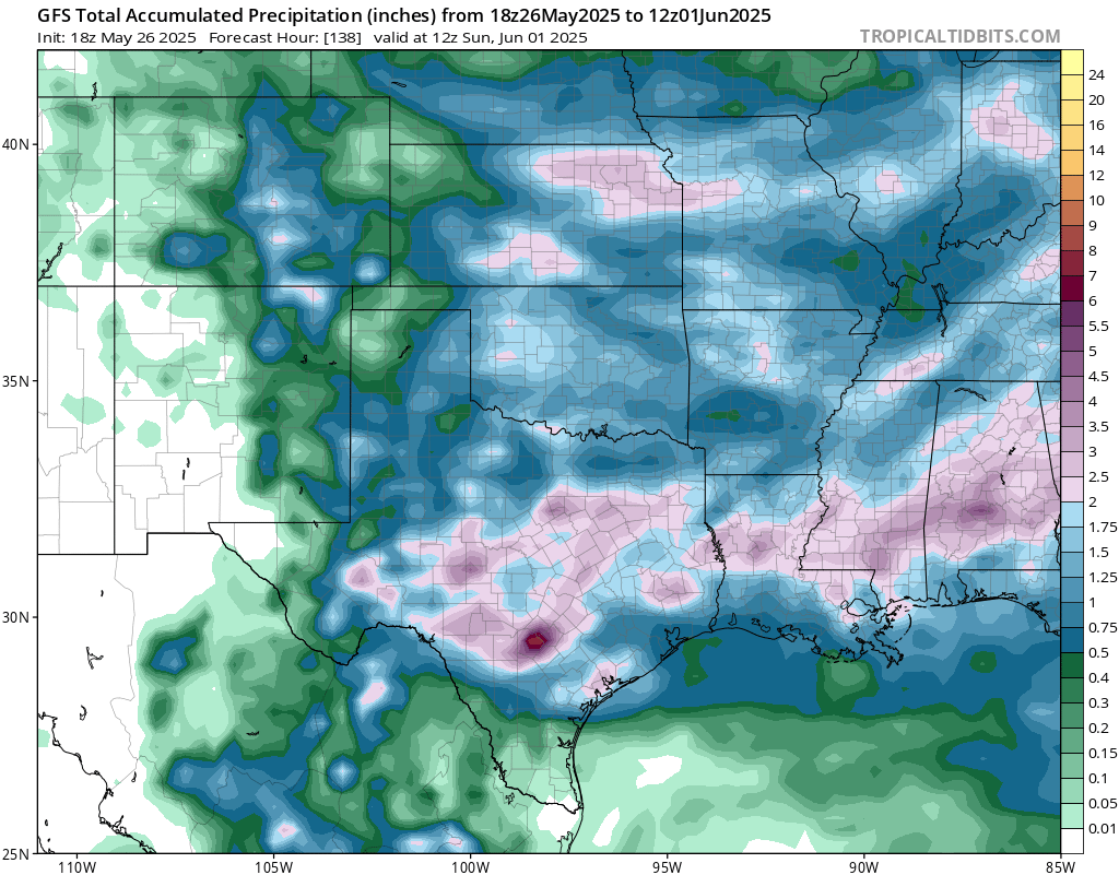
The Central United States will see their fair share of rain through Sunday, with most of the rain in the lower plains into Texas. This is mainly due to the stalled out fronts that are in place for today and Wednesday, as well as a series of shortwave troughs moving through the region underneath the large scale troughing.
[wpcode id=”41149″]
Eastern United States
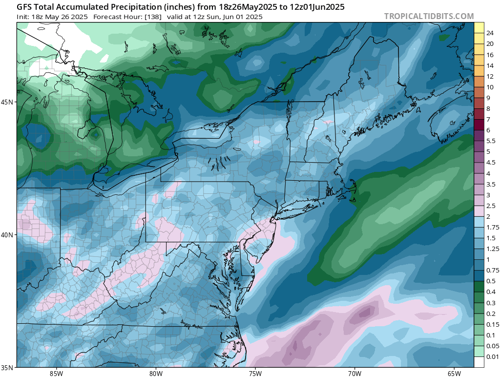
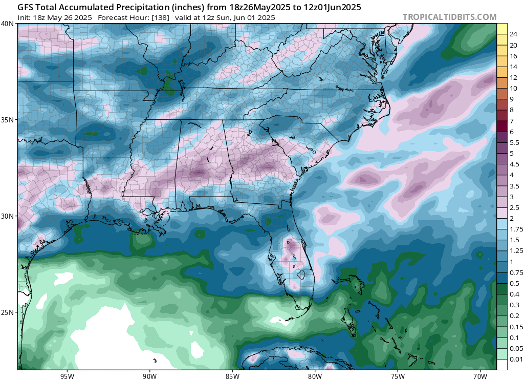
The eastern half of the country will also be seeing lots of precipitation through Sunday, with chances of rain each day in the forecast. The stalled front and shortwave troughs are also responsible for this pattern here in the east region.
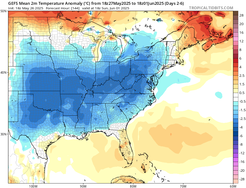
Temperatures will feel much cooler than average in the east, with temperatures around 5 degrees below the average, again thanks to the troughing in the region. There should be some feel of relief from the early start of summer-like temperatures that have penetrated the region.
[wpcode id=”41149″]
Travel Outlook
With severe weather today and Wednesday, travel will be impacted from western New Mexico through San Antonio to New Orleans through Atlanta. Drive with caution if you’re heading out on I-10 or I-25 for today and Wednesday and stay weather alert while traveling through these areas! Remember, follow the safety directives of the NWS to stay safe – such as not sheltering under an overpass if you come across a tornado on the highway.
High winds may cause travel issues in southern California. North winds 20 to 30 mph with gusts up to 50 mph are expected through the morning today in Santa Barbara County Southwestern Coast and Santa Ynez Mountains Western Range.
[wpcode id=”41149″]
Extended Outlook
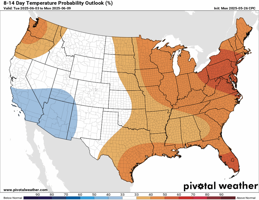
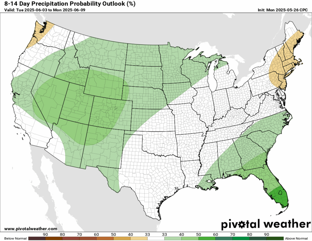
For the first week and into the beginning of the second week of June, the Climate Prediction Center is forecasting a pattern that contrasts with this week’s conditions. Temperatures are expected to be near or slightly below average with wetter conditions in the west, while the south through the northeast will see warmer temperatures with near-average precipitation. The southeast may be slightly wetter. This shift is due to increased ridging over the east and more troughing over the west.
Thanks for tuning in to this National Forecast! Tune in to our local, tropical, and regional forecasts to stay updated on the latest!


