A soggy pattern continues across the Gulf South as a stalled front and persistent Gulf moisture fuel daily rounds of showers and thunderstorms. While the first half of the week will be stormy and humid, a gradual drying trend is expected by the weekend as the front finally lifts out and high pressure builds in.
This Week’s Set Up
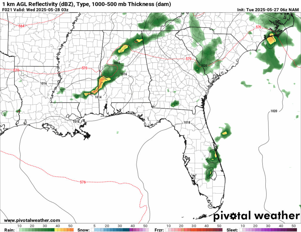
Rain chances for Tuesday night from the NAM model //Courtesy: Pivotal Weather
A stubborn frontal boundary draped across the Deep South will keep the region locked in a stormy, humid pattern through much of the week. With Gulf moisture surging northward and upper-level disturbances riding along the stalled front, expect frequent rounds of thunderstorms, especially during the afternoon and evening hours from Tuesday through Friday.
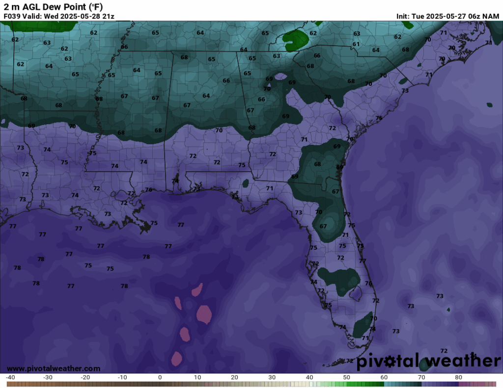
Dew Points for Wednesday evening from the NAM model //Courtesy: Pivotal Weather
For today (Tuesday), a weak upper-level impulse interacts with the stalled front and abundant Gulf moisture. Scattered to widespread thunderstorms develop by midday, especially inland, then drift southeast. Gusty winds, frequent lightning, and heavy downpours. Localized flooding is possible in poor drainage areas. On Wednesday, a stronger upper-level disturbance moves in, enhancing lift and storm coverage. Widespread showers and thunderstorms, especially in the afternoon and evening. This is likely the wettest day of the week. Torrential rain, lightning, and isolated strong wind gusts. Urban and low-lying areas may see brief flooding.
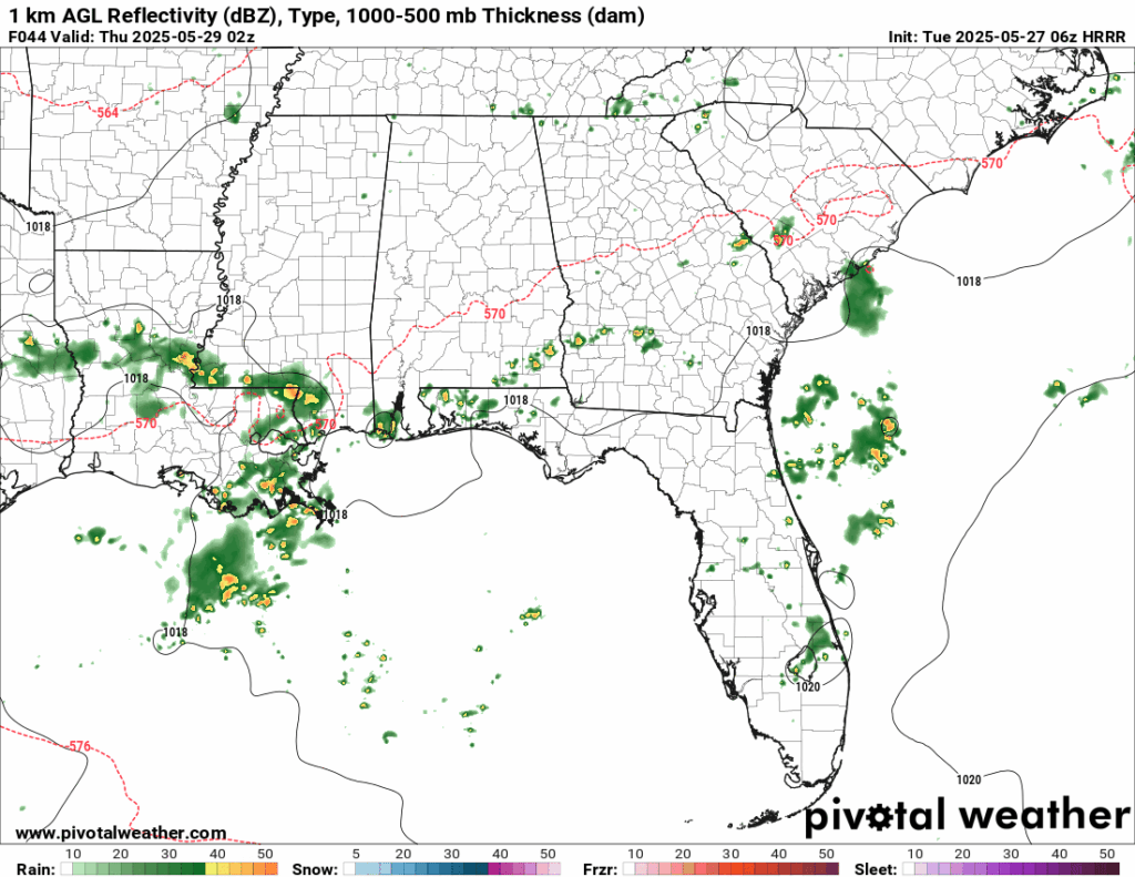
Rain chances for Wednesday evening from the NAM model //Courtesy: Pivotal Weather
Thursday, the main front begins to sag southward, but a trailing surface low keeps the atmosphere unstable. Scattered thunderstorms continue, especially in the afternoon. Some breaks of sun are possible between storms. Storms may be more isolated than on Wednesday, but they will still be impactful. By Friday, a final wave of energy rides along the front before it exits the region. Showers and thunderstorms are likely, especially in the morning and early afternoon. Lightning, gusty winds, and heavy rain, but coverage should begin to decrease by evening.
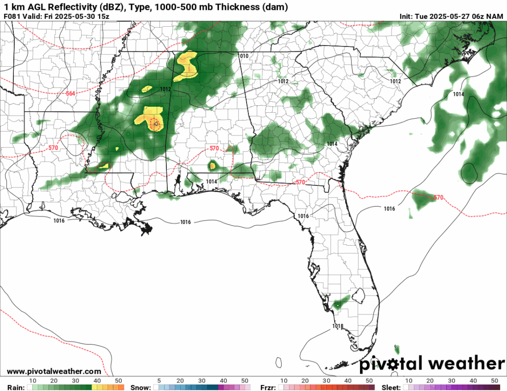
Rain chances for Friday morning from the NAM model //Courtesy: Pivotal Weather
Regional Day-to-Day Forecast
This Afternoon – Expect partly sunny skies with scattered thunderstorms developing by late morning and continuing through the afternoon. Some storms may be strong with heavy rain and gusty winds. The high will be in the low 90s with a 60% chance of rain. South winds from 5 to 10 mph.
Tuesday Night – Storms taper off after sunset, but a few showers may linger before midnight. Skies become mostly cloudy with patchy fog possible by early morning. The low will be around 70, with a 40% chance of rain.
Wednesday – A very active weather day. Showers may begin in the morning, but widespread thunderstorms are expected in the afternoon. The high will be in the upper 80s, with a chance of rain at 90%. Winds will be clam out of the southwest at 5 mph.
Wednesday Night – Storms gradually diminish, but scattered showers and rumbles of thunder may persist into the evening. Skies remain mostly cloudy. The low will be in the upper 60s with a 40% chance of rain.
Thursday – Partly sunny with scattered thunderstorms developing by midday. These will be more isolated than Wednesday but still capable of producing brief heavy rain. The high will be in the mid to upper 80s with a 60% chance of rain. Winds will be calm out of the southwest at 5 mph.
Thursday Night – A few lingering showers or storms early, then mostly cloudy and calm overnight. The low will be in the upper 60s with a 30% chance of rain.
Friday – Another round of showers and thunderstorms likely, especially in the morning and early afternoon. This is the last major rain event before the pattern shifts. The high will be in the mid 80s with a 60% chance of rain. Winds will be light and variable.
Friday Night – Storms clear out, leaving partly cloudy skies and cooler, drier air settling in. The low will be in the low to mid 60s, with a 20% chance of rain.
Saturday – Mostly sunny with just a slight chance of an isolated afternoon storm. Much more pleasant with lower humidity. The high will be in the mid 80s with a 30% chance of rain. There will be a light breeze most of the day.
Saturday Night – Mostly clear and comfortable. The low will be in the low to mid 60s.
Sunday – Mostly sunny and warm with only a slight chance of a pop-up storm in the afternoon. The high will be in the upper 80s, with a 20% chance of rain. Winds will be calm the majority of the day.
Sunday Night – Clear to partly cloudy and mild. The low will be in the mid 60s.


