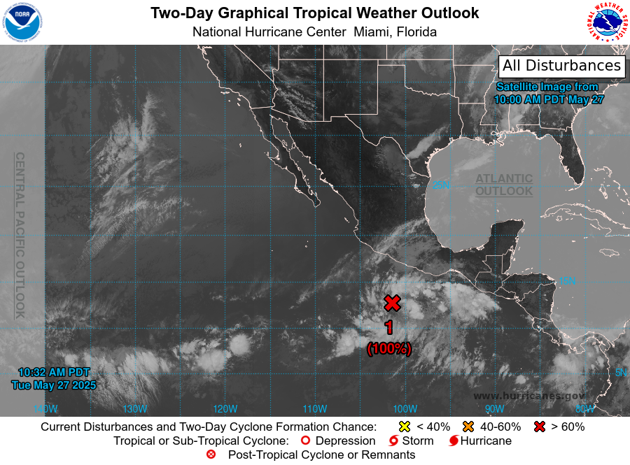
Hello everyone! Although there is no tropical activity in the Atlantic as of right now, there is one tropical disturbance situated in the Pacific Ocean, South of Acapulco, Mexico. The National Hurricane Center has raised the chance of this disturbance forming into a cyclone in the next week from a 90% chance on Monday to 100% chance on Tuesday. In fact, this disturbance is likely to form into a cyclone 48 hours from Tuesday, so it will be important to keep a close eye on this disturbance in the next couple of days.
[wpcode id=”41149″]
Analyzing this Disturbance
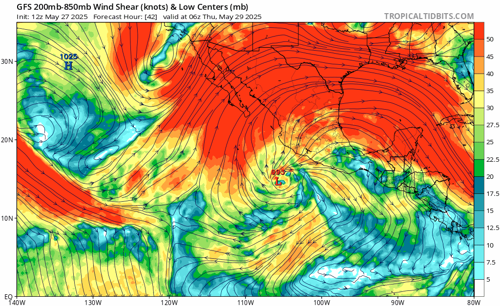
Now that the NHC has raised the chance of this disturbance developing into a tropical cyclone to 100% where will it go? Looking at the image above, we can see the disturbance beginning to circulate as a low pressure zone, moving Northwest at around 10mph. Following this low pressure system through the next few days, it travels Northwest up the coast of Mexico, and could possibly make landfall on Mexico around Saturday morning. Although, it is important to keep in mind that many of the ensemble members do not show this disturbance making landfall.
If this system does make landfall, which at this point is unlikely, but shouldn’t be ruled out, safety concerns would include high winds, storm surge, flooding, and even tornadoes. If these conditions are possible, watches and/or warnings will be put out, but as of right now there are no watches or warnings in the area.
[wpcode id=”41149″]
Future Development and Possible Threats
As for current conditions in the Pacific, the ingredients needed for a good tropical cyclone are there. Ocean temperatures in the area are high, with temperatures staying above 85 degrees Fahrenheit. These warm seas surface temperatures will drive the energy of this disturbance, helping it to intensify into a cyclone. Along with these warm ocean temperatures, relative humidity is high in the concerning area. Additionally, wind shear in the area is low and the showers and thunderstorms within the disturbance are beginning to organize.
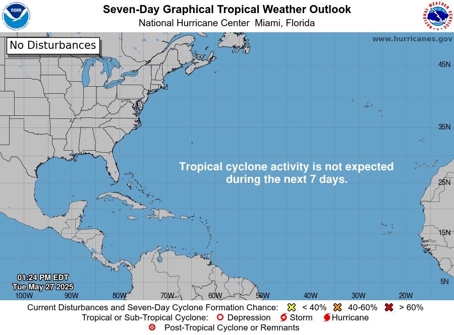
On the other hand, the Atlantic is showing no signs of a possible tropical disturbance within the next week. This is expected, as it would be quite early for tropical activity to be present in the Atlantic right now. Hurricane season in the Atlantic will be officially starting up on June 1st, and further into the summer season we should expect more activity in that area. So for now, there shouldn’t be much to worry about in the Atlantic, but it will be important to monitor the current disturbance in the Pacific.
[wpcode id=”41149″]
Final Thoughts
Overall, we will most likely have to wait a few more weeks to see any tropical activity in the Atlantic, but it will be crucial to keep an eye on the disturbance in the Pacific to see how it evolves. Current environmental conditions in the Pacific support the possibility of this disturbance intensifying rapidly, but landfall is unlikely. If landfall does occur, it will most likely hit the coast of Mexico. Seeing a tropical disturbance this early may be a sign of a busy hurricane season ahead, especially with warmer than average ocean temperatures, but for now we will wait and see.


