Tropical Storm Alvin is still making its way along the southern coast of Mexico, and a new disturbance is forming in its wake. Currently there is no anticipated tropical activity in the Atlantic for the next week, but now we are officially one day away from Atlantic hurricane season. Let’s see what’s going on with Alvin and the other disturbance in the Pacific, and see how the 2025 Atlantic hurricane season might look.
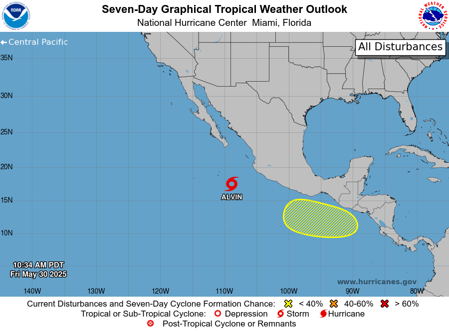
The image above from the National Hurricane center shows the current setup of how the Central Pacific is looking. As you can see, Tropical Storm Alvin is still staying strong below the Southern Coast of Mexico, but now there is another disturbance brewing south of Central America. Let’s take a deeper dive into each event:
Tropical Storm Alvin
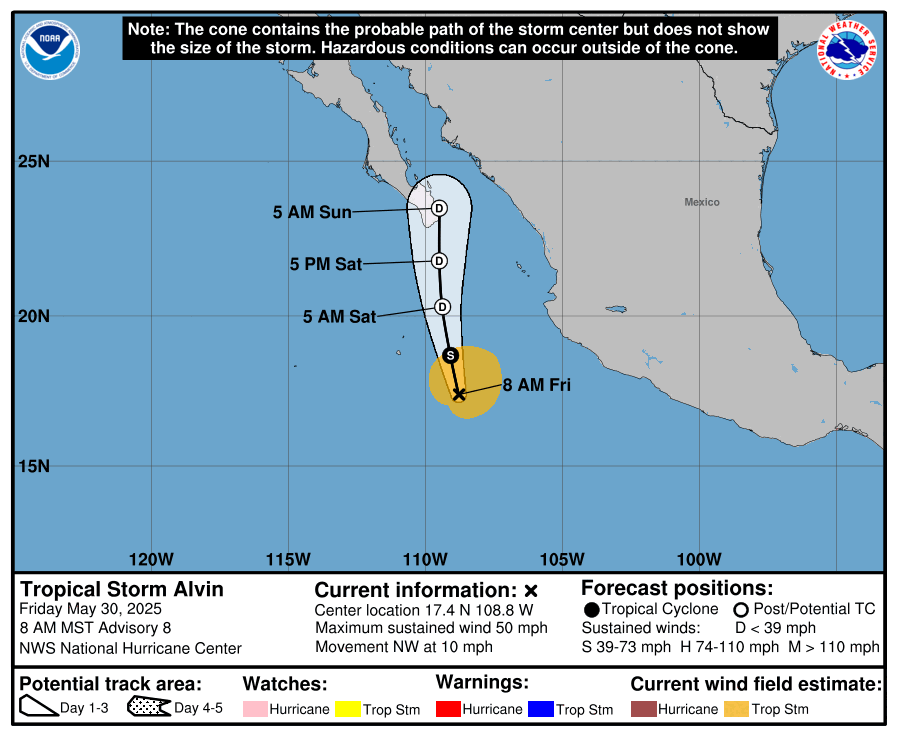
Tropical Storm Alvin was classified as a tropical storm on Thursday, and its maximum sustained wind speed has reached 50 mph. For a disturbance to be considered a tropical storm, its maximum sustained wind speed must be between 39 mph and 73 mph. Alvin is continuing to move in the Northwest direction along the coast at about 10 mph. It is forecasted to make landfall on the southern tip of Baja California Sur early Sunday morning. Fortunately, it is expected to dissipate later on Sunday, hopefully minimizing the amount of damage for those in the area.
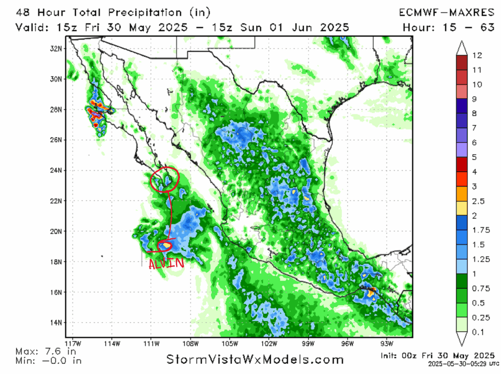
The main concern of Alvin is rain, and the image above shows about 1 and 1/2 inches of rain accumulated from Friday to Sunday morning after Alvin hits Baja California Sur (I’ve denoted in red Alvin’s storm track and where it is expected to make landfall.) Issues like flooding and storm surge shouldn’t be a huge problem with one inch of rain, and we can see that the majority of Mexico will be receiving a similar amount of precipitation. In addition to this, models are also showing a low chance of tornadoes and high winds being produced from Alvin. These threats should stay low throughout the weekend, hopefully with minimal impact in the region.
Another Disturbance Nearby
There is already another disturbance in the Pacific South of Central America. This disturbance only has a 30% chance of forming into a tropical cyclone of some sort in the next week, as it currently lacks organization and a well-defined low pressure zone.
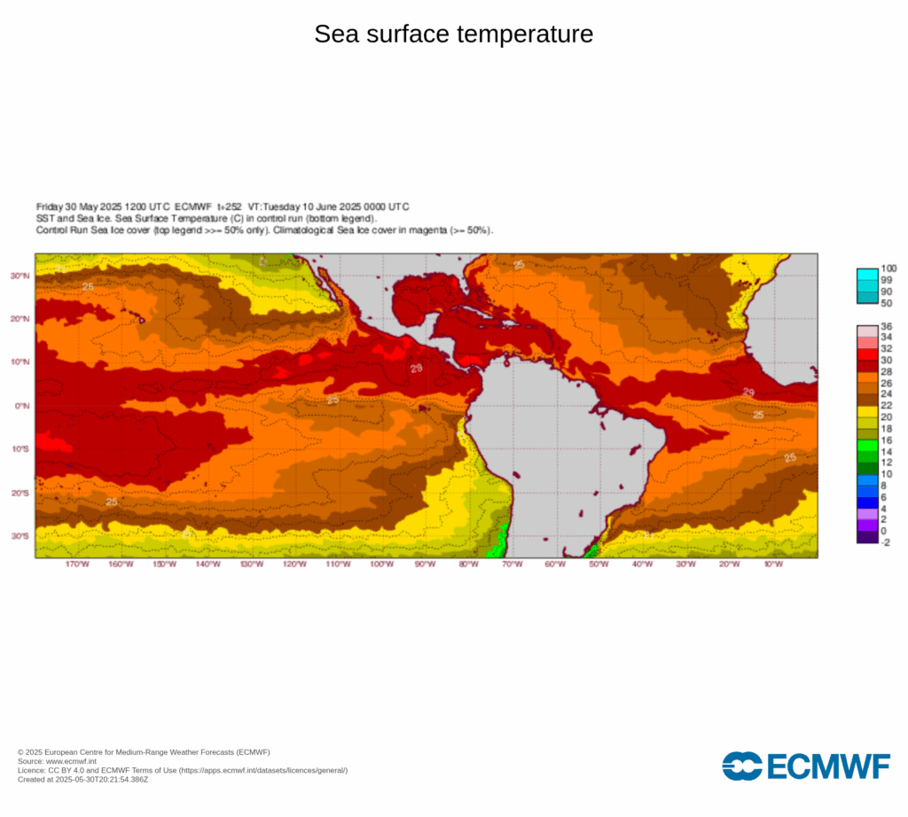
However, environmental conditions in the area are definitely encouraging trouble in the Pacific. For one, wind shear is looking to be low and stay low for a while. Additionally, sea surface temperatures will be warm enough to sustain cyclone-like activity.
Atlantic Hurricane Season
Although there hasn’t been any tropical activity in the Atlantic yet, hurricane season in the Atlantic officially begins tomorrow, June 1st. The National Hurricane Center has predicted that this year will be an “above normal” hurricane season, meaning that more tropical storms will occur than normally. The NHC has also predicted 6-10 hurricanes forming this year, 3-5 of which being considered major hurricanes.
So as the Atlantic gets ready for a busy hurricane season ahead, the Pacific already has some activity. Along with a potential disturbance, Tropical Storm Alvin is keeping it moving along the coast of Mexico, and predicted to hit the tip of Baja California Sur early Sunday morning, likely with minimal impacts of storm surge, flooding, or tornadoes. If you happen to be in the area, make sure to pay attention to local authorities on any advisories issued, and NickelBlock will keep you updated on all tropical activities this hurricane season!


