Hey everyone! We have another hot weekend coming up with feels like temperatures into the 100s! The tropics are also starting to brew up. Let’s take a look at the situation:
[wpcode id=”41149″]
Today’s Overall Setup
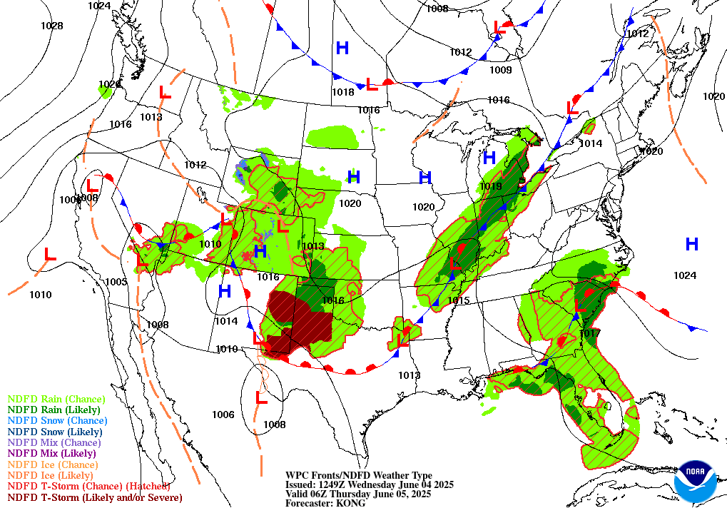
Here’s a look at our overall synoptic setup today. We have a very interesting pattern to look at. There are several fronts to look at. There is one long stationary front spanning from southern California through the Rockies, back south into New Mexico, that then turns into a warm front through Texas, connects to a low pressure near Arkansas, and stretches northeastward into the Midwest into southeastern Canada. This long frontal boundary is bringing showers and thunderstorms to the areas shaded in green, with severe storms possible north of the warm front in the eastern New Mexico and western Texas region shaded in dark red. Florida and surrounding states in the southeast are also experiencing a slow-moving stationary front, which is bringing lots of rain to that region.
[wpcode id=”41149″]
Today’s Local Forecast

Here’s an hour by hour look at your rain forecast for today. Very isolated showers are possible going into the afternoon and evening hours. We are currently sitting under some high pressure, so most of us will stay dry today! These isolated showers could contain lightning, heavy rain, and potentially small hail if you happen to be located underneath any one of the cells. Stay alert this evening!

Here’s an hourly look at the forecast for today for the region
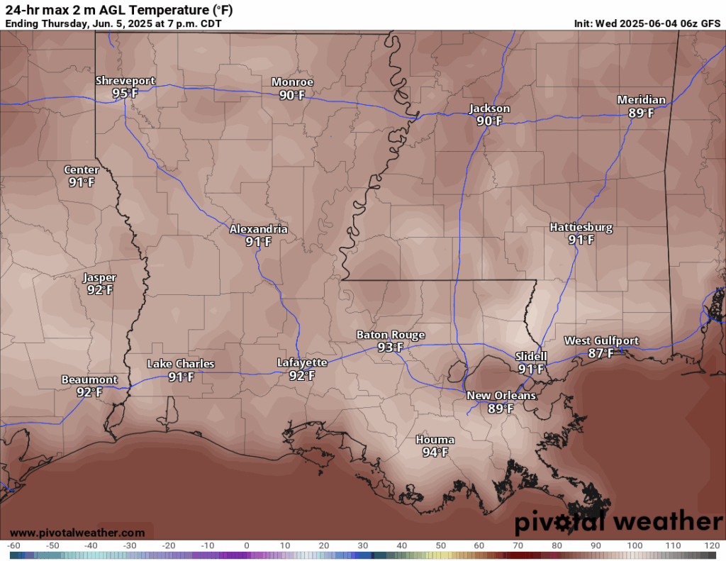
Today’s high temperatures will reach into the low to mid 90s for most of you today. The high pressure is keeping the sky clear of any clouds, so daytime heating is in full force!
[wpcode id=”41149″]
This Weekend’s Forecast
Looking ahead into Friday and the weekend, we can see that temperatures will be in the 90s each day, with some areas approaching 100! That’s not including how the humidity will actually make it feel!

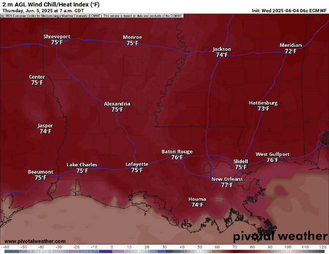
Dew points this weekend are well into the 70s, making those 90-degree temperatures feel like the 100s! That tropical moisture is in full effect. Make sure to bring a bottle of water if you are going to be outside this weekend. You will definitely need to take frequent breaks and go into the air conditioning whenever possible to relieve yourself from the heat.
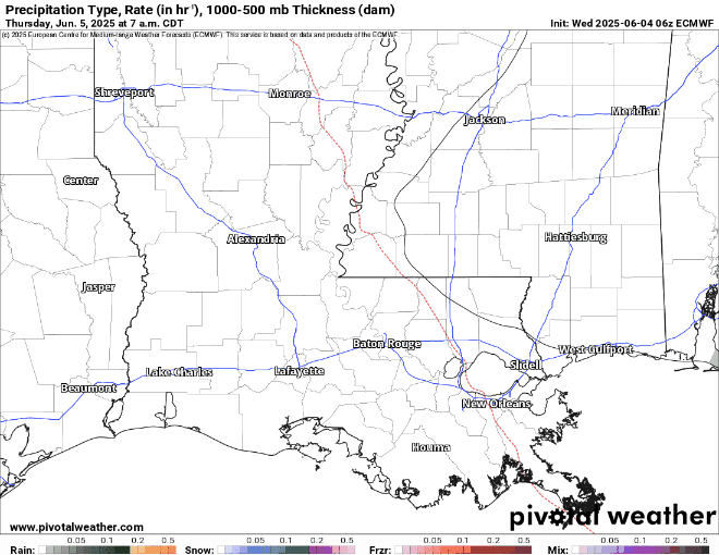
Here’s a look at the European modeled rain rates for Friday through Sunday. Rain is possible in our local area during the early morning hours of Friday, with some larger more organized cells coming through on Saturday in the evening. These storms stick around into Sunday, with the main storm threat coming in on Sunday night. We will be keeping an eye on the SPC if any severe weather risk is expected for both of these days. At most, an isolated wind threat is most probable with the segment of storms coming through.
[wpcode id=”41149″]
Extended Local Outlook

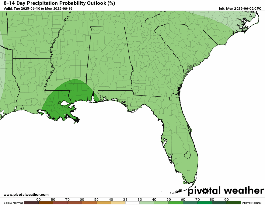
Looking further ahead to the next 8-14 days, the Weather Prediction Center is expecting an increased amount of precipitation, interestingly enough, bullseye right in our local area! Expect more of a rainy pattern for the 2nd-3rd week of June, due to some increased troughing.
[wpcode id=”41149″]
Latest Tropical Update

The National Hurricane Center (NHC) is giving the area of showers and thunderstorms south of southern Mexico a 80 percent chance of development in the next 7 days. If it does become developed into a tropical depression or tropical storm, it is expected to, like Alvin, weaken and not affect land directly.
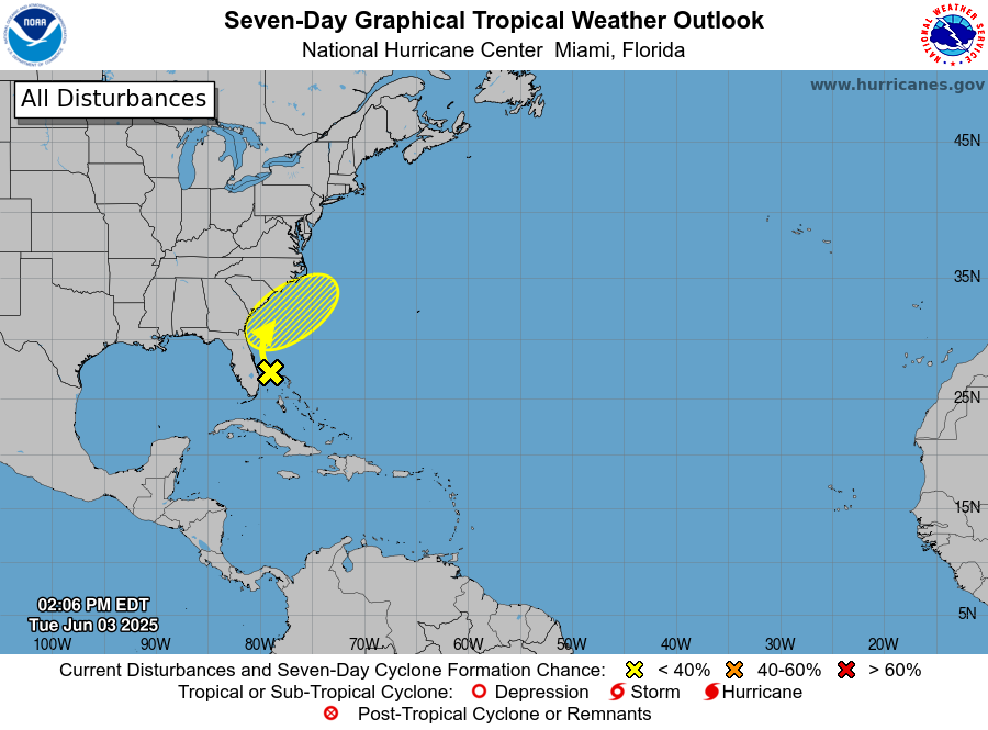
The Atlantic basin currently has an area to watch, however, it has been given a zero percent chance of development in the next 7 days. This will not cause any major impacts to the CONUS, but there will definitely be increased rainfall in this region in the next week or so with it’s associated moisture.
Check out our daily tropical updates for more in-depth information on the tropics!
REGIONAL DAY TO DAY FORECAST
Today: Chance of afternoon thunderstorms. Highs in the lower 90s. Calm winds becoming east northeast around 5 mph. Chance of rain 50 percent.
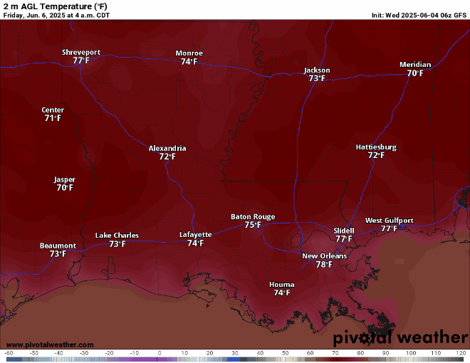
Tonight: Partly cloudy. Lows in the low 70s. Calm winds.
Friday: Sunny, with a chance of afternoon thunderstorms. Highs in the mid 90s. Calm winds becoming southwest around 5 mph.
Friday Night: Partly cloudy. Lows in the mid 70s. South southwest winds around 5 mph.
Saturday: Showers and thunderstorms likely after 1pm. Highs in the mid 90s. West wind around 5 mph. Chance of rain 60 percent.
Saturday Night: Showers and thunderstorms possible. Lows in the lower 70s. Chance of rain 30 percent.
Sunday: Showers and thunderstorms likely, partly sunny. Highs in the lower 90s. Chance of rain 70 percent.
Sunday Night: Mostly cloudy, showers and thunderstorms possible. Lows in the lower 70s. Chance of rain 50 percent.
Monday: Showers and thunderstorms likely. Highs in the upper 80/lower 90s. Chance of rain 70 percent.
Monday Night: Mostly cloudy with showers and thunderstorms likely. Lows in the lower 70s. Chance of rain 60 percent.
Tuesday: Scattered thunderstorms. Highs in the higher 80s. Chance of rain 50 percent.
Tuesday Night: Mostly cloudy in the evening, with periods of rain overnight. Lows in the lower 70s. Chance of rain 40 percent.
Wednesday: Mixed clouds and sun with scattered thunderstorms. Highs in the higher 80s. Chance of rain 50 percent.
Wednesday Night: Cloudy with a few showers later at night. Highs in the low 70s. Calm winds. Chance of rain 30 percent.
Next Thursday: Scattered showers and thunderstorms. Highs in the higher 80s. South southeast winds 5 to 10 mph. Chance of rain 50 percent.
Next Thursday Night: Mostly cloudy with a slight chance of showers and thunderstorms late at night. Lows in the low 70s. Calm winds. Chance of rain 30 percent.
Next Friday: Mix of sun and clouds with scattered thunderstorms. Highs in the lower 90s. South southeast winds 5 to 10 mph. Chance of rain 50 percent.
Next Friday Night: Isolated thunderstorms in the evening, then partly cloudy skies. Lows in the low 70s. Calm winds. Chance of rain 30 percent.
Next Saturday: Partly cloudy with afternoon thunderstorms. Highs in the lower 90s. Calm winds. Chance of rain 40 percent.


