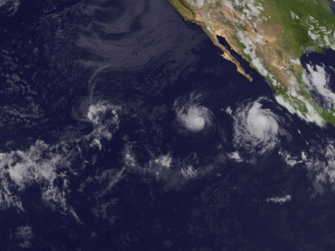
The East Pacific is shaping up to be a tropical storm factory early in the season. There are two distinct areas where development is possible, one is a system southwest of Mexico that could get a name as early as tomorrow, and a secondary system a few hundred miles west of that one. Both of these storms don’t look like they’ll directly impact land, as a ridging regime over Mexico will steer them out to sea. But, there is one very specific scenario where one storm could impact land, that I’ll detail below. Meanwhile, the Atlantic Ocean seems to be quiet in the near term, as the one area of interest has failed to develop.
POTENTIAL DEVELOPMENT AREAS
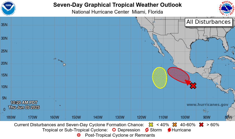
Ocean surface temperatures in excess of 80 degrees Fahrenheit, ample moisture, and converging winds surrounding existing showers and thunderstorms are setting the stage for our storm that will most likely become Tropical Storm Barbara. Shear is currently light in the area, it’s probable that storms will organize into a tropical depression or storm, if not tomorrow, very soon after that. The NHC has given this area a 40% chance of developing a depression or storm in the next 48 hours, and an 80% chance of doing so in the next 7 days.
Meanwhile, a secondary area of development is a hundred miles or so to the east of the first. This secondary area is not as far along on the track of becoming organized as our first, and by the time it will try to become more organized, it may have some wind shear to fight. It is forming on the east side of a trough, meaning it will be moving north. The NHC has given this area a 30% chance of developing a depression or storm in the next 3-7 days.
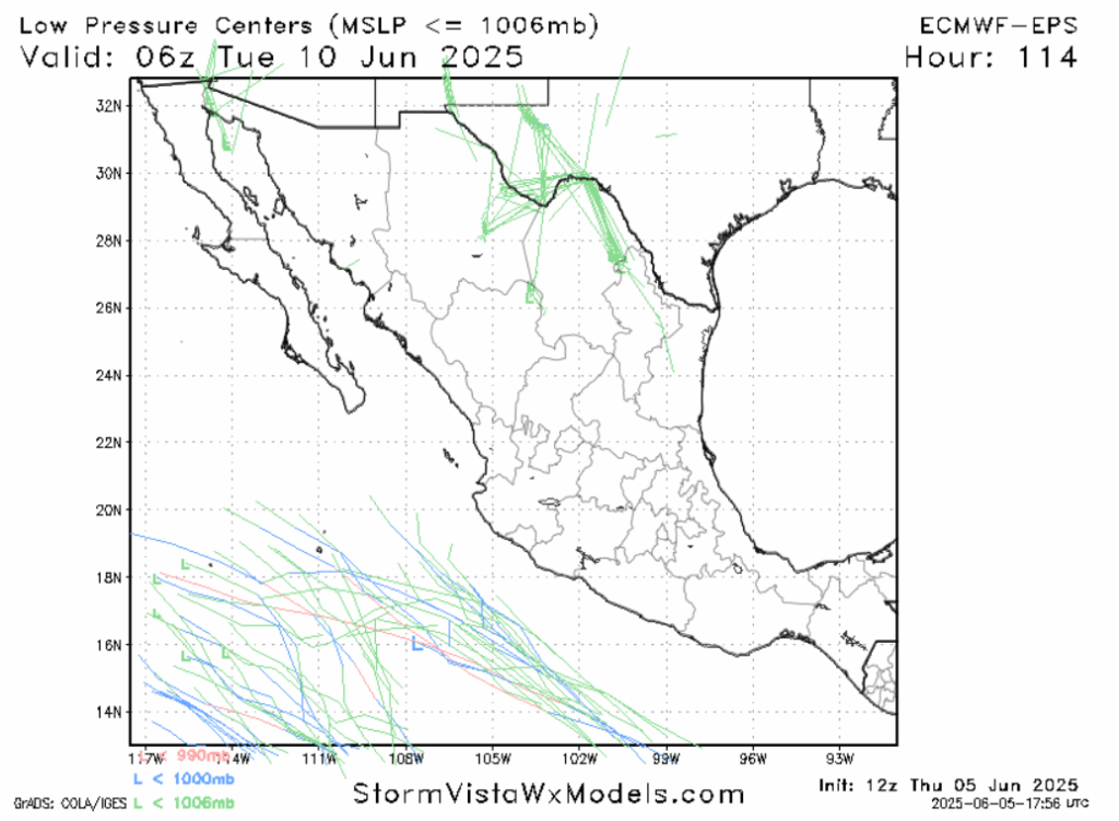
This setup is an interesting one as we have two development areas close to each other, that will only be converging as time goes on. What may happen, if both areas do develop into storms, is a process called the Fujiwhara Effect. This term may be familiar to those who’ve seen Twisters, but it can happen with hurricanes too. In some cases, systems of similar strength can actually merge. But due to these two systems likely being of different intensity, especially with wind shear being a factor, what would likely occur in this scenario is that the storms may deflect off of each other. A Fujiwhara-induced deflection is probably the only way either of these storms would get close to land.
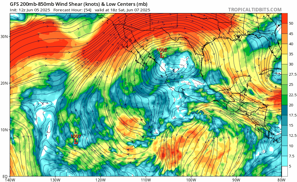
Regardless of what happens, wind shear is expected to remain very strong over Northern Mexico this week. This will act as a shield of sorts. If a storm tries to get up that way, it will go the way of Alvin, getting “sheared apart” until it is little more than a post-tropical low. This “shield” looks like it will remain in place long enough to protect Baja California from whatever storm comes out of our first area of development, but could potentially abate next week. So if the second area of concern develops into a storm and moves north, impacts could be in store, although this scenario is far from the most likely one.
Looking to the 7-14 day time frame, I don’t see a good reason why we won’t also see more tropical formation in the West Pacific. This area has been a factory of tropical activity, and the conditions supporting that won’t change too much in the near future.
A QUICK WORD ON THE ATLANTIC
Frequent readers may want to know what happened to the area of interest right off the coast of Georgia and South Carolina I mentioned in my last update on Monday. I had a feeling that area was going to be a nothingburger back then, and it appears I was right to be suspect of it. A specific area of low pressure didn’t really even form. It is quite stormy in this part of the country right now, flooding is a modest concern, but what’s occurring can he hardly described as tropical in nature.

As for the rest of the Atlantic, an abundance of Saharan Dust and an absence of sufficiently warm ocean surface water is delaying the de jure start of Hurricane season in the Atlantic basin. The part of the Atlantic that is warm enough is too close to the Equator to have the Coriolis Force needed for a tropical storm. The Gulf of Mexico, and to a certain extent the Caribbean, is warm enough and far enough away from the Sahara, such that development is possible in the 1-to-2 week time frame. The moisture is there, the vorticity may not be. Some models show a tropical storm signal on the west side of the Gulf of Mexico.
CONCLUSION
Those with interests in western and southern Mexico should keep a close eye on the two areas of development, although the most likely outcome is that all anyone on land will see is some rain, as a ridge should steer the storms out to sea.
[wpcode id=”41149″]


